Continued from the previous page.
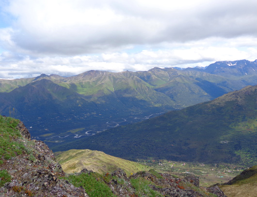
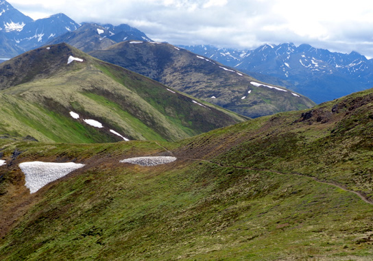
I took the next group of photos as I gradually descended the south side
of Mt. Gordon Lyon from the rocky summit.
I was able to see deeper into the North Fork Eagle River Valley than I
had been able to see from Rendezvous Peak. Note the serpentine river in
the north valley:
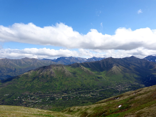
The South Fork Valley of the Eagle
River is at the bottom of the picture above and is shown in its entirety
below:
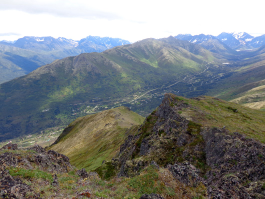
The rivers merge to the left of those photos at the town of Eagle River.
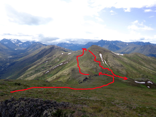
On the way down Mt. Gordon Lyon
I was aiming for the saddle between Gordon Lyon and Rendezvous Peak
about 666 vertical feet below me. This was my general route for the next
couple of miles:
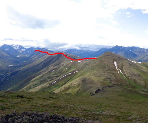
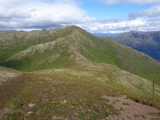
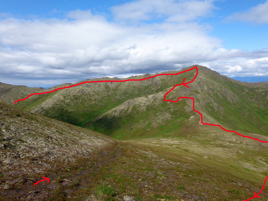
The red line below defines Rendezvous Ridge, which I've hiked three
times in recent weeks. I didn't go out on the ridge today -- just wanted
to show it from this perspective on Mt. Gordon Lyon:
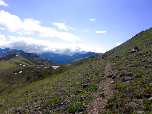
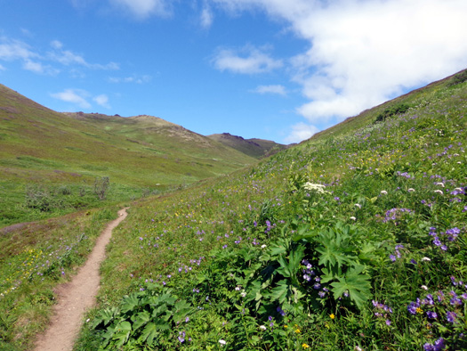
Here are some more pictures from my descent to the saddle:
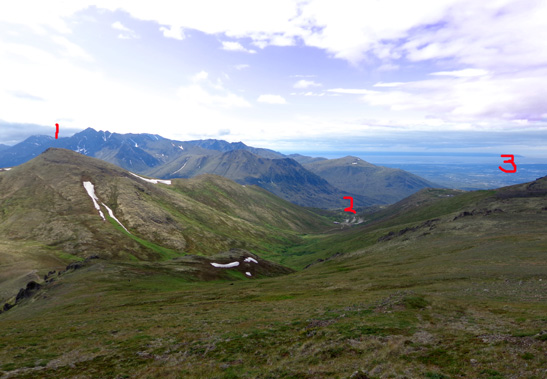
#1 = Rendezvous Peak (elev. 4,101 feet). #2 =
trailhead parking area at Alpenglow Ski Area.
#3 = Anchorage Bowl and Cook Inlet. Like I
said, you can't get lost up here!
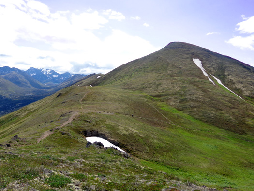
There was a steep section past these rocks that I
bypassed to the right.
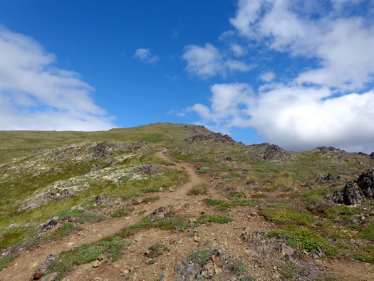
Looking back to the summit before I took a little
detour.
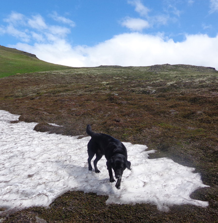
On the more gentle grade of the detour Cody got to play in a
patch of snow.
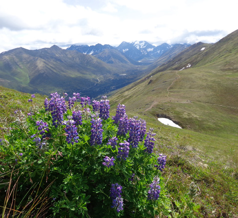
If I hadn't gotten off the trail I wouldn't have
seen these beautiful lupines.
I worked my way back to the trail after it got less steep and continued
down to the saddle.
If I ever go up to the summit this way I'll stay on the trail. My knees
are fine going up. Going down steep terrain with no cartilage is
the problem.
On the saddle between Gordon Lyon and Rendezvous,
looking south toward Rendezvous
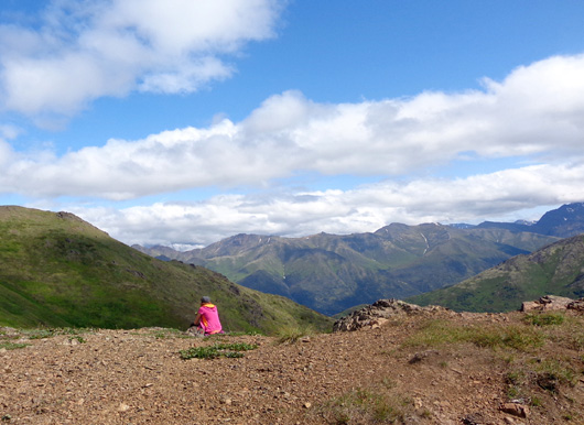
On the saddle, perched above the South Fork Eagle
River Valley = a great place for a lunch break.
Looking back up Mt. Gordon Lyon; you can't see the
summit very well from the saddle.
I crossed the saddle between Gordon Lyon and Rendezvous and climbed up the steep
back (east) side of Rendezvous Peak to a second saddle between
Rendezvous and Little Teton Peak.
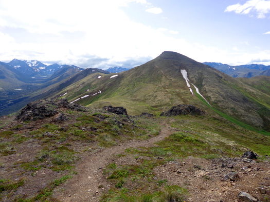
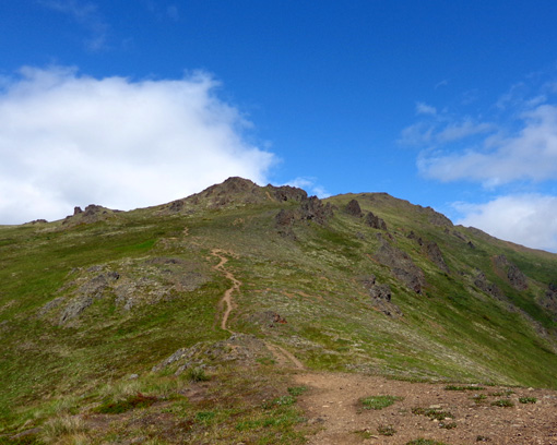
The next view shows
the high ridge I hiked and the summit of Mt. Gordon Lyon in the
background, the saddle in the center, and two trails going up/down the
"back" side of Rendezvous Peak in the foreground. I hiked up the steeper
one on the right and down the more gentle alternate path on the left:
As I climbed toward the next saddle I had great views down into the
South Fork Valley of the Eagle River:
The next two pictures show Rendezvous Ridge, which I've hiked three
times previously (see
June 23,
June 30, and
July 19 entries for photos):
From the saddle between Rendezvous and Little Teton peaks
I could see down to the JBER runway and wondered what was going on. I
couldn’t see any planes flying around:
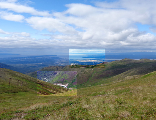
Trailhead parking area is highlighted in closer
box, JBER and Knik Arm/Cook Inlet in far box.
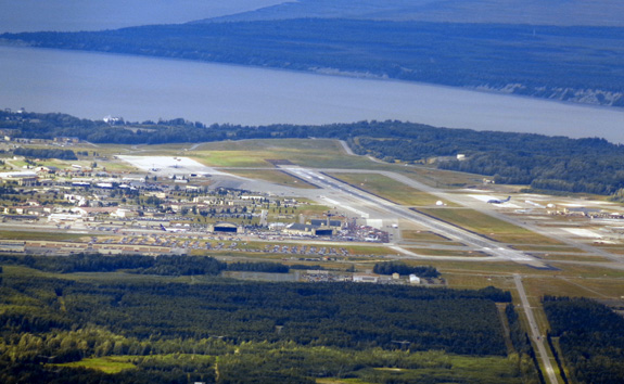
Whoa! I can get pretty close up with 16 megapixels
and 16x zoom!
Think what folks with those long zoom lenses can
see . . .
After realizing what a great view of the air show I could see from the
hillside, I decided to descend in time to
catch the Thunderbirds’ exhibition at the overlook several miles down
Arctic Valley Road instead of hiking on Rendezvous Ridge again.
I walked down a little easier path to the main trail (as I’ve done twice
previously) and returned to the parking area. I took these photos on
the descent:
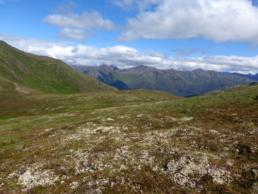
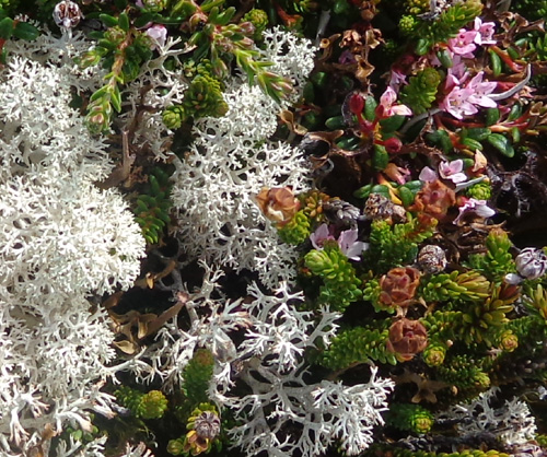
Above and below: white lichens in the tundra
on Rendezvous Peak look like snow from a distance.
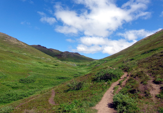
Two photos looking back up the main trail to Mt. Gordon Lyon and the
ridge on the left that I ascended at the beginning of my hike:
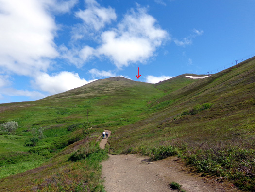
Below is a last look up the main trail to Rendezvous Peak and the saddle
(arrow) where I turned around.
As you can see, it was still a beautiful,
mostly sunny day -- perfect for a hike and an air show!
I really enjoyed this hike; I always enjoy
seeing new things.
This is also a good loop
for dogs because there is plenty of drinking water for them in Toklat
Creek and the little streams that drain into it.
I drove a few miles
down the Arctic Valley Road to a large parking area overlooking JBER and
the entire Anchorage Bowl. Several vehicles were already parked there so
their occupants could observe the Thundebird show from four or five air
miles away.
Next entry: the Arctic Thunder Air Show from Jim's
perspective at the flight line and my perspective part way up Arctic
Valley Road
Happy trails,
Sue
"Runtrails & Company" - Sue Norwood, Jim O'Neil,
and Cody the ultra Lab
Previous
Next
© 2012 Sue Norwood and Jim O'Neil
