This may be our last pretty day for a while. It was 60 F. and sunny when
I got up at 6AM, with a few puffy clouds to the east. Sunrise was about
4:16 AM, sunset last night about 11:43 PM.
Amazing. Not only is it light when we go to bed and get up, the SUN is
still shining!!! I love this "Midnight Sun" concept.
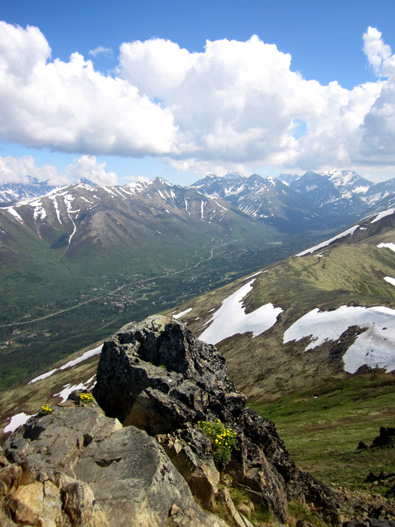
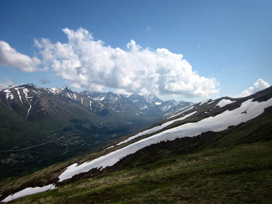
Enjoying a beautiful summer day with spectacular
views from Rendezvous Peak
Temps got to the mid-70s F. at Black Spruce Campground this afternoon.
There are so many microclimates around the Anchorage area that I usually
just record what’s happening at the campground (it is similar to the official
weather station at the airport a little farther south in Anchorage).
It's several degrees cooler when I'm hiking at higher elevations in the mountains.
Jim left for a 21+ mile bike ride on base about 11 AM. He's been all
over the place and is still finding new bike paths and roads to explore.
JBER is huge. I'll write more about his rides in another entry.
ARCTIC VALLEY TRAILHEAD
It took me a while to get motivated to go hike. I didn’t leave the
campground with Cody until 1 PM.
I drove about twelve miles to the Arctic Valley trailhead for a loop
around and to the summit of Rendezvous Peak in Chugach State Park. This
appears to be the nearest trailhead for me to go hiking in the Chugach Range.
Arctic Valley is north of the Hillside Trail System, closer to Eagle River.
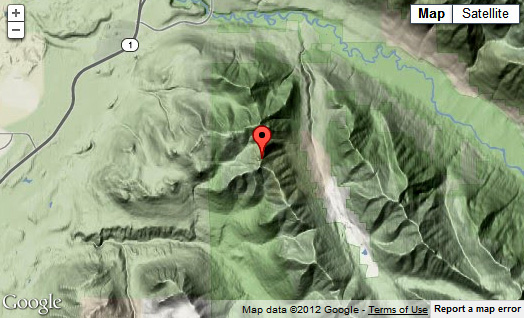
Google topo map showing Rendezvous Peak; I got that
from the website link above.
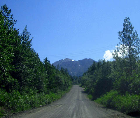
Arctic Valley Rd. can be accessed off the Glenn Hwy. at MM 8 from the
north or MM 7 from the south. It is paved for about one mile past
a golf course. The last six miles are dusty gravel with some washboard
surface.
Most of the road passes through military property and may be closed down
during certain training operations or for security reasons, as in the
immediate aftermath of 9-11.
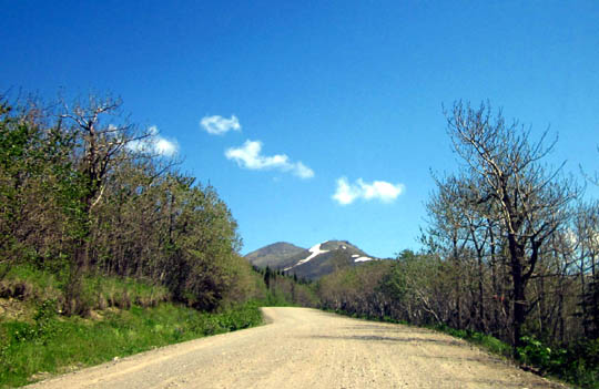
I drove up from about
sea level at our campground to 2,600 feet at the trailhead, which is on
Alpine Valley Ski Area property. It was
interesting to see the changing plant zones as I ascended from all the
bright green leaves and grasses in the valley to bare deciduous trees and then
to the low sub-alpine shrubbery at the trailhead.
Bright green leaves from sea level to about 2,000 feet
elevation (above),
green grass but fewer deciduous leaves over 2,000
feet (below)
Much of the trail to
the peak was in the alpine zone (tundra).
Parking at Arctic Valley is in a very large two-tiered gravel lot near
the Alpenglow ski lodge. Apparently every vehicle must pay $5 for a day pass.
I don't know if skiers can get a season pass in the winter. Even
though most of the trail I hiked was in the state park, folks with the
annual state park pass must also pay since the parking lot is on ski
property.
You can park free if
you leave your vehicle about one-half mile down the road, just before
the ski resort, and walk up the road to the trailheads. I might do that
if I go back up there again.
ROUTE CHOICES
I talked with two local guys who parked next to me re: where the trail goes
because there is no map at the trailhead, the Chugach State Park map is
vague about this area, and I hadn't looked online for any information
yet.
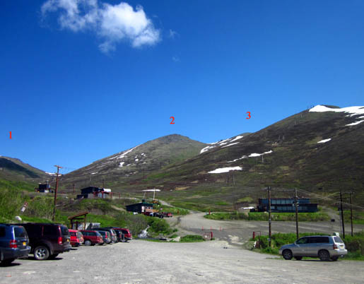
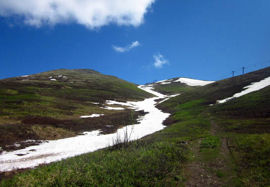
I could see two trails going up from the parking area, shown below. One
goes off to the left for about half a mile to a ridge that separates the
ski area from Cook Inlet. The main trail in the center of the photo
below accesses Mount Gordon Lyon (beyond the #1 in the photo below),
Rendezvous Peak (#2), and Little Teton Peak (#3):
I knew that the main trail to the peaks splits into two about half a
mile from the trailhead, with one trail swinging around the left side of
Rendezvous in a big arc and another trail taking a much steeper, more
direct route to the saddle between Rendezvous and Little Teton.
The guys told me the
advantages and disadvantages of both ways. I wasn't in any hurry so I
took the longer, more gradual trail up and planned to go down it, too.
There are many hiking
variations you can do from this trailhead. I'll mention some of them as
I describe the route I took.
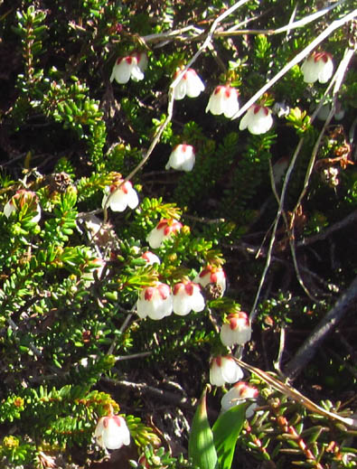
Delicate-looking Starry Cassiope AKA Alaskan
Mountain Heather
is a dwarf evergreen shrub I found growing at about
the 2,800-foot level.
Since most of the
terrain is low brush or tundra you can also just strike off on your own
cross-country route to reach the various ridges and peaks or to access
prime berry-picking areas in late summer.
That's not so great
for fragile plants in sensitive areas but all the renegade trails
indicate people have been doing it for a while.
MAIN TRAIL TO THE FIRST SADDLE
I started from the parking area at about 2,600 feet elevation, which was above treeline at
this location.
The lodge and a restaurant/ski shop are behind a gate at
the bridge over Toklat Creek. The gate was open all day today. If it is
closed just walk around it, go past the ski
shop, and continue up the wide dirt path.
It's hard to see in this small photo but there's a
bridge across the creek to the left of the trail.
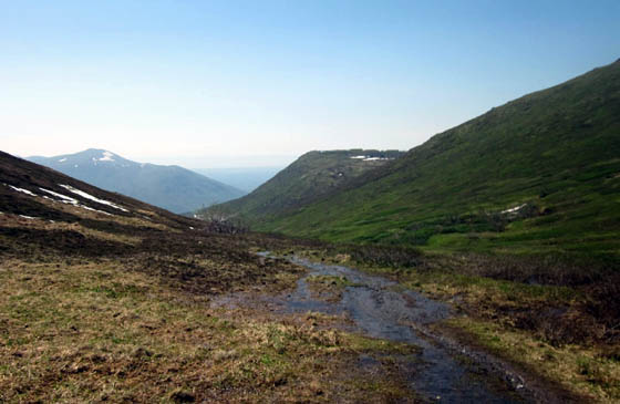
The trail was dry for the first half mile along Toklat Creek.
Snow still covers much of the creek, which drains the area surrounding
Rendezvous, Little Teton, and Gordon Lyon peaks:
A bridge crosses the creek and leads to another, less-traveled trail
that appears to parallel the main trail uphill on the other side of the
creek. I might try that trail if I go back up to Rendezvous again. I
can access the long ridge to the left, which ends at Gordon Lyon, by
hiking up one of those mountains.
The main trail narrows to single track at its intersection with the
trail going up the steeper, shorter route to the saddle between
Rendezvous and Little Teton. That trail, shown below, lies between the
ski lift and the gully still covered in snow:
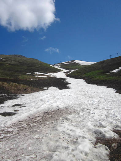
Today that trail was
still partly under the snow so I didn't take it up.
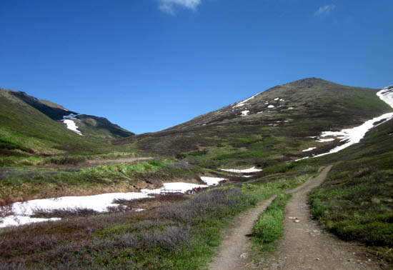
I turned left to follow the main trail and the larger branch of the
creek that comes down the valley between Rendezvous and Gordon Lyon:
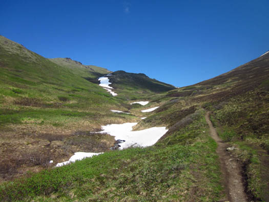
The scenery along this creek
reminded me of the old Colorado Trail in the Pole Creek area before
Segment 23 was rerouted along the Continental Divide.
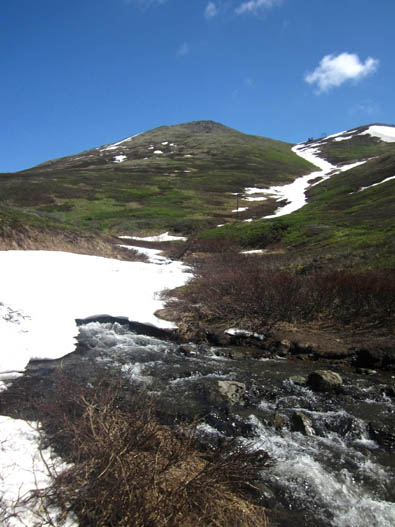
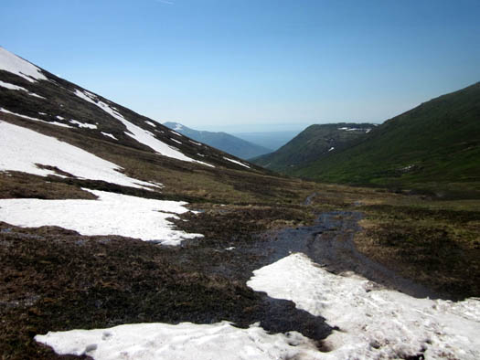
The trail became much wetter as I gradually climbed to the first saddle
between Gordon Lyon and Rendezvous at 3,470 feet:
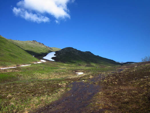
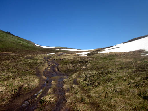
It looked like the snow had very recently melted over much of the ground
around me. Until I reached the first saddle I saw very few flowers and
not much that had greened up.
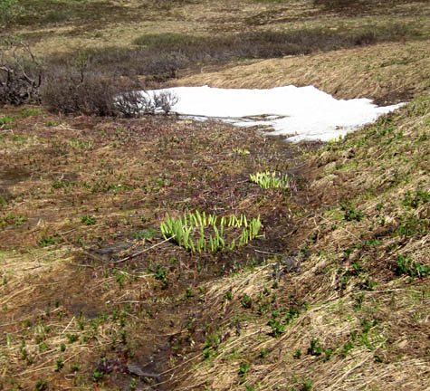
Skunk cabbage (circles of green leaves in the
center) and other plants
are just starting to emerge where the snow has very
recently melted.
Because the trail was so muddy and slick, some people coming down were
walking through the low alpine shrubbery and other plants. It was easier
to get traction going uphill so I stuck to the wet trail as much as possible.
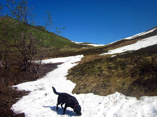
Cody had more fun
walking through the snow to the right of the trail on the north flank of
Rendezvous:
A few hundred yards below the saddle I left behind the low shrubs and
entered the alpine zone.
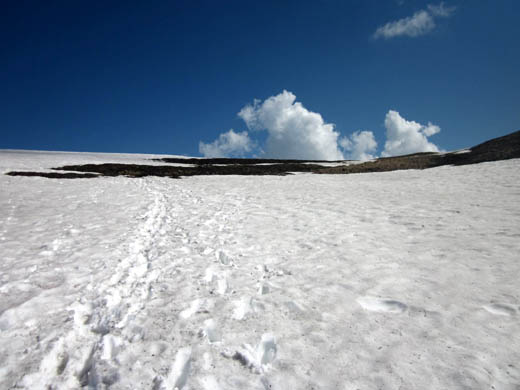
I walked through some soft snow that still covered the trail in some
places. The most was a 300-foot section near the first saddle where the slope is shaded
much of the day:
There were some good views toward Anchorage and Cook Inlet behind me as
I climbed higher. Periodically I stopped to look behind me:
The scenery was even better when I reached the first saddle.
The snow was gone, a carpet of little alpine flowers was in bloom, and I could
start to see the peaks of taller mountains to the east in the Chugach Range:

I was filled with anticipation of beautiful mountain and valley scenery
from the first plateau and I was not disappointed!
The views are gorgeous from this saddle between Mount Gordon Lyon to the north . . .
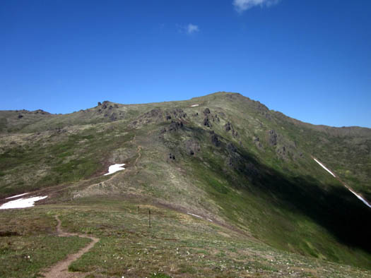
and Rendezvous Peak to the south.
Several couples were sitting in the grass enjoying the scenery and
eating lunch. Cody and I took a break here, too, for photos and a snack.
I was able to take some pictures without people in them.
To the east I could
see clearly down into the South Eagle River valley, known to locals
as South Fork. The homes along the river
reminded me of village scenes in the Alps:
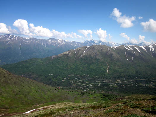
North end of the valley (above) and the south end
(below)
Even though the peaks I saw
are only 4,000 to 8,000 feet high I felt like I was in a much higher
mountain range similar to the San Juans near Silverton, CO.
At this first saddle hikers
have several options:
-
stop to enjoy the
views and go back down to the parking area for a hike of about
two miles;
-
go left (north) and
up the trail about a mile to Mount Gordon Lyon (elev. 4,134');
either return to the saddle or continue west to explore the long ridge
with views to the north;
-
go up to the saddle
between Rendezvous and Little Teton peaks, where you have several
more choices of trails to take.
I took a total of 191
pictures on this hike and the drive through Arctic Valley. While editing
them I whittled the total down to 159 (hey, that's pretty good for me!).
Since I'm including about 60 of those in this entry I'll spread the
photos over two more pages to make it easier to download them.
Continued on the next
page . . .
Happy trails,
Sue
"Runtrails & Company" - Sue Norwood, Jim O'Neil,
and Cody the ultra Lab
Previous
Next
© 2012 Sue Norwood and Jim O'Neil
