We did that! Jim and I enjoyed our third day of sunshine in a row by being outdoors,
in the mountains, as much as possible today.
Temps reached the low 70s F., only the seventh day in Anchorage this
summer that has been over 70 degrees. Apparently last year there were
only seven days over 70 F. the whole summer so maybe July, 2012 won’t
end up being the coldest July in the city in modern history.
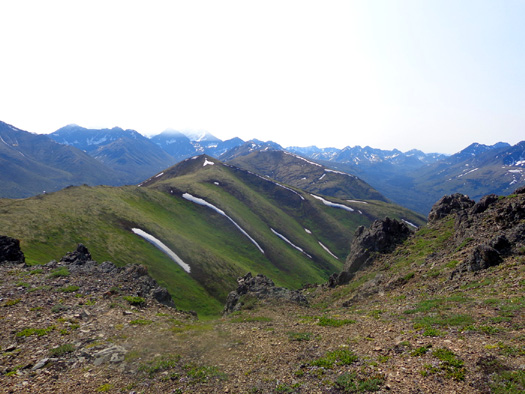
Look at
the snow in mid-July at 3,800 feet elevation!! Just kidding --
those are white lichens
on
Rendezvous Ridge. There are still some remnants of snow up
here, however.
Again, I don't mean
to complain, only educate other travelers who haven't been to South
Central Alaska before. "Summer" has a whole new meaning up here!
SO MANY CHOICES . . .
Today
I wanted a moderately long hike somewhere high enough in elevation that
I could see into the beautiful Chugach Mountain Range and out to the
waters of Cook Inlet:
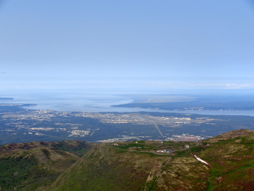
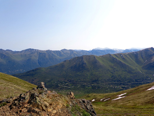
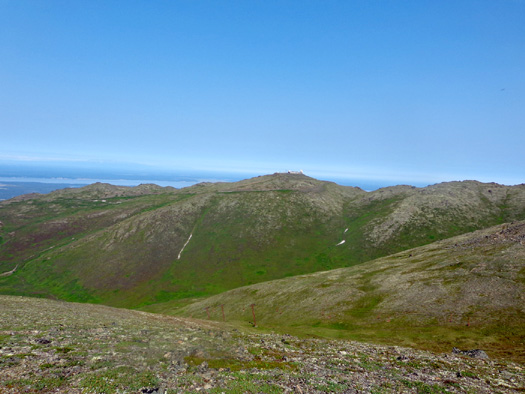
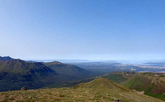
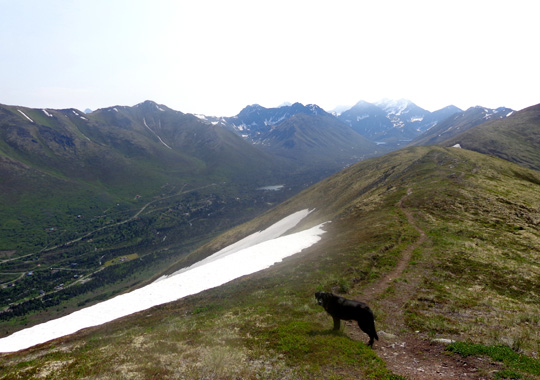
View toward
JBER (see the flight line?), Anchorage, and Cook Inlet from Little
Teton's summit
I studied all my trail maps and descriptions and couldn’t come up with
anything better than Little Teton Mountain, Rendezvous Peak, and
Rendezvous Ridge again.
I like the variety of
trails in that area and all the great views, so I wasn’t just “settling” for
something less than grand just because it's the most convenient Chugach
hillside trailhead to JBER.
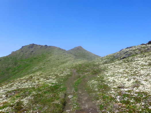
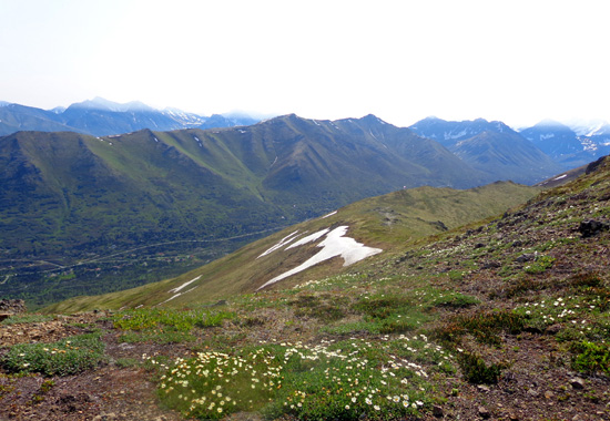
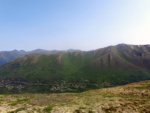
View of Rendezvous Peak from the ridge trail
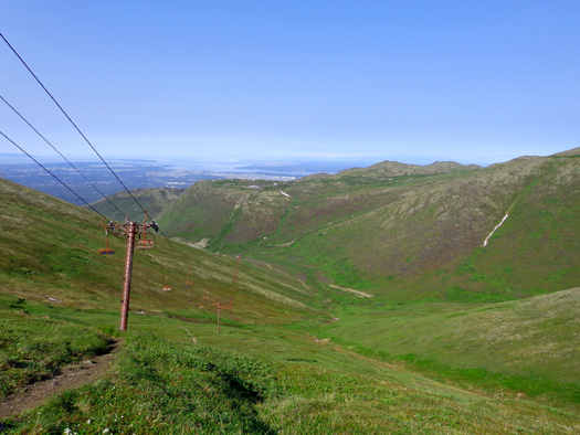
I also realized it might make an interesting and fairly easy bike ride
for Jim if he rode up Arctic Valley Road with me in the truck to the
trailhead, then rode his bike back down to JBER – about 12 miles, mostly
downhill, to the campground and farther if he did more mileage on base.
Jim was game for that. I’m glad he got to sort of see where I’ve been
hiking and enjoy the views from Arctic Valley Rd. as he came down. This
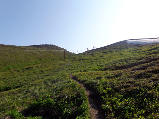
is one I shot on June 23:
I've been to the
Arctic Valley trailhead at the Alpenglow Ski Area for two previous hikes on the
ridge between Rendezvous Peak and Little Teton Mountain. Photos and
descriptions of those hikes are dated
June 23 and
June 30.
I was curious how
much snow had melted and if any different flowers were blooming now,
almost three weeks later.
UP & AWAY
I wasn't sure exactly
which of several trails I'd take this time. I decided to make it up as I
went. No matter what route I took, I knew Cody and I would have fun.
When I got to the first major trail intersection, I decided to hike up
the short, steep trail to the saddle between Rendezvous and Little Teton
Mtn., an elevation gain of over a thousand feet in 7/10ths of a mile:
Looks are deceiving; this is a pretty steep slope!
Not much snow this time.
This photo looks back down the trail from the saddle to the parking area
and the Anchorage Bowl:
From the saddle you can see down into the valley on the other side
(east) where the South Fork of
the Eagle River flows. The north fork of the river is in the valley
behind it:
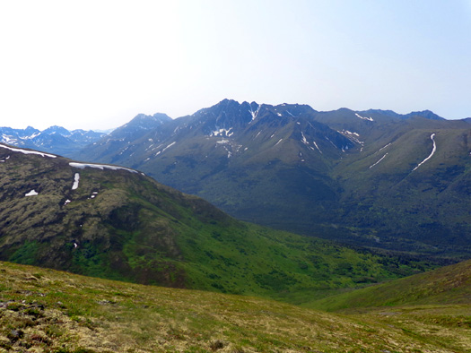
Looking east to the South Fork of the Eagle River
You can also see along much of Rendezvous Ridge to the southeast from
the saddle:
On one of my hikes up here in
June I climbed to the top of Rendezvous Peak (elev. ~ 4,100
feet). This time I chose to climb to the top of Little Teton. I took a
short side trail from the saddle
to the summit (elev. 4,017 feet).
My total elevation gain so far in 1.3 miles from the parking area
(~ 2,629 feet elevation) to the summit was 1,386 feet, also considered
to be a fairly steep climb.
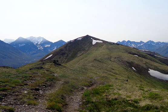
On the way to the top
of Little Teton I took this shot of Rendezvous Ridge,
noting there is less snow than three weeks ago:
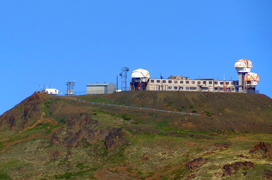
These panoramic views panning from the northwest to the southwest are from the
summit of Little Teton:
Above and below: old Nike missile site on one
of the peaks to the northwest
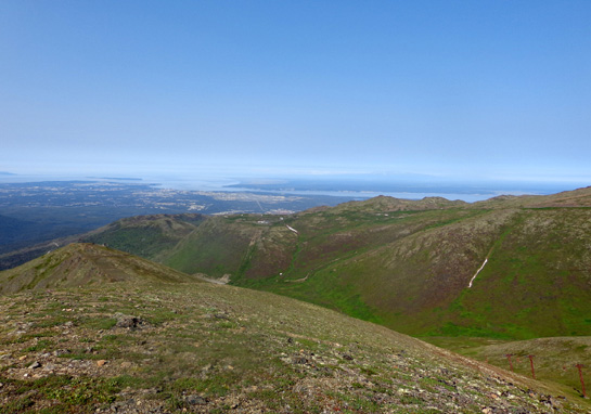
View to west over Anchorage and Cook Inlet
View southwest to Turnagain Arm
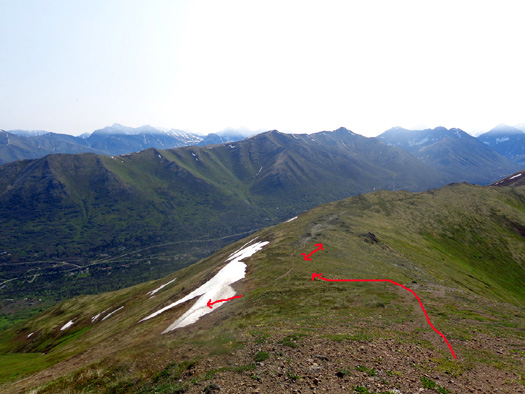
I dropped down to Rendezvous Ridge on a faint trail (long red arrow
below) on the south side of Little Teton. You can easily see the trail
along the ridge that I marked with a two-way arrow.
I hiked out two miles on the ridge and back, going over the snow bank (small one-way arrow to left) on
my return to the saddle:
RENDEZVOUS RIDGE TRAL
Cody and I hiked a little over two miles along the ridge, going at least
half a mile farther than the last time when the clouds were so low that
I couldn’t see what was ahead.
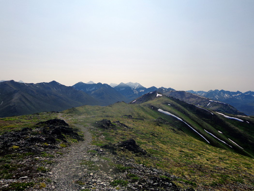
The ridge roller-coasters up and down to the point where I turned
around. These
photos are in order as I hiked outbound (south) on the sometimes-rocky
trail:
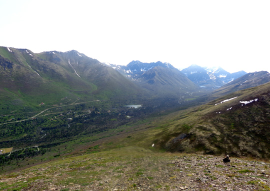
View into the valley on my right (southwest)
View into valley on my left (southeast), the South
Fork of the Eagle River
There are great views into the South Fork valley
all along the ridge.
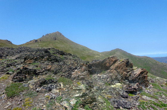
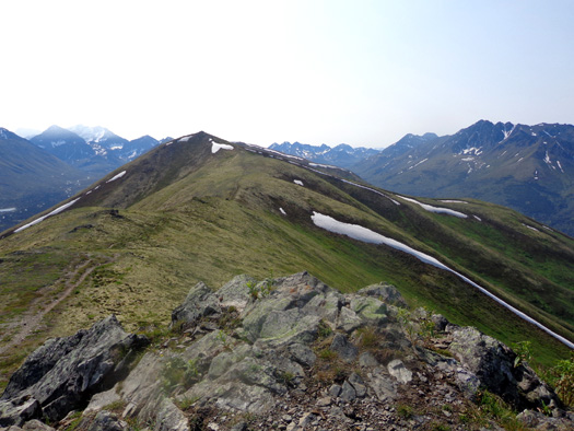
I got up to 3,892 feet on one of the peaks about 1˝ miles south of the
saddle (the summit was a little higher than that), then dropped down to
3,543 feet before turning around.
You can see that peak in the distance in the next photo. The rock
formation on top looks like a nipple from this direction:
Last time I turned around as the trail ascended toward the peak because
I couldn't see anything beyond it in the fog.
This time I continued hiking the trail on the right flank of the mountain a little
below the rock formation at the top and descended the other side
for about half a mile (350 feet elevation drop) to this spot:
Past that point the trail really takes a dive down to the South Eagle River.
I didn't have time to go there today.
Continued on the next
page . . .
Happy trails,
Sue
"Runtrails & Company" - Sue Norwood, Jim O'Neil,
and Cody the ultra Lab
Previous
Next
© 2012 Sue Norwood and Jim O'Neil
