What a great day!
This was one of our prettier days in Anchorage so far.
That was a pleasant
change, as were the differences I discovered on my hike today.
Although it was
overcast yesterday when Jim and I rode our bikes on the Coastal Trail it
became sunny in the evening. That's happened several times in Anchorage and it's a
bit maddening because we prefer to do our rides/hikes in the morning or
early afternoon. We'd love to have some sunshine then.
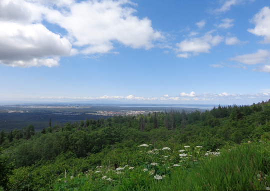
View toward sunny Anchorage and Cook Inlet from the
Arctic Valley Rd. in the Chugach Range
This soon after the
summer solstice, when it's sunny in the evening it isn't anywhere near dark yet when we
go to bed. We're getting used to that. It'll seem odd when it's dark
at bedtime later in the summer!
It was sunny when we got up this morning and stayed sunny all day in
town -- Jim loved that. Temps got up to the low 60s F. in the
Anchorage Bowl (valley) where he spent the day.
I was almost 4,000 feet higher in the mountains and in a very different
world, as you'll see.
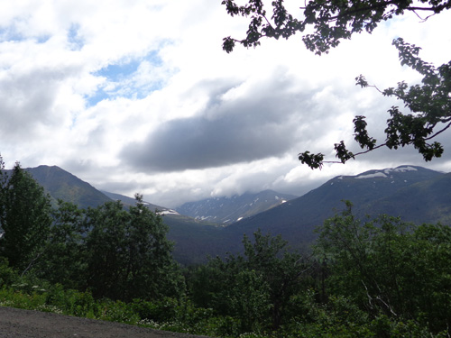
The Chugach Mountains were covered in clouds most
of the morning and afternoon.
We went separate ways this morning. Jim wanted to
ride his bike downtown to see the Vietnam Moving Wall in the
Delano Park Strip and attend a
memorial service to honor Alaskan military troops who died in Viet Nam,
Iran, and Afghanistan. I'll write more about all the things he did and
saw in the next entry.
I preferred to use a sunny day for a hike with Cody in the Chugach
Mountains. That's the focus of this entry.
SUN? WHAT SUN??
Since it was nice and sunny in the valley this morning I assumed the
nearby mountains would be nice and sunny, too.
Not!
I could see all the clouds hanging over them as soon as I got to the
entrance of the campground at 10:30 AM. Oh, well, I could still see some
sun during my hike.
I never did get above all the clouds on Rendezvous Ridge but the
mountains had a beauty and mystique of their own with the clouds moving
in and out.
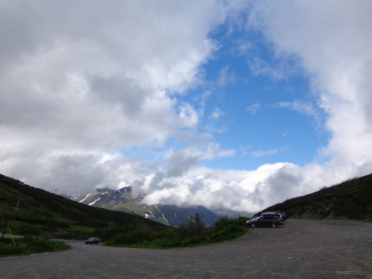
Interesting blue hole in the clouds at the
trailhead parking area this morning
This was my second trip to the Arctic Valley trailhead.
I planned to hike to Rendezvous Ridge the same way I did a
week ago but
go farther along the ridge itself this time.
There were only 9-10 vehicles in
the parking lot at the ski area when I arrived and fewer people on the trail than last
Saturday. I had to pay $5 to park again. I could have parked outside the ski
area and walked in for free but I preferred to use that time to hike
farther on the ridge, not the road.
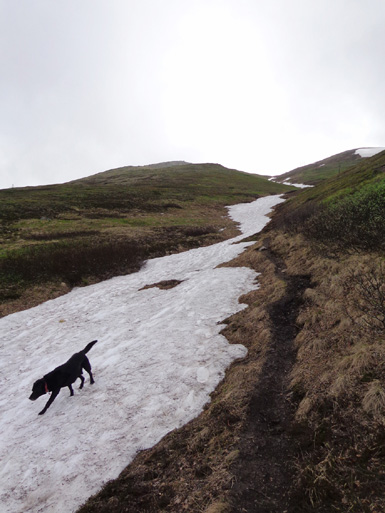
Just from the parking lot I could see that a lot of snow had melted
since I was up here last Saturday. That also meant the trail would
probably be wetter until I got up to the ridge.
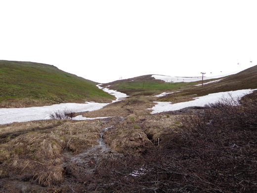
The first half mile is on mostly dry, wide gravel trail with an easy
grade. Then the trail splits:
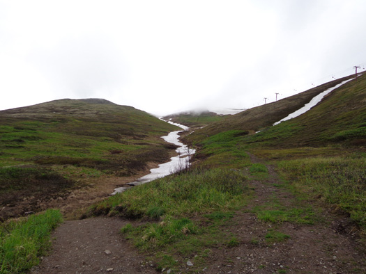
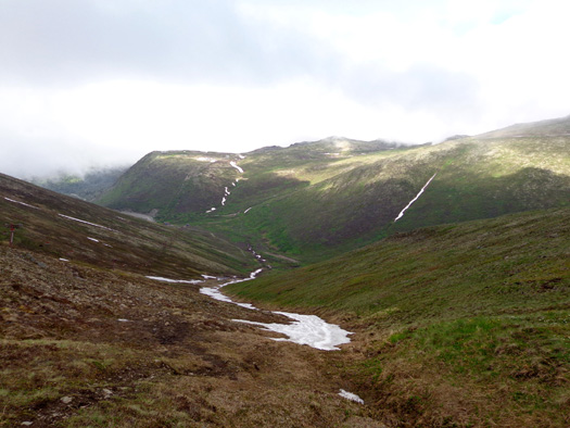
Where did all the snow go?? Rendezvous Peak
is on the left;
Little Teton's
summit is under clouds in the distance.
Last weekend I followed the main trail to the left along the creek
through the valley between Rendezvous Peak and Mount Gordon-Lyon. It is longer but
a more moderate grade than the trail to the
right, which ascends the ravine between Rendezvous and Little Teton
peaks near one of the ski chairlifts.
The trail to the right is a much steeper -- and much shorter
-- way to get to the saddle
between Rendezvous and Little Teton peaks, which is where I'd begin hiking
along Rendezvous Ridge.
UP,
UP, & AWAY
When I got to the trail split I decided to save time by climbing up the
shorter, steeper trail on the Little Teton side of the snowy
ravine that I butt-slid partway down last weekend.
That wasn't the greatest idea, however. I'm not sure I saved any time
going this way even though it's at least twice as short as the main
trail. I fell into the same trap as last Saturday -- from where I
was standing I could see up to the saddle. When I was up on the saddle
last week I could see down to my truck. This route is the most direct
way going either direction. <sigh>
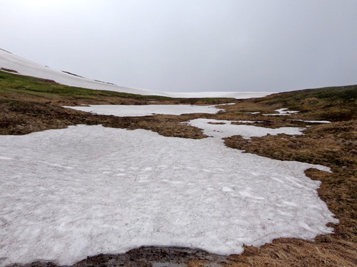
The main problem today was the deteriorating snow. In the intervening week since I was here
much of the snow has melted, what's left is more icy because it has
thawed and refrozen, and the ground where the snow has melted is muddier.
The plants are still brown where the snow just
melted.
Some parts of the trail were very muddy. This IS a
drainage, after all.
I had to detour around most areas where the trail is
still covered with snow. It was just too icy to walk on or dig my feet into for traction.
I didn’t even consider butt-sliding down this steep slope again today
because of the current conditions.
I was in and out of snow all the way up the ravine. The higher I
climbed, the more dry the trail:
The climb up this secondary trail is pretty steep – a 1,062-foot gain in
7/10ths of a mile. (I consider a thousand feet per mile to be relatively steep. Everyone's
perspective on that is different.)
Elevation at the parking lot is 2,629 feet. The trail intersection half
a mile up is at 2,878 feet. The saddle 7/10ths mile above the
intersection is 3,940 feet. All these are per today’s GPS readings,
which can vary from day to day and device to device.
Mama Mia! Trust me when I say that these photos are deceptive
regarding how steep an incline it really is in some places. Fortunately
there are a couple of little plateaus along the way.
Looking back down to the parking area from part way
up the ravine
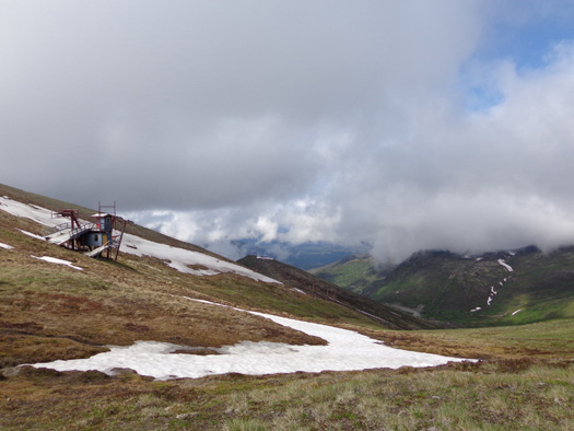
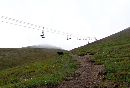
One of two chairlifts on Little Teton; last week
this whole area near the saddle was under snow.
Between the steep
pitch, lack of traction, and detours
I had to stop several times to catch my breath on the way up. I used
those opportunities to take photos. It took about 30 minutes to complete
the climb to the saddle.
No one else came up that way behind me; the other folks I could
see took the main trail. Even though it took me a while to get up to the
saddle I felt
like a real stud!
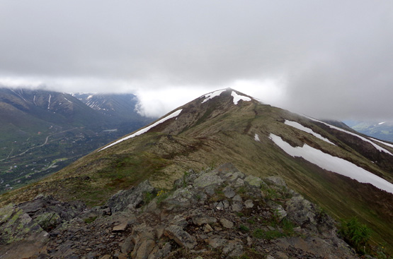
AMBLING ALONG THE RIDGE
I took a break at the saddle to eat a Clif bar and give Cody some dog
bones and water. Then we hiked along the Rendezvous Ridge Trail for 1˝
miles to the south:
It was fairly chilly on the ridge at 3,600-3,900 feet but I stayed warm
enough as long as I kept moving. The wind was blowing at about 10-20 MPH and
clouds moved in and out the whole time I was up there.
It was "cool" in more than one sense of the word.
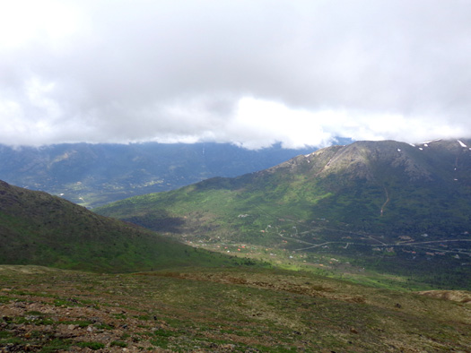
Since I'd already seen what most of the valleys on either side of the
ridge looked like on a sunny day last week, I wasn't too disappointed at
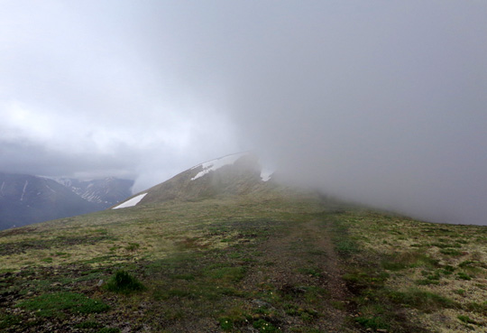
my limited views today. I enjoy hiking in fog or clouds, which give the
landscape a surreal quality.
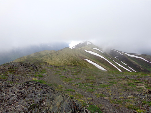
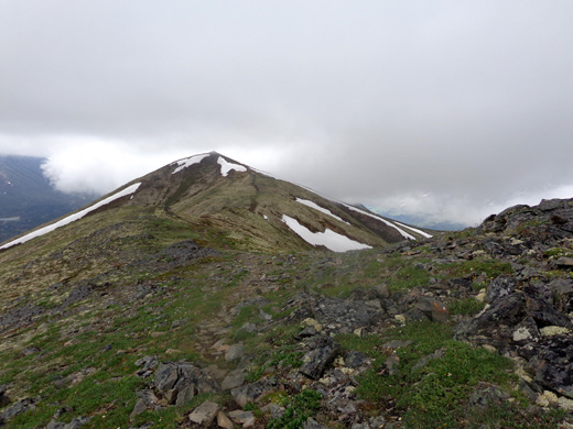
The peak in the distance is where I decided to turn
around. It's about 1˝ miles from the
saddle.
The next set of photos is in order outbound along the ridge:
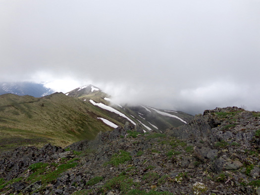
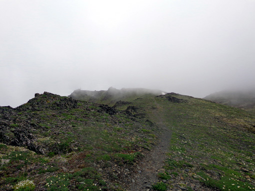
I was never in a white-out but sometimes I couldn’t see down one or the
other side of the ridge to the valleys below.
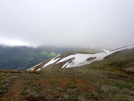
The Ship Creek valley, Anchorage, and Cook Inlet are to the west,
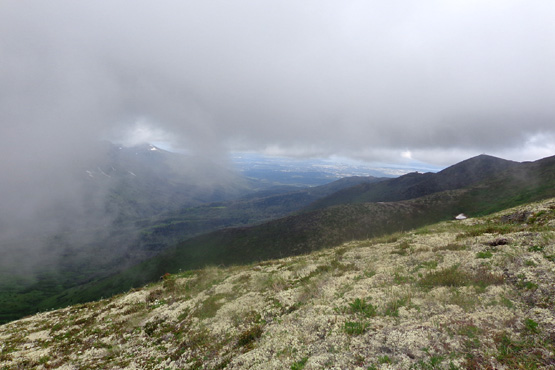
Lots of white lichens cover the tundra on this part
of the ridge.
the north and south forks of the Eagle River to the east:
South Fork of the Eagle River (near valley), North Fork in background;
photo taken at the upper saddle.
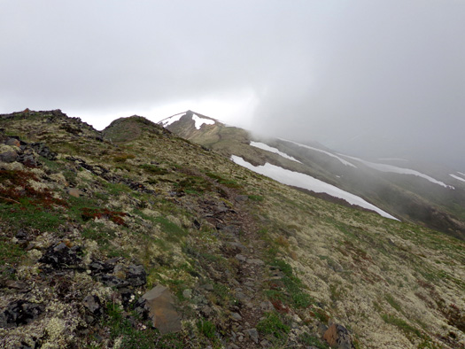
On the way back across the ridge the clouds parted enough to give me a couple good views
of pretty turquoise blue Eagle and Symphony Lakes, which lie below the
glaciers at the end of the South Fork Valley of the Eagle River:
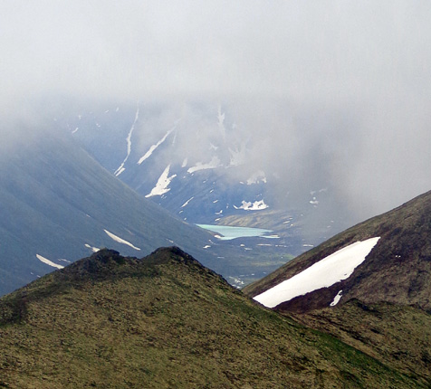
There is a trail farther along the ridge that goes down to the lakes but
I didn't go that far today.
I turned around at the highest peak on the ridge that I could see when
the clouds weren’t obscuring it:
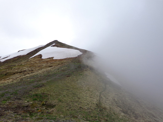
I took another break there for a few
minutes, hoping the clouds would move out so I could see down to the
lakes and continue hiking further south.
That didn’t happen fast enough so I started back toward the
Rendezvous-Little Teton saddle. I decided there wasn't much point in continuing if
I couldn't see where I was going.
Continued on
page 2 . . .
Happy trails,
Sue
"Runtrails & Company" - Sue Norwood, Jim O'Neil,
and Cody the ultra Lab
Previous
Next
© 2012 Sue Norwood and Jim O'Neil
