Continued from the
first page.
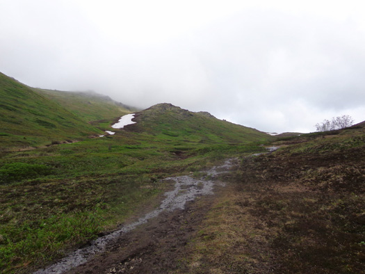
THE RETURN TO THE SADDLE
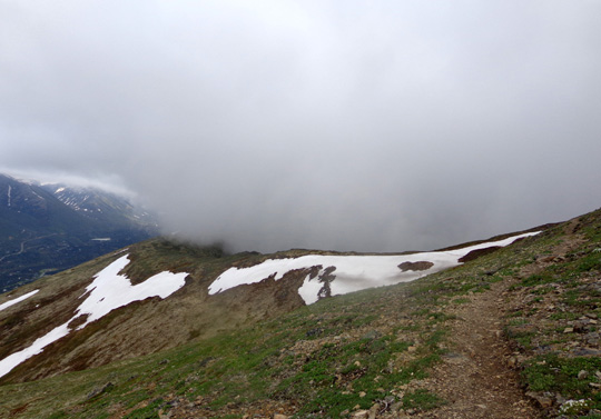
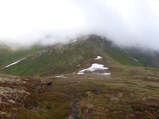
Here are some of the photos I took going back north along the
ridge toward the
saddle between Rendezvous and Little Teton peaks. The clouds continued
moving in and out:
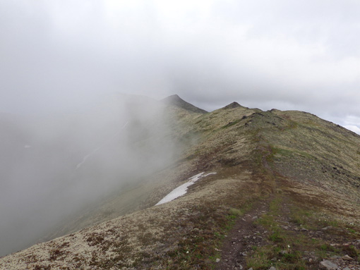
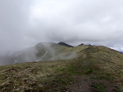
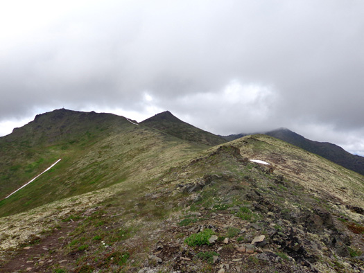
In those photos Little Teton Peak is on the left and Rendezvous is the
pointed summit closest to it on the right.
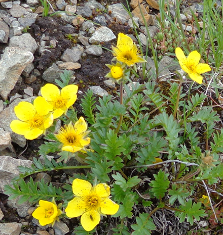
LOTS OF ALPINE FLOWERS
As I hiked out and back on the ridge I noted numerous flowers that
thrive in the harsh conditions of the tundra.
There were more flowers on
the wind-whipped ridge than in either of the more protected valleys that I hiked up or down,
possibly because there are more hours of sunshine on the ridge.
I don't know the names of most of the flowers I saw. I have two
little Alaska and Yukon wildflower booklets I've picked up along the way
but neither has many of the ones I've spotted in recent weeks. I'll
include what information I have or give my best guess.
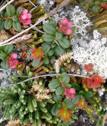
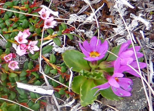
I love this montage of various alpine plants,
including lichens.
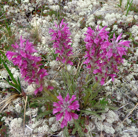
These purple lousewort flowers (above) are
surrounded by white lichens (close-up below).
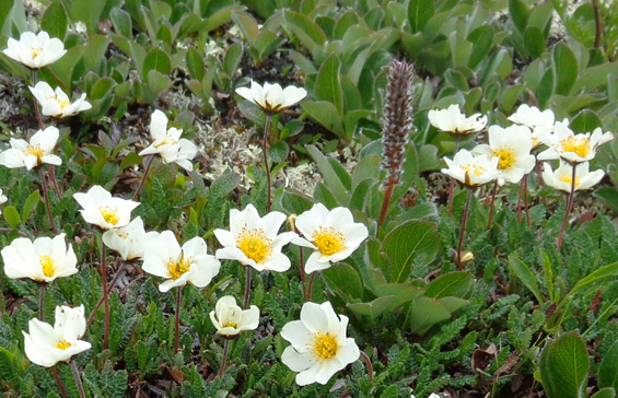
Here are several kinds of white flowers I saw on the ridge and upper
part of Rendezvous Peak:
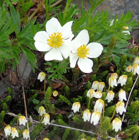
I think the two larger flowers are mountain avens;
they look
very similar to cut-leave anemones AKA wind
flowers.
There are some more flower photos from this hike at the bottom of this page.
BAGGING A NEW PEAK
I didn't originally intend to climb to the top of Little Teton Peak
today but it was easy and occurred by chance on my way back from my
ridge walk.
Last weekend when I ventured less than half a mile on the ridge there was a 100+-foot-wide snow bank near
the saddle that was somewhat scary to cross. However, both out and back I was able to dig into it sufficiently to not slide down a
long embankment toward the Eagle River.
Today it was even more
risky – less snow but more icy and I couldn’t dig into it very well:
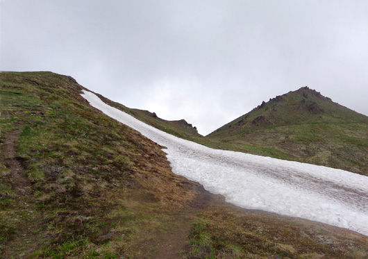
Note smaller trail on far left that goes up Little
Teton.
Once again, my picture just doesn't show the angle of the slope adequately.
I got across the snow OK
outbound but decided on the way back to just climb up about 150 feet to
the top of Little Teton (elev. 4,030 feet) so I could avoid the snow
and bag another peak.
That worked well. Two young women
and their big St. Bernard-Pyrenees mix were in the vicinity and decided
climbing Little Teton was safer than going across the snow again, too. They’re the only other hikers I
saw that high on Little Teton or the ridge today.
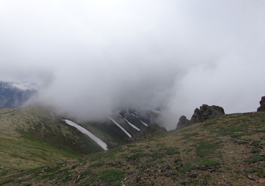
Part way up Little Teton Peak, looking back at
Rendezvous Ridge; now it's covered with clouds.
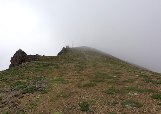
There is a communications tower and second
chairlift on Little Teton's summit.
I took another short break on the summit of Little Teton, then hiked
down a short distance to the "upper saddle" between Rendezvous and
Little Teton Peaks. That's where I landed at the top of the short, steep
climb I described earlier.
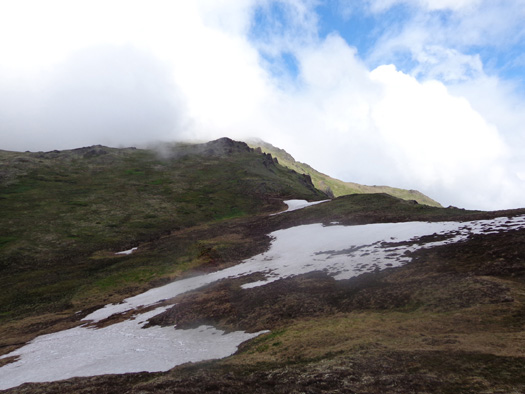
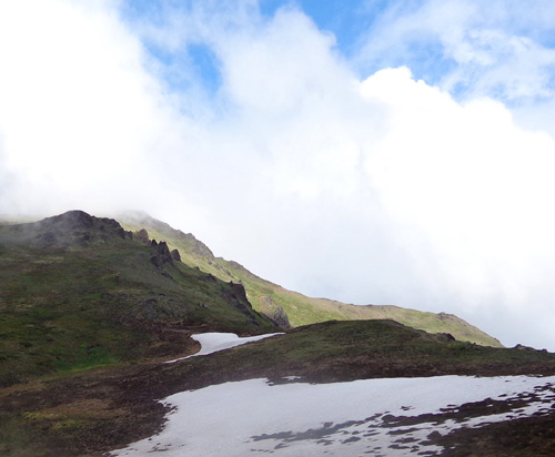
A
DIFFERENT DESCENT
Since it was so messy on the ascent to this saddle I did not go
back down to the parking lot the same way I went up.
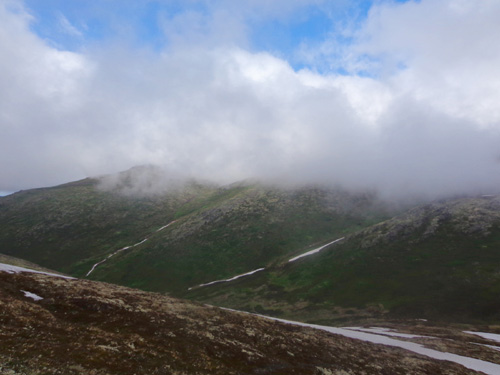
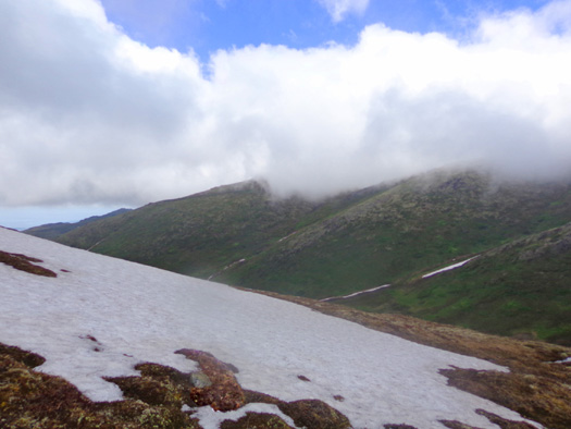
One last look at the ridge while it's still
visible; good thing I hiked it when I did!
I took a longer, more gradual route back to the "lower saddle" between
Rendezvous Peak and Mt. Gordon-Lyon.
I began my descent from the upper saddle on the main trail but
after about one-third mile I detoured to the left (north) on a faint trail that
a hiker showed me last week. It avoids a very steep section of trail with
loose gravel that would be difficult for me to negotiate going downhill with
bad knees. I went uphill on it last week with no problem.
This alternate trail is more narrow but obviously
well-used. Mt. Gordon-Lyon
is ahead of me on the north side of the saddle; its
summit is under clouds.
The main trail runs through this valley.
The north side of Rendezvous Peak doesn't get much sun,
even in June,
so there was more snow as I descended toward the
lower saddle and main trail.
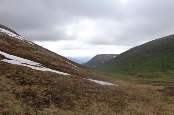
The alpine plants are still brown where the snow
has just melted but they green up within a
few days. The growing season at this latitude and
altitude is mighty short. This is the end of June!
The alternate trail got me
down to the
lower saddle (elev. about 3,600 feet) between Rendezvous Peak and Mount
Gordon-Lyon.
A little before I
reached the saddle two young male runners were coming up toward me
wearing running shorts and shoes -- no shirts:
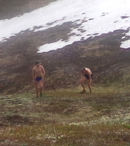
Brr. All of a sudden
I didn't feel so studly any more. <sigh>
This is a good place
to "hill train." Even on this more gradual trail they were really
leaning forward to power up the mountain. A little later I saw them
bounding down the steep Little Teton slope I hiked up this morning.
Ten or twenty years ago I could have done that, too.
I wonder if they're
training for one of this summer's trail races such as the short but
steep Mt. Marathon event in Seward on July 4 or the 24-mile race on the
Crow Pass Trail July 21? There are a number of interesting mountain
trail foot races in Alaska each summer.
I took this picture
from a little way below the saddle, looking up at Gordon-Lyon. I cropped the second photo
from the original. I just like the shapes and
colors:
Then I descended on the main trail the rest of the way to parking area.
There were more
hikers when I rejoined the main trail. It was even muddier
that it was last Saturday. Like the other hikers ahead of me, I followed a
detour on a
renegade trail that was higher up and more dry. That way we weren't up to our ankles
in the mud.
I figured it was less harmful to the vegetation to walk where others had
already made trails than to go cross-country and damage even more
plants.
This week most of the main trail is a drainage
ditch running parallel to the creek farther to the left.
Cody had a lot of fun
where the snow was soft enough for him to dig and roll around in it. He
had plenty of water until we were on the ridge. I gave him water from my
Camelbak twice up there.
This hike was about 6ľ miles long
and took over three hours with several breaks.
I also took lots of pictures with my new Sony camera today to test it out. So
far I’m pleased with the photo quality.
I didn't realize until I downloaded the photos, however, that most have
a blurry spot in them because the lens got smudged early in my hike.
Rats. It's more noticeable when the photos are larger than the ones here
on the website, which I was able to tweak a bit in PhotoShop to sharpen
up the blurry areas.
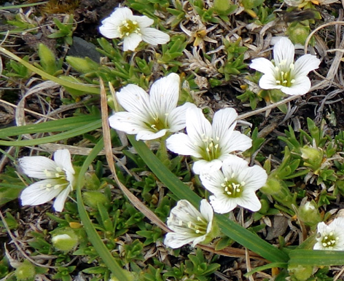
Two more kinds of delicate-looking alpine flowers
from the ridge;
they have to be much tougher than they look to grow
in this harsh environment.
These flowers like more water; they are in the
drainage area along the main trail.
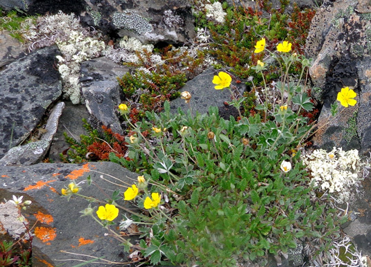
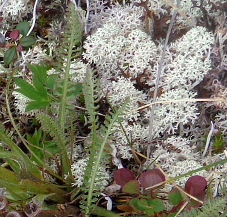
Another flower that grows on the ridge; I like the
contrast with the orange fungi (lichens?)
growing on the rock and the other green, white, and
red alpine plants nearby.
I took over 200 large photos (16-megapixel = 4608 x 3456 pixels) and the rechargeable battery held out
fine. I've never had a proprietary battery like this in my previous
digital cameras, just lithium AAs that were easy to replace with spares
I carried.
I'll have to experiment with recharging this battery (how often, how long) -- and
remember to put the battery back in the camera so I "don't leave home
without it." I don't have a spare.
Next entry: Vietnam Moving Wall, veteran's memorial service, and
Jim's bike ride today
Happy trails,
Sue
"Runtrails & Company" - Sue Norwood, Jim O'Neil,
and Cody the ultra Lab
Previous
Next
© 2012 Sue Norwood and Jim O'Neil
