We woke up to another beautiful sunny morning. The prediction was for a
cloudy day, however, so we figured we'd better get going early for some
outside activities.
My activity of choice was another hike up in the
Chugach Mountains east of Anchorage. In the next entry I'll explain why
I chose to do that instead of attend the Arctic Thunder Air Show at JBER.
That was Jim's preference of how to spend the day.
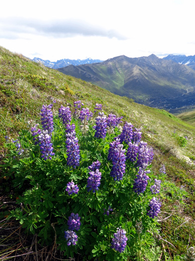
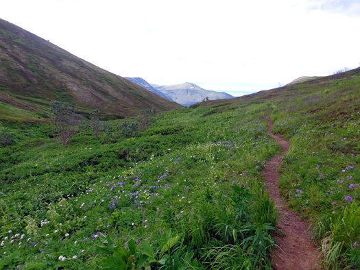
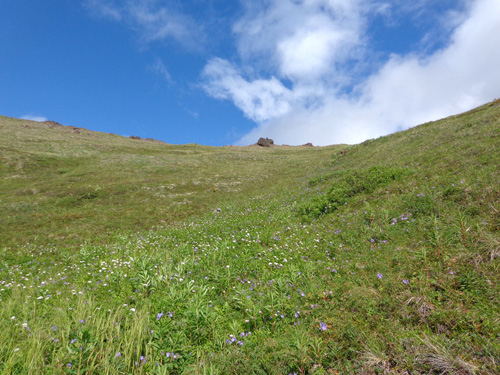
Lush lupines on the south face of Mt. Gordon Lyon, above the South Fork Eagle River Valley
As you'll see, however, I did get to enjoy some
of the air show -- from high up in Arctic Valley and not down on
the base. But I'm getting ahead of myself . . .
LET'S DO SOMETHING DIFFERENT
Although my legs were still a little tired I didn’t want to waste a
mostly-sunny day inside. I took Cody up to the Arctic Valley-Rendezvous
trailhead at the Alpenglow Ski Area again (my fourth time
there) for a relatively challenging hike.
I did a little over five miles and basically made up the route as I went
along. Even though I began at the same trailhead as I have three times
previously, the first half of my hike was on new trail to me.
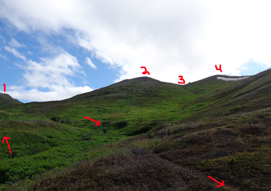
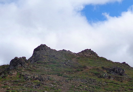
#1 = south
shoulder of Mt. Gordon Lyon. #2 = Rendezvous Peak.
#3 = saddle
between Rendezvous Peak and Little Teton Mtn. (#4).
Did I say "trail?" Some of it was cross-country and that was fun.
I began at about 2,600 feet elevation at the trailhead and walked up the
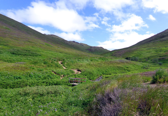
wide dirt road above the ski area buildings. After about Ľ mile I
crossed Toklat Creek on a wooden bridge and walked up a narrow trail on
the other side of it:
I could still see the main trail on the northwest side of Rendezvous
Peak most of the way up to the saddle between Rendezvous and Mt. Gordon
Lyon, which became my goal halfway up the slope.
My original plan was to follow the creek to its source before the
saddle, then go right (south) toward Rendezvous Ridge again.
Curiosity got the
best of me, howver.
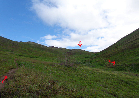
Top arrow is
Mt. Gordon Lyon. Left arrow is the trail I started on. Right arrow is
main trail I came down.
There was a long ridge
to my left (north) that I've never
seen over. You can see it in the photos above.
I knew what was on
the other side -- the town of Eagle River, the
north and south Eagle River valleys, Knik Arm, and
beyond -- but I hadn't seen all that from the perspective of being high
on a mountain ridge, just from the Glenn Highway. Why not just go up
there and get a different view?
The first part of the
route was on a real trail, although much more narrow than the main trail
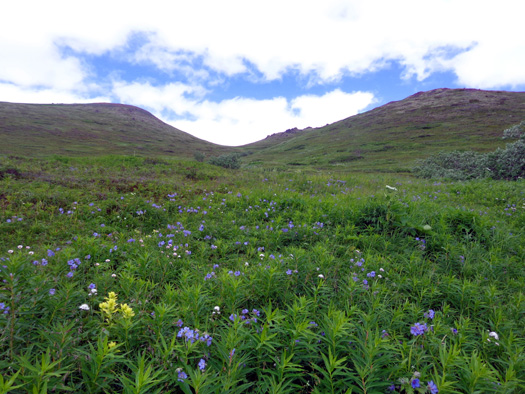
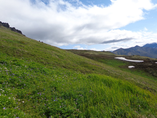
on the other side of the creek. I loved all the pretty flowers. Each
time I come up here, there are more flowers in bloom:
Looking back
where I hiked up from trailhead
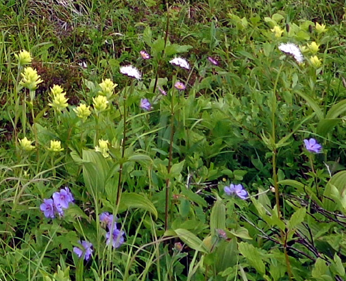
Wild blue
geraniums, cream-colored Indian paintbrush, white Alaska spirea, and
purple asters
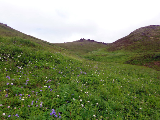
Looking
north toward ridgeline
I decided to go cross-country up a drainage area to the ridge on the
north:
There were some faint animal trails but I mostly just picked my way
through the grass and flowers on one side, then the other, of the little
stream coming down the drainage.
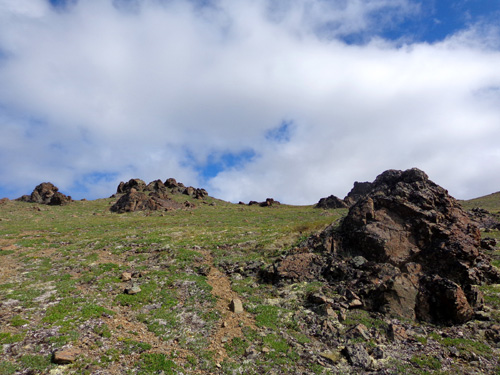
I just generally aimed for the rock formations at the top of the ridge:
From below it appeared that I could hike east on the ridge to Mount
Gordon Lyon (elev. 4,134 feet) and then down (south) to the saddle
between Gordon Lyon and Rendezvous (elevation 3,468 feet).
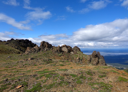
I was able to do that but I took a circuitous route to see various views
along the ridge and the summit of Gordon Lyon. I also found my own route
down to the saddle because the established trail is too steep for me and
has loose rocks.
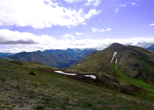
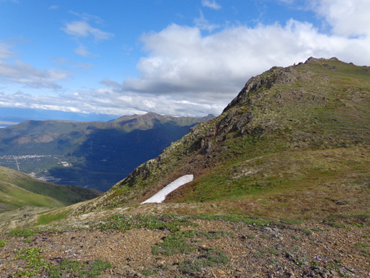
Can't get lost up here: there's familiar Rendezvous Peak to the south.
Looking back down the drainage I climbed
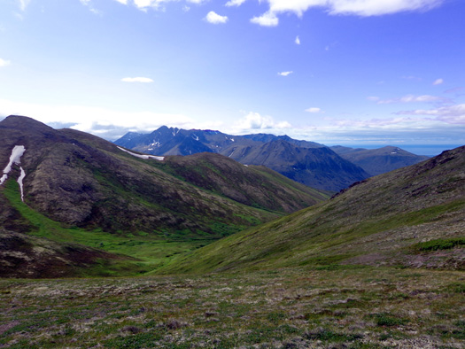
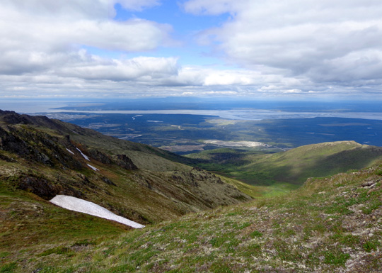
The views from that ridge allowed me to see Knik Arm, the town of Eagle
River, the serpentine north branch of Eagle River, the Flats, and
northern Chugach Mountains in a different perspective than I’ve seen
previously.
I really enjoyed the colorful rock formations and the spectacular panoramic views as I walked east
toward the summit of Gordon Lyon:
Above and below: views of Knik Arm and The
Flats

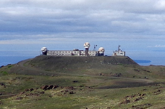
When I got high enough I could see back west to the old Nike-Hercules
missile site on what is now called Site Summit. I've seen it from the
saddle between Rendezvous and Little Teton but this was closer and a
different perspective:
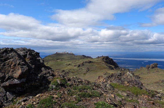
Here's another view back to
the west from a fire ring on the ridge:
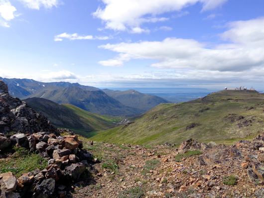
The decommissioned missile
installation is on the right, the parking area at the trailhead is in
the center, and the Anchorage Bowl and Cook Inlet are in the distance.
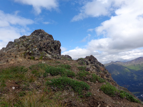
The next six photos are approaching my goal peak, Mt. Gordon Lyon.
Elevation at the rocky summit is about 4,134 feet (different maps and websites have
different elevations):
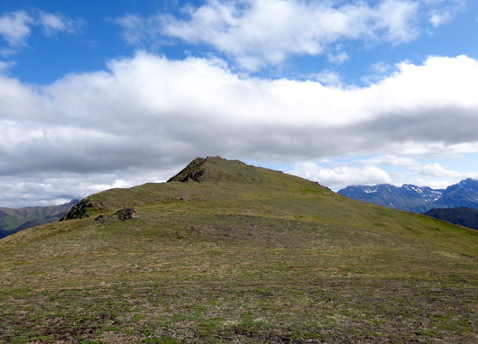
The tundra looks smoother than it really is but
it's easy to walk up here with no trails.
I could see down to the town of Eagle River as I
approached the summit.
View NW toward Knik Arm and Cook Inlet
Above and below: Cody and I had the craggy
summit of Mt. Gordon Lyon to ourselves
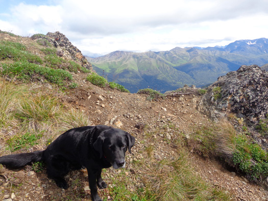
What a sweet boy: Cody will happily follow me
anywhere.
Continued on the
next page . . . too many scenic
photos for one page!
Happy trails,
Sue
"Runtrails & Company" - Sue Norwood, Jim O'Neil,
and Cody the ultra Lab
Previous
Next
© 2012 Sue Norwood and Jim O'Neil
