Of the eleven different trails I hiked this week at Joshua Tree,
Barker Dam was the only one with any visible standing water. It seems as
out of place in the middle of the Mojave Desert as the palm trees
in the park's oases.
It was quite refreshing to see a little pool of water (unfortunately,
not the pretty blue lake that some websites* show) and a large green area
where water recently stood. It makes you realize how tough of a life it
must have been to try to raise cattle here -- and for the
wildlife that continues to call this place "home" to survive in such a
harsh climate.
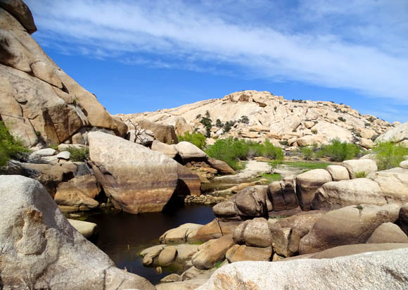
There was a little bit of water
pooled near the dam this week but not extending back to that
green area in the distance with
the grass and trees where a reservoir sometimes builds up.
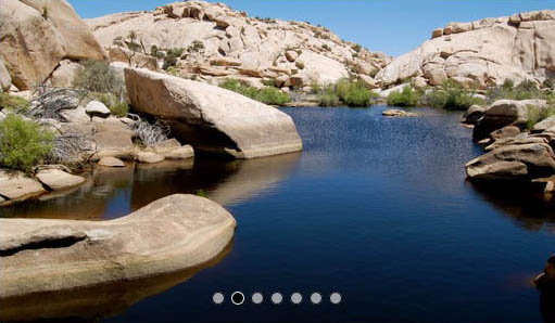
* I copied this photo from the
HikingProject.com web page because it
shows the lake when it's full:
Because of the water source, in the winter and spring, at least, this
is understandably one of the best places in the park to spot wildlife
early in the morning or evening.
Both times I hiked this trail, however, weren't at natural feeding
times and there were too many people around for wildlife like bighorn
sheep and coyotes to come out of cover for a drink of water. I tried to
take most pictures without people in them but sometimes I just didn't
want to wait for everyone to get out of sight:
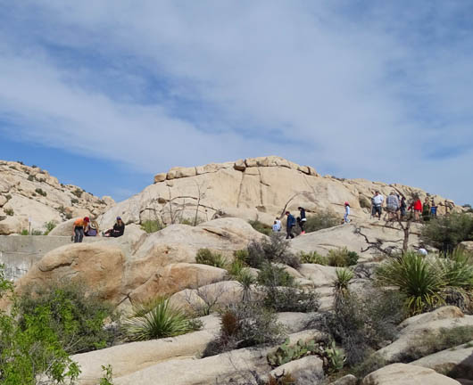
Part of a large group of people
near the dam Tuesday afternoon
I hiked the
loop CCW both times, by myself in mid-afternoon two days ago and about 9
AM this morning with Jim.
It was more pleasant this morning and there were fewer people on the
trail that early. We hustled out of the parking area as soon as we
realized folks were gathering for a ranger-led group hike and we were
able to stay ahead of them.
I'll show photos of the loop from both days, including some
petroglyphs, and explain a little more about the history of the cattle ranch.
GETTING THERE + GENERAL DESCRIPTION OF THE TRAIL
This is one of the most popular (read: busy) trails in
the park because it is rated as "easy" in difficulty by the Park
Service, it is relatively short (about a 1Ľ-mile
loop), it is readily accessible, it is scenic, it has water part of
the year, and it has some interesting history.
Because of all the boulder piles, the Barker Dam Loop is also popular
with rock climbers and boulderers. I saw several of them on my first hike.
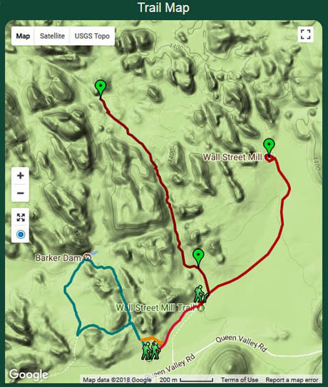
Here's a section of the park map to show the trail location:
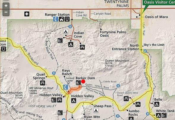
I marked Barker Dam with a red dot; it is in the southern part of
the Wonderland of Rocks area. The main park road is highlighted in yellow.
Parking for the Barker Dam Loop is a few hundred yards off Park
Boulevard, the main east-west road through Joshua Tree. It shares a
trailhead with the Wall Street Mill Trail, as shown in this trail
diagram from the
Hikespeak.com website:
I added the orange line at the bottom to indicate the connecting
trail between Wall Street (red) and Barker Dam (blue). The dark red trail
going up the middle of the diagram is
Wonderland Wash.
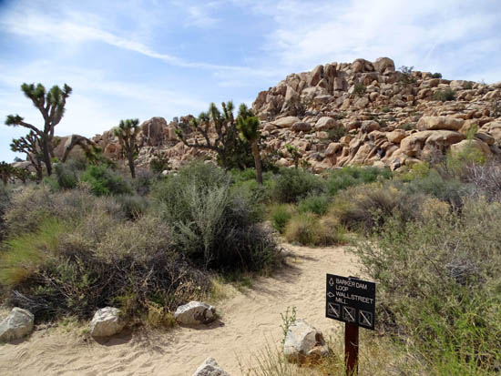
As mentioned, both Wall Street and Barker Dam trails begin from the
same parking area. If you plan to hike just one of the trails,
be sure to read the signs so you start out on the correct one. They look
similar but are clearly marked.
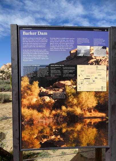
This is the interpretive panel
at the Barker Dam trailhead:
When I hiked both trails on Tuesday I did the
Wall Street Mill Trail first, then took a short trail tangent
(what I marked in orange above) to the Barker Dam Trail. I didn't
go back to the parking area until I was finished with the Barker Dam
Trail.
Here's a picture from that tangent:
As you'll see in various photos on this page, trail surfaces range
from smooth hard-packed sand to bedrock. There are some steps here and
there but the trail itself isn't very rocky. It's not wheelchair- or
stroller-accessible, however.
The trail undulates with a minimal elevation gain and loss of only
about 50 feet. Some places are quite narrow between boulders, others
wide open in the desert.
As with most of the trails at Joshua Tree,
there isn't much shade and any standing water in the reservoir behind
the dam isn't potable. Folks who want to spend time hanging out at the
dam or scrambling in the rocks should take adequate water with them.
Otherwise, you can blitz through the loop in well under an hour.
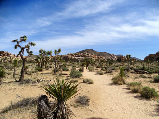
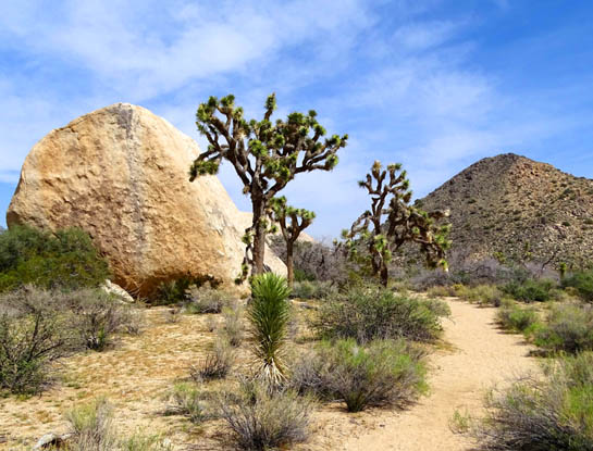
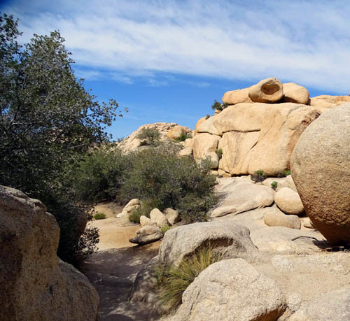
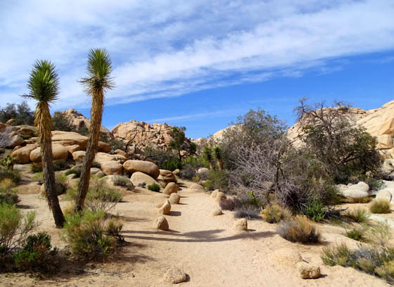
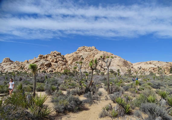
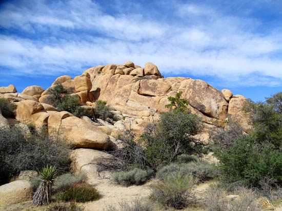
Despite the lack of water on most of this loop there are quite a few
shrubs, grasses, and trees in places other than the reservoir, including
a fair number of Joshua trees in the open desert
(photo above) between the dam and the cave with petroglyphs.
Because the trail is at elevations over 4,200 feet, not
very many wildflowers, shrubs, or cacti were in bloom yet.
TRAIL PHOTOS CCW FROM THE TRAILHEAD TO THE DAM
These photos are roughly in order and from two different hikes this
week. Most are from my hike on Tuesday when I was by myself, seeing the
trail for the first time.
I didn't take as many pictures this morning when I was with Jim,
partly because I'd already taken so many but mostly because the sun was
lower today and photos from the first half of the loop didn't come out as
well. Despite conventional wisdom that "the best photos are taken early
in the morning or evening, not in direct sunlight," I don't find that to
be true when shade obscures colors and details.
Mojave yucca in bloom on the
left, juniper above it, and Turbinella oak on the right
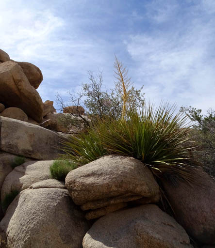
A Parry Nolina, another kind
of yucca; this one isn't blooming yet.
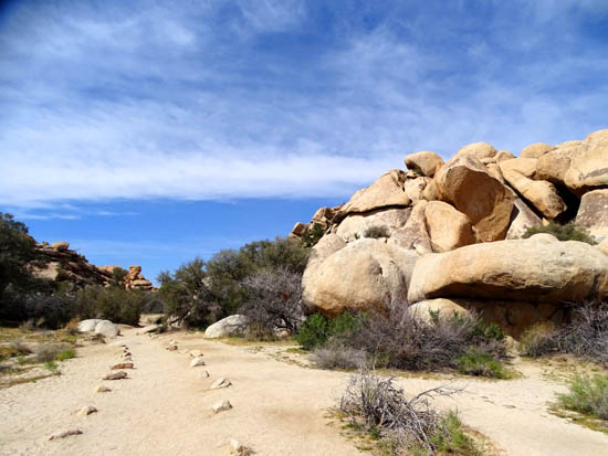
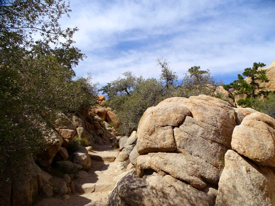
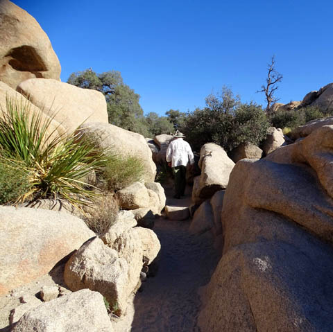
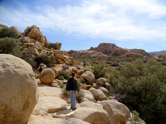
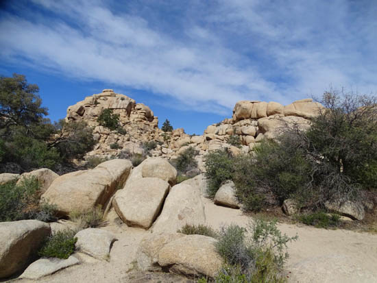
Now we're entering one of my favorite parts of this loop, the
more narrow trail through boulders.
Despite some clouds, I got much better photos here on Tuesday afternoon
when the sun was higher, even though the sky was more clear this morning.
The one picture below that I included with Jim to show how narrow
the trail can get, also shows how much shade is there when the sun is low.
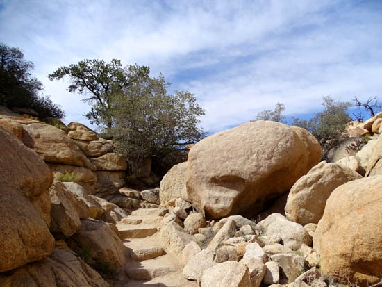
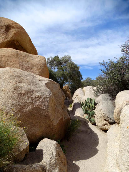
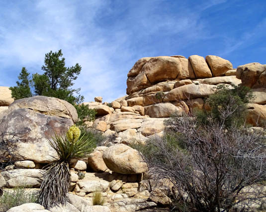
Cool, huh? Love those rocks!
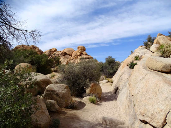
SCENES FROM THE DAM & RESERVOIR
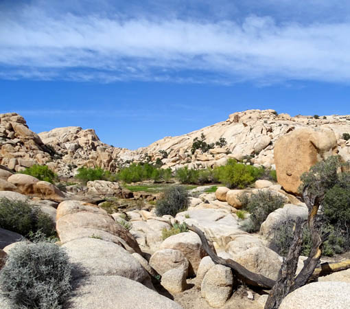
Now the trail opens up as we approach the reservoir,
which was mostly dry both days this week when I was there. Some hikers
were walking off-trail in the sand near the green trees in the next
picture:
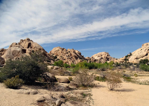
Those trees are at the edge at what is sometimes a real
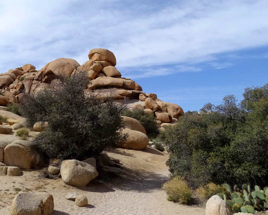
lake.
The reservoir area is surrounded by tall boulder piles
on all sides, an open invitation for folks who want to climb up for
better views. The trail curves to the left and goes over bedrock close
to the boulders on this side of the reservoir:
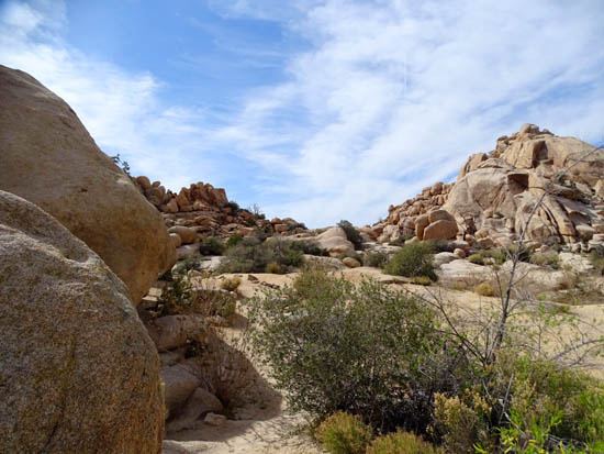
The little dam is in the
distance, under the red dot.
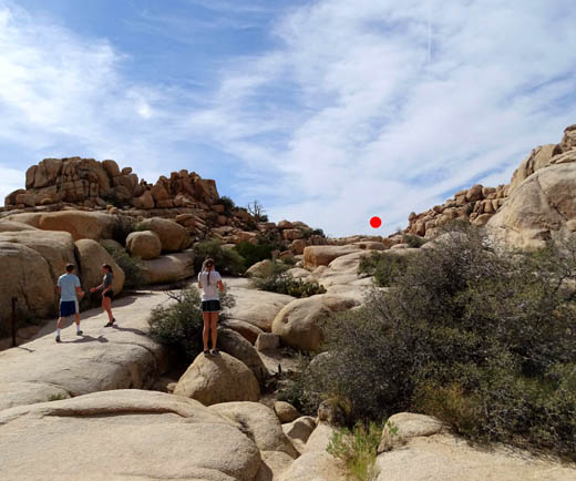
Another view of the dry reservoir
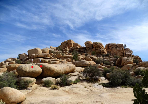
Two people (above red dots) up on
the boulders; the "trail" is in the foreground.
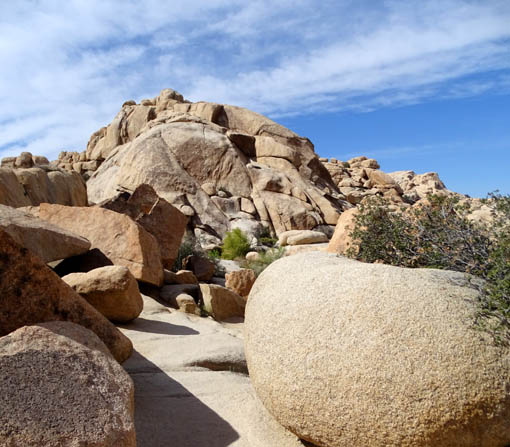
More fun rocks to walk around
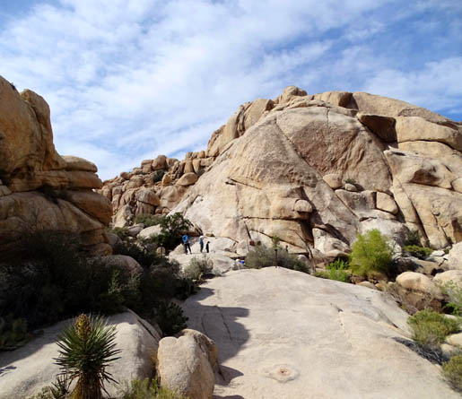
Nearing the dam and pool of water (where
the people are standing)
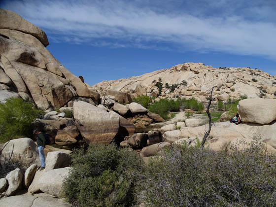
This is the best shot of the water that I got. I think
the lines on the rocks indicate various water levels over the years:
A sign at this location tells the history of the stone
and concrete dam, which is shown in the next picture. I included some
people for perspective on the size of the dam:
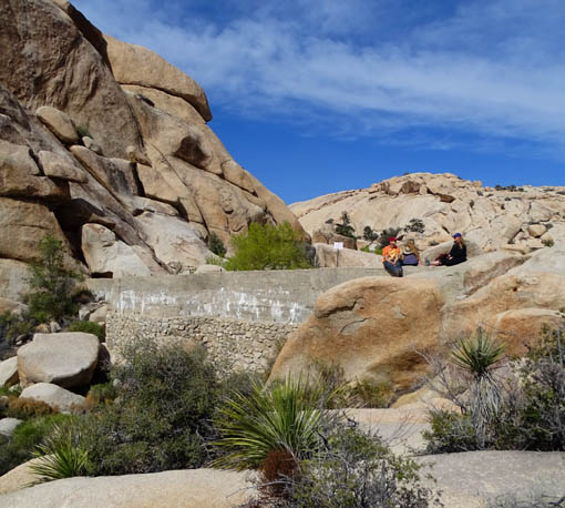
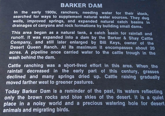
Here's what's written on the sign at the dam re: the history of
it and others built in this area by cattle ranchers in the early 1900s.
It also explains why the lower part of the dam is made from rocks and the
upper part from concrete:
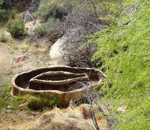
Below the dam is the intact cattle trough mentioned on the sign:
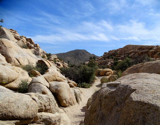
PETROGLYPHS & THE REST OF THE LOOP
Continuing clockwise from the dam to the petroglyph cave, the trail
drops down over bedrock and steps to open desert floor for several
hundred yards until it reaches an intersection with a short path to a
shallow cave with petroglyphs:
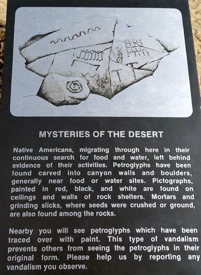
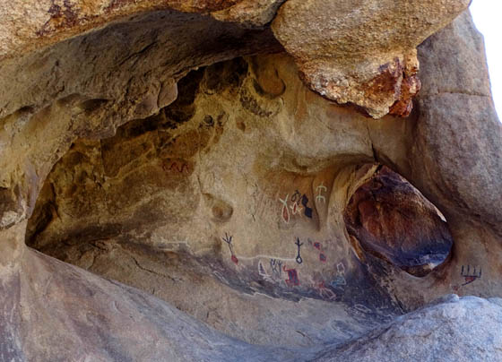
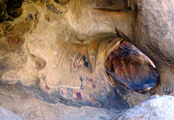
I was disappointed to see that the carved petroglyphs
had been painted over (vandalized!). I've seen better ones before, and
I'll have photos of much more authentic pictographs and petroglyphs to
show you later this year from Valley of Fire State Park in Nevada and
rock walls near Parowan, Utah.
It's about a quarter mile on flat, smooth trail back to
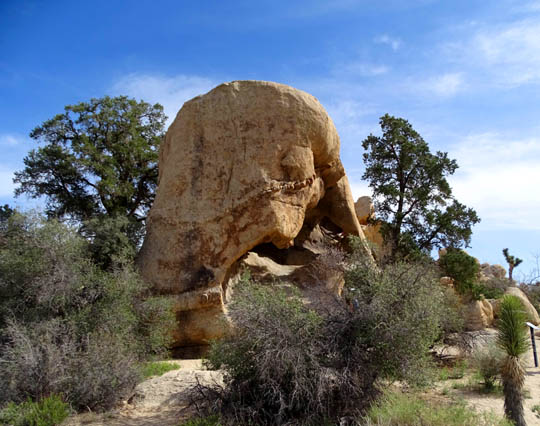
the parking area from the petroglyph cave:
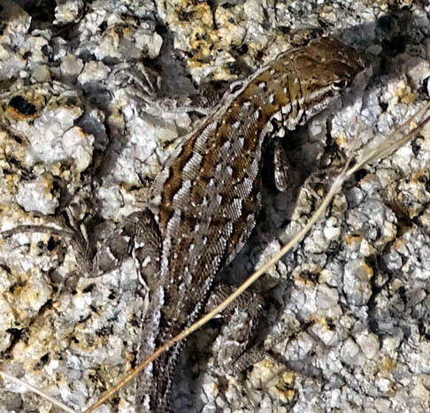
The rest of this guy's trail is about as long as
the part of him you see above.
This is a scenic and fun trail that people of all
ages can enjoy. It's one of my top four favorites at Joshua Tree. I'm
just sorry there wasn't more water in the reservoir this week. That
photo from the HikingProject page is so picturesque with the lake at
"full pond."
I'm not the only one who likes this loop in the
spring, so plan to get there early and on a weekday, if possible, to
avoid the crowds.
Although I was able to find a parking spot in the
early afternoon on Tuesday, there were so many people near the dam and
petroglyphs that I wasn't able to get as many pictures as I wanted
without strangers in them. There were many fewer people on the trail on
Thursday in the early morning and it was cooler.
Next entry: another very scenic and relatively
short trail loop at Joshua Tree -- Hidden Valley
Happy trails,
Sue
"Runtrails & Company" - Sue Norwood, Jim O'Neil,
Cody the ultra Lab, and Casey-pup
Previous
Next
© 2016 Sue Norwood and Jim O'Neil
