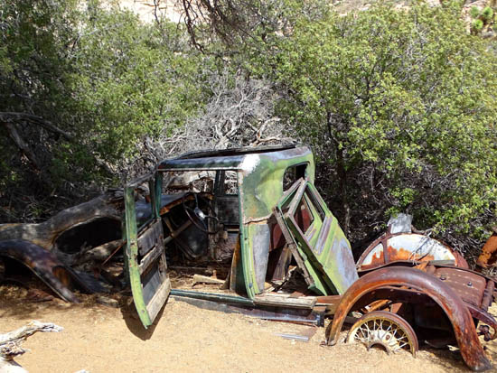
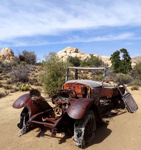
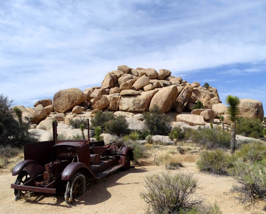
And that's not all -- there are some really cool vehicle
relics from the 1930s or '40s (??) to be admired and photographed, too:
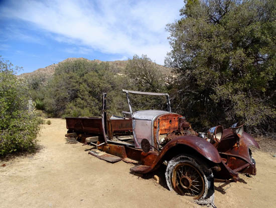
I found those as interesting as the remaining parts and pieces of the
old mill.
Now you might be thinking that the
California gold rush was in the late 1800s, before vehicles like these
would be on the scene. It was.
However, this area enjoyed
a second gold and silver rush during the Depression in the 1930s.
According to the park interpretive sign at the
trailhead (next picture), long time rancher-miner Bill Keys recognized the need for a
gold processing mill as more and more miners poured into the area. If
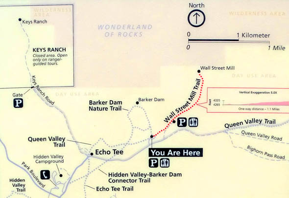
you look at the park trail map farther below you'll see his ranch in the
upper left corner.
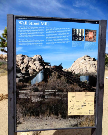
In 1930 he bought the Wall Street Mill site because it
had an existing well. He gathered the machinery to build his mill from
other mine and mill sites and processed the ore for the Desert Queen
Mine and for other folks with small mines in the area.
Keys ran the mill until 1966 on an as-needed basis,
charging a fee to remove the gold from the ore. He returned the gold to
the miners or sent it to a smelter or the U.S. Mint.
Because the Wall Street Mill is so well preserved --
despite repeated efforts of vandals to damage it -- it is listed on
the National Registry of Historic Places.
I'll have another interesting bit of history about the mill's owner
later.
If you want more information about the mill itself, you
can do an easy internet search. Some of the links I found re: the
trail to the site also contain some of the history.
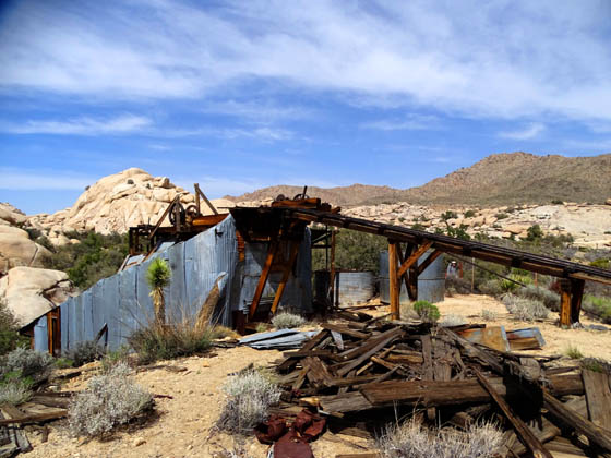
I'll show more pictures of the mill's remains (and more old rusty
vehicles) later in this entry, too.
GETTING THERE & TRAIL DESCRIPTION
This was hike #5 for me on this date and not the last one! I'll have
a separate entry on the sixth one, the adjacent Barker Dam loop, dated March 24.
I liked that trail so much I came back a second time with Jim so he
could see it, too.
I thought the Wall Street Mill Trail was an
easy hike because it's rather level (about an
80-foot elevation gain and loss) and only 1.1 mile to the mill
site from the trailhead that is used by the most people. So that's 2.2
miles round-trip.
This trail shares a parking lot with the popular Barker Dam loop
and one of the Wonderland of Rocks trails. If 2.2 miles out and back is
too far, you can drive about 3/10ths
mile farther on dirt Queen Valley Rd. to a much smaller parking area and
jump on the trail there, saving 6/10ths of a mile roundtrip on the hiking distance.
You can see the "P" for parking at both places on this map from the
park's interpretive panel at the main ("You Are Here")
trailhead:
Although I'd rate this an easy trail compared to other trails at
Joshua Tree, the park website and printed guide list this hike as moderately
difficult, perhaps because the well-marked trail is sandy (parts of it are through
washes), has no shade, and is at 4,300+/- elevation?
I reached the large parking area for the Barker Dam-Wall Street
Mill-Wonderland of Rocks trails about 1 PM and it was fairly crowded on
this Tuesday in late March. Most of the visitors were headed to the
popular Barker Dam Trail, not the Wall Street Mill Trail. For me, that
was fine because I had fewer people to deal with as I hiked out and back
to the mill site.
Here's my GPS track for both hikes. Ignore the loop on the
left for now. We'll start at the gold dot (parking area) and head to the
right:
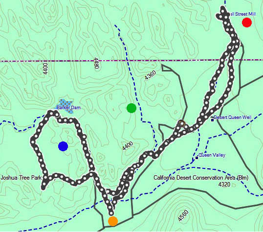
The blue dot is the Barker Dam trail loop that I'll cover in a
different entry. The green dot is the Wonderland Wash "trail" I followed
right before this hike. The red dot is the destination for the current
hike I'm describing, the Wall Street Mill Trail.
I think I'll just abbreviate that to the "Mill Trail" for the rest of
this entry!
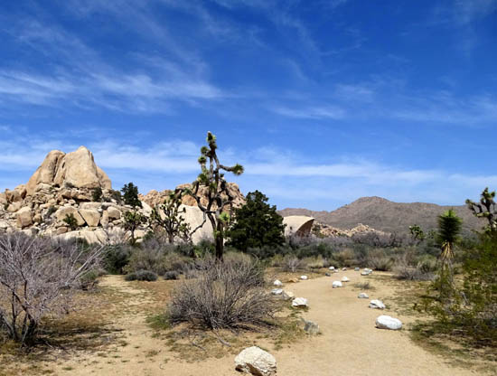
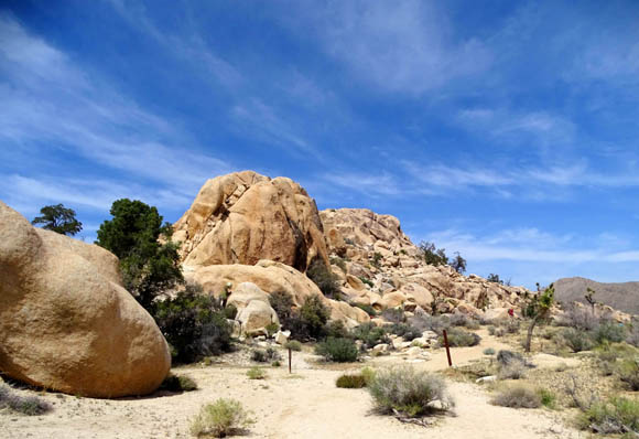
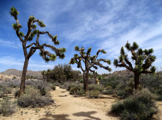
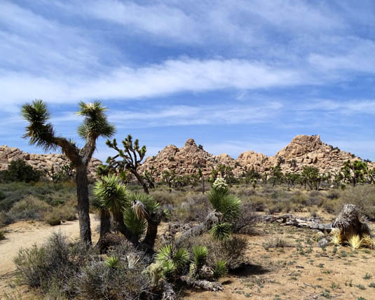
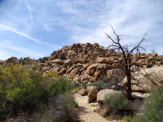
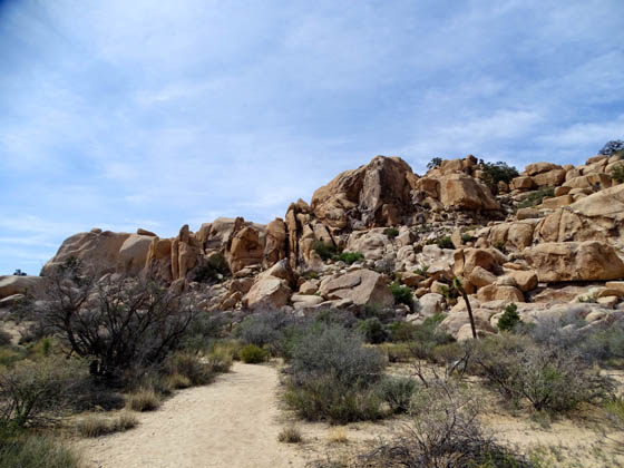
From the parking area the Mill Trail follows a sandy wash past some
of the park's scenic monzo-granite rock formations/boulder piles:
I mentioned that the trail is well-marked. If there
aren't signs or rocks lining the path, it's obvious where it goes.
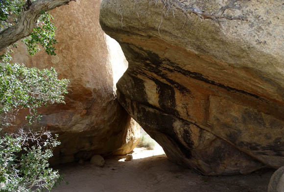
However, there are also a lot of little side trails that
go closer to the boulders, either ending there or paralleling the main
trail. These are fun to explore, especially when you find "tunnels" like
these to walk through:
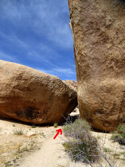
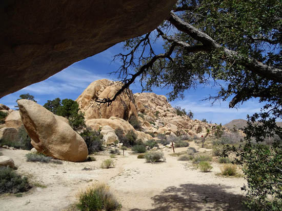
Using an overhanging rock and
tree as a "frame" for the trail ahead
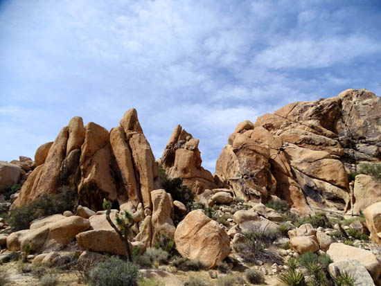
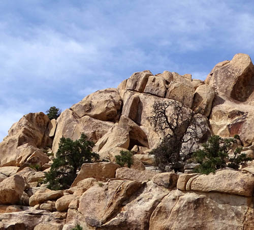
Junipers, Turbinella oaks, and other trees and shrubs
grow in some improbable places among the boulders:
The desert to the right as you're hiking outbound is rather flat and stark
except for some wildflowers and Mojave Desert shrubs in bloom in the spring
and all the iconic convoluted, multi-armed Joshua trees:
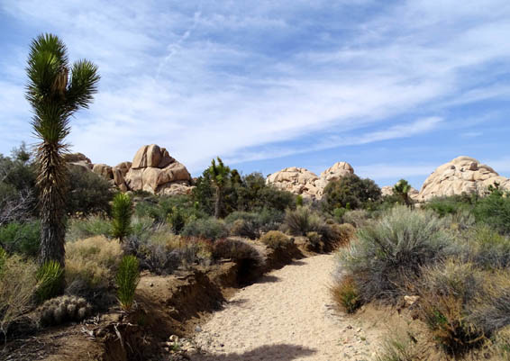
After passing most of the nearby boulders the trail follows a more solid
sand path the rest of the way to the mill:
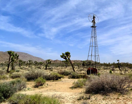
An old windmill is on your right outbound about 6/10ths of a mile
from the main trailhead:
Close to the mill the wash I followed (I can't remember if it was the
main trail or a side one) had more dense shrubs and trees:
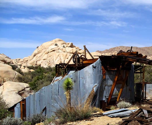
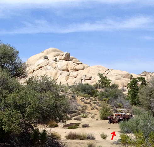
Before you get to those rock piles in the distance you start seeing
the relics among the trees and bushes
that are taking over the old mill site.
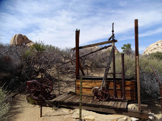
WALL STREET MILL
When you get to the site just wander around, read the signage, pose with the equipment and old
vehicles, take pictures, and try to think what the place would have been
like when it was in operation.
The top part of a sign erected by the Park Service shows a diagram of
how the stamp mill operated and gives its history:

Here are a few of the other pictures I took:

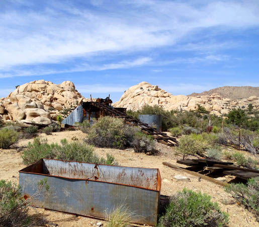
I've seen pictures taken from inside a decrepit bunkhouse
looking out at the rocks in the background but I didn't see such a
building.
I liked the old vehicles the best:
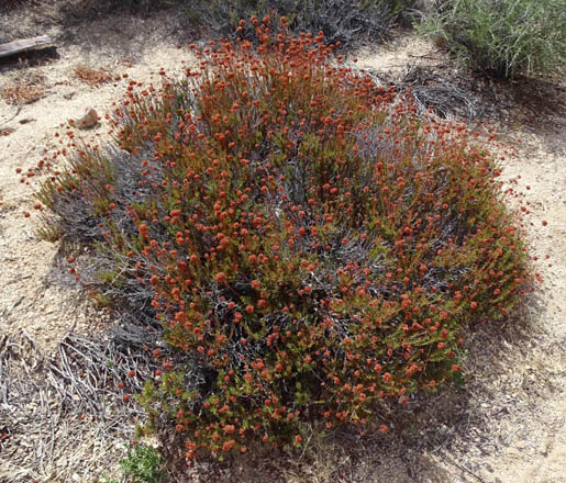
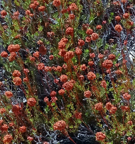
I found a large clump of reddish California buckwheat
that was new to me in the mill area:
On the return I noted a ranger-led group of hikers at the windmill:
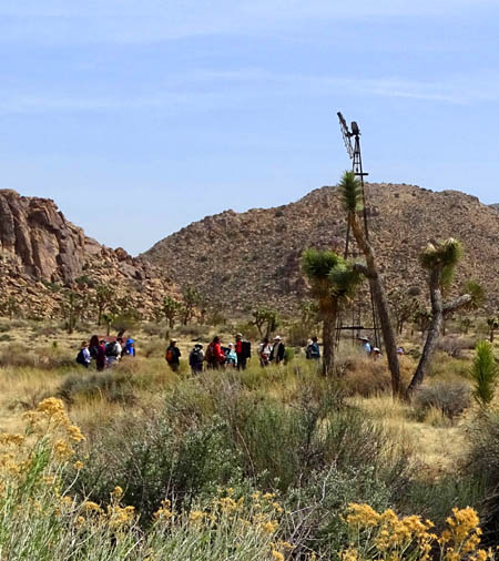
When convenient, we've enjoyed some hikes with rangers
at national parks over the years. It's a great way to learn more about
the history, flora, fauna, and other information about an area. This
time I deliberately went out ahead of them because I didn't have the
time to do the narrated tour and hike the Barker Dam Trail.
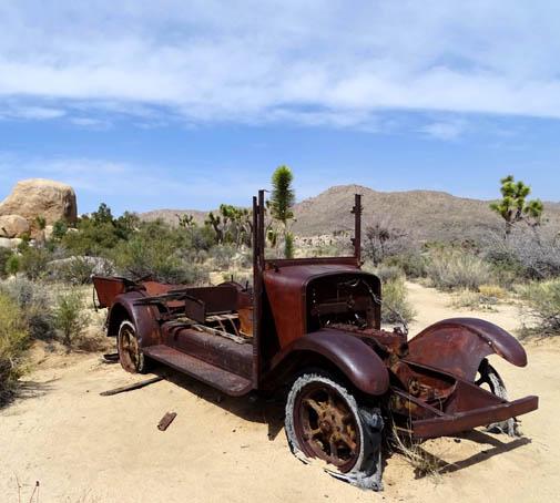
Just past the windmill on the way back I took a
triangular detour on a narrow path to see another rusted-out vehicle.
You can see the short detour on my GPS track at the beginning of this entry.
A few hundred feet from the trailhead I turned to the
right when I came to a sign for a tangent to the Barker Dam loop.
I passed these rocks before coming to the intersection
with the main Barker Dam Trail:
You could also take that tangent and return to the parking area from
the Barker Dam Trail without going around that loop, just to see some
different rock formations. It would add only a quarter mile or less to
the total distance.
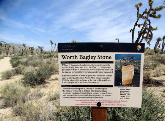
MONUMENT TO WORTH BAGLEY
I mentioned earlier that I had a bit more history to share with you
about Bill Keys.
Part of the way out the Wall Street Mill Trail visitors used to come to a stone
memorial erected by Keys that was inscribed, "Here is where Worth Bagley
bit the dust at the hand of W.F. Keys, May 11, 1943."
Keys and Bagley had a property dispute over control of the road that
accessed the mill. During an argument -- or ambush, as Keys
testified -- a gun went off and Bagley was
killed. Keys was convicted of manslaughter. After spending five years at San
Quentin, he was pardoned by a judge who ruled that he shot Bagley in self defense.
Because of repeated vandalism to the large rock, the park has removed the
memorial and put up this sign near the place where Bagley died:
Lots of history out here in this desert!
FINAL THOUGHTS ABOUT THE WALL STREET MILL TRAIL
If you have the time while in the park and are a history or antiques buff, it's well worth your
while to do this relatively short, easy hike. People of all ages can
find things to like about it.
History-wise, I enjoyed it and am glad I went back to the site.
From the perspective of just hiking, however, it was near the bottom of my
list of favorites of all the trails I hiked at Joshua Tree. In my
opinion, other trails like Mt. Ryan, Barker Dam, Skull Rock, Boy Scout, and Hidden
Valley have many more interesting plants, terrain, and views.
Next entry: scenes from two hikes on the Skull Rock/Jumbo
Rocks trail loop
Happy trails,
Sue
"Runtrails & Company" - Sue Norwood, Jim O'Neil,
Cody the ultra Lab, and Casey-pup
Previous
Next
© 2016 Sue Norwood and Jim O'Neil
