This is a continuation of my first full day hiking at Joshua Tree,
and the fourth trail I found to explore.
I'd already hiked about 4˝ miles total
on the Mt. Ryan, Hall of Horrors, and Cap Rock trails and had the whole
afternoon ahead of me on a day with perfect weather up at 4,000+ feet
elevation in the park.
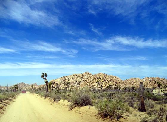
On the hunt for my next hike . . .
It was only about noon and I still had plenty of time and energy, so I
consulted my park maps and trail descriptions and decided to continue
west on the park road toward Barker Dam.
HIDDEN VALLEY CAMPGROUND
On the way I tried to find the Hidden Valley Trail at the Hidden Valley
picnic area. I wound up in the Hidden Valley Campground by mistake and
was unable to find the trailhead. I found it a couple days later at the
picnic area, which has a separate entrance from the campground.
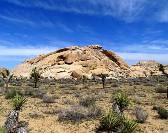
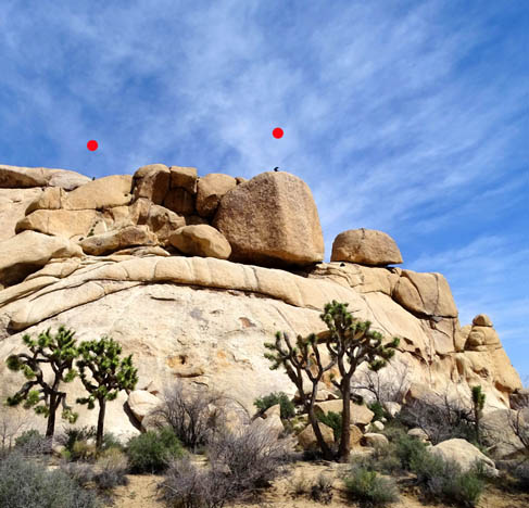
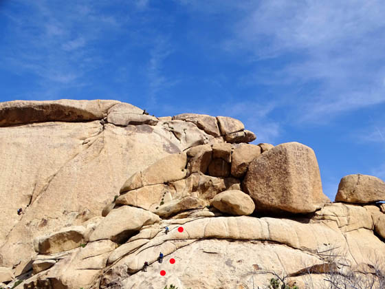
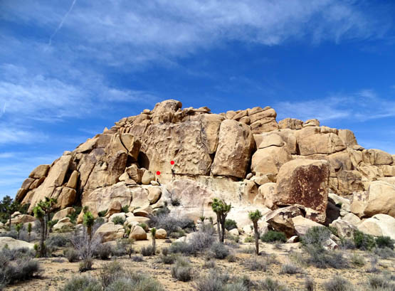
What I did find in
the campground were some scenic campsites for tents and small RVs, and a rock
formation with at least three climbers on it:
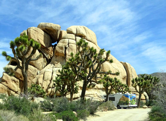
Pretty cool
rocks to camp beside!
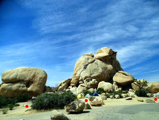
I marked
three campsites with red dots.
Three
climbers under two red dots
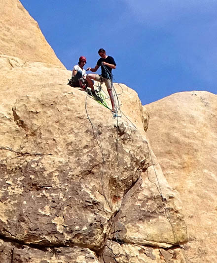
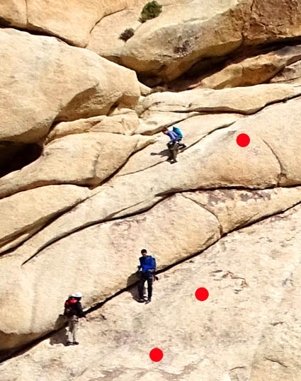
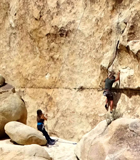
Close-up of
two of those climbers; I couldn't see the ropes
until I
downloaded and enlarged the photos.
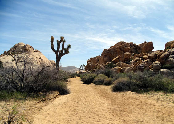
A little farther down the road to Hidden Valley, Barker Dam, and Wall
Street Mill I saw a sign for Wonderland of Rocks. That wasn't on my
agenda for today but curiosity made me stop there to check it out.
I thought a ranger at the visitor center had said Wonderland was a large
area of the park, not a trail per se, but I parked in the first parking
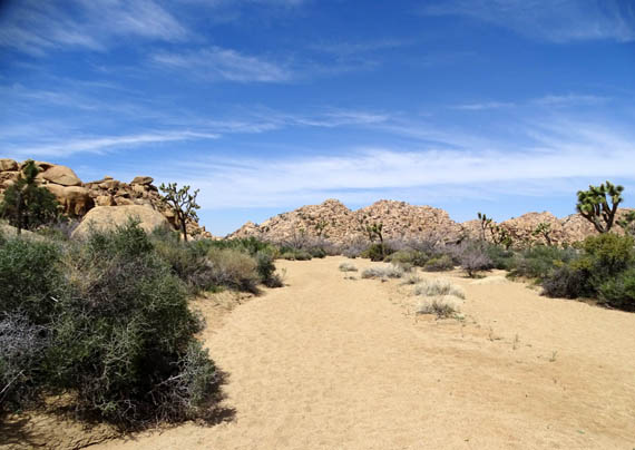
area I came to and walked 1/2 mile back a sandy wash.
SO WHAT IS THE
"WONDERLAND OF ROCKS?"
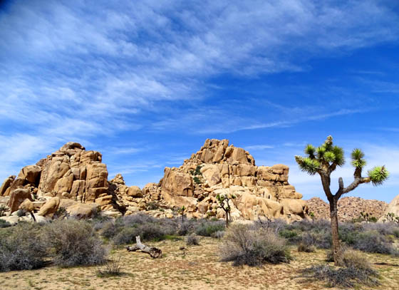
This is another mecca
for the rock climbers and boulderers who flock to this park for the
myriad of opportunities available to test their mettle on a gazillion monzo-granite
rock formations.
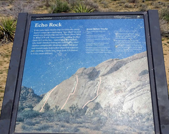
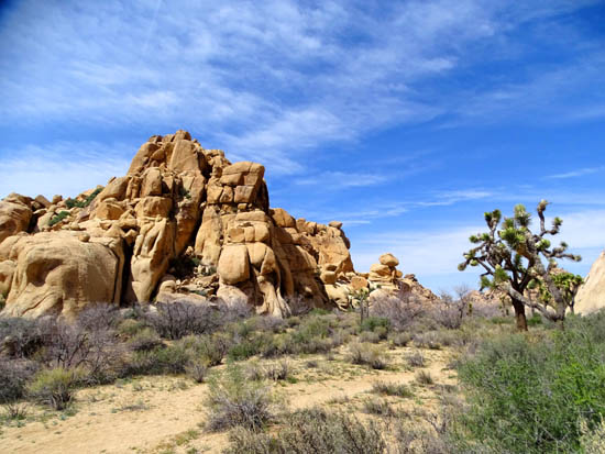
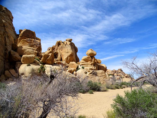
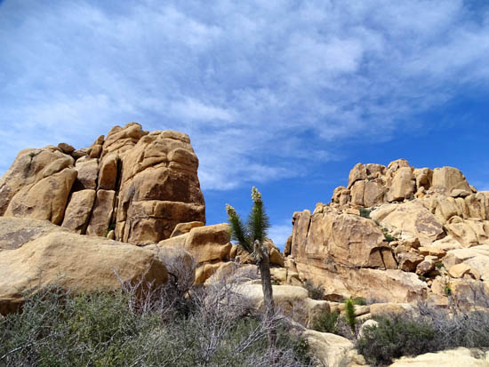
And, by golly, at the
rock formation closest to the parking area I spotted at least three
climbers ascending a route in the middle of Echo Rock. It's not one of
the three routes shown on the sign I photographed:
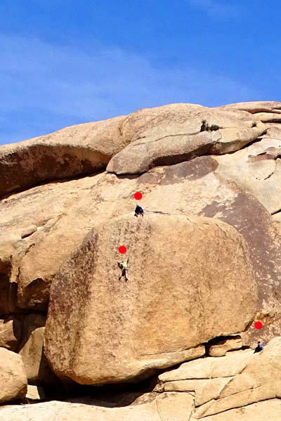
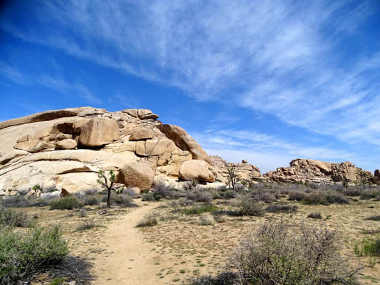
I saw at least a dozen more climbers
as I walked in the soft, sandy wash, wandering past one rock
formation after another. I examined the rocks even more thoroughly than
I usually do for regular photo ops, hoping to also spot as many climbers as possible.
Wonderland Wash is the second trail
I found this morning that wasn't listed in the park's hiking guide or
website. I just happened upon it and had to do more research later on
other websites to see where and how far it goes.
Here's a good little
map from the
Hikespeak.com website that shows this
trail's location between the Barker Dam and Wall Street Mill trails,
which are listed in the park's hiking guide:
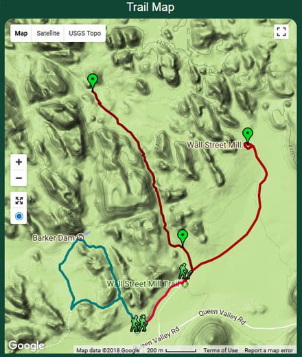
HikeSpeak describes the trail for a mile
out and a mile back from this trailhead. It's the dark red line running
through the middle of the map above and to the upper left, ending within view of a rock
formation dubbed the Astro Dome. I didn't go that far.
An un-maintained single track path
reportedly continues beyond that. It is used primarily by rock climbers
and bouldering enthusiasts to reach various formations to climb.
Unfortunately, once
again I didn't know what all I could see on this trail until
after my hike. There is an unmarked path only 1/10th mile from the
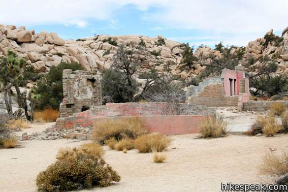
trailhead that goes to the scenic pink, crumbled ruins of Wonderland Ranch.
This is a picture of the ruins from
the
HikeSpeak webpage:
You can also apparently get to the old
ranch house from the Wall Street Mill Trail, too, but I also missed a
second side trail to the ruins while hiking the Mill Trail this afternoon.
Rats. It would have been fun to find
interesting camera angles to shoot there.
PHOTOS FROM MY HIKE
Since this trail wasn't on my original list of hikes for today and I
didn't know where it led, I went back the wash for only half a mile. These are some
of the pictures I took along the way:
Some Joshua trees in bloom in
this area, too
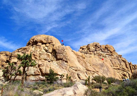
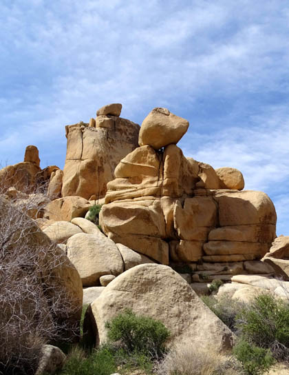
Two more climbers (under red
dots) who've reached the top of this formation
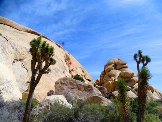
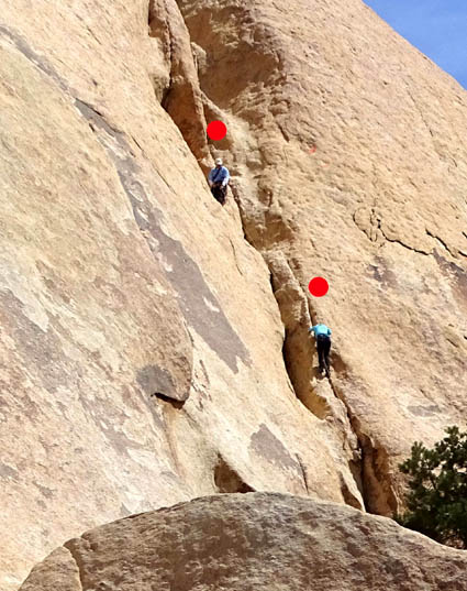
Above and below: three more
climbers up a steep rock face,
with two of them enlarged below
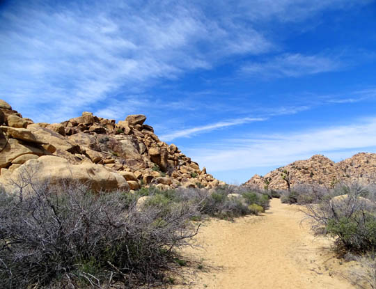
After half a mile I turned around and went back to where I'd
parked. The rock formations always look different from another direction:
Above and below: Two of these three climbers
may have been ones I
saw on top of the formation when I was hiking
outbound.
These were coming back down when I got back to the same place.
Did I mention that I was fascinated by all the climbers
today??
Here are
two more, one clearly a woman who was already halfway up the
formation:
Go, girl! As athletic as I've been my whole life, I was
never brave enough to do technical climbing.
FLORA
There are some Joshua trees in this area, most in
bloom, but not as heavy a concentration of the trees as other places
where I'd already
hiked this morning.
I saw some of the same wildflowers and flowering shrubs
I'd seen previously, including the two below:
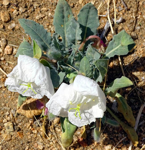
Desert Primrose (this flower
also has several other names)
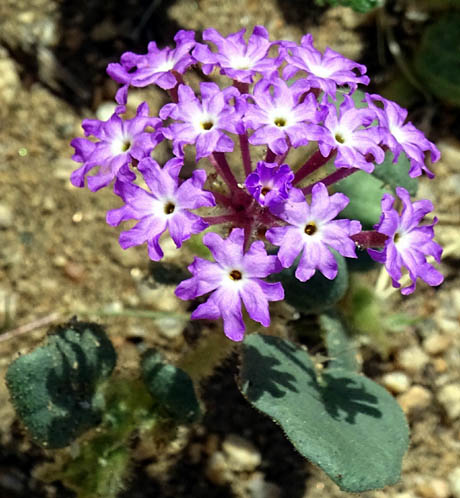
Above and below: Desert
Sand Verbena
There were also lots of yellow Desert Marigolds and
Wallace's Wooly Daisies blooming near these flowers.
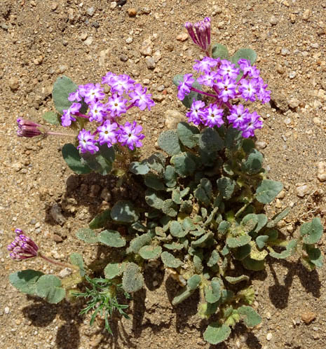
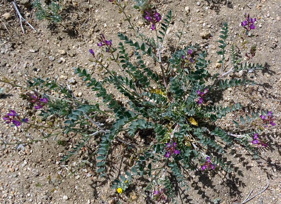
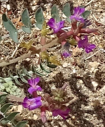
The next widely spreading purple flower was new to me --
Freckled Milkvetch. This clump is about three feet wide:
That short hike was entertaining and gave me another mile at 4,100+ feet.
I was up to about 5˝
miles for the day and it was still early afternoon. I wanted more.
So I headed for the nearby Wall Street Mill trailhead, hiking that
trail out and back and also the Barker Dam loop.
Next entry: hike
#5 for the day -- history and more on the Wall Street Mill Trail
Happy trails,
Sue
"Runtrails & Company" - Sue Norwood, Jim O'Neil,
Cody the ultra Lab, and Casey-pup
Previous
Next
© 2016 Sue Norwood and Jim O'Neil
