This was my seventh of eleven different trails to hike at Joshua Tree
this week and it ended up being my third or fourth favorite.
I hiked it solo on Wednesday and went back a second time the next day
with Jim because I knew he'd like the unusual "skull" and the
undulating trail through some spectacular rock scenery. Photos in this
entry are from both hikes.
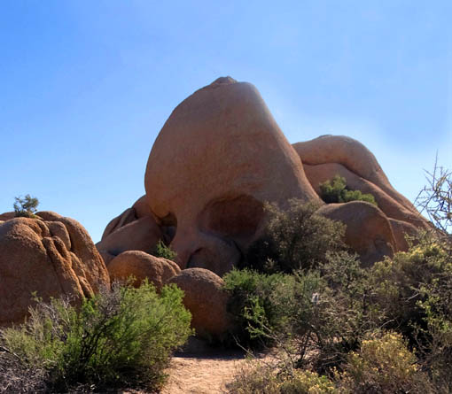
This is a very popular trail, particularly right at Skull Rock, which
is just a few yards off busy Park Boulevard, the main east-west route
through the national park.
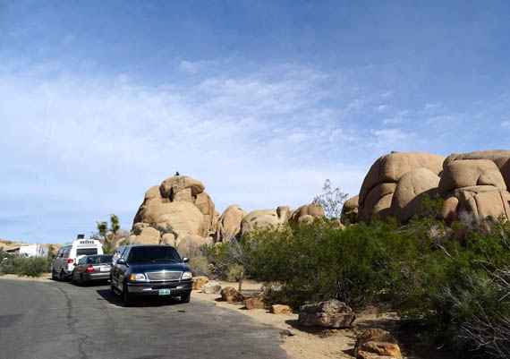
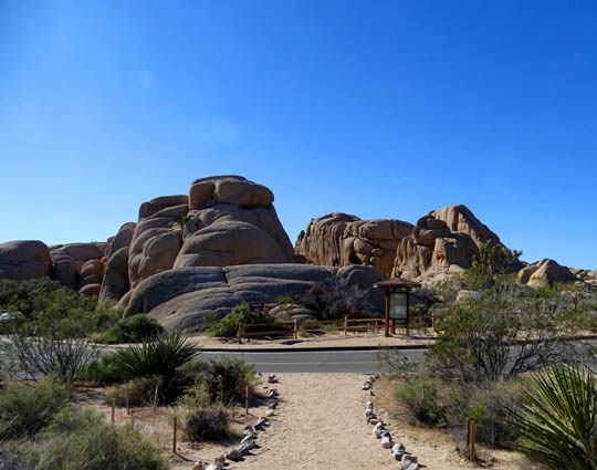
The skull is at the NE end of the loop. The area stays congested and
by the middle of the morning, it can be difficult to find a parking
spot. I took the next shot from across the road the second time I hiked
the trail:
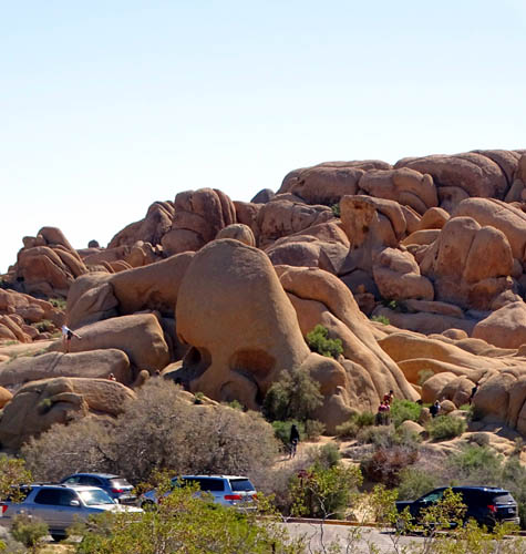
It's hard to see if you're looking at this picture on a
small screen but at least a dozen people were around the skull right then.
Fortunately, many people just hop out of their vehicles and stay only
a few minutes to take pictures of Skull Rock, then leave. If you want to
hike all or part of the trail, you can also access the trail from two
places in or across the road from Jumbo Rocks Campground, through which
this loop passes. Just don't park in someone's camp site.
Here's a diagram of the trail from one of several signs along the
loop:
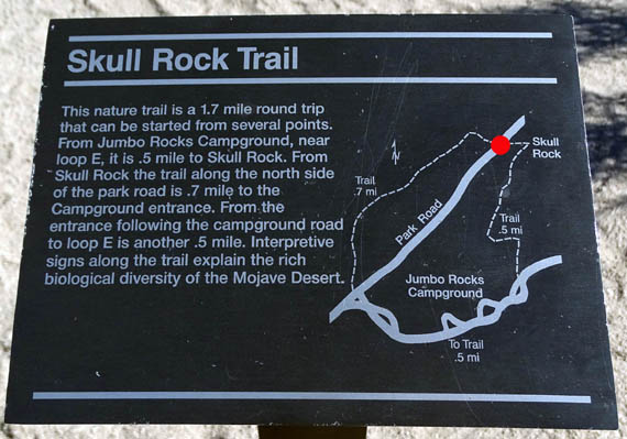
I added the red dot to indicate the place I parked both times I hiked
the trail, right near Skull Rock.
If you're looking at this entry on a small phone or tablet screen and
can't read the trail description or distances on that sign, here's the scoop:
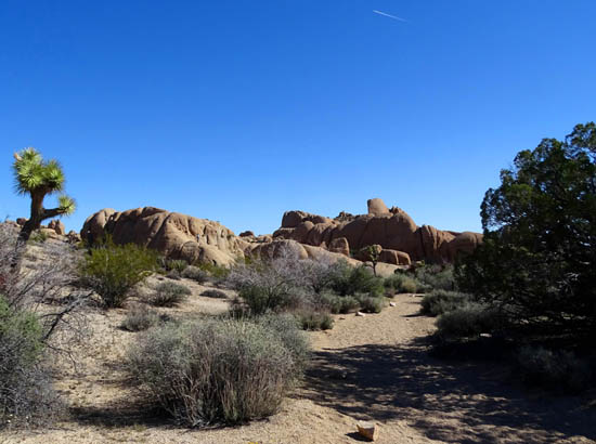
The undulating, well-marked trail loop is 1.7 miles long.
There are three segments: 1) a half-mile nature trail with signs
about the flora and fauna between Skull Rock and Jumbo Rocks Campground on the
south side of Park Boulevard; 2) half a mile through the
campground itself on paved roads; 3) 7/10ths of a mile on the
other (north) side of Park Boulevard, which was the most interesting segment of
the trail to me.
Part of the Skull Rock nature
trail on the south side of the park road
On my solo hike on Wednesday I arrived at the parking area closest to
Skull Rock about 9 AM and hiked the whole loop in the clockwise direction.
On that hike I ended up with 2.2 miles because of deliberately
going off into some gullies and up on rocks to explore further. My GPS
recorded 716 feet of elevation gain and loss at 4,123 to 4,278 feet altitude.
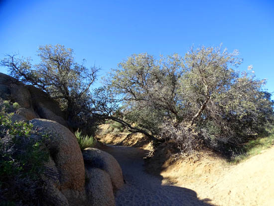
An easy part of the trail on the north
side of the park road
The next morning Jim and I stopped at Skull Rock fairly early so we
could see it and take pictures with few to no other people there. Then
we drove farther west to hike the loops at Barker Dam and Hidden Valley.
On our way back east on the park road we stopped to do the section of
the Skull Rock loop I liked the best through the boulders, slots, and
washes -- the northern part of the trail across from Skull
Rock and the campground. It was less crowded at that time of day than
the trail between the skull and the campground.
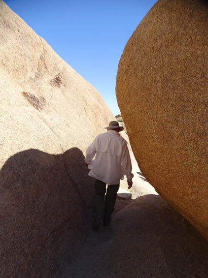
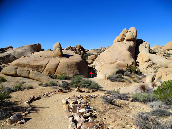
Fun with narrow slots to slither through
Jim began his hike across from the campground entrance and hiked
7/10ths of a mile NE toward Skull Rock, the same direction I hiked it
the previous day. I drove ahead to Skull Rock, parked (lucked out on
that!), and walked back along the trail toward Jim. When we met, I turned
around and walked back to the car with him.
There weren't a lot of people on the northern section of the trail
either afternoon even though Skull Rock itself had plenty of company
both times.
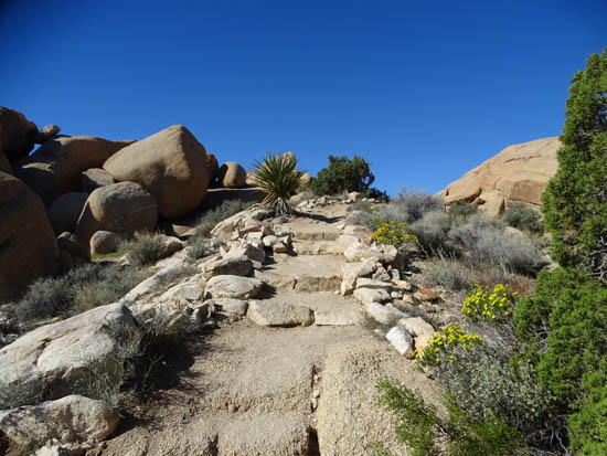
One of many sets of steps on the north part of the
Skull Rock loop
The Park Service rates this trail as easy, and I agree with that but
I'm surprised, based on some of its other ratings, that it considers this trail
easier than the very flat Wall Street Mill Trail.
The Skull Rock loop undulates through some soft sandy washes and
narrow slots between boulders on the north side of the road. There are
also some rocks, roots, and rock steps. It's not wheelchair or stroller
accessible except on the paved roads through Jumbo Rocks Campground.
SKULL ROCK TO JUMBO ROCKS CAMPGROUND
These are some other photos I took in this segment of the loop on my first
hike, all on the south side of the park road, going clockwise, starting
at Skull Rock and ending in the campground. (See trail diagram above.)
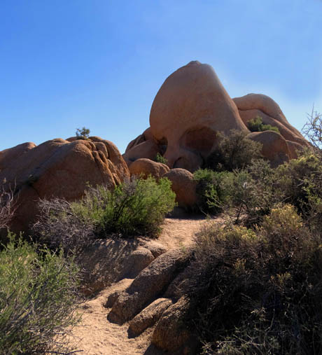
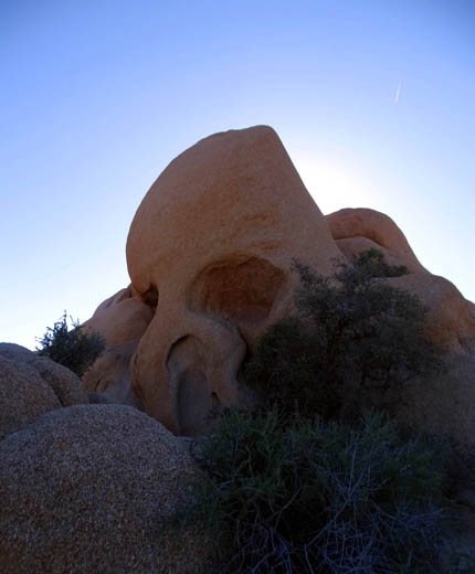
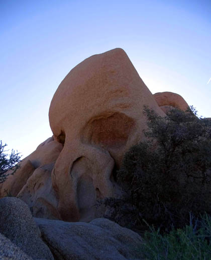
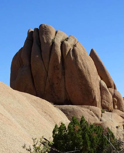
Let's start with some other photos of the eponymous Skull Rock taken
at different times of day:
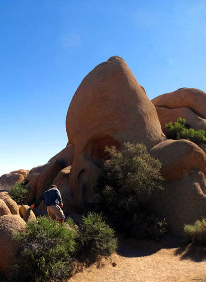
Here's an unknown person to give
some perspective re: the size of Skull Rock.
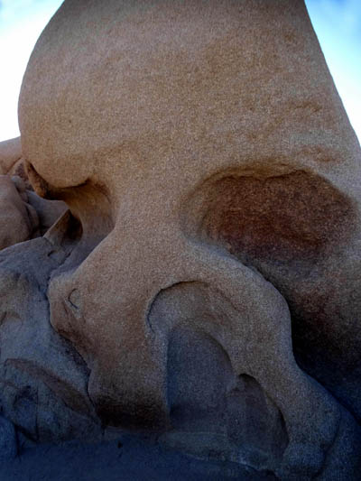
The skull is a little creepier the closer you get:
OK, let's hike, heading southwest toward the campground.
I consider this section to be more of a
nature trail because of all the signs re: the desert ecosystem.
Although it's undulating, this half mile is significantly easier to
negotiate than the trail on the other side of the road.
The trail sometimes goes through
soft sand in washes on both sides of the road.
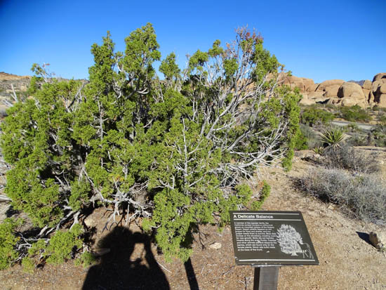
Me and my shadow; the sign
describes the delicate balance of the ecosystem, describing how the
California Juniper tree and
desert wildlife are dependent on each other for their mutual survival.
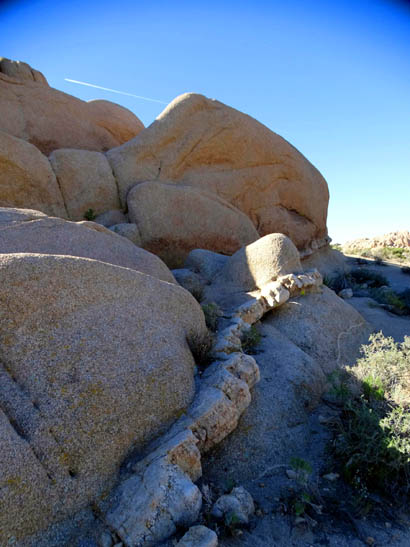
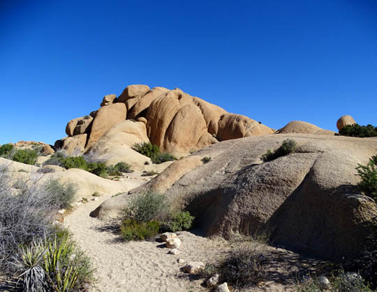
This is the only place in the
park where I remember seeing this kind of
unusual rock "stripe" between the
boulders. I don't know how it was formed.
Here's another conundrum:
Why are the boulders
on the left rounded and the ones
on the right pointed?
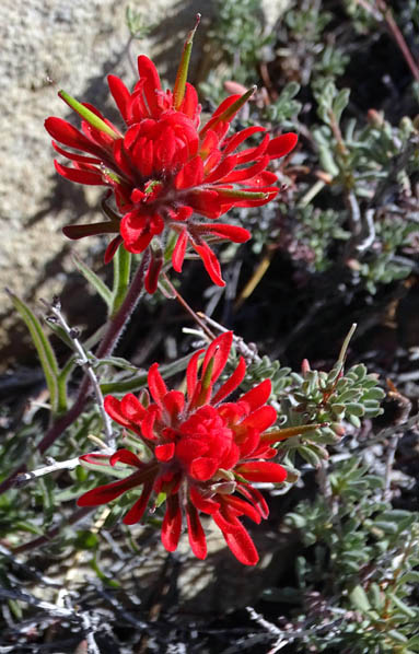
Desert Paintbrush: you
can't miss the bright red in
an otherwise relatively colorless
desert setting!
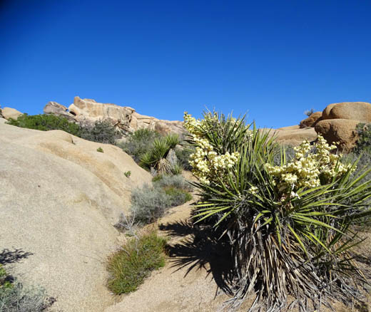
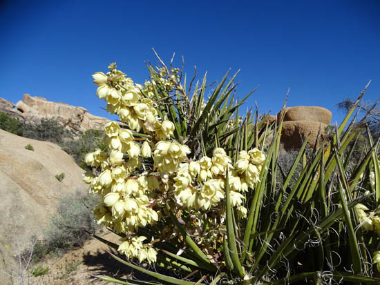
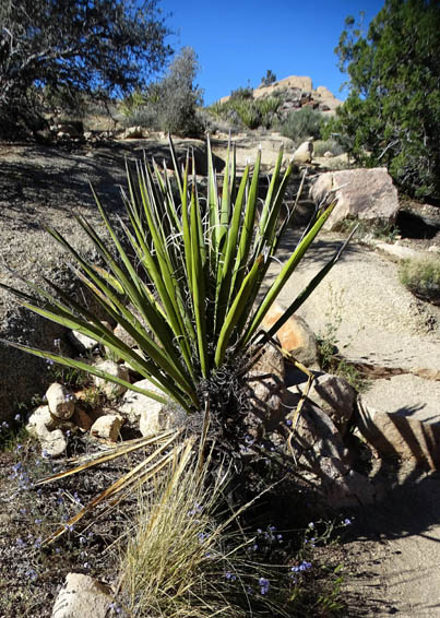
Just before half a mile the trail makes a wide S-turn on the ridge above
the Jumbo Rocks Campground and drops down past a clump of Mojave yucca
in bloom to the paved road going through the campground:
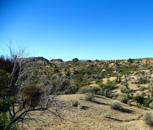
It's another half mile on the campground road past the small but attractive
campsites set among the boulders, some restrooms if you need them, and out
the other side to the main park road:
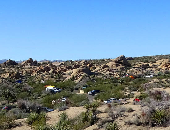
Above and below: This
campground has about 100 sites and they were full all week.
After walking through the campground you'll come to a trail that crosses the main park
road. The Skull Rock loop continues on the other side:
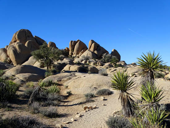
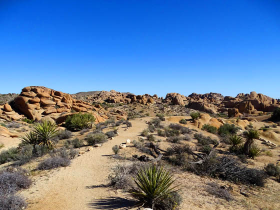
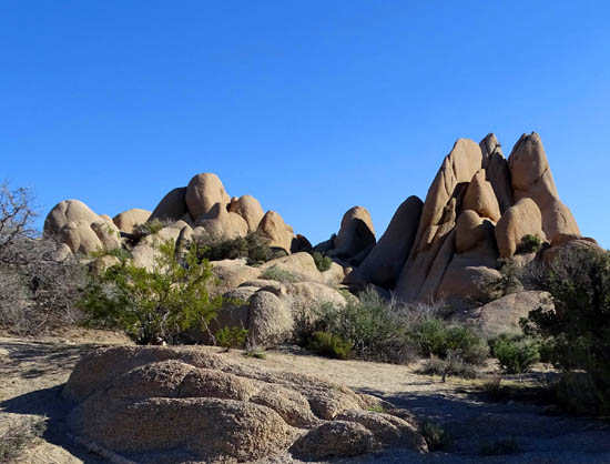
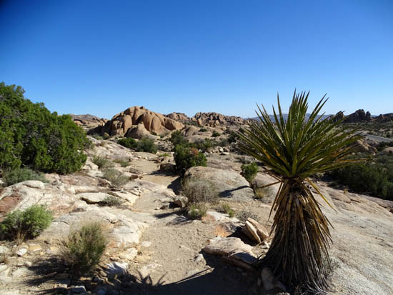
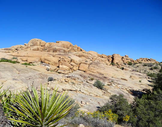
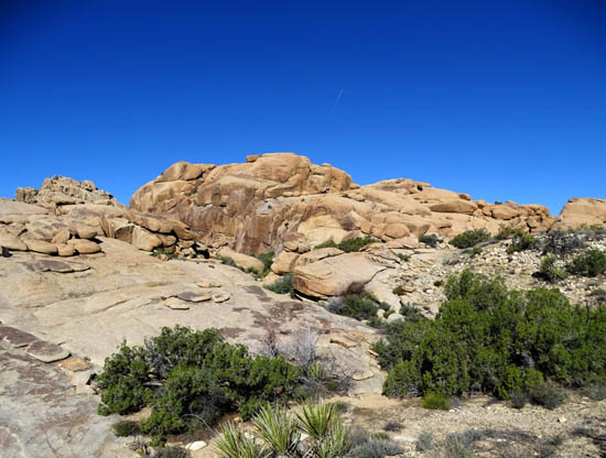
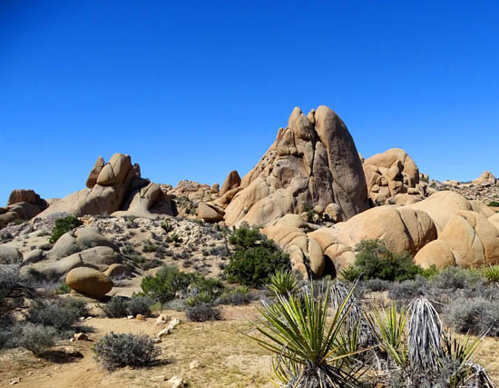
THE NORTHERN SEGMENT OF THE TRAIL
Ah. Now we're over to the part of this loop that I like the best
because it's less traveled, more wild . . . and therefore
more interesting to me.
Let's head 7/10ths of a mile northeast, back to the skull. Get ready
for some awesome rock formations, narrow slots, wide panoramas, deeper
washes, and higher ridges. Here are some representative pictures
in addition to those shown earlier, in
order going clockwise on the loop:
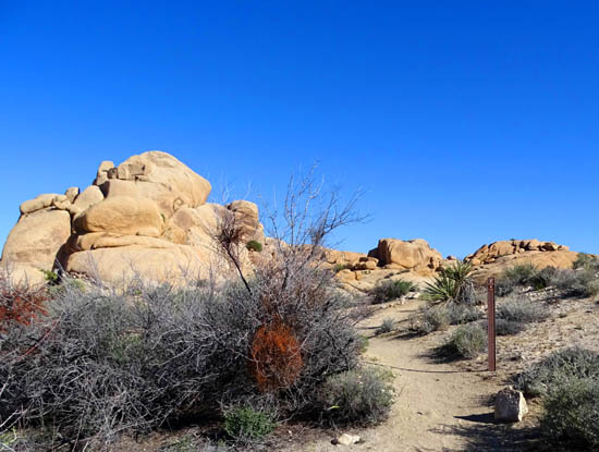
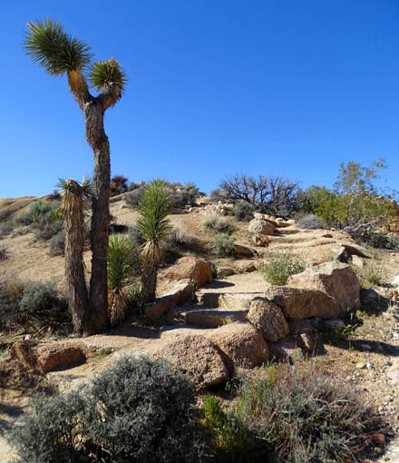
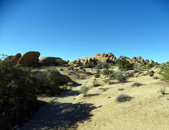
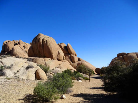
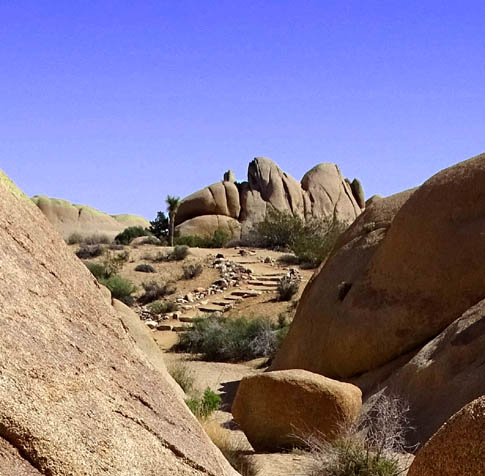
There are a lot of rock steps on this side of the loop:
When the trail is on the ridge in the
next two photos, you can see the park road for a little while.
I didn't even notice it while hiking because I was too
busy looking at the fabulous scenery and watching my footing!
Most of the time, rocks and hillsides block the
view of the road and the trail feels remote.
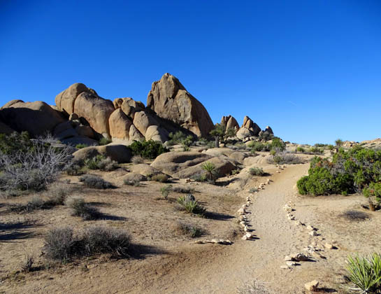
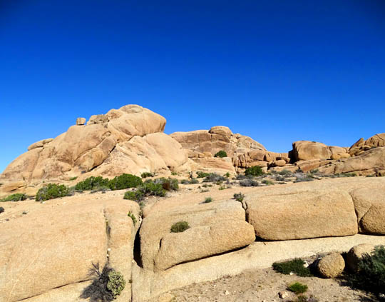
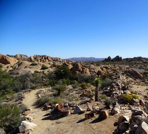
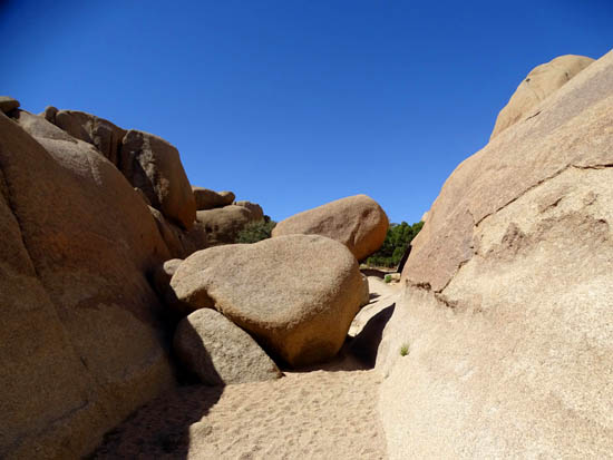
There are so many cool boulders, big rock formations,
and massive areas of bedrock along this trail, like in the next photo, that would
be really fun to explore off-trail for hikers with more time than I had. That's one
good reason to stay in a nearby campground rather than outside the park.
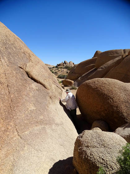
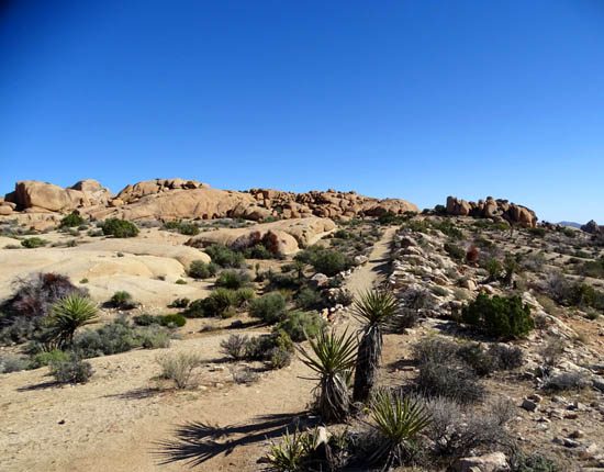
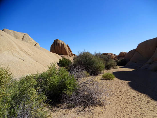
The trail repeatedly roller-coasters down into washes or
gullies and back up to ridges:
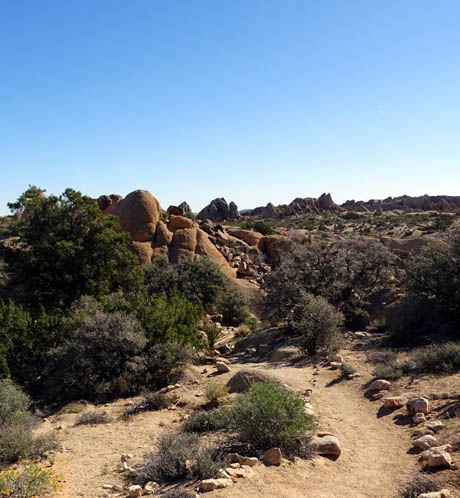
In the last quarter mile the trail goes through a soft,
wide wash and comes to a fun part of the loop with a slot canyon with
several boulders to maneuver through. I showed Jim going through the
most narrow one farther up in this entry.
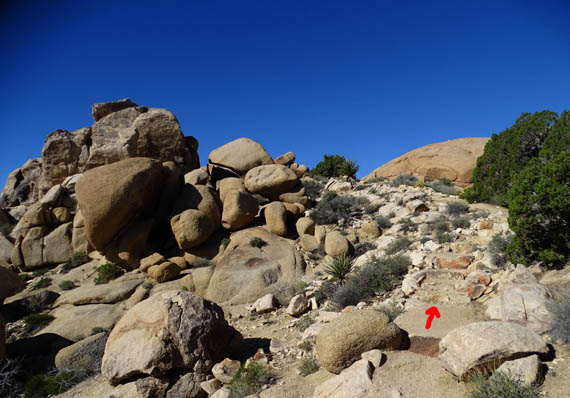
"X" marks the spot.
Looking back at two of the narrow
passages around tall boulders
Looking ahead to the climb
up to the last ridge before Skull Rock
View back to the slot canyon
(arrow) from part way up that hill
Another view back
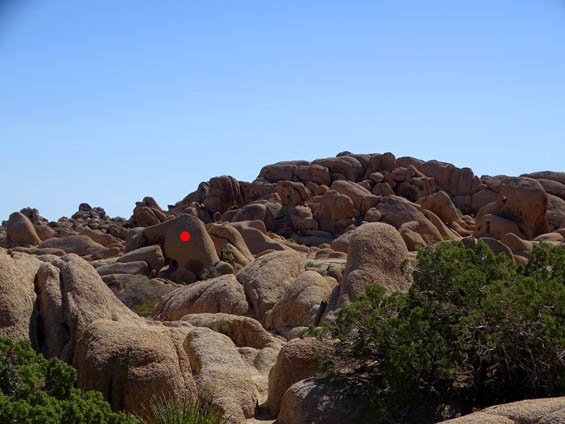
View across the road (can't see it here)
to Skull Rock from the last ridge; I gave the skull a red dot.
See why I like that trail so much???
And that's only a few of the scenes along the way.
There's a lot to enjoy along this part of the loop, even if you don't
explore and climb the rocks.
Next entry: the Split Rock Loop Trail with a side
trip to Face Rock (hmmm . . . Skull Rock and now Face
Rock??)
Happy trails,
Sue
"Runtrails & Company" - Sue Norwood, Jim O'Neil,
Cody the ultra Lab, and Casey-pup
Previous
Next
© 2016 Sue Norwood and Jim O'Neil
