If someone asked me to name my ONE favorite trail of the eleven I
hiked in Joshua Tree National Park this week, I'd have to say it's
either this one or the
Mt. Ryan Trail.
The two trails are very different -- one on a mountain with
panoramic views from the top vs. one in an enclosed valley, surrounded
by rock walls and boulder piles that feel more protective than claustrophobic. Although
Hidden Valley was one of the shortest trails I hiked, I had a lot of
"ooh's" and "aah's" on this one-mile loop.
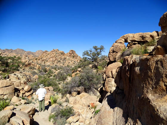
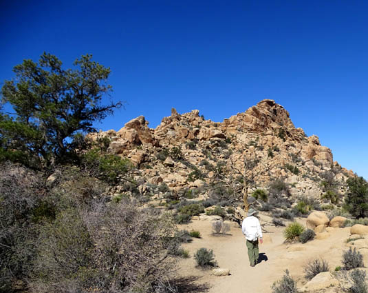
Jim looks down into the lower
part of the valley before we descend into it.
I'm kind of glad it was the next-to-last trail I hiked in this park.
Otherwise, some of the others might have been a bit of a disappointment.
If you have limited time at the park, even just a day, I'd recommend
this trail if you want a hike that is representative of what Joshua Tree
has to offer. It is short, rated as "easy," located right off the
main park road, and as scenic as it gets in the high Mojave Desert.
It even has some intrigue. The rock-enclosed valley was rumored to
have been used by horse and cattle rustlers to hide their stolen
critters back in the 1800s:
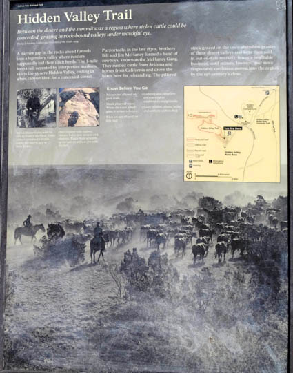
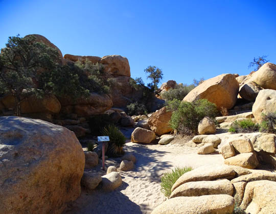
Interpretive panel at trailhead
TODAY'S HIKING AGENDA
This morning's weather was perfect up in the main part of Joshua Tree
-- clear and sunny and in the 60s F, much more pleasant than
2,000 feet lower in Twentynine Palms and the Marine base.
Jim hasn't been up here to hike as much as I have and I wanted to
show him a couple of my favorite trails. We were both a bit tired from
all the hiking and cycling we've done the last few days, so we kept the
total mileage this morning to about three miles on three different trails.
Hidden Valley was new to both of us. I planned to hike it earlier
this week but had trouble finding the trailhead. I was looking for it in
the Hidden Valley Campground but it's across the main park road at the
Hidden Valley picnic area.
Here's a section of the park map to show its location on the south
side of Park Boulevard:
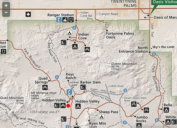
We went to Barker Dam first, arriving about 9 AM so we could beat the
crowds there. That worked out well, as noted in my
previous entry.
Hidden Valley was our second hike; we got to that trailhead about
10 AM. I had read that it's very popular, too, and we did encounter more
people on this trail than Barker Dam since we started later. However, we
were able to get a parking spot OK at Hidden Valley, too.
Our last trail of the morning was Skull Rock. Jim really liked all
three trails. Those three are in my Top Five Favorites at Joshua Tree.
ABOUT THE TRAIL
This Google map from
HikeSpeak.com shows the location and
orientation of the trail, which is outlined in red. Note all the rock walls/hills
surrounding the valley:
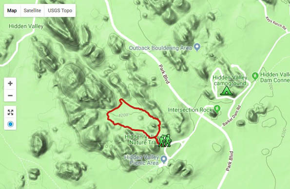
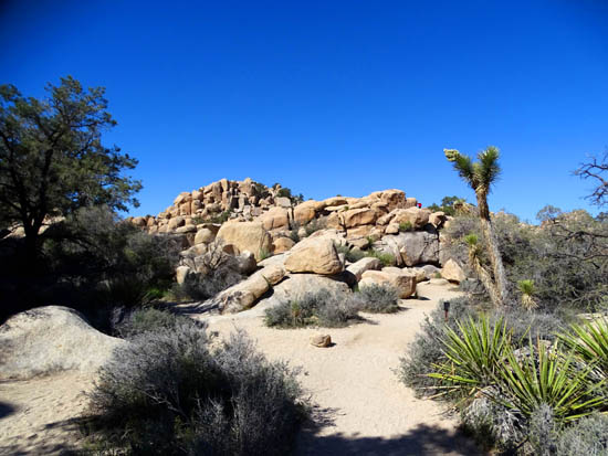
The majority of the 1.1-mile trail is a loop that includes an
interesting out-and-back section through rocks that rancher Bill Keys
blasted through in the 1930s so he could graze his cattle in the then-verdant
valley:
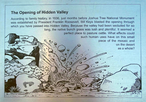
Sign near the trailhead
Outbound, in 1/10th of a mile you can turn either right or left when you come to
the T-junction with the loop. Jim and I turned right and went CCW. In
either direction, the trail is relatively level through the upper part of
the valley before descending to the lower section.
My GPS recorded 270 feet of total gain and loss between 4,180-4,262
feet elevation over 1.1 miles.
Although the trail is rated "easy" by the Park Service, it is not
wheelchair- or stroller-accessible. Some parts of the trail are smooth,
hard-packed sand but there are also rocky areas with steps, narrow
passageways between boulders, and some loose, deeper sand.
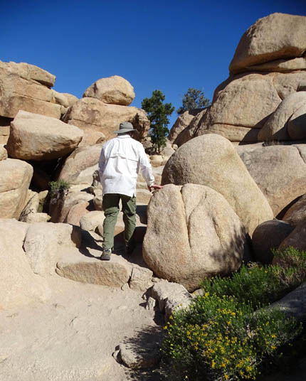
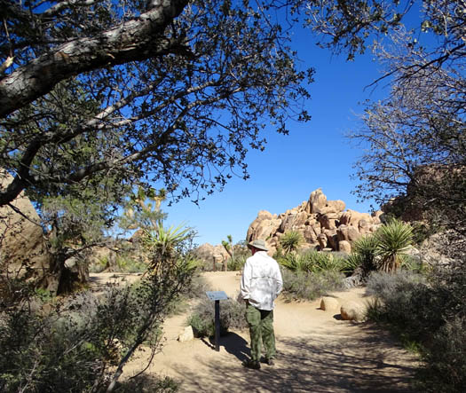
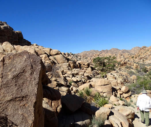
Jim climbs up rock steps through some boulders.
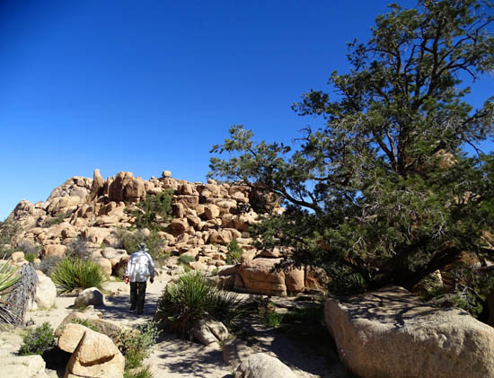
There is a lot to like about this loop in addition to its location,
length, and ease of walking.
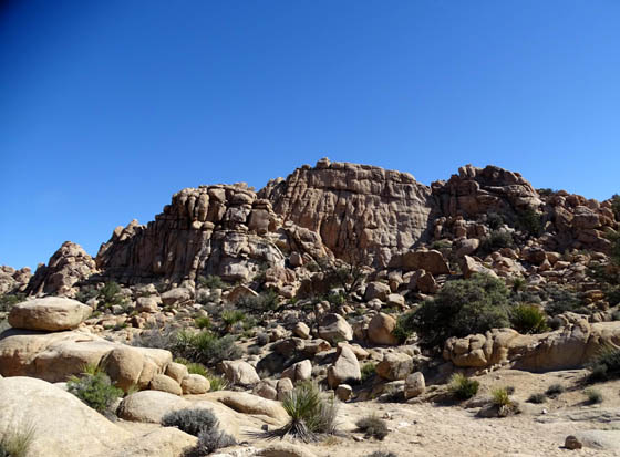
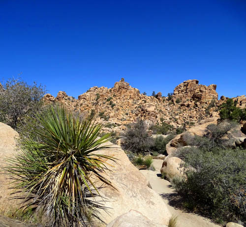
It's very scenic and as pretty as any desert
park we've seen in the Sonoran or Mojave deserts. It is also more lush with
wildflowers, grasses, shrubs, cacti, and trees than most of the other
areas where I've hiked at Joshua Tree, and it offers hikers more shade:
Jim is dressed appropriately
for the desert sun with long, lightweight pants,
a white sun shirt, and a
wide-brimmed hat.
Wildlife is abundant (lots of mammals, reptiles, and amphibians live
here) and it's a photographer's dream landscape.
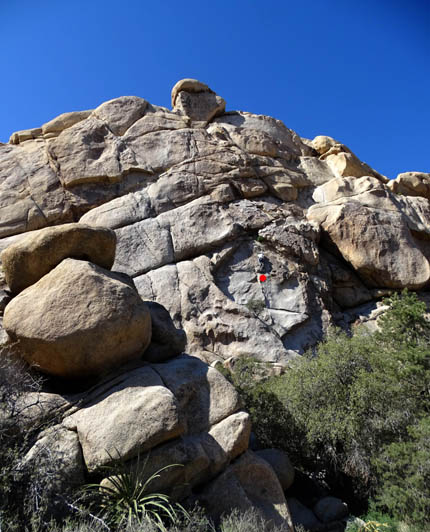
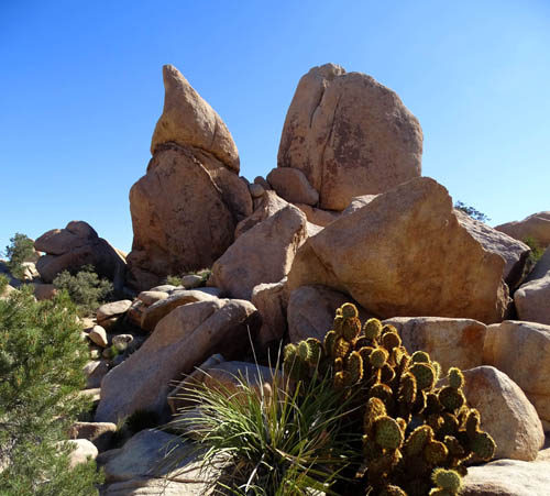
Kids and adults can have lots of fun with all the rocks.
Boulder piles from low to high are an open invitation for
scrambling and technical rock climbing.
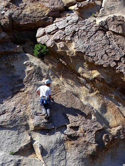
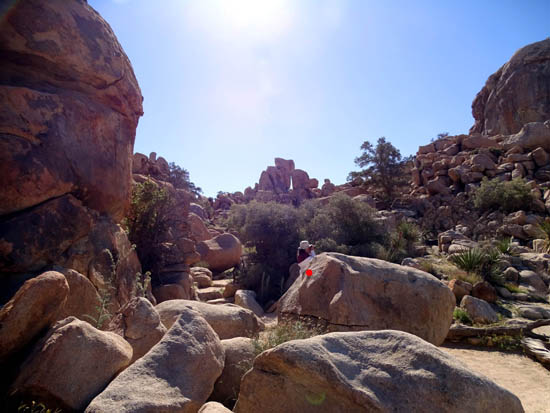
The next two photos show a climber on a high rock wall near the trailhead.
He's just above the red dot in the first picture. When I enlarge the
photo I can see a rope below him but not above, so I guess he's blazing
his own "trail" up that mountain:
And one more reason to like Hidden Valley: it's just
plain fun to imagine places among the boulders where those 19th
Century rustlers might have hidden their stolen cattle!
VIRTUAL TOUR OF HIDDEN VALLEY
The remaining photos are in order from the trailhead, then
hiking CCW around the loop.
Since I was usually walking behind Jim, stopping to take photos in every
direction, he's in some of the pictures. It's good to have people in
photos sometimes to show perspective re: the size of the boulders, trees,
etc.
Above and below: The valley still looks like
it's impenetrable
from a distance, even after Keys blasted out an
opening.
Up a couple series of steps . . .
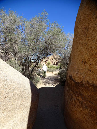
. . . through some humongous boulders
. . .
. . . and Jim has arrived at the junction
with the loop. We turned right and went CCW.
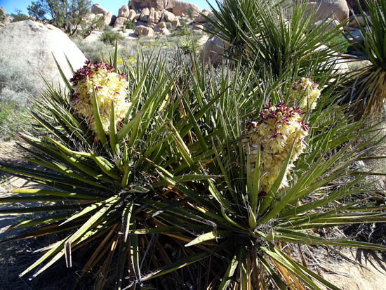
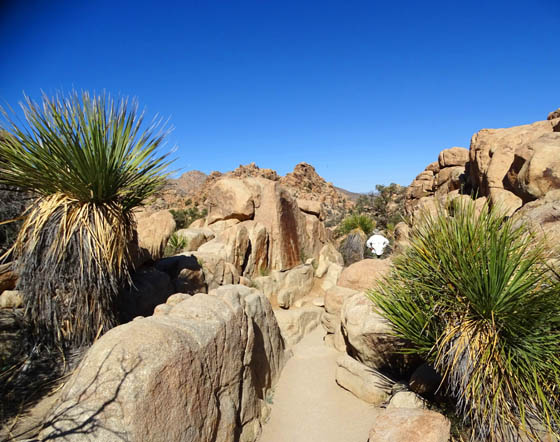
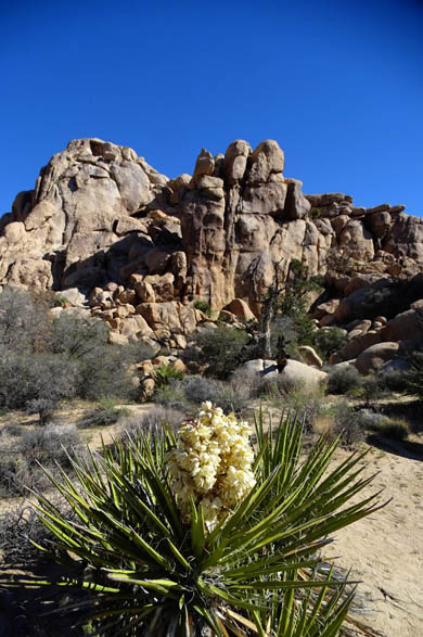
We were soon greeted by large blooming Mojave yuccas.

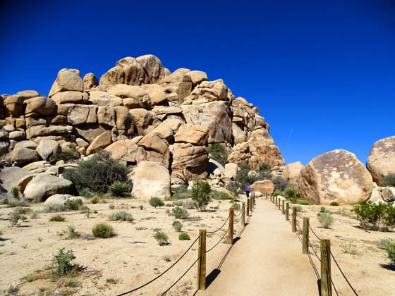
A perfect path for a little while;
this loop is great for trail running, too.
More yuccas in bloom, as well as a little
hedgehog cactus at the lower left
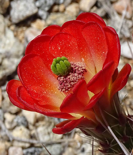
What a bright spot in the desert!
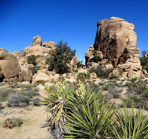
Some places look like a giant rock garden, deliberately placed
and planted.
None of the beavertail cacti were in bloom
yet in Hidden Valley.
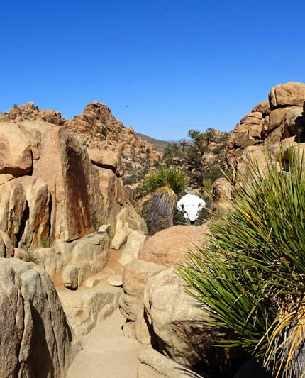
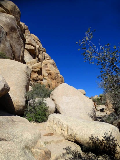
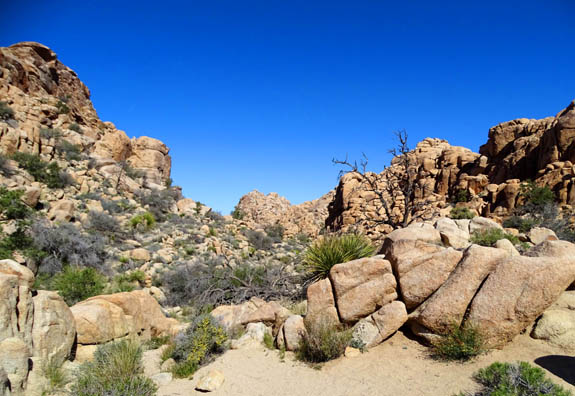
Through a cool rock corridor to a great
view of the lower valley, where we're heading next.
Jim's looking at the Big Picture ahead of us; I'm momentarily
distracted by the little
"window" in the rocks above.
Looks like another impenetrable pile of
rocks, eh? The path is easy to follow, though.
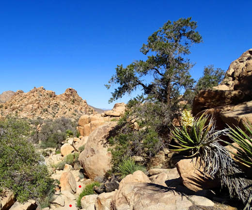
It's amazing how little water these trees and other plants need.
They grow in such
improbable
places. I marked the narrow trail with two little red dots.
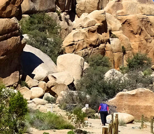
On the lower valley floor, a woman (above
red dot) takes pictures.
According to a sign, rock climbers call
this monolith "The Great Burrito."
This is a terrific little trail, not to be missed if you visit Joshua Tree.
Next entry: the last, and longest, trail I hiked in the
park -- the Boy Scout Trail
Happy trails,
Sue
"Runtrails & Company" - Sue Norwood, Jim O'Neil,
Cody the ultra Lab, and Casey-pup
Previous
Next
© 2016 Sue Norwood and Jim O'Neil
