This is the eleventh different trail I've hiked
this week at Joshua Tree. I'd do more but I'm running out of time and energy!
Although the Boy Scout Trail is not in my Top
Five Favorites in the park, it is an interesting, varied trail that
represents what Joshua Tree has to offer in the way of scenery, terrain,
flora, and fauna at a variety of elevations.
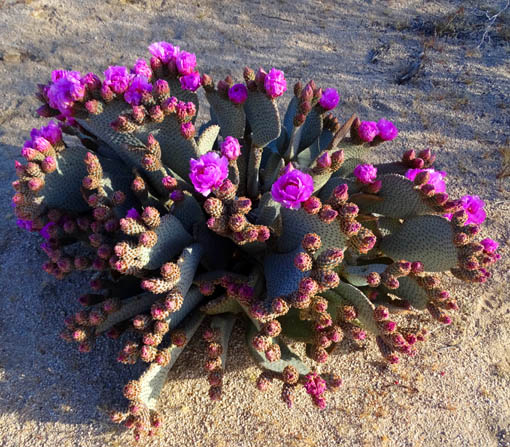
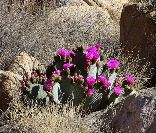
Beavertail
cacti were in bloom on the trail between 2,800 to 3,500 feet elevation.
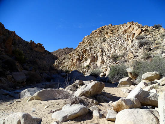
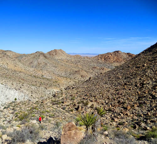
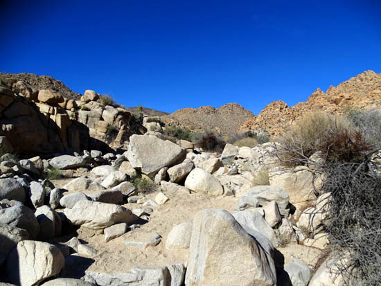
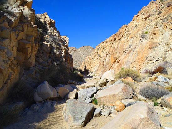
Rough going
through the lower canyon area (miles 2-3 going southbound)
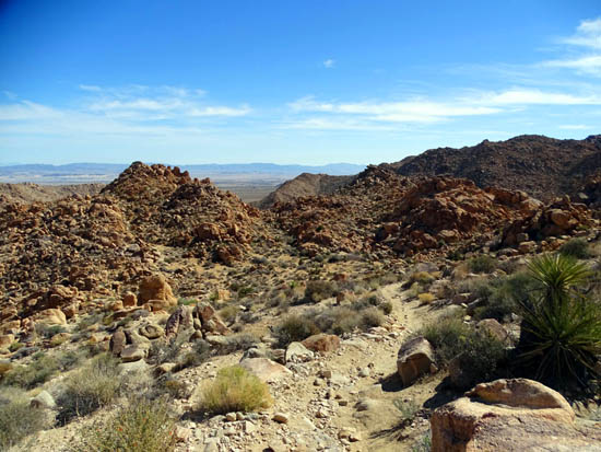
Rocky trail
and views to the Morongo Basin from the highest ridge (~ mile 4 going
south)
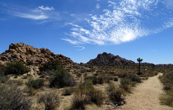
Mostly
level sandy trail through the Joshua trees in the last three miles toward Keys
West trailhead
At 8+ miles end to end, it's one of the longer
trails in the park and more remote than most when you're in the middle of it.
That appealed to me as a seeker of solitude and an
endurance hiker (former ultra-distance trail runner) but its
distance and difficulty -- from strenuous to easy, especially
going point-to-point in the uphill direction -- makes it a less
popular option for many hikers.
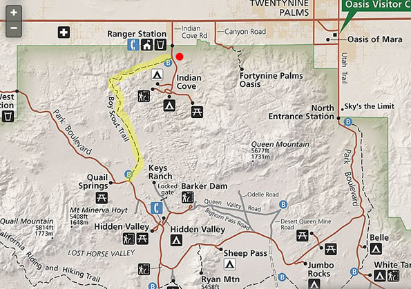
My end-to-end hiking route (yellow), starting at
the Indian Cove trailhead (red dot)
There are ways to get around both the distance
and difficulty of this trail, however, if
you have less time or energy than it takes to do the whole trail either
south to north (the more popular downhill direction), north to south
(uphill), or the whole thing out and back from either end (= 16.6 miles).
You can simply go out as far as time and energy
allow from either the north or south trailhead, turn around after half the time
and/or distance you allot, and hike back to your vehicle.
Easy-peasy. That also eliminates the necessity of spotting
vehicles one or more vehicles.
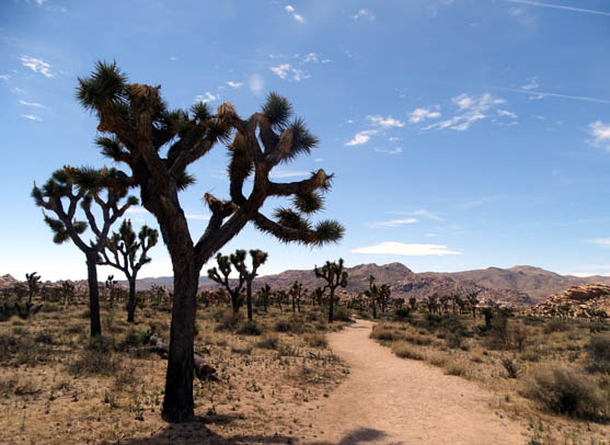
Joshua tree
"forest" in the southern portion of the Boy Scout Trail
Many people go out and back some particular distance from the
south end AKA Keys West, where the trail is more level and
hard-packed in the high Mojave Desert for about three miles before beginning its
descent through washes and canyons in the Wonderland of Rocks.
If you start at the north (Indian
Cove) trailhead, you'll run into rougher trail conditions after only a mile
of flatter low Mojave Desert terrain.
Going southbound -- the uphill direction
I hiked -- I'd rate this trail as "easy" the first mile
from Indian Cove, "moderate" to "difficult" the next
four miles through washes and canyons and up and over the ridge, and "easy" the
last three miles before reaching the southern trailhead at Keys West.
TODAY'S M.O.
Jim came up with today's most excellent hiking/cycling idea.
He dropped me off at the northern end of the Boy Scout
Trail at Indian Cove (off US 62 west of the town of Twentynine Palms) so I
could hike the 8.3-mile trail point-to-point to its southern end on
the main park road.
He then drove the car to the southern trailhead (Keys West) via the west park gate
at the town of Joshua Tree, parked it in that large parking area so I could
drive it home after completing my hike, and rode his
bike almost 30 miles back to our campground on the Marine base via the
park's northeast gate (Oasis of Mara) above Twentynine Palms.
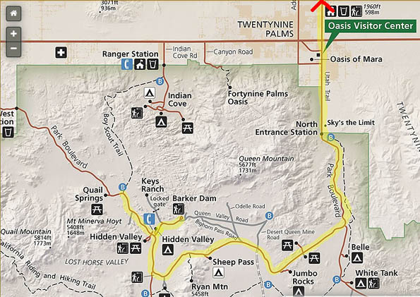
Here's his
route through the park:
We both got in a hard workout. I probably had more fun than Jim, though,
because he had to deal with a lot of traffic on the park road. I noticed
there were more people in the park this afternoon than yesterday at the
same time -- it's almost the weekend now.
But I didn't run into very many people on the Boy Scout Trail. It was
fun when I did talk to a few other hikers but I relished the quiet time
alone, too.
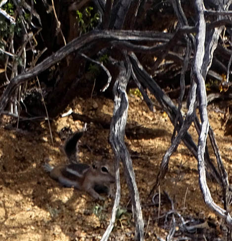
This little guy didn't have much to say but he didn't run away in fear.
Per my GPS, the Boy Scout Trail ranges in elevation from about 2816 feet
at the low north end (Indian Cove) to 4,125 feet at the highest point.
It measured 4,007 feet at the southern end (Keys West). Other websites
list higher elevations ranging from about 2,900 feet to almost 4,200
feet.
I recorded a net elevation gain of 1,513 feet going southbound --
the "uphill" direction -- and only 323 feet of loss in
8.3 miles. YMMV if you go off-trail for any exploring or rock
scrambling.
According to the park literature and websites I've read, most people hike
this trail northbound so they have a net elevation loss. My knees do better going
up and since there was so much loose rock on the steep parts of the
trail, I would have had difficulty staying upright if I'd gone the other
direction.
One of a group of three hikers (above) descends the
steepest section of trail into the canyon
area, going in the opposite direction I hiked. The
worst loose rock was in this area (below).
The only terrain challenge for me going southbound was
about three miles total of sand/grit in various washes I walked through.
Soft, deep sand really slows me down and works my legs harder.
In addition, the
middle miles through the canyon and up and over the highest ridge are
very rough, with loose gravel, rocks to climb over, and crude rock
steps.
Above and below: Yup, those are both parts of
the "trail."
In addition, some sections of
the trail have eroded into a "V" shape that also makes walking or
running more difficult.
I was tired at the end of the hike and very glad to see the car but,
ironically, my legs and knees were fine -- my right arm
caused me the most grief the last few miles. It's still sore from
a nasty bike wreck several weeks ago at the Imperial Dam LTVA.
I used one trekking pole and kept it in my left hand most of the time.
The roughest sections warranted two poles for this aging hiker but I
wanted a spare hand for my camera.
TOUR OF THE TRAIL FROM NORTH TO SOUTH (UPHILL
DIRECTION)
These photos start from the northern trailhead, which has very limited
parking along the road that goes to Indian Cove Campground.
Here's a topo map from the information boards at
either end of the Boy Scout Trail:
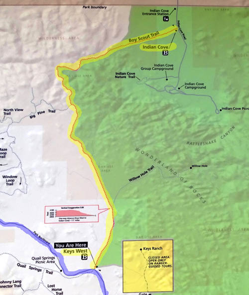
Both the green and white areas on that map are in the park; the white
indicates wilderness. The trail is marked in yellow. The blue highlight
lower left is the main park road. Note the little pink elevation profile;
I went from R. to L. on that (uphill direction).
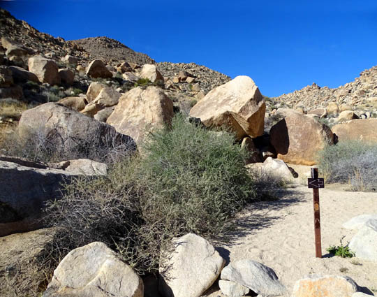
It's easy to spot the Indian Keys trailhead with its kiosk and split-rail
fencing:
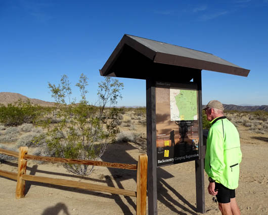
Jim's dressed
for cycling, reading the information
at the northern trailhead while I get ready to hike.
I started hiking about 7:30 AM.
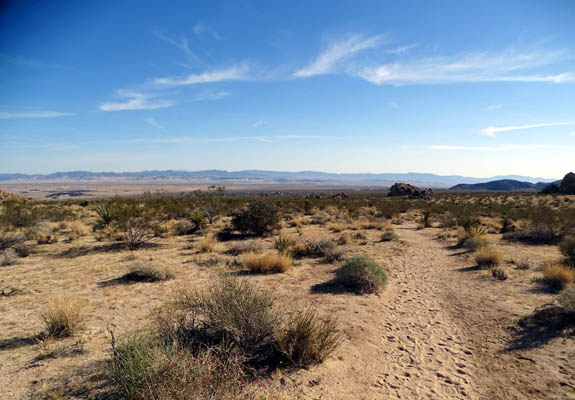
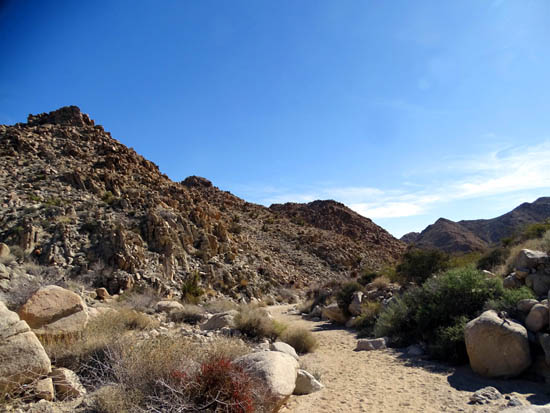
Going southbound, the first mile, approximately, was very gradual uphill
on smooth sandy trail through open desert as I headed toward the rock piles
and mountains in the Wonderland of Rocks:
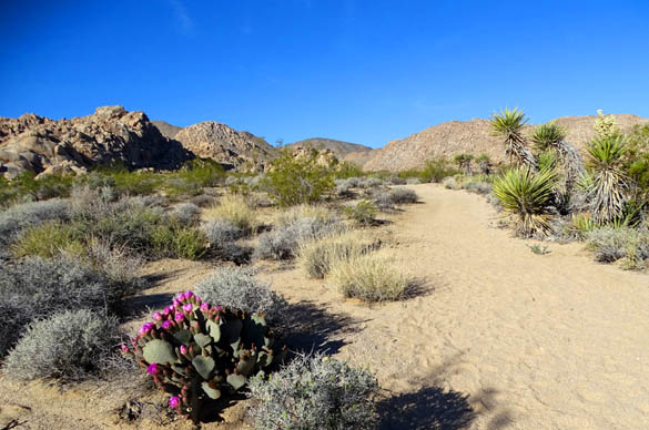
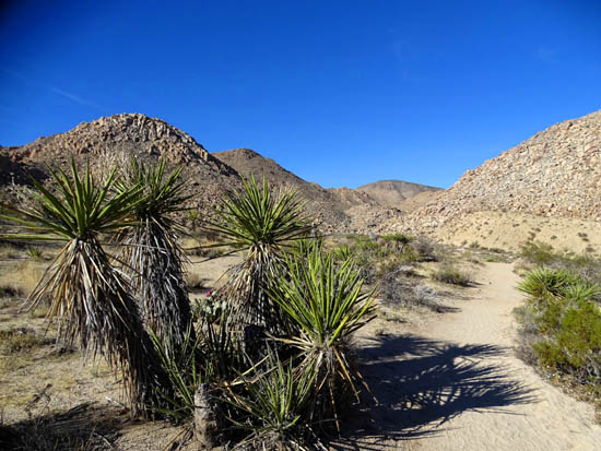
Beavertail cactus (L) and Mojave yucca (upper R.)
in bloom
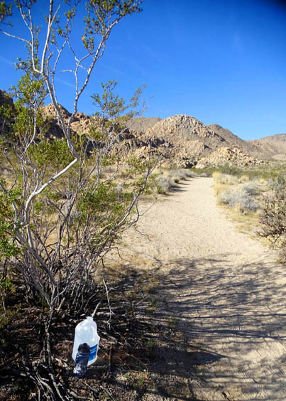
Water stash, probably for a trail runner doing
16+ miles out and back from the south end
As I gained a bit of elevation
I had good views down into the large Morongo Valley until I
dropped into a shallow basin with some soft sand:
Looking back down the trail toward Indian Cove; the
town of
Twentynine Palms and the Marine base are in the
distance, farther below.
In the basin, just follow the footprints and some
rocks here and there that mark the path.
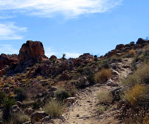
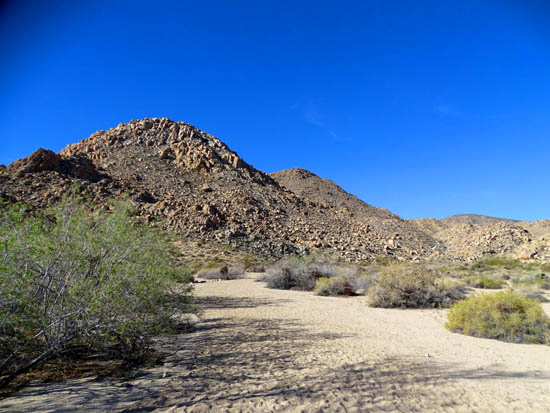
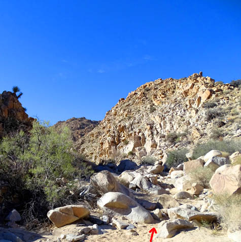
Now the real fun begins!
After walking through the basin, the climb to a higher wash through canyons
starts up through some rocks at this left arrow:
In this first section of trail and in the canyons
I especially loved all the flowering beavertail cacti with their bright
pink flowers. Today they were blooming only under 3,500 feet elevation.
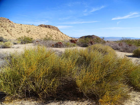
Lots of yellow Creosote and Brittlebrush flowers were also blooming in
the lower desert.
This section had numerous wildflowers in bloom, as did most of the rest
of this trail. I saw several new kinds of flowers today, including these
in the shallow basin:
Bladder Sage AKA Paper Bag Bush looks delicate but
must be pretty tough to withstand Mojave Desert
conditions.
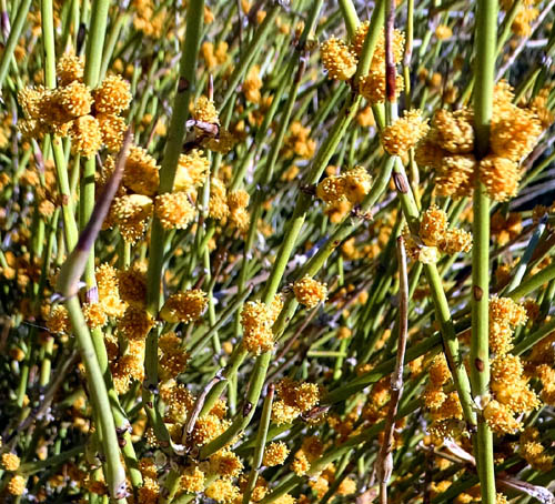
Above and below: Mormon Tea (Ephedra) grows
in large clumps.
After we're done touring the Mojave Desert I'll
do an entry focusing on flowers that grow there, similar to the
one I did on Sonoran Desert flowers.
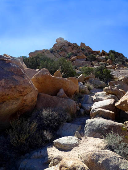
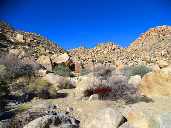
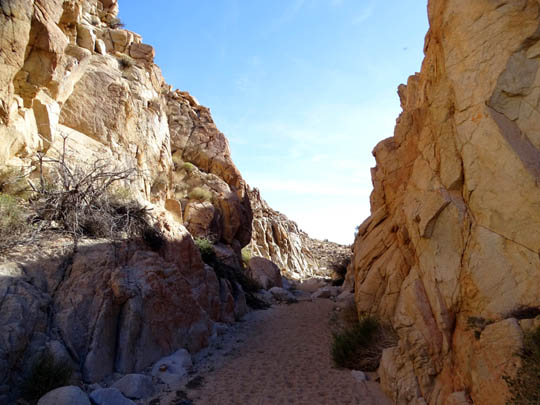
THROUGH THE WRINGER
The second mile and into the third were uphill through a wash in a canyon and it was very
slow going through the deep sand/grit and over rocks:
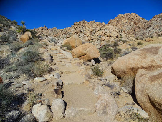
A nice staircase up to the high wash
By then I was appreciating the shade provided by some of the high walls:
Temps at our campsite down at 1800 feet were 56-78 F. today and although
it was cooler at the higher elevations where I was hiking, the sun was
merciless.
And spring has just
barely begun! What must this place be like in the middle of the
summer??
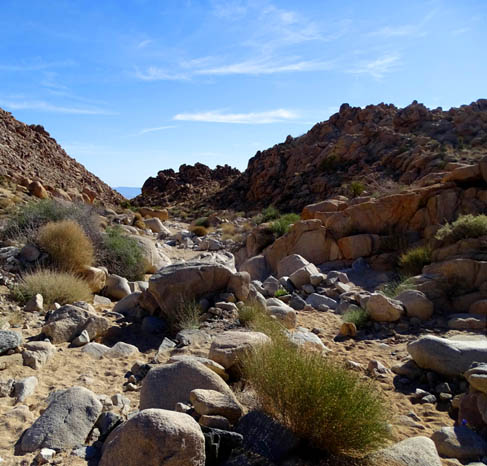
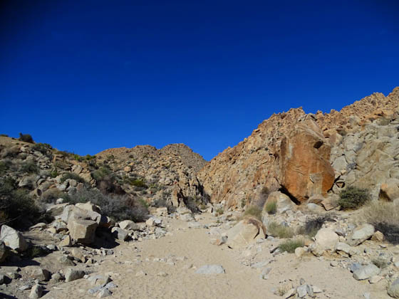
There were more rocks
to negotiate after that slot canyon, and some merciful smoother areas of
trail before making the final push up the ridge in the third and fourth
miles:
This section had several red Barrel
Cacti that weren't quite ready to bloom . . .
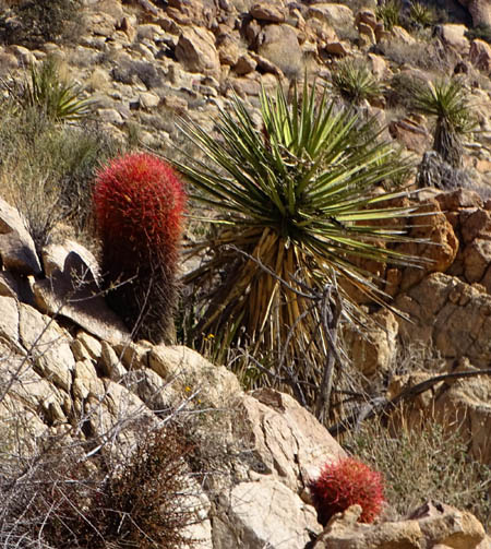
. . . and a lot of different plants already
blooming, including purple-pink Beavertail Cactus, white Mojave Yucca,
white Mojave Aster, white Dune Evening Primrose, white Monkeyflower,
white Wooly Daisy, yellow Wallace's Wooly Daisy, yellow Desert Marigold,
yellow Goldenbush, yellow Creosote Bush, yellow Golden Evening Primrose,
white and yellow Desert Dandelion, blue Phacelia, blue Desert Canterbury Bell,
blue Notch-Leaf Scorpion Weed, and several others I haven't been able to
identify.
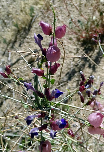
These are some of the
flowers that were new to me:
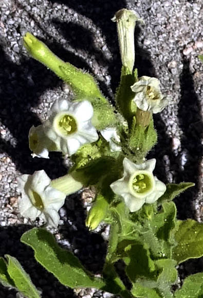
A type of Monkey Flower; I also saw one the was
growing out of the
top of a high rock, apparently in a little
crevice with sand.
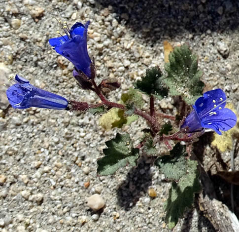
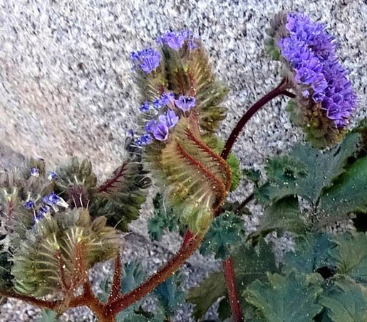
Desert Canterbury Bell
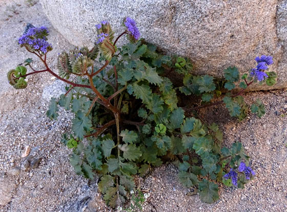
Above and below: Notch-Leaf Scorpion Weed, a
very unusual plant indeed!
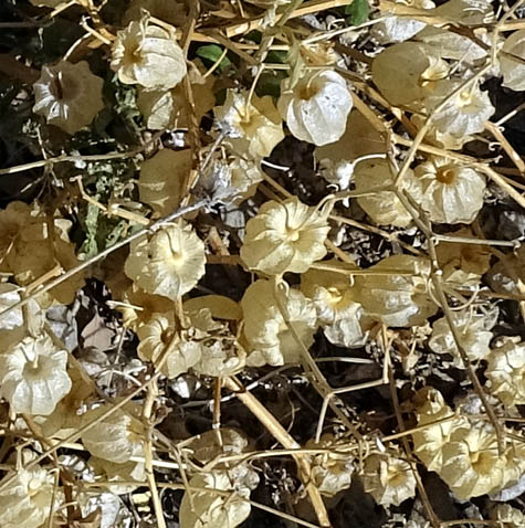
And I don't even know if the next photo shows a type of flower or if the
little "lanterns" are seed pods. The closest I've been able to ID it is
the Physalis family that includes Chinese Lantern. It's one of the more
interesting plants I found today, growing in a clump about two feet wide
in the gravelly wash.
This is a close-up of the white and tan balloon-shaped "lanterns" that
are about 3/4 inch wide:
Continued on the next
page . . . up to the ridge, high washes, and the upper desert plateau
Happy trails,
Sue
"Runtrails & Company" - Sue Norwood, Jim O'Neil,
Cody the ultra Lab, and Casey-pup
Previous
Next
© 2016 Sue Norwood and Jim O'Neil
