In the previous entry I talked about visiting the Lake Mittry Wildlife
Area twice during our stay at nearby Yuma Proving Ground this winter.
Although the lake was pretty, there weren't any trails to hike and we
didn't like riding several bumpy miles on a dusty dirt road with
vehicular traffic to get there.
In contrast, I drove or rode my bike two miles to the Laguna
Division Conservation Area four or five times a week during the five
months we wintered in this area!
Water, birds, green marsh plants, views of Castle
Dome Mountain . . .
what's not to like about the Laguna Conservation
Area??
This wildlife area was just two paved miles from our campsite
and had a lot more going for it when we got there -- over nine miles
of wide, smooth, non-motorized dirt roads to walk and ride our bikes;
trails through sand dunes; pretty lakes that fluctuated with
the release of water from the two nearby dams; lots of birds, big and
little mammals, and wildflowers; very few other visitors;
and it's free!
It was a fabulous place for us to let the dogs swim and run/walk
off-leash, ride our
bikes, and get some stress-free exercise.

Casey retrieves a stick in one of
the channels of water.

Jim rides with Casey at
the conservation area.

Cody checks out the horse hoof
prints in the sand on our favorite sand dune trail.
We saw horses at the conservation
area only a couple times.
I wrote about this scenic wildlife conservation area in the
December 4, 2015 entry and included about twenty photos I
took in the fall and early winter.
I'll include mostly new pictures from January to March, 2016 in this
entry. I have quite a lot to choose from because there was always
something interesting to photograph.
ABOUT THE CONSERVATION AREA
This relatively new conservation area, which encompasses about 1,200 acres of
Colorado River floodplain -- mostly on the Arizona side of the river
-- is designed to protect the environment and wildlife.
Its secondary purpose is
for public recreation; it is open to wildlife watching, hiking,
cycling, fishing, hunting (in season), and horseback riding.
Here's a map of the conservation area from the LCR MSCP
website:

That's an older map, perhaps a concept design, because even when the
water levels in the conservation area were low this winter, there was a
lot more water than that in both the upper "reach" (what they
call a section) and lower "reach."
The conservation area is about 4.3 miles long and up to 1/2
mile wide. Most of the land lies in Arizona; a little bit is on the
California side of the state border (see blue boundary line on map above).

The conservation area is a work in progress, not expected to be
"finished" until 2018. The young vegetation, newly constructed fencing,
and other projects will undoubtedly continue beyond that.
The basics are already in place, however.
Wide dirt roads form a nine-mile long figure-eight loop through the
wetlands and around two large lakes fed by canals coming from the
Colorado River. The road around the first large lake and some shallow
ponds is 4.4 miles long;
the loop around the lake farther south ("second reach") is 4.9 miles,
for a total of about 9.3 miles if you walk or ride the entire figure-eight.
Many native trees, shrubs, and grasses have been planted by
volunteers to replace invasive species that were removed, to protect the
shifting sand dunes, and to provide suitable habitat for a variety of
native and migratory wildlife.

Cody walks through an area where
clumps of grass have been planted between the road and a large
basin that was sometimes a
shallow lake, and sometimes mostly dry (see photos at end of this page).
Many young cottonwood trees were planted in one area
where I often walked through the sand dunes with the dogs. Sometimes
several inches of water covered the ground under them, and sometimes it
was dry.
Water levels fluctuate from day to day, depending on
the release of water from the nearby dams. It reminded me of high and
low ocean tides.
The leaves were a pretty yellow-gold color until
January, then suddenly new green leaves came out for an instant spring
season in February:

Early January

Mid-February
After we arrived in the fall, workers began setting low posts into
the ground around the lakes and stringing thick wire cables through them.
It was interesting to watch their progress until we left in late
March:

Some posts in, some waiting;
workers used a large auger to dig the holes.

Unloading wire cable and wooden
posts

Some of the completed fencing,
and a man riding a horse (partly highlighted)
When the project is completed, visitors will be able to drive back to
the second lake to fish and hunt (in season). It's too far for most
people to want to walk. I usually cycled around the lower lake because
the flat terrain was hard on my joints when I walked the whole 9+
miles. The fencing is designed to keep vehicles on the
road and in designated parking areas.
We're glad the project was not completed before we left.
Otherwise, we would have had to share the road with noisy, motorized
vehicles raising dust.
WINTER? WHAT
WINTER??
I already showed some pictures above of some of the cottonwood trees that were
planted at Laguna.
The conservation area also has many honey mesquite trees, coyote willow
bushes, rabbitbrush, and various kinds of grasses. Some were already there but
many were planted in the past few years to stabilize the dunes and
provide nesting areas and cover for wildlife. It's been a major undertaking
to grade the land and plant so much new vegetation.
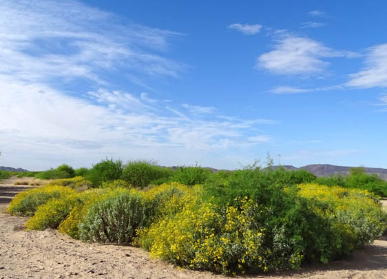
Just as it was interesting to watch the cottonwood leaves turn yellow in
the winter and be rather quickly replaced with new little green leaves
in early spring, it was fun to see the honey mesquite trees, grasses,
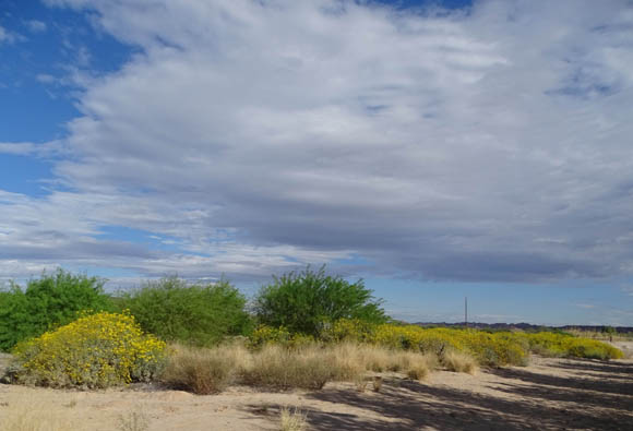
and other plants turn bright green in February:

Above and below: honey
mesquite shrubs/trees in the sandy area where I often walked the dogs


Spring has sprung in the lower
lake ("second reach")

View west toward the Imperial
Dam LTVA, where you can see some boon-docking RVs in the distance
"Winter" is very short here!
These pictures of all the green plants and colorful flowers should
give you some idea why so many people like to spend what little "winter"
there is, in Arizona.
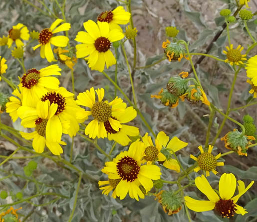
The yellow rabbitbrush flowers stayed in bloom the whole time we
were here, from late October to late March, but the shrubs bore many
more flowers in the spring:
A few new wildflowers were in bloom in the conservation area before we left in March.
I'll include them in a separate entry about spring desert flowers.
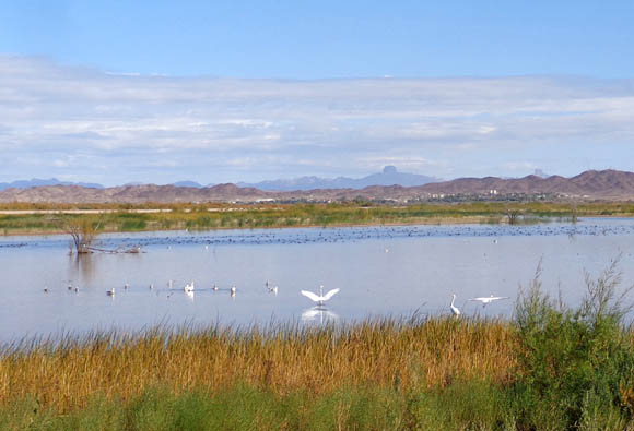
LOTS OF FAUNA, TOO
This conservation area has at least as much water as
sand. Numerous native and migrating ducks, geese, herons, egrets, and other waterfowl can
easily be seen and photographed from the roads through the wildlife area.


We saw the footprints of many more birds and small mammals like rodents,
rabbits, and raccoons than we saw the actual critters.
I took pictures several
times of the tracts of animals that had busy foraging during the night or early morning
hours before I got there to walk the dogs:

I'd guess these are mostly little rodent
tracks between burrows under the plants.

Very tiny and interesting
track -- I wonder what critter made it?

Raccoon tracks

Small bird tracks

BIG bird track! (my
shoes are men's size 10)
One type of mammal we did see quite often in the conservation areas, LTVA,
and other places near Yuma Proving Ground was the burro.
Many feral burros wander
around the area and will come quite close to humans and friendly dogs, although
the only picture of this trio that I could get was of their butt end:

I've got better pictures of burros from the nearby LTVA, where
I saw them several times a week. I'll show some of them in the next entry.
SAND SWIRLS & OTHER SCENES
My favorite part of the Laguna Conservation Area continues to be
the pretty sand dunes near the parking area. It's one of several places
here with shifting dunes. I loved the soft, almost-white, sculpted sand
and all the plants.
A nice loop through the sand here is about a mile long. I walked
the dogs there several times a week. Many of the pictures in this entry
are from this sandy area.
This wind-sculpted hill is one of my favorite parts of the sand
dune area:

It looks quite different with green leaves in March compared with
yellow leaves in November.
I took many other photos of wind-sculpted sand in this part of the
conservation area. Here's just one more example:

Here are a few other random scenes from the Laguna Conservation Area early this
year:


Views from the lower lake looking north toward YPG
and Castle Dome (above)
and west toward the Imperial Dam LTVA (below)


Very low water level in one of the lakes near the
entrance in January (above) and February (below);
earlier in the winter, the water was in the
foreground of both photos, as shown two pictures below.


Same spot in late November at "full pond" or "high
tide."

Sometimes I could almost reach out and touch this
boulder "cairn" near
the entrance to the conservation area (above); other times,
shallow
water covered the ground for 20-30 feet in front of it
(below).

Each day before I went over to the conservation area I'd try to guess
what the water level would be because it could fluctuate not only from
day to day, but also from hour to hour.
This is an interesting place to spend an hour or half a day if you're in
the area. I don't know how much busier it will become when vehicles are
allowed to drive beyond the parking area but during this winter, it was
the perfect quiet and very convenient oasis for Jim and me to ride our
bikes and walk the dogs.
Next entry: our second-favorite playground near YPG
-- the desert around Imperial Dam Long Term Visitor Area (LTVA), including
scenes along Ferguson Road
Happy trails,
Sue
"Runtrails & Company" - Sue Norwood, Jim O'Neil,
Cody the ultra Lab, and Casey-pup
Previous
Next
© 2016 Sue Norwood and Jim O'Neil
