Sounds like an oasis in the desert, doesn't it? And it pretty much is.
Although there is a lot of brown desert terrain on and near Yuma
Proving Ground, where we're spending the winter, there are several
relatively lush wildlife areas nearby that we've been enjoying.
All are possible because of the water flowing through them from the
Colorado River -- and the foresight of the BLM and other federal
and state agencies to set them aside as public lands for conservation
and recreation purposes.
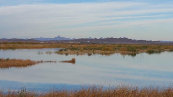
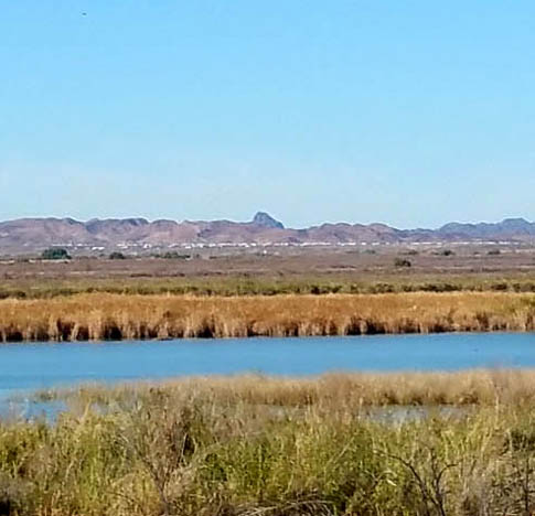
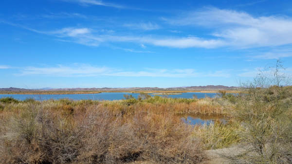
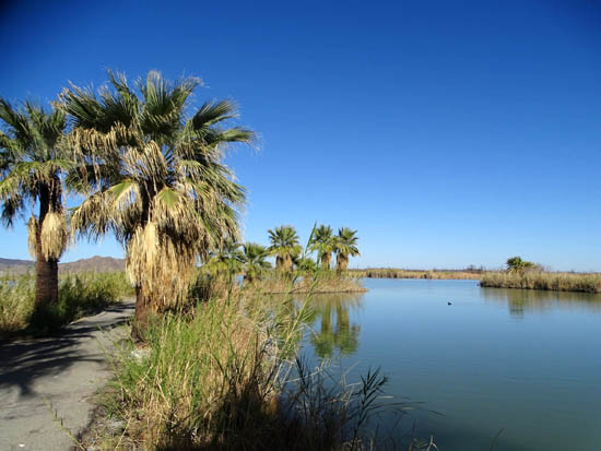
View across one of the lakes at Laguna
Conservation Area near YPG; Castle Dome is in the distance.
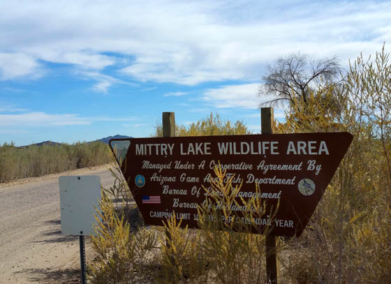
In this entry I'll describe the Mittry Lake Wildlife Area, which is
owned by the Bureau of Land Management and Bureau of Reclamation, both
federal agencies, but run by the Arizona Game & Fish Department.
Mittry is a stocked lake popular with fishermen and women.
All the photos in this entry are from January 29 and January 31,
2016, when I rode my bike down to the lake from our campground at YPG. Jim rode
with me the second time.
Subsequent entries will focus on recent pictures from the
Laguna Conservation Area and the Imperial Dam Wildlife Area, which I've
covered previously in the 2015 journal.
MORE ABOUT MITTRY LAKE
According the the BLM
website, the wildlife area includes about 600 acres of
water surface and over 2,400 acres of marsh and upland terrain.
The area supports a wide variety of vegetative and wildlife species
and is framed by three mountain ranges:
Wetland/marsh vegetation close to the lake
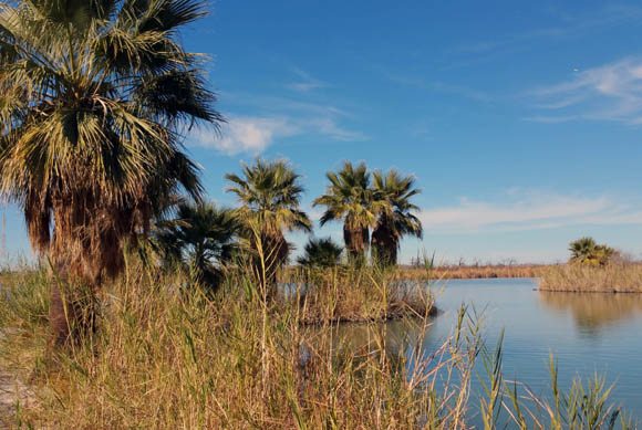
Palm trees near the camping area
Upland vegetation in this area where some RVers are
boon-docking north of the lake
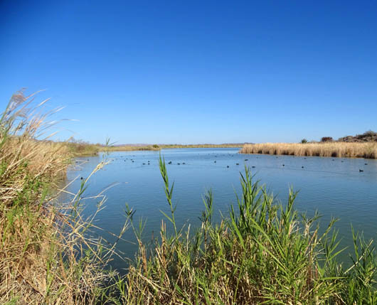
The wildlife area provides riparian, wetland, and aquatic habitat for
many wildlife species. The Important Bird Area website states that
it is one of the most accessible settings for wildlife viewing in
Arizona's Colorado River floodplain.
In the winter, for example, up to 10,000 resident and migrating
waterfowl may be present:
The desert scrub and riparian vegetation also support a wide variety of
other birds, mammals, reptiles, and insects.
Then there are the fish. With all that water,
Mittry Lake and the surrounding area offer numerous fishing
opportunities. Bass, catfish, sunfish, and crappie are the most
prevalent species.
The lake has boat ramps at either end;
the fishing is reportedly better out on the lake in a boat than
along the shoreline.
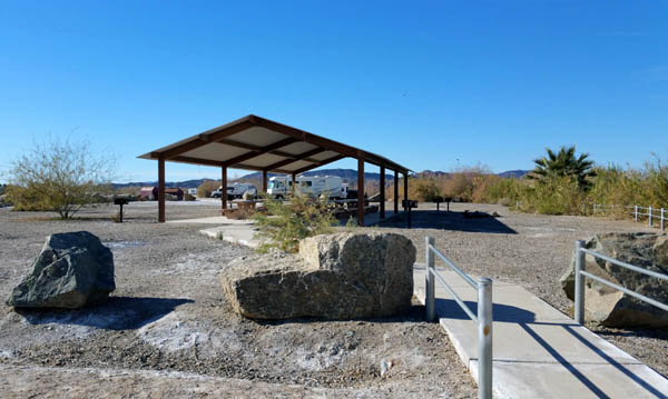
The main boat ramp has restrooms and a large ramada
for groups to gather.
Numerous serpentine waterways connect to the main lake body, which
you can see in this Google map of the area. Mittry Lake is at the bottom
of the map:
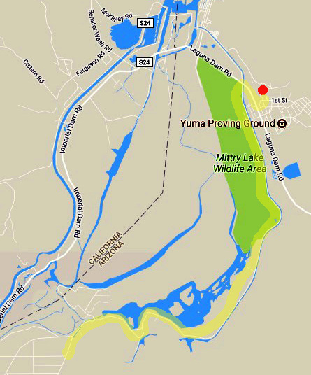
Most people reach the lake from Yuma, which is to the south. The southern
end of the lake is about a 17-mile drive from downtown going east on US 95
and north on Avenue 7E.
The northern end of the lake is only about
six miles from the administrative and RV park gate at Yuma Proving Ground.
I marked the approximate location of our RV site with a red dot and our bike
route in yellow on the map above.
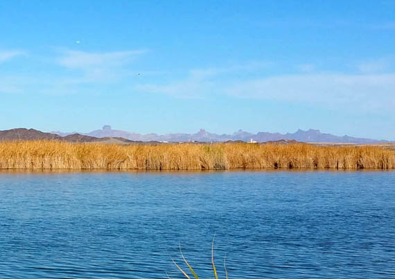
The Imperial Dam Long Term Visitor Area is in the upper
left corner of the map off Senator Wash and Ferguson Roads. The white
dots you may be able to see in the far distance in some of the lake
pictures in this entry, like the one below, are RVs parked in the desert
at the LTVA:
LET'S TAKE A RIDE!
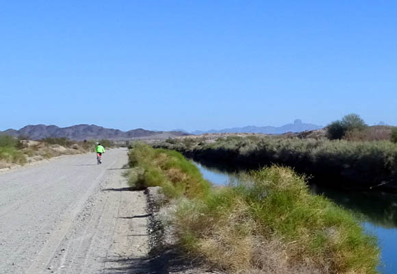
Two days ago I made my first cycling trek from
our RV park to the southern end of Mittry Lake, riding out and back 15+ miles
roundtrip.
Although the sand and gravel road to the lake is
very close to the entrance to our part of YPG, neither of us had ever
been down there before this week.
The first two times I tried to ride my bike there I had to turn around
within a quarter mile because the road was uncomfortably wash-boardy and the sand
and gravel surface was too thick for the tires on my cyclocross bike.
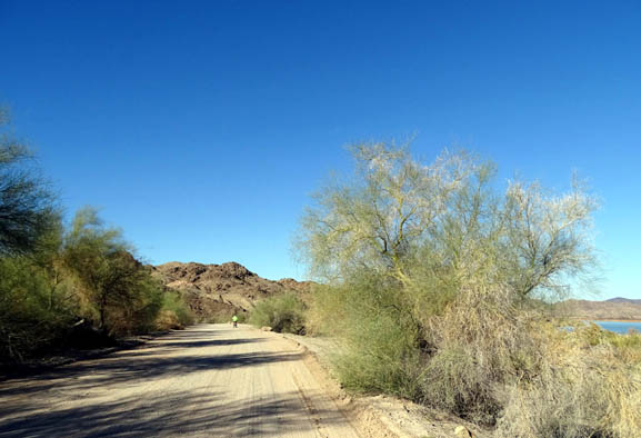
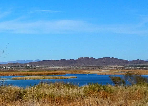
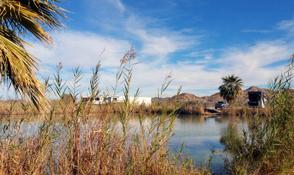
Jim heads
back toward YPG near the end of our ride today; Castle Dome
is in the distance to the right.
Jim's mountain bike tires are more suitable for this road but he was just never
interested in seeing the lake until I convinced him to ride down there
with me today.
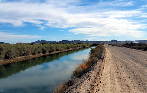
The road was graded about two weeks ago so I decided to try it again.
It's not as bad now, especially on the edge of the roadway next to the
canal that it follows below South Laguna/East Imperial Dam Road:
Friday wasn't the best afternoon to ride down because of all the traffic --
folks going down to fish and camp for the weekend. A lot of dust was
stirred up that day. Traffic was surprisingly
lighter this morning, a Sunday, when Jim rode down to the lake with me.
[Addendum: Neither of us rode down there again before we left YPG
in March, mainly because of the dust.]
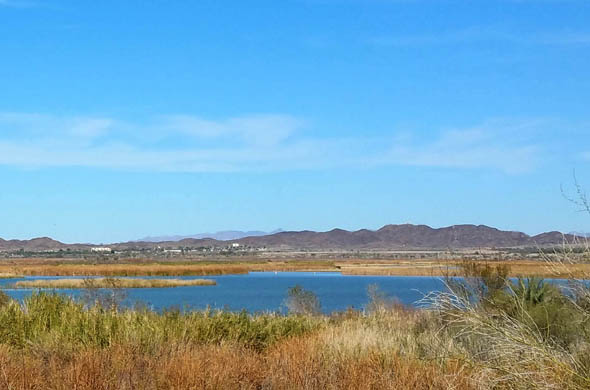
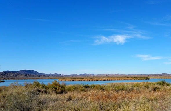
Heading south from
YPG along the dirt road toward the lake, the first three or four miles
next to the canal are flat and rather boring until you get closer to
some hills and the lake.
The scenery definitely improves when you can
look across the pretty lake:
Looking west toward the LTVA
Looking northwest toward Imperial Dam
Looking north toward YPG and the Castle Dome
Mountains
RV CAMPING
Neither of us was aware of the camping opportunities at Mittry Lake.
On
my first trip down I noticed the RVs boon-docking along the road, as
shown in one of the pictures above. Since so many people boon-dock in
this desert, I wasn't surprised.
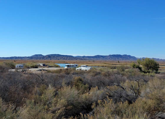
I was surprised, however, when I rode past the main boat ramp and saw a
BLM dispersed or unimproved campground with about five dozen RVs ranging from basic
truck campers and small travel trailers to large Class A motorhomes and
toy haulers.
"Dispersed" is what you call the camping at the huge Imperial Dam LTVA a
few miles away, also managed by BLM. We had just never researched what
other free or low-cost dispersed and unimproved camping is available in the area.
Camping at Mittry Lake is limited to 10 days per year. I don't know if there's a fee
and I didn't look closely enough to see if there are any hookups (I
doubt it). Most of the RVs are in an area near the boat ramp and bathroom.
A few very desirable sites like those in the photo above back up to the lake.
A
recently burned area near the main camping area looks a little
other-worldly:
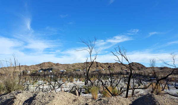
Both natural and human-caused wildfires are rather
prevalent in this area, according to one of the websites I consulted. The marsh grasses
burn easily and grow back rather quickly, but trees like cottonwoods take
a lot longer.
If you're in the Yuma area for a few
days, weeks, or months during the winter this is one of several
interesting wildlife areas that is scenic and convenient to visit,
especially if you like to fish, boat, camp, and/or watch birds.
Next entry: new photos from the nearby Laguna Division Wildlife
Conservation Area
Happy trails,
Sue
"Runtrails & Company" - Sue Norwood, Jim O'Neil,
Cody the ultra Lab, and Casey-pup
Previous
Next
© 2016 Sue Norwood and Jim O'Neil
