In addition to the 3,500 acres of desert land within the boundaries
of the LTVA, there are thousands more acres of public lands surrounding
this wintertime boon-docking nirvana.
That's where Jim and I hiked and
rode our bikes a couple times a week from October to March -- in
the hills and washes outside the LTVA.
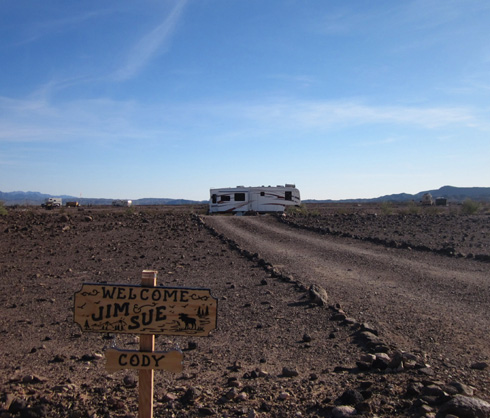
Four years ago we spent a couple months dry camping within the
Imperial Dam LTVA during the height of the season in January, February,
and March. We had an acre of land all to ourselves (next photo). You can read about
it in our
2012 journal.
With the explosion of RVers in recent years, we could see many more
camping units of all types and descriptions spread out over the LTVA this year.
By January, a wagon-wheel of seven or eight RVs occupied the
circle we had to ourselves four years ago. The next photo shows our
previous site from the "back," where I could get closer to take a picture:
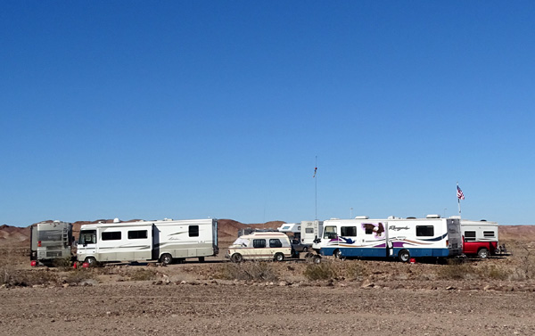
The whole LTVA was more full than four years ago, a sign of better
economic times. That was one of many reasons we were happy to be parked at the nearby
Yuma Proving Ground (YPG) military RV park this winter, with full
hookups and a spacious designated site to ourselves.
I wrote about hiking and cycling in and near the LTVA in the December 4, 2015
entry. I will reiterate some of the text here but feature mostly new
photos I took in January, February, and March of this year.
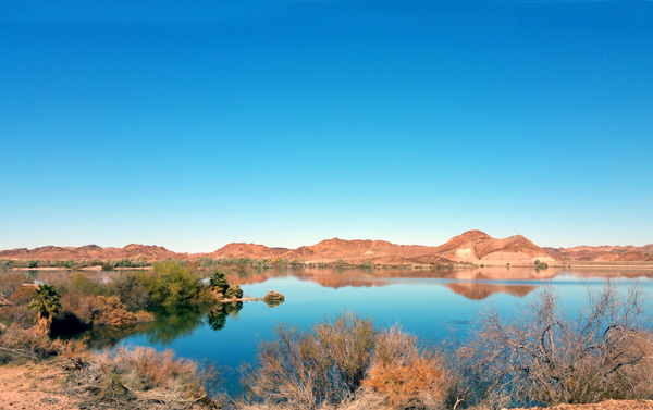
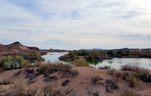
Serenity defined: View of Senator
Wash Reservoir in January
I will also include a section with pictures from Ferguson Road, which
leaves the northwest side of the LTVA and travels over some mountainous terrain, ending on a
high plateau with superior views of scenic Ferguson Lake and the
more colorful Imperial Wildlife Refuge.
GETTING THERE
The entrance to the LTVA is about three miles from our RV park at Yuma Proving Ground,
at the intersection of Senator Wash Road and Imperial Dam Rd. on the California
side of the Colorado River.
To reach this area, visitors driving up from Yuma could take either S24, a county road
through agricultural farms and orchards in California, or drive up
US 95 in Arizona and go west on Imperial Dam Rd. past YPG.
Here's a
map of the LTVA:
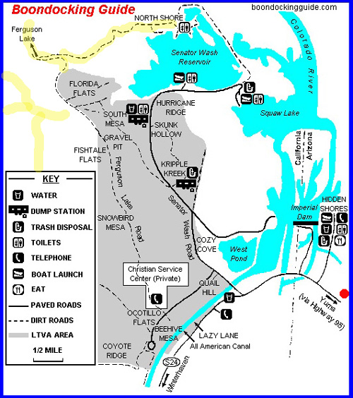
The LTVA is the gray area. I marked some of the Jeep roads and trails
where I hiked and/or rode my bike in yellow; there were more places than
that to the west (left) of the LTVA. The red dot is close to our RV park
at Yuma Proving Ground.
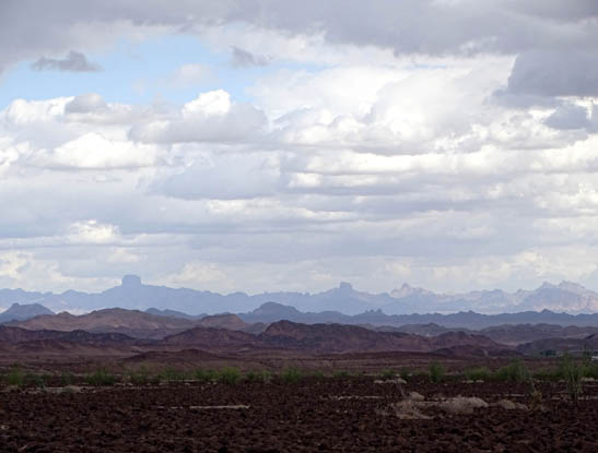
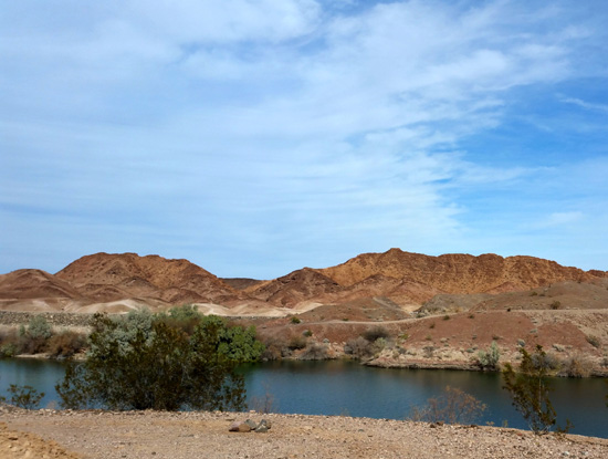
Except for Senator Wash Reservoir and
Squaw Lake, the LTVA and surrounding public lands are mostly rather barren mountains
and desert lands punctuated by numerous dry washes.
I shook my head when
I first read the BLM description above re: "flat landscape."
Ha!
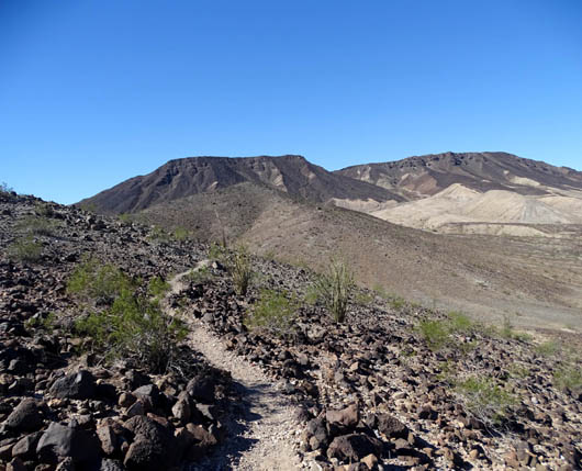
Hills, hills, and more hills -- actually low
mountains -- out Ferguson Rd.
The campground areas do
have some areas that are relatively flat but there are plenty of hills
and low mountains both inside and outside the LTVA.
You can see from almost every photo in this entry how hilly the
area is. That's one reason we liked hiking and cycling there so much.
Not only are there great views from the higher spots, going up and down
continuously is a lot more interesting than walking or riding on really
flat terrain.
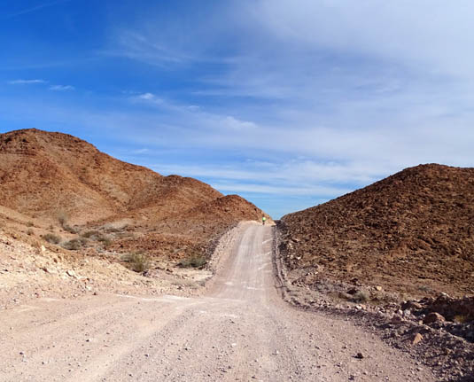
Jim pedals up a short but steep hill on Ferguson
Rd.
Imperial Dam is one of seven LTVAs in far southwestern Arizona
and southeastern California. Run by the BLM, they are cheap
boon-docking opportunities for snowbirds.
If you're paying to camp at Imperial Dam there is no additional cost to
use the trails or reservoir. For visitors like us, however, there is a
$10 day-use fee ($5/day with our NPS senior pass) or $75 annual fee to
use the lake, trails, and other facilities within the LTVA boundaries.
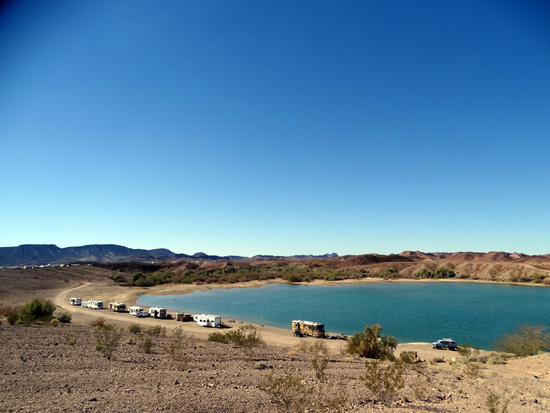
It's dirt cheap to camp up on the plateau; it costs
more to park your RV
down by Senator Wash Reservoir (above) or Squaw Lake
(below)
Paying a fee to hike inside the LTVA seemed exorbitant to us. After all,
we get into most national parks, monuments, and forests for free with
our NPS senior pass.
This winter we got around the
day-use fee legally by driving or riding our bikes through the LTVA and parking
past the visitor area boundaries to hike or continue riding on
free public land.
It was very interesting to see the LTVA when we first arrived in late
October, about a month before most snowbirds arrive and set up their
campsites. When we camped there four years ago it was in the busiest
months of January, February, and March.
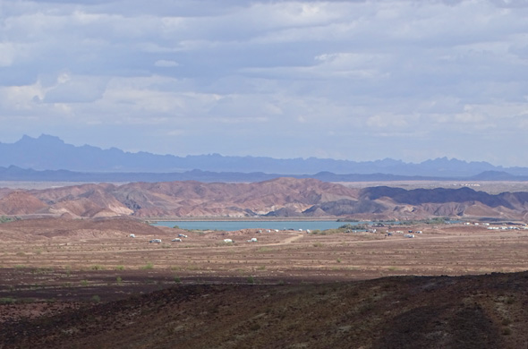
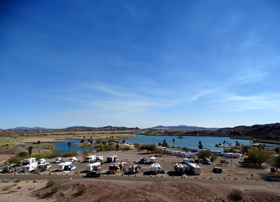
Looking down at part of the LTVA when very
few RVs were there in early November
This picture taken
from about the same spot (on one of my favorite trail
loops) shows many more RVs in the same area the third week of January:
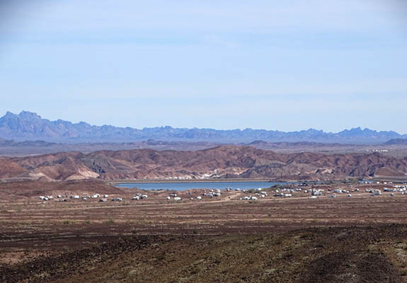
That's only one small part of the LTVA; there are many more
"neighborhoods" farther south on the property.
SOME PHOTOS FROM MY HIKES
I hiked near the LTVA alone or with one of the dogs two or three times a
week and rode my bike over there about once a week.
Jim hiked with the dogs and me occasionally but more often rode his bike on
the dirt roads through the LTVA and Jeep roads outside its boundaries.
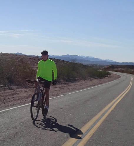
Jim rides on Senator Wash Rd., which is paved from
the entrance to
the LTVA at Imperial Dam Rd. to Squaw Lake (about 3
miles).
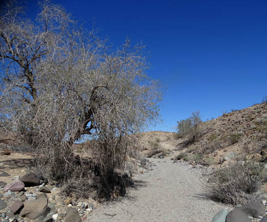
The photos in this section are ones that I took on various hikes,
sometimes on established trails (often made by the resident feral
burros) or Jeep roads and sometimes just navigating cross-country over
the desert, down into washes and slot canyons, and up into the mountains.
With so few trees and other vegetation, it's easy to find your way
around out here off-trail or off-road, especially if you're above the
desert floor on a ridge and can see for dozens of miles.
Trail near the top of the ridge
on my favorite loop hike at the LTVA,
looking west (away from the lake and campers)
Another view toward the western mountains
from my ridge loop, with
a creosote bush in bloom the
second week in March
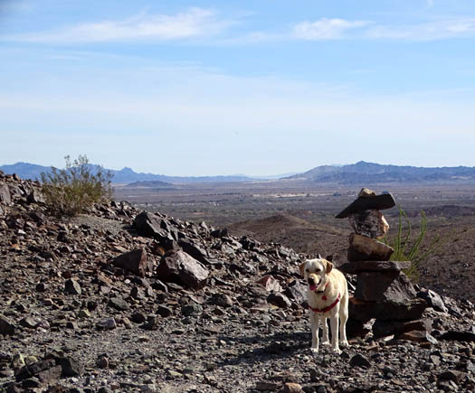
Casey stops near a rock inukshuk
on that loop; many Canadians camp at the LTVA in the winter.
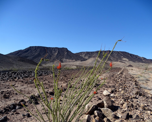
Ocatillo blooming in March on the
desert floor; west mountains in the background
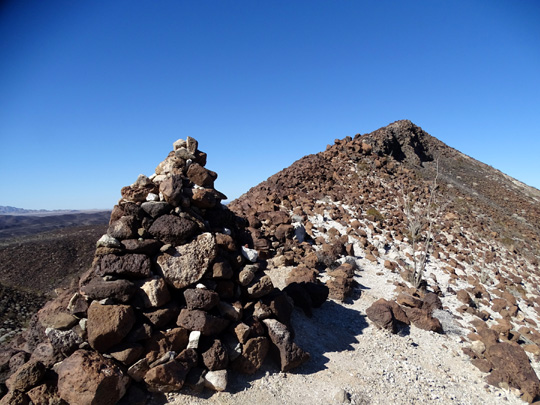
Cairn on a high pass in the
mountains west of the LTVA, above, and the view back to the east
from the pass, below; it's a
rough trail to get up there but the panoramic views are worth it.
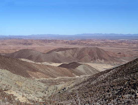
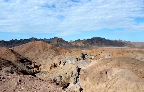
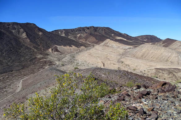
Most of the desert terrain is rather stark, primarily shades of tan, brown,
and gray, but there's a stark beauty about it with all the
textures and layers, such as the mountain ranges in
the distance:
Layers of mountains and Castle Dome visible
from one of the hills I like to hike
Those layers of fading colors remind me of some of the pictures I took
of the Blue Ridge Mountains during my Appalachian Trail Adventure Run in
2005. They just make me want to keep going up and over, and up and over,
to get to the farthest range.
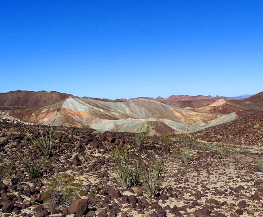
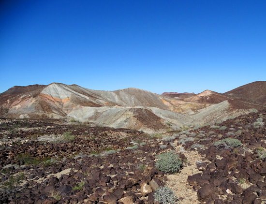
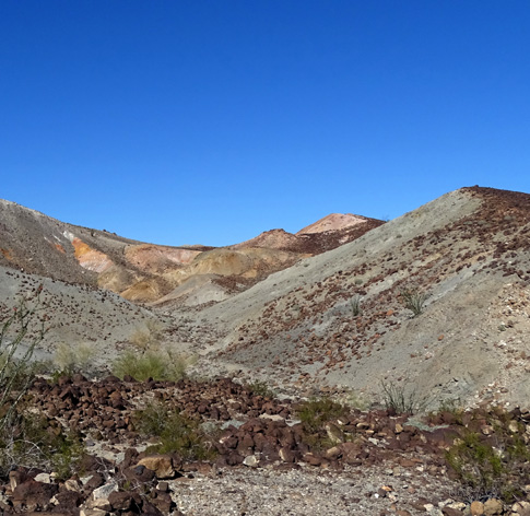
There is one new area of desert I explored this spring just a couple
miles outside the LTVA that was more colorful than anything else nearby.
I called it the "painted" hills.
I had seen it many times in 2012 and 2015-6 from the ridge on my
favorite loop to walk the dogs but never hiked back there until this
February:
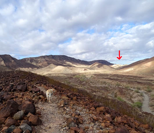
There it is, Casey! Let's
go check it out.
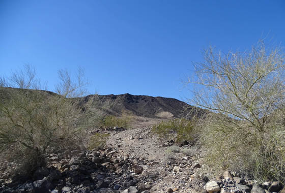
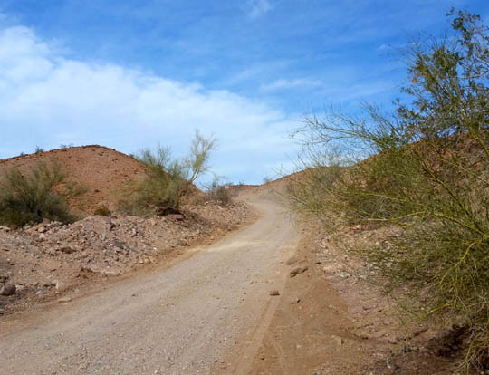
There are a couple ways to get there, including
this rough part of a loop.
A shorter out-and-back has a little smoother Jeep
road.
I hiked back there with Casey the first time, then showed it to Jim and one of our
neighbors on subsequent hikes.
That's the most colorful spot I've found
in or near the Imperial Dam LTVA. (Imperial Wildlife Refuge has lots of colorful
hills but it's farther north along the Colorado River.)
THE NORTH SHORE
Another new place I rode my bike a couple times this year is along other Jeep roads on the north
shore of Senator Wash Reservoir. It is marked on the LTVA map near the
beginning of this entry.
Some designated tent and RV campsites are available on that side of the
lake but you'd need a 4WD vehicle or small rig to negotiate the steep,
narrow, rough roadway to get there.
That side of the lake gave me a different perspective than seeing it
from the two sides of the LTVA and from high points where I hiked on the
western hillsides.
WASHES & SLOTS
I also sometimes hiked through the numerous washes and at least four slot canyons just west of the LTVA
camping area. This is a large drainage area for rainwater -- what little
falls here annually -- to flow into Senator Wash Reservoir.
Some of the washes are rather smooth with sand and pebbles, others quite
rocky:
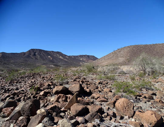
The washes range in width from a few feet wide to about a hundred feet.
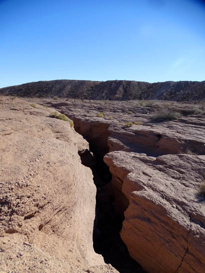
The widest wash feeding the reservoir has two slot canyons eroded into
it:
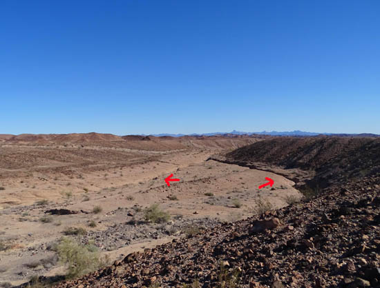
Looking downstream into the wide wash from the
desert plateau
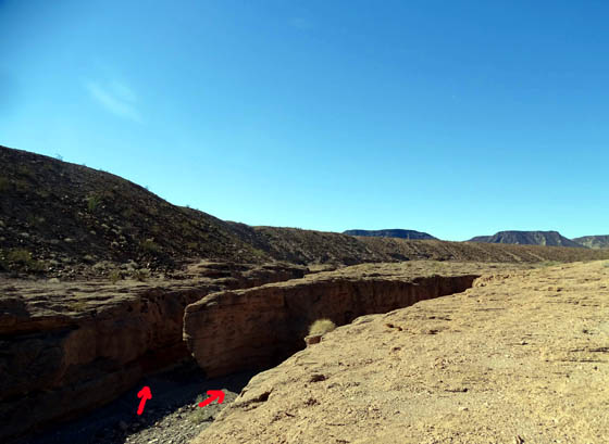
Lower end of the two slot canyons, where it's easy
to enter them
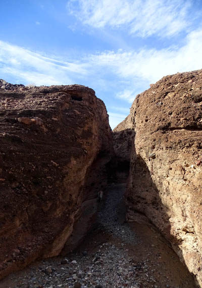
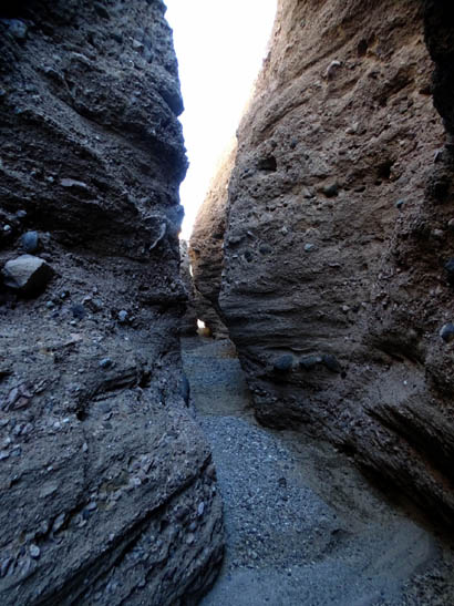
Above and below: inside these slots, with
walls 12-15 feet high
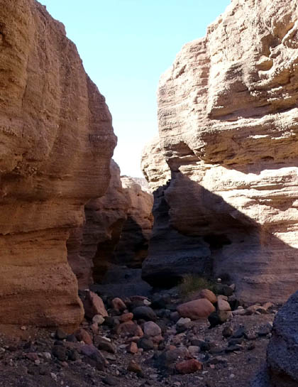
There are at least two other slot canyons farther upstream, too. The
more narrow one has walls up to 20 feet high:
I've gone in the lower (easy) end of each of the slot canyons and have
had to turn around before exiting the high end because of either
boulders that were impossible for me to climb or steep, smooth walls at
the end that I also couldn't climb.
Sometimes I just walked above the more narrow slots and looked down into
them; that's less claustrophobic:
I had to go out and back in all of them. Younger folks with stronger
limbs or a buddy to assist could probably manage all three, unless
subsequent gully-washers change the landscape significantly.
Very little rain falls here but it's important to listen to weather
forecasts and be aware of any rain that is pending or has already fallen
upstream any of these slot canyons. Even an inch of rain during one
storm in this desert could result in a dangerous flood in such narrow
slots.
Continued on the next page: colorful rocks and desert
flowers, wandering burros, and great views from Ferguson Road
Happy trails,
Sue
"Runtrails & Company" - Sue Norwood, Jim O'Neil,
Cody the ultra Lab, and Casey-pup
Previous
Next
© 2016 Sue Norwood and Jim O'Neil
