One of the reasons folks like to spend the winter at Desert Breeze RV
Park at Yuma Proving Ground or the nearby Imperial Dam Long Term Visitor
Area (LTVA) -- besides all the warm sunshine -- is the opportunity for
lots of recreational activities like watching and photographing
wildlife, fishing, boating, cycling, and hiking.
There are a good
number of lakes and canals on both the Arizona and California side of
the Colorado River and the new Laguna Conservation Area is a
welcome addition for local residents as well as thousands of snowbirds
from all around the USA and Canada.
When we were at the LTVA four winters ago we found some nearby
streams and trails. We discovered even more this time. We went off-base
nearly every day to explore them on foot or bike.
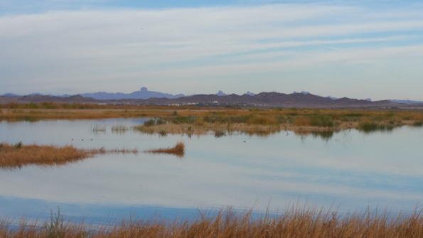
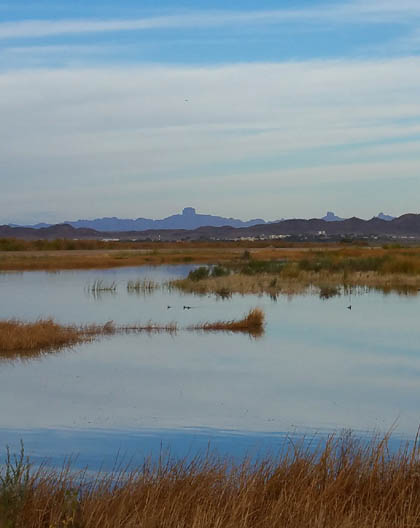
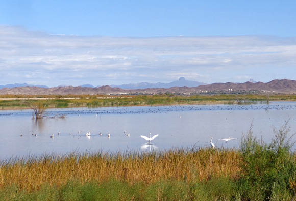
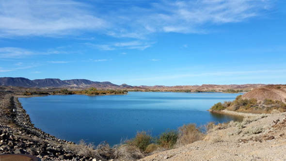
Serene view of Castle Dome in
distance from the Laguna Conservation Area
We don't fish or have a boat but we love being near lakes and
streams. This entry will showcase photos from some of our rides and hikes this winter
in both wet and dry areas of the desert near YPG.
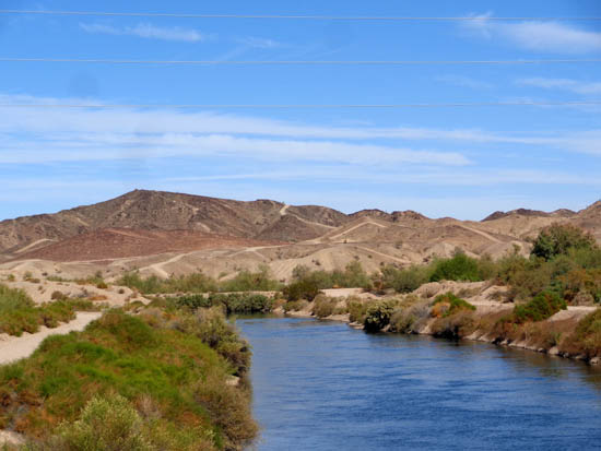
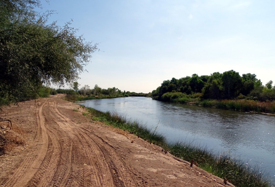
ADJACENT CANAL & HILLS
About half a mile west of the gate on Imperial Dam Road to Desert
Breeze RV Park is an intersection along one of the canals running from
the nearby Colorado River.
The dirt road to the south goes several miles to Mittry Lake. We
didn't ride our bikes down there until later in the winter so I'll
include photos of that in the 2016 journal. Several times this fall I
walked on the shorter road to the north, however, and up into the
network of hills behind our campground.
The canal is scenic and a quiet place for fisher-folks to fish and
dogs to swim:
The hills behind our campground fascinated me from Day One. Straight
out my large desk window I could see a dirt road topping one of the hills
to the north and I wanted to see what was beyond!
I found out that some of the land is on base and not accessible (or
not advisable, since it might have some unexploded ordinance) but
much of it is open to off-road vehicles like Jeeps and ATVs. The maze
of roads and trails is confusing through the hills so it took me a couple hikes to find
the right ones to that high vantage point.

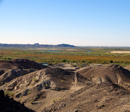
Once I got up there I wasn't real impressed with the terrain to the
north but I liked the expansive views to the south over the base and the
nearby wildlife conservation area:
It was fun to look down on the campground and see our site from that
perspective. I'm not including photos overlooking the base for security reasons.
LAGUNA CONSERVATION AREA
A little farther west on Imperial Dam Road, just a couple miles from the
RV park, is a large wildlife refuge that has been developed since we spent
the winter here four years ago. It is open to wildlife watching, hiking,
cycling, fishing, hunting, and horseback riding
and is designed to protect the environment.
This new wildlife area is still a work in progress but the basics are in place -- wide dirt
roads that form a nine-mile long figure-eight loop through the wetlands
and around two large lakes fed by canals coming from the Colorado River.
This huge grading machine sits in the parking area, with a long line of
metal and wood strung out behind it:
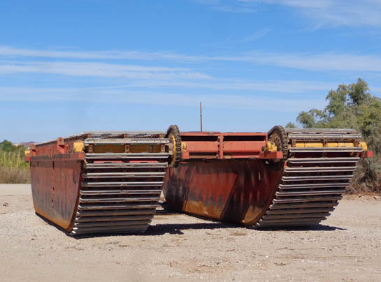
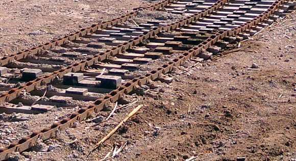
It's still obvious in some places where the machine
was recently used. Many native trees, shrubs, and grasses have been
planted to provide cover for wildlife and stability to the shifting sand dunes.
We can attest to the fact that this area gets some very strong winds.
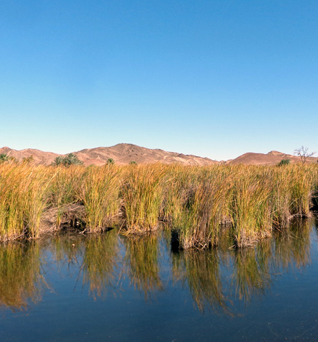
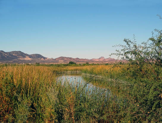
The conservation area has at least as much water as
sand. It's odd to see wetlands and lakes in this mostly barren
desert terrain but they are visible from Imperial Dam Road (next photo) and all
through the wildlife area (second photo below).
Numerous ducks, geese, herons, egrets, and other waterfowl can
easily be seen and photographed from the roads through the wildlife
area.
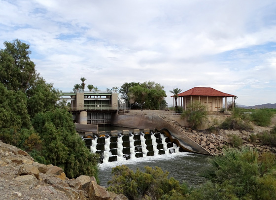
It was interesting to see the differences in water level from day to
day as the flow of water was controlled remotely by nearby dams (one is
shown below).
I'd sometimes joke about the water being at "high or low tide"
because it resembled oceans the way it would rise and fall.
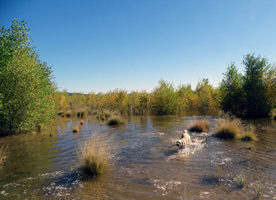
Sometimes these trees and shrubs were high and dry
(above) and
sometimes they were inundated with water
(below), which Casey liked.
I also enjoyed watching the colors of the leaves and flowers
morph from fall to spring (the winter season is short to nonexistent here).
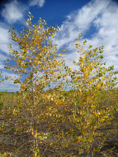
These cottonwood leaves fell in January and new green
leaves popped out soon after.
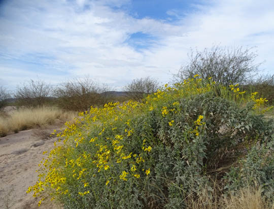
Rabbitbrush (I think) was in bloom the whole time
we were here.
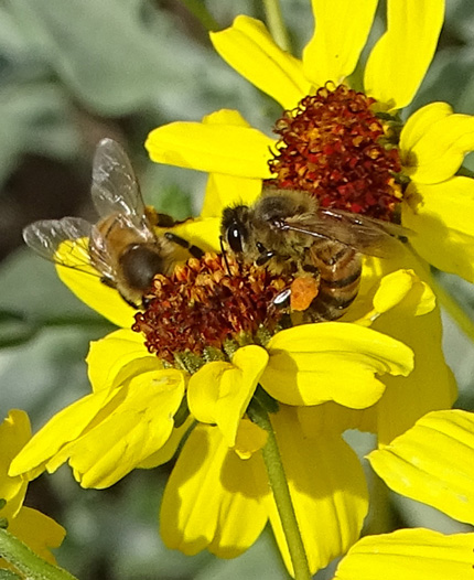
Busy bees
I took one or both dogs here to walk several times a week because
it was so peaceful, scenic, convenient, and fun for the dogs to run
loose and swim.
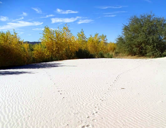
My favorite part is off to the SW side of the parking area. It's
one of several places with pretty sand dunes in the conservation area. I
loved the soft, almost-white, sculpted sand and all the greenery. A nice
loop through the sand here is about a mile long.
Laguna has many more trees, shrubs, flowers, grasses, and birds
than any other place within ten or fifteen miles of our campground.
There are lots of cottonwood and honey mesquite trees, coyote willow
bushes, rabbitbrush, and various kinds of grasses. Some are native but
many were planted in the past few years, according to a volunteer I
talked with. It's been a major undertaking.
Animal tracks (coyote? fox?) and colorful
fall leaves on one of the sand dunes
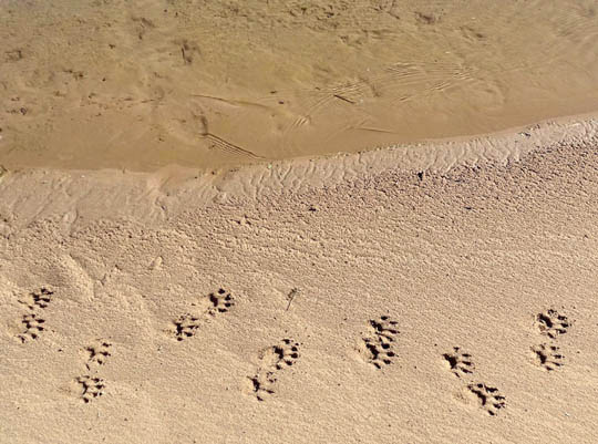
Cute little raccoon paw prints nest to the water;
there were also lots of bird foot prints in the sand.
We also liked to ride our bikes on the wide, unpaved road loops around the lakes
because almost all traffic has been prohibited beyond the parking
area this winter.
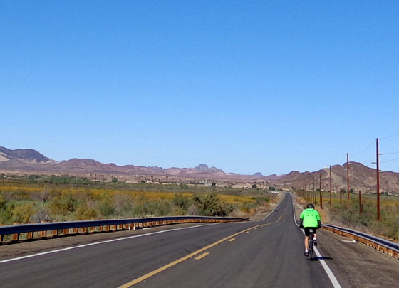
Jim rides on Imperial Dam Road past
the wildlife area (on the left); the LTVA is in the distance
ahead.
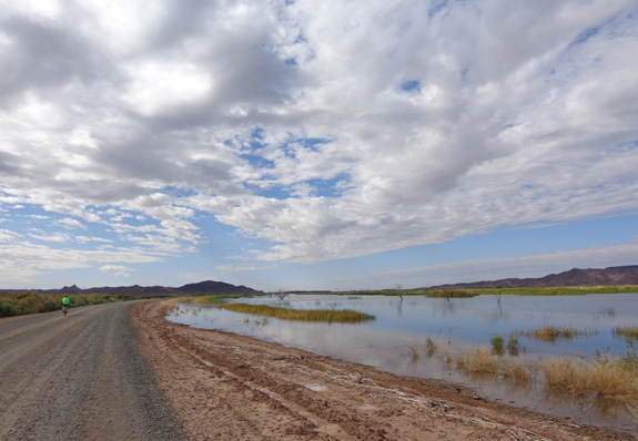
Jim rides by the lower lake in the wildlife area;
it's at "high tide" in this picture.
By the time we left in March some low post-and-cable fencing was erected
by the road around the first lake. One of the workers said that the public
would eventually be allowed to drive motorized vehicles to more easily access
the lakes for fishing and other recreation.
I'm glad we were able to hike and bike here before that happens.
This winter the only vehicles we had to dodge were work trucks and
graders.
Here are some other pictures of the wildlife area:
This photo looking toward the hills in the LTVA
almost looks
like a painting even when blown up to full size.
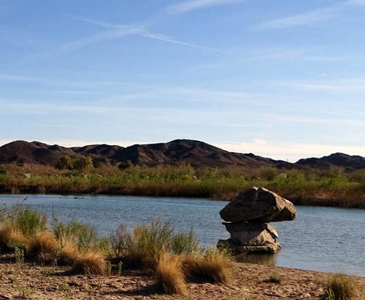
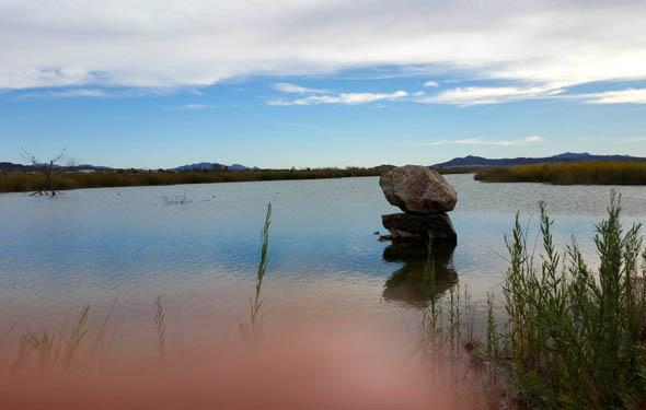
Above and below: These stacked
boulders in the water near the
parking area make
an interesting subject to photograph.
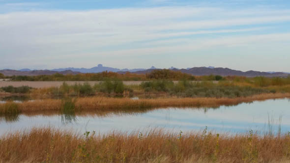
Some of my favorite photos of the conservation area are wide-angle views
like the one above and below that I took with my new Samsung Galaxy Note 4 cell phone.
We finally traded in our flip phones in November and got our first smart phones.
The camera is 16-megapixel:
View of Castle Dome and several other dome
formations to the NE of the wildlife area
IMPERIAL DAM LTVA & ENVIRONS
We also either drove or rode our bikes over to the BLM's massive long-term
visitor area and surrounding public lands a couple times a week.
The entrance to this area is about three miles from our RV park at YPG at the
intersection of Senator Wash Road and Imperial Dam Rd., which is called S24
on the other side of the Colorado River in California.
The LTVA and surrounding public lands cover many thousands of acres. Except
for Senator Wash Reservoir and Squaw Lake, it is mostly rather barren mountains
and desert lands punctuated by numerous dry washes.
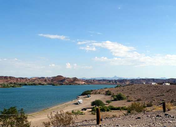
View of Senator Wash Reservoir
before most snowbirds have arrived;
camping by the two lakes
is limited to two weeks but up on the
plateau visitors can stay from September to April.
Imperial Dam is one of seven LTVAs in far southwestern Arizona
and southeastern California. Run by the BLM, they are cheap
boon-docking opportunities for snowbirds.
If you're paying to camp at Imperial Dam there is no additional cost to
use the trails or reservoir. For visitors like us, however, there is a
$10 day-use fee ($5/day with our NPS senior pass) or $75 annual fee to
use the lake, trails, and other facilities within the LTVA boundaries.
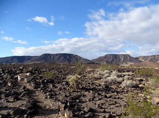
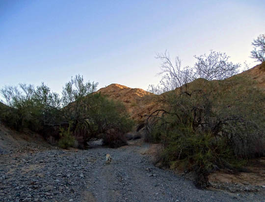
Casey leads the way on my favorite loop
trail through those mountains.
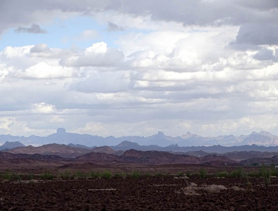
Layers of mountains and Castle Dome visible
from one of the hills I like to hike
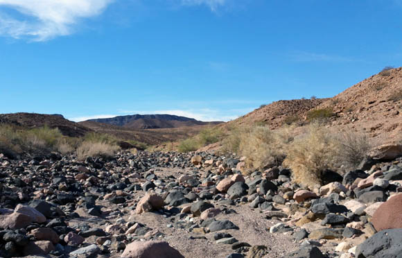
Some of the washes are very rocky
and hard to negotiate.
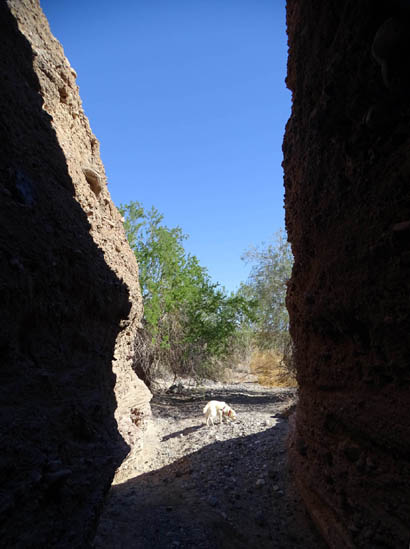
Casey at the entrance to one of
the slot canyons
That seemed exorbitant to us. After all, we get into most national parks,
monuments, and forests for free with our pass. We got around the
day-use fee legally by driving or riding through the LTVA and parking
past the visitor area boundaries to hike or continue riding on
free public land.
It was very interesting to see the LTVA when we first arrived in late
October, about a month before most snowbirds arrive and set up their
campsites. When we camped there four years ago it was in the busiest
months of January, February, and March.
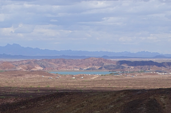
Looking down at part of the LTVA when very
few RVs were there in early November
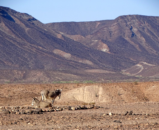
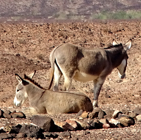
Most times when we were riding through the LTVA or hiking outside its
boundaries we saw small groups of wild burros. They came right up to
our campsite when we stayed there in 2012 but they are more skittish
when they see hikers coming on the trails.
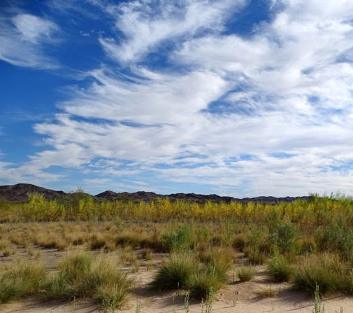
Since most of this area lacks color, especially with so few trees
and shrubs, I'm showing just a few photos from the places where we rode
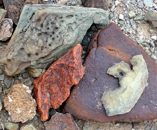
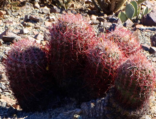
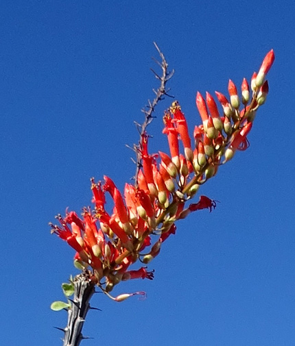
and hiked. I was always happy to find the occasional colorful rock,
barrel cactus, or a red ocatillo flower:
I'll have pictures of more flowering cacti in the 2016 journal, as
well as scenes from the longer bike rides we did in the spring to Ferguson Lake.
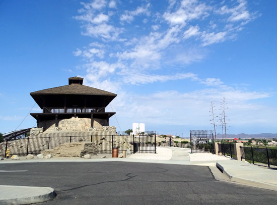
SUNRISE POINT & YUMA'S WETLAND PARKS
Yuma has several parks bordering the Colorado River on the north side of
town. I occasionally stop in one of them to walk on the way to run errands.
The East and West Wetlands Parks and Gateway Park are on the Arizona side
of the river and have some paved bike paths along the riverbank.
Access to the East Wetlands is on Prison Hill Road, which leads
to the Yuma Territorial Prison State Historic Park:
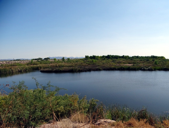
Sunrise Point is on the California side of the river and has sandy trails
around a lake.
The park is part of the Yuma East Wetlands District adjacent to the Ocean-to-Ocean
Bridge that connects Fort Yuma Indian Reservation to the City of Yuma. Multiple
ongoing ecological projects are helping rid the area of invasive spwcies of plants and
restoring the natural riparian habitat along the river.
Sunrise Point AKA Anya Nitz Pak ("sun coming up" in the Quechan
Indian language) is a nature park and cultural resource for both
visitors and the Native Americans who live here.
In addition to a fishing lake and trails, there is also an interesting
plaza near the parking area with a circular fountain and pergolas
for shade:
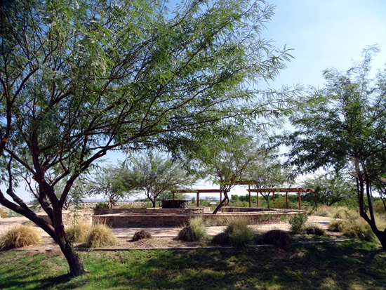
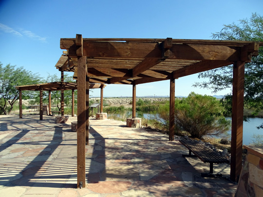
Places like these with water are true oases in the desert.
Next entry: another, larger oasis in the desert --
colorful scenes from the
Imperial National Wildlife Refuge and Painted Desert Trail
Happy trails,
Sue
"Runtrails & Company" - Sue Norwood, Jim O'Neil,
Cody the ultra Lab, and Casey-pup
Previous
Next
© 2015 Sue Norwood and Jim O'Neil
