The Department of the Interior's Fish & Wildlife Service administers 550
wildlife refuges around the country. The mission is to conserve fish and
wildlife and their habitat. All or most of the refuges are free to
enter and some allow camping.
On a beautiful sunny day in December we decided to drive up to the
nearby Imperial National Wildlife Refuge with the dogs. Four years ago
we hiked the Painted Desert Trail with Cody but we didn't spend much time
in the rest of the refuge.
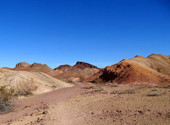
Colorful part of the Painted
Desert Trail
Imperial NWR is one of two large national wildlife refuges adjacent to
the northern part of the sprawling Yuma Proving Ground Army base.
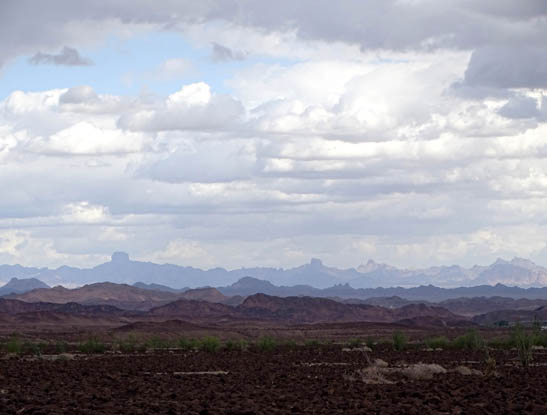
The other refuge, Kofa NWR, is the location of the unusual Castle Dome
mountain range that we can see from the base, the LTVA, and the Laguna
Conservation Area. I've inclouded several photos in this series of entries
that show one or more of the iconic domes in the distance:
Kofa NWR is humongous at 665,400 acres. We didn't visit it until
February so I'll show photos from it in the 2016 journal.
Imperial NWR is much smaller at "only" 25,768 acres but it's a more
manageable size to negotiate and I liked it better because it is strung
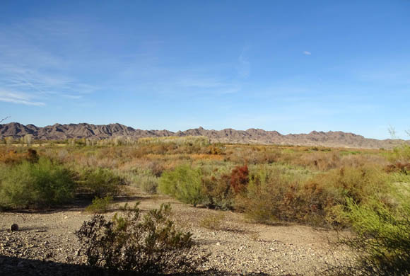
out along the Colorado River. It is more green and colorful than the
predominantly barren terrain I saw at the Kofa NWR.
Most of the land at Imperial NWR is on the Arizona side of the river.
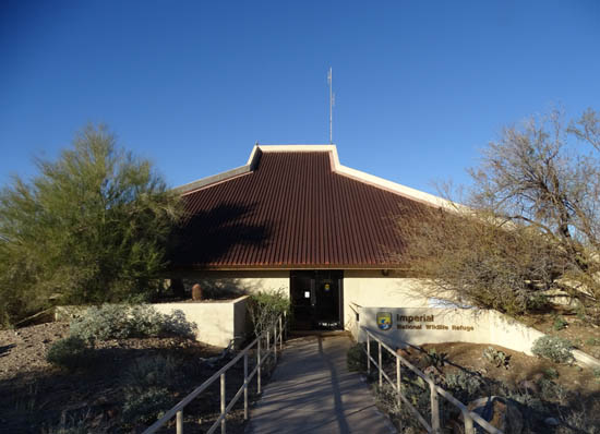
The visitor center, trails, overlooks, and the only road going into it,
Red Cloud Mine Road, are also on that side. More than 15,000 acres of
the refuge are federally designated wilderness that can't be developed.
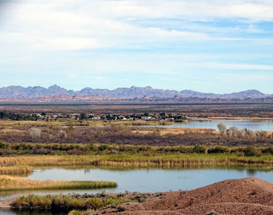
View toward the Colorado River
from the large Imperial NWR visitor center windows
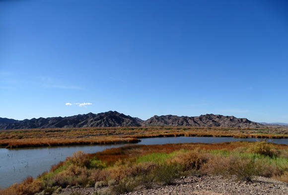
At the northern edge of the Sonoran Desert, this refuge includes
upland desert habitat, marshes, and Colorado River backwaters.
Wetland wildlife is most abundant during the winter. The original
"snowbirds" -- ducks, geese, shorebirds, other
water birds, hummingbirds, and song birds -- flock to the lower
Colorado River to stay warm, just like humans do. It's a great birding
area. At least 275 species of birds have been observed on the refuge.
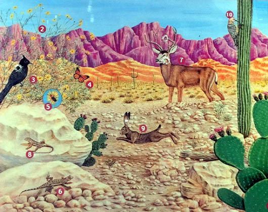
Sign at the Painted Desert
trailhead showing some of the wildlife found in the refuge
Many reptiles and mammals live here year-round, including desert
bighorn sheep, mule deer, mountain lions, bobcats, coyotes, gray fox,
jackrabbits, raccoons, squirrels, lizards, and snakes. Feral horses and
burros are not part of the natural ecosystem -- they were
introduced years ago by humans -- and sometimes create
problems for native wildlife species.
Popular activities include watching and photographing wildlife and
the scenery, hiking the Painted Desert Trail, driving the hilly dirt
road to the observation points, looking at the exhibits at the visitor
center, picnicking, boating, fishing, hunting, and horseback riding.
Leashed dogs and those "under voice control" are allowed in the
refuge. Camping is not.
LET'S GO!
We had already picked up a brochure with information and maps for the
wildlife refuge so we knew where to go from our RV park on base --
east on Imperial Dam Rd., north on US 95 to approximately MM 46, west
on Martinez Lake Road through the Proving Ground for ten miles, then north
on Red Cloud Mine Rd. for a few miles to the visitor center.
Martinez Lake, shown in the upper middle of the next photo, is a
little community with some permanent residents but mostly winter
visitors. I took this picture of the lake and town on a different date
and from a high point on Ferguson Road on the California side of the
river:
We drove around town to see what was there. For future reference we
checked out the small military campground, a private campground, and an
area where boondockers can camp on public land. It's a good
place for folks who like to fish and/or boat but for this winter we'll
remain at Desert Breeze RV Park on base.
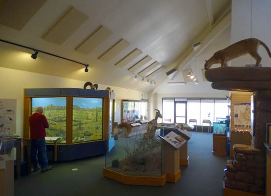
Next we went to the visitor center at the refuge, where there are interesting
displays of the critters that inhabit the refuge and a long walkway to
an observation tower:
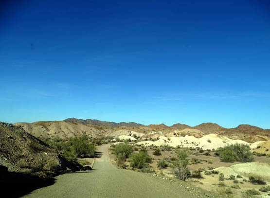
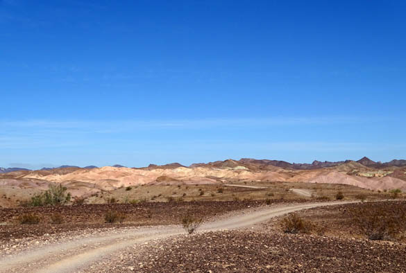
The winding dirt road continues several more miles through hilly
desert terrain past spur roads to the Palo Verde and Mesquite observation
points above the river to the parking area for the Painted Desert Trail:
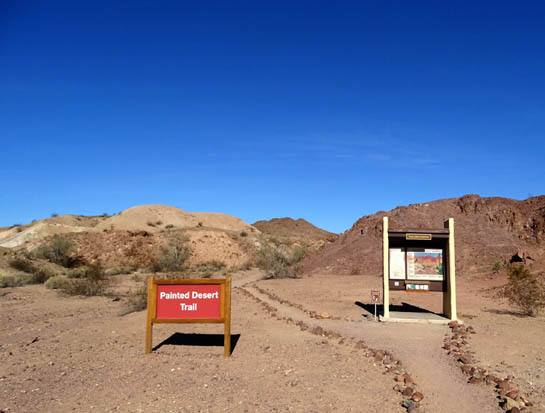
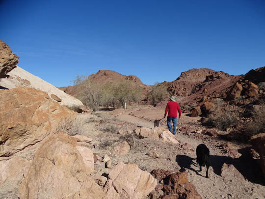
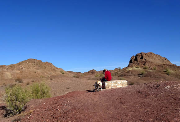
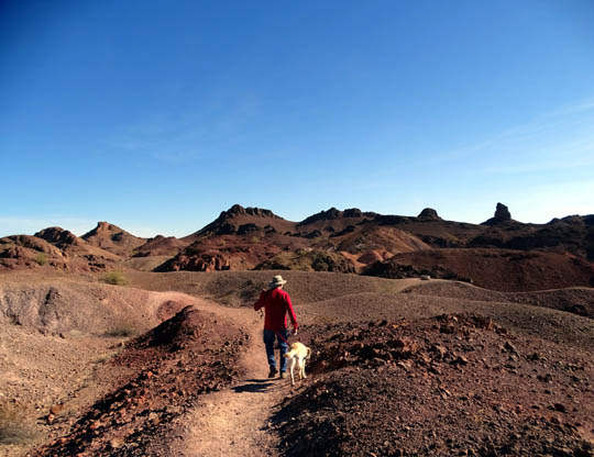
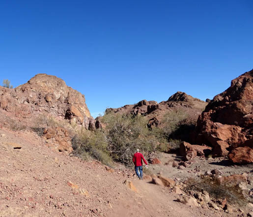
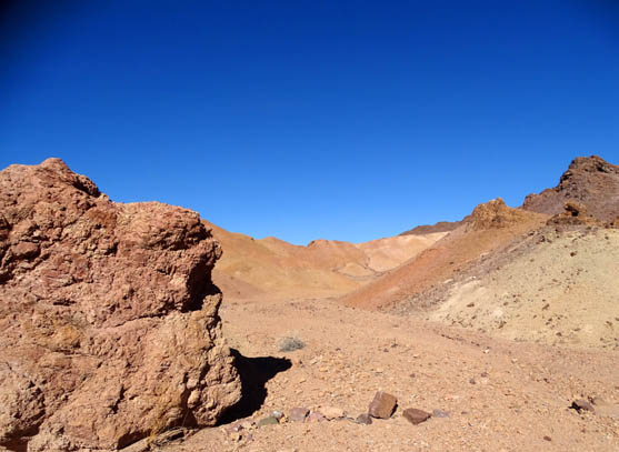
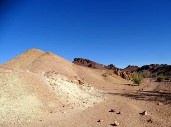
PAINTED DESERT TRAIL
This 1.3-mile loop is easy to follow as it winds through hilly
terrain but it has some steep spots and a few steps. It takes hikers past the
most colorful volcanic rocks in the refuge.
These photos are in order going clockwise around the loop:

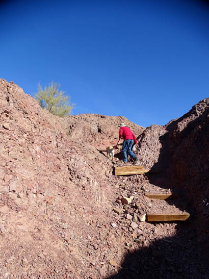
Hiking and horseback riding are allowed in the wilderness areas of the
refuge but this is one of only two established foot trails. The other
one is the shorter path to the observation deck near the visitor center.
Bicycles and all motorized vehicles can ride only on roads.
The terrain is interesting but less impressive
to us than it was four years ago since we spent so much time recently in Red Canyon and
Bryce Canyon. They are hard to beat for colorful rocks!
Although the wildlife refuge has a lot of green trees, shrubs, and
grasses along the river, its desert scenery can't compare
with those vibrant Utah canyons and cliffs -- but it's more
colorful than the LTVA and Laguna Conservation Area, so it's well worth
a
visit when we're in the Yuma area.
VIEWS FROM OVERLOOKS
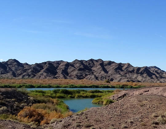
After hiking we drove a couple miles farther back Red Cloud Mine Rd. in
the Odyssey minivan to the Smoke Tree Overlook, which a woman at the
visitor center had told us has the best views down to the Colorado
River.
She said that although the dirt and gravel road isn't as wide or smooth
as the first part to the Painted Desert Trail, we should be able to
drive it that day in our 2WD car with care. After a rain, 4WD is highly
recommended past the Painted Desert parking area.
The road wasn't so bad, even though it is "primitive" and
not as wide or maintained as well as the first part of the road. Since it hadn't
rained in about six weeks it wasn't slick or washed out.
Jim did a good job driving up and down the steep,
short hills, over small rocks, and around sharp curves. Luckily we met
only one other vehicle on the narrow part of the road and there was room for us to
pass each other going very slowly.
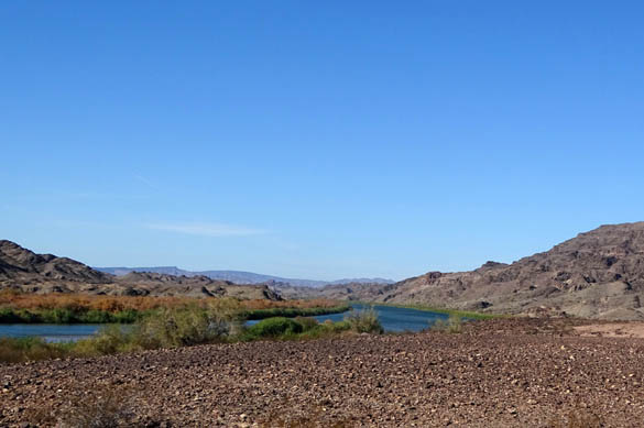
On the way back out we drove out to the Ironwood overlook, too:
When we were in the visitor center that morning Jim noticed a sign in the restroom
announcing two photo workshops in January and February. As we were leaving the
refuge we stopped back at the visitor center so I could sign up for the
January workshop.
I'll have more photos of the refuge in the 2016 journal, from both the
Arizona and California sides.
Next entry: fields of dreams -- Yuma's rich agricultural
industry and a tour of Imperial Date Gardens' orchards and processing plant
Happy trails,
Sue
"Runtrails & Company" - Sue Norwood, Jim O'Neil,
Cody the ultra Lab, and Casey-pup
Previous
Next
© 2015 Sue Norwood and Jim O'Neil
