I've been waiting three years to hike this trail on
a sunny summer's day so I could get better scenic photos than the ones
from my two previous hikes up to the ice field on
July
7, 2012 and
two days ago.
Both of those days were so overcast that I could barely see where the
ice field ended and the sky began, and the lonely nunataks -- the
little peaks of mountains buried in ice thousands of feet thick --
were barely visible from the top of the trail.
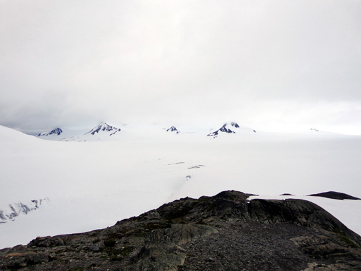
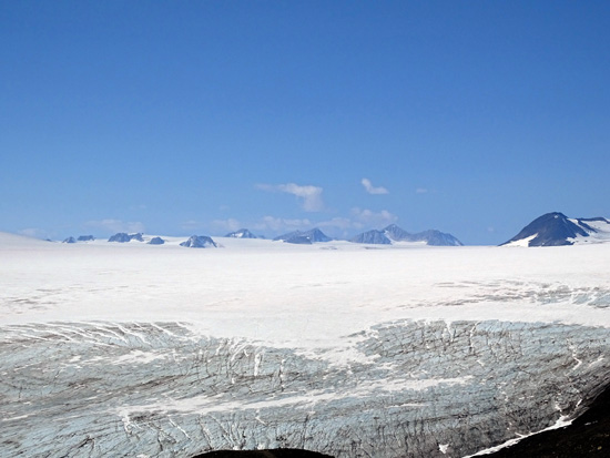
Looking south to the ice field
from the high point on the trail 7-7-12 (ethereal, eh?)
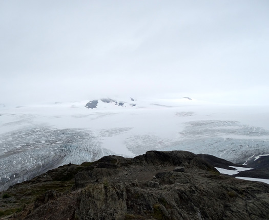
Same place, similar overcast view two days
ago (note less snow this year) on 8-5-15
But today . . .
Ah, today the weather was perfect. Just look at the same scene
when the sky is blue and you'll understand why I wanted to go back up
there so badly when it was sunny:
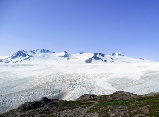
That's what I'm talkin' about!!
This morning I hiked solo up the Harding Icefield Trail for 4˝
miles to the high point where Jim stopped on Wednesday and
continued down toward the ice a little farther than the other day.
I took a gazillion photos of the ice field, Exit Glacier, the hanging
glacier next to/above it, the surrounding peaks, and a bunch of mountain
goats. I took my sweet time at the high point and had a blast all day, until
taking a nasty fall about a mile from the end of the hike.
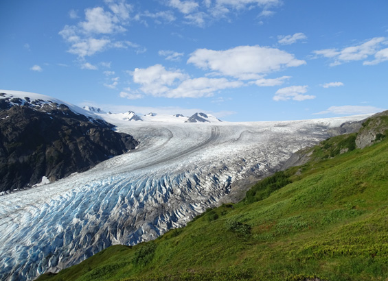
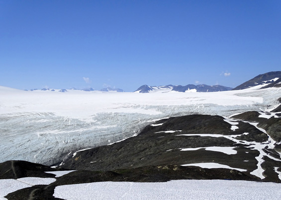
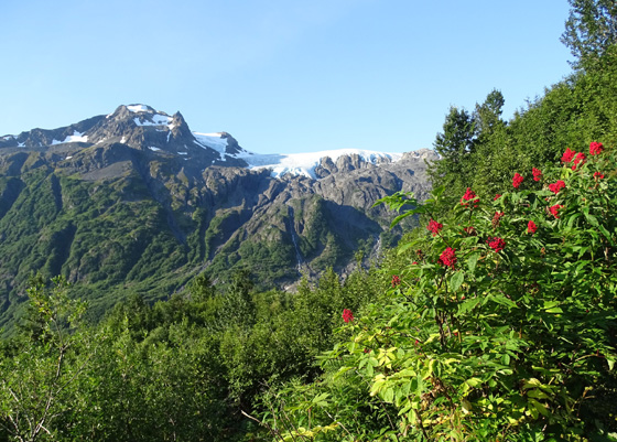
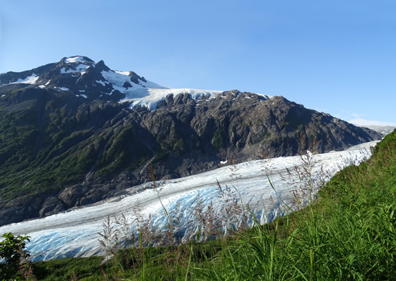
This is one of my favorite
pictures today -- Exit Glacier and the edge of the
ice field from the overlook about
3 miles up from the visitor center. Awesome!
Despite spending several hours in the Seward hospital ER this evening
-- yes, this entry is full of drama -- I'm very glad I went
back up again.
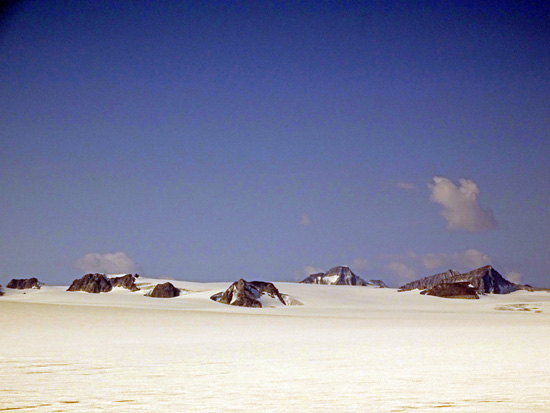
The scenery is even more spectacular under a blue sky and I could see
farther across the ice field than on the previous two hikes. There were
a bunch of nunavaks in the distance to the west that I've never seen
before:
I could also see more of the upper reaches of Exit Glacier's blue ice,
but not its origin. I'm not sure where an ice field ends and a glacier
begins:
Very, very cool -- no pun intended.
Since I've already described this trail in some detail in the two
previous entries (links above), I'll focus more on photos of gorgeous
scenery and those mountain goats than on verbiage in this entry. Be
forewarned -- it's still long (four pages) but you can always just
scroll through the pictures if you want.
Sit back and enjoy. Alaska scenery doesn't get much better than this.
THE THIRD TIME'S A CHARM
I woke up about 5:30 AM but couldn't tell if the sky was clear or
not. I stayed in bed for a few minutes until the sky got lighter --
it gets quite dark at night in southern Alaska for a little while now
-- and I could tell that it was indeed blue, not overcast.
I got ready to leave by 6:45 and was on the trail at 7:20,
more than an hour earlier than when Jim and I went up on Wednesday.
On the way to the national park I saw a mama moose and two calves along
Exit Glacier Road. I caught them out of the corner of my eye, thinking
it was a group of several deer. When I realized they were moose,
I stopped the truck and got out to take a couple pics of mom walking
across the road:
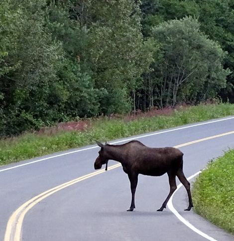
The calves moved back into the brush and I didn't wait for them to come
out again. Seeing three moose was a great start to my morning!
There were only a couple vehicles in the parking lot when I got to the
Kenai Fjords National Park visitor center at Exit Glacier.
Three people signed the Harding Icefield Trail register before I did:
I didn't see them until much later, in the tundra as they were coming
down, and no one passed me all the way up in three hours.
(The first guy I saw, probably in his 50s, was running back down. He was up
there early on Wednesday, too. He recognized me and we talked for a
little while.)
BLUE-SKY PHOTOS FROM THE ASCENT
Here are some of the
photos, in order, that I took on the way up the trail. Many are similar
scenes I've shown in previous entries but I think these look much better
with the blue sky.
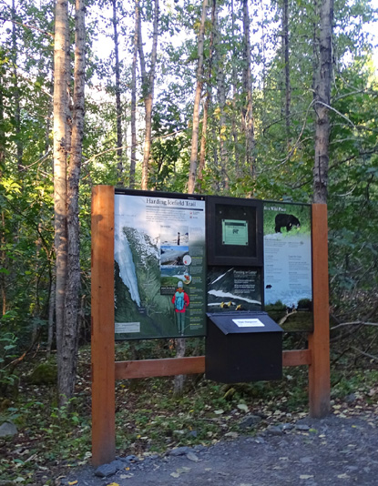
I'll begin with the
map of the trail from the interpretive panel at the trailhead:
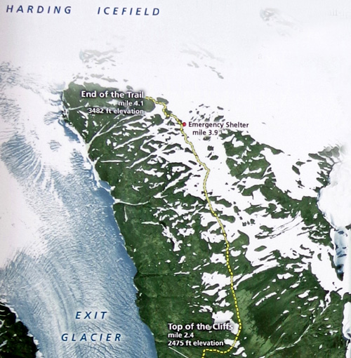
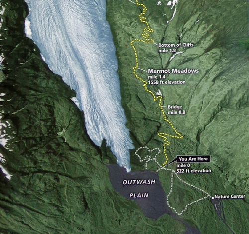
All trails at Exit Glacier start at the nature/visitor center in the
lower right hand corner of the map.
It's 4/10ths of a mile on the right side of the first trail loop to
reach the yellow dotted lines representing the Harding Icefield Trail on
the map above. Follow the trail map from the bottom up to the ice field.
Distances shown are from the trailhead, not the nature center.
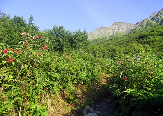
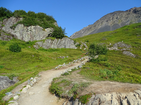
I could see the hanging glacier above Exit Glacier
before I could see Exit Glacier.
Mountain(s) to the north
The first views of Exit Glacier are from Marmot Meadows, the point at
which the trail gets the closest to the glacier:
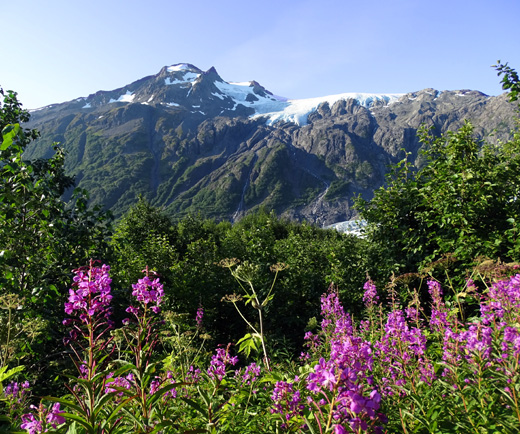
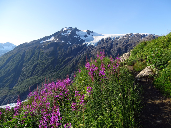
Tall fireweeds are at their peak at this elevation.
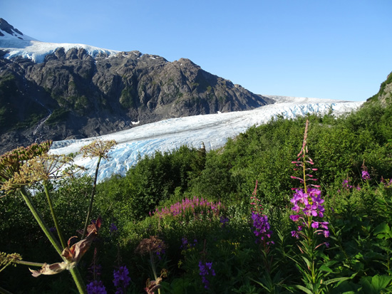
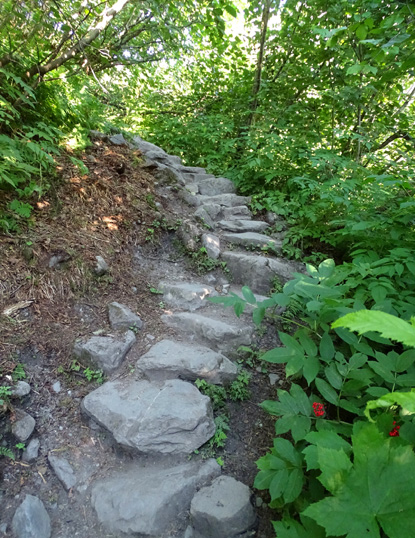
The glacier looks good from Marmot Meadows but you need to switchback a
mile up through the more rocky area to the Top of the Cliffs overlook to
begin to see the ice field:
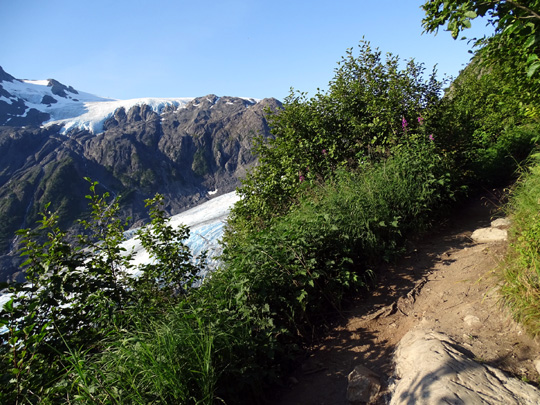
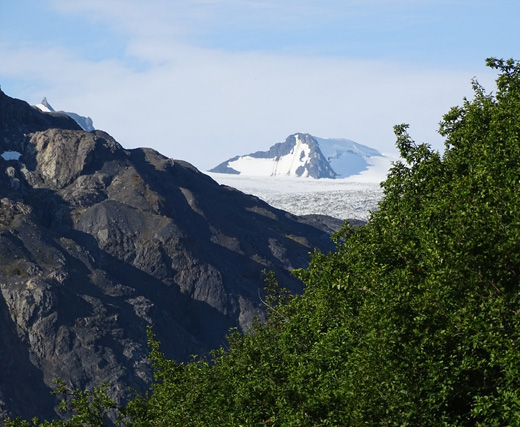
This is the first peek you can get of a nunatak,
and it's the first time I've seen one
in the mid-Cliffs area because the clouds obscured
it the previous two hikes.
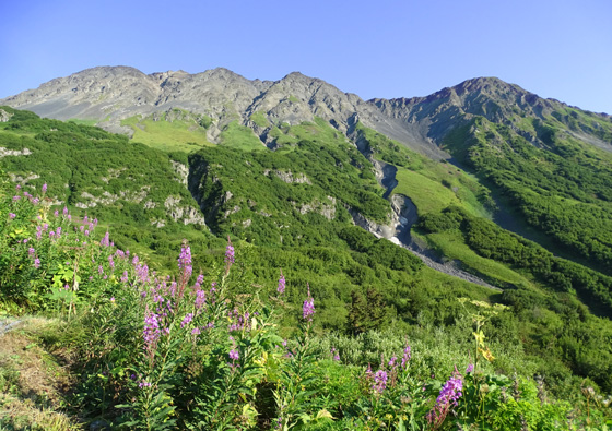
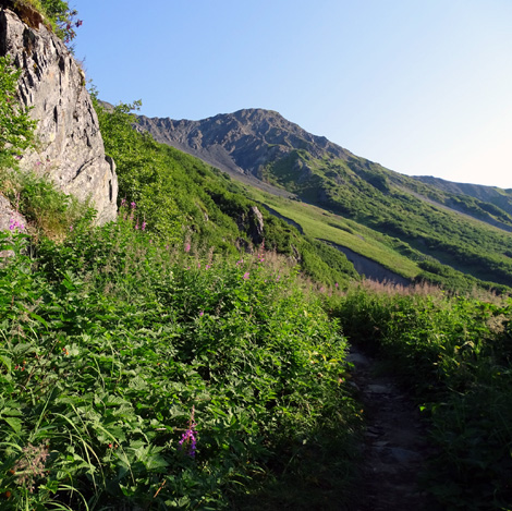
You can tell you're climbing higher; pretty soon you'll be at the
same level as the hanging glacier in the background.
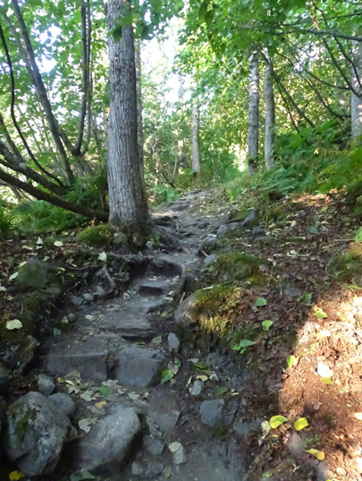
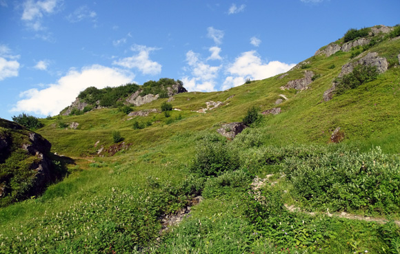
The last part of The Cliffs section is more open, with views of rock
formations:
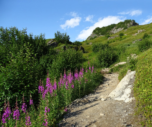
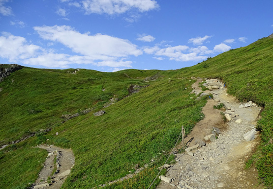
Switchbacks approaching the Top of the Cliffs overlook
Continued on the next page: views of Exit Glacier and the
Harding Icefield from the overlook to the high point
Happy trails,
Sue
"Runtrails & Company" - Sue Norwood, Jim O'Neil,
Cody the ultra Lab, and Casey-pup
Previous
Next
© 2015 Sue Norwood and Jim O'Neil
