This was a beautiful, sunny morning and I had to get out and make the
most of it. Temps ranged from 51 F. overnight at our campground in
Seward to the mid-60s during the day, with some breeze and increasing
clouds in the afternoon.
For the Kenai Peninsula, it was great weather!
It would have been a good morning to go up to the Harding Icefield again
-- so I could get those blue-sky photos that have eluded me on my
two previous hikes there -- but I was too tired from
yesterday's rather strenuous hike to the ice field to
consider doing it all over again today. Tomorrow looks like the sunniest day of the next two
that we'll be here so I plan to go up then.

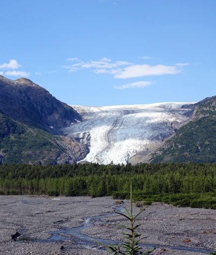
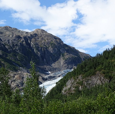
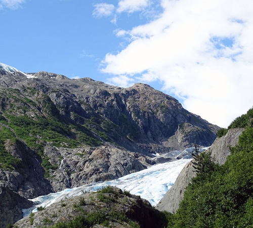
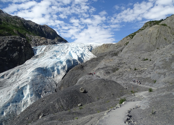
View of top
of Exit Glacier at the edge of the Harding Icefield; photo taken
from the Harding
Icefield Trail on 8-7-15. You can see most of
the glacier from the valley but not the ice field.
Both the
trailhead to the Harding Icefield Trail and the trails that lead
visitors to viewpoints of the lower parts of Exit Glacier are located in
this area of Kenai Fjords NP. It's a 10- to 11-mile drive from Seward to
the visitor/nature center.
Entry into the park is free
-- there's no better deal in the Seward area than this.
To see
anything else in this magnificent 669,983-acre park you have to take a boat or plane
tour. Those are quite interesting, too, but nowhere near free. We took a
memorable day cruise to Aialik Glacier, one of the park's tidal
glaciers, in
2012 and it was well worth the cost.
Here's a map of the northern
half of the park. An arrow marks the
Harding Icefield Trail, which climbs the slopes of the mountains on the
north side of Exit Glacier (a blue line on the map) to its
origin at the edge of the ice field. The glacier flows about two miles
down the mountain and ends in the Resurrection River valley:
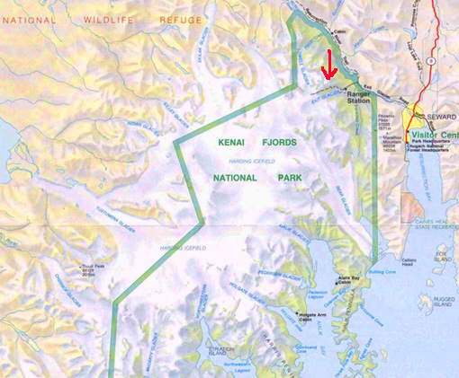
Exit Glacier is just one of about forty glaciers that start in the ice
field and either hang off the edge of cliffs (like one above Exit
Glacier), end in valleys (like Exit Glacier), or terminate in a bay or
fjord (those are called tidal glaciers).
Jim and I visited Exit Glacier when we were in this area three years ago
and I wrote a 2-page
entry then. I won't go into quite as much detail in this one.
GETTING THERE
Exit Glacier Road begins about three miles north of Seward on the Seward
Highway. It follows the scenic Resurrection River for about eight miles:
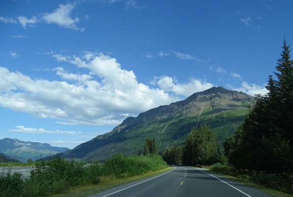
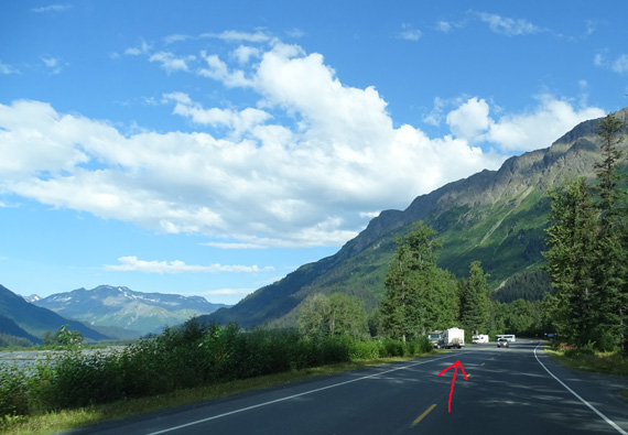
There is a wide pull-off where people like to park
to fish, picnic, or stay overnight in their RVs.
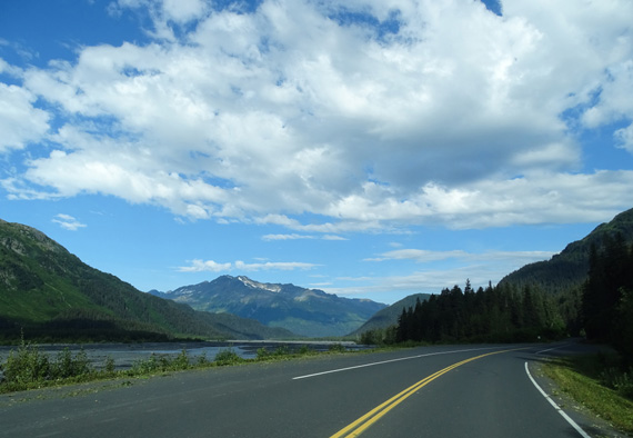
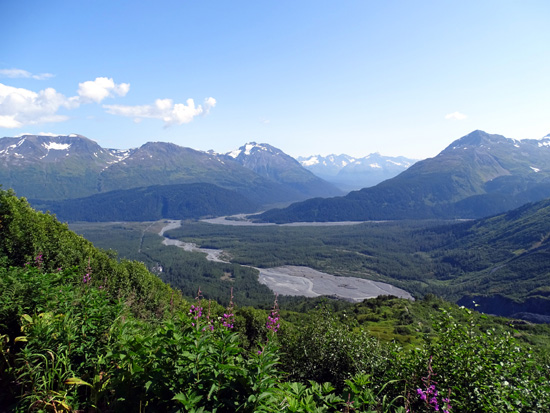
You can see Exit Glacier from the road a couple miles before reaching
the park's visitor/nature center:
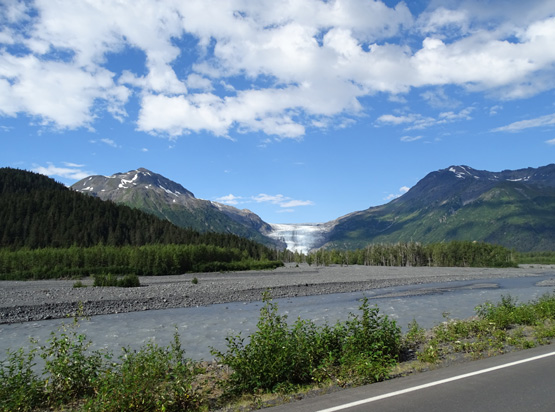
Resurrection River in foreground, Exit Glacier in
middle background
Several little braided streams that emanate from
the glacier and
surrounding mountains flow into the Resurrection
River.
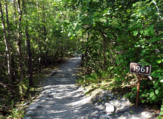
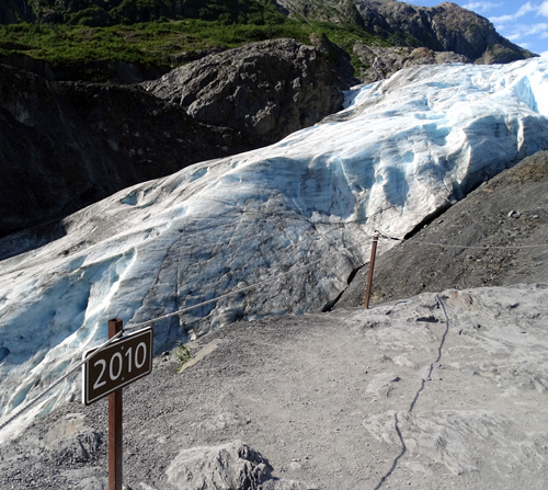
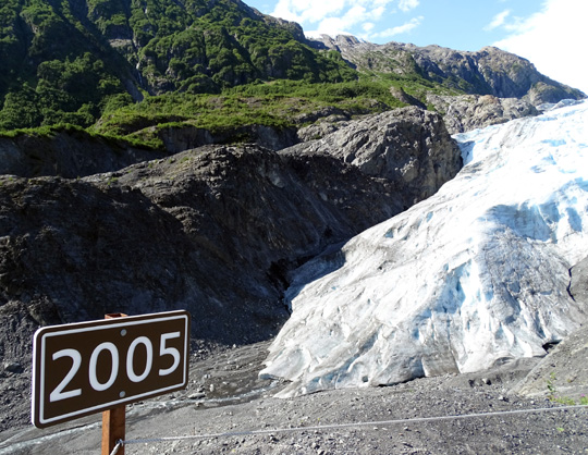
Soon after passing the handsome wooden park entrance sign you'll see a
little sign that says "1815," which indicates the reach of Exit Glacier
200 years ago:
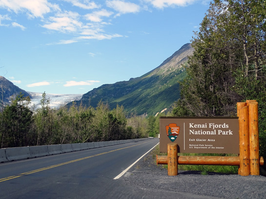
There is a good view of Exit Glacier from the
entrance sign and as you approach the parking area.
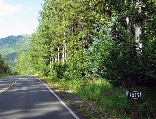
You'll see more of these date signs along the road and foot trails as you
approach the glacier. They are a graphic reminder of how much this
glacier has retreated.
This interpretive panel along the Edge of the Glacier Trail also shows
the glacier's retreat:
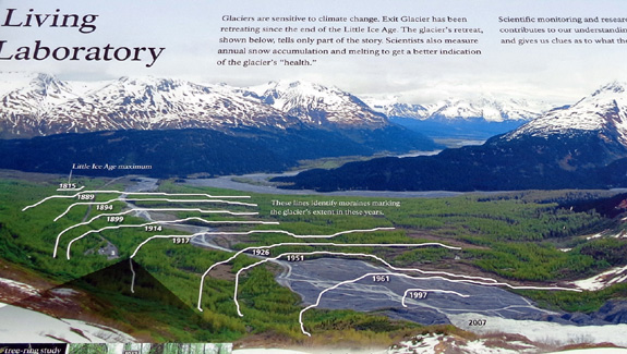
In the three years since I first walked up close to the glacier I can
tell it has noticeably retreated. I'll talk more about that a little later.
On your first visit it's a good idea to visit the nature center after
you park your vehicle:
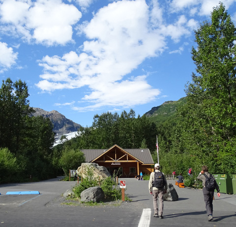
At the nature center you can get the park brochure with trail maps, look at
exhibits, ask the rangers questions, sign up for ranger walks or talks, visit the
Alaska Geographic Bookstore, and get your bearings before starting out
on a hike.
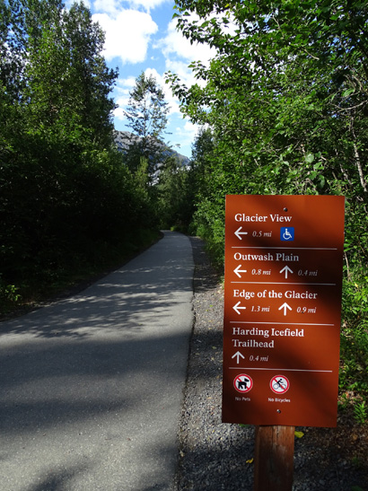
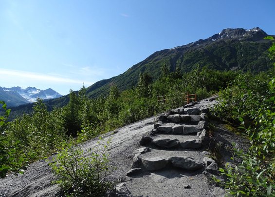
EXIT GLACIER TRAILS
There is a nice network of trails of varying difficulty from one that is wheelchair-accessible to more gnarly, rocky trails that allow visitors
to get great views of Exit Glacier. You must hike the more difficult
Edge of the Glacier Trail to get up close to the ice, though.
Here is a little map of the trails from an
interpretive panel at the visitor center. Go to the park
website to see a larger map. I marked this
one with red arrows to show how I did today's 2.5-mile hike:
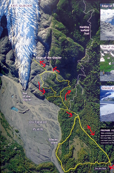
All the trails begin at the visitor/nature center.
The solid yellow line indicates the one-mile Glacier View Trail that is
wheelchair-accessible. It is part paved and part smooth, crushed rock. At
the spot marked "Glacier View" visitors have a good view of Exit
Glacier (duh!). I didn't go out that way this morning but have previously
(see
photos from July 6, 2012).
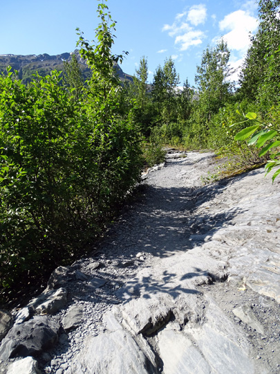
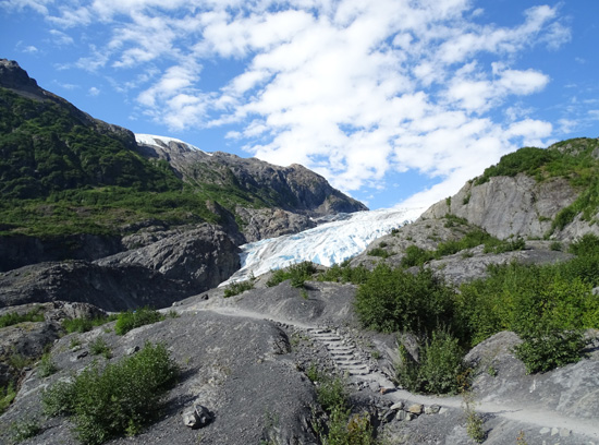
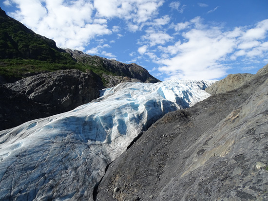
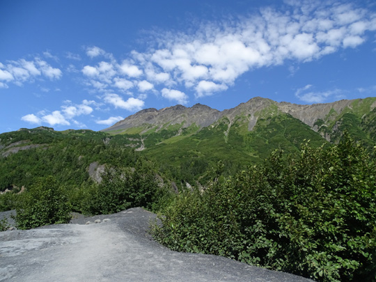
Today I followed the right side of the Glacier View loop to the trail
that connects with the more rough Edge of the Glacier Trail that
undulates over moraines and bedrock left exposed by the receding
glacier.
Here are some photos of the trails until I reached the toe of the
glacier:
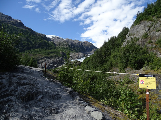
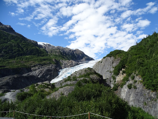
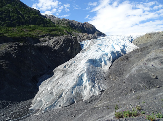
A spur trail at the end of the Glacier's Edge Trail gets you closer to
the side of the glacier -- but not as close as it used to!
All this
bare rock used to be covered by ice.
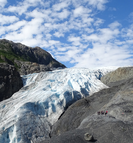
As I mentioned several days ago about Byron Glacier in Portage Valley, Exit Glacier has
also noticeably retreated in the three years since we last saw it.
The overlook at the end of this spur trail used to get within about 10-15
feet of the ice. Now it's 45-50 feet away.
Rangers don't want
you to hike down to the glacier along its length but you can walk right up
to it by hiking through the gravel and little braided streams in the Outwash
Plain at the toe of the glacier.
Heading
back the spur trail to the loop trail
Toe of the
glacier
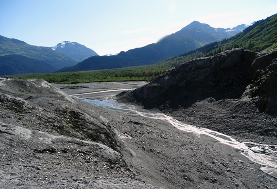
The Outwash Plain is the gravel area where the glacier has retreated but hasn't
filled in yet with plants, shrubs, and trees. It is braided with streams
of water from melting ice and snow in the glacier and from the nearby
mountain slopes.
The next two photos are from the other side of the Edge of the Glacier
Loop:
Streams
flowing through the Outwash Plain
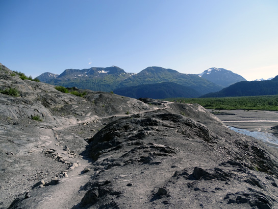
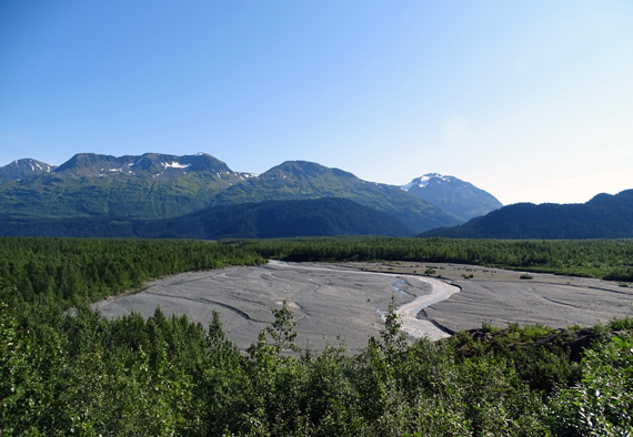
I took this photo of the Outwash Plain and Resurrection River valley
from partway up the Harding Icefield Trail the next day:
If you want more information about Exit Glacier you can refer to my
entry from
July 6, 2012 and/or go to the park's website link in the
quote at the top of this page.
Note that this is a busy place for visitors of all ages in the
summer because it is so accessible by vehicle and is located in a
popular vacation area. Get there early to hike. By mid-morning on
a pretty day the parking lot is often full.
Next entry: sunny photos from my second Harding
Icefield hike, one of my most memorable hikes ever (and
I've done a lot of mountain hiking and trail running!)
Happy trails,
Sue
"Runtrails & Company" - Sue Norwood, Jim O'Neil,
Cody the ultra Lab, and Casey-pup
Previous
Next
© 2015 Sue Norwood and Jim O'Neil
