One of my best memories of Alaska from our first trip three years ago
was hiking up to the Harding Icefield.
Fifty feet
long and thirty feet wide, the Harding Icefield blankets a large portion
of the Kenai Mountain Range.
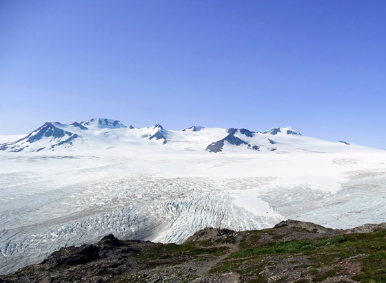
View of nunataks in the ice field from the end of the
Harding Icefield Trail on a sunny day (8-7-15)
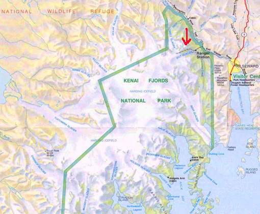
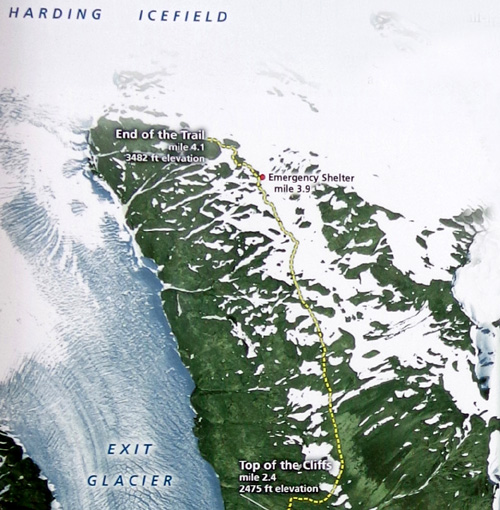
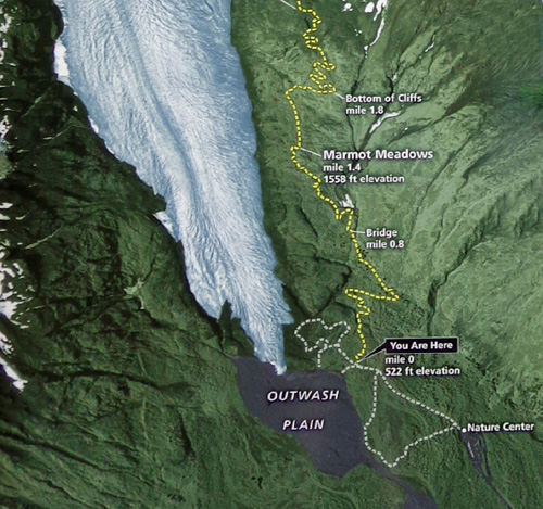
Green line shows part of the park boundary; arrow
marks Harding Icefield Trail we hiked.
How many people ever get right up next to an ice field, especially by
foot?? That was first on my list of things to do in Seward this trip and I
really wanted Jim to see it, too, since he wasn't with me on my first
hike up there.
WHEN CLOUDS ARE A GOOD THING
NOAA predicted mostly sunny this morning, with a 20% chance of showers
after 1 PM. That didn't happen -- and I didn't take the sunny
photo above until two days later.
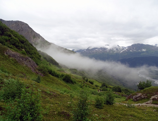
When I got up at 6:30 AM it was mostly sunny but became
overcast by the time we left the campground in Seward at 8. It remained overcast
during our entire hike, with even more low clouds when we came back down
the trail:
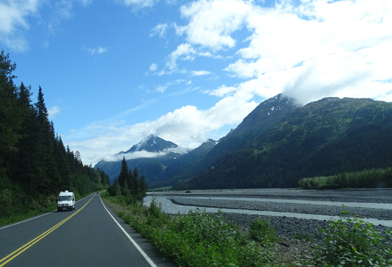
As we were driving the few miles back to Seward the clouds were already
moving out and it became mostly sunny the rest of the afternoon and
evening:
Well phooey!! That was initially frustrating for me but the clouds turned
out to be A Good Thing.
I wanted to go up to the ice field on a sunny day since it was overcast
when I hiked there in
2012 and difficult to tell the snow from the clouds:
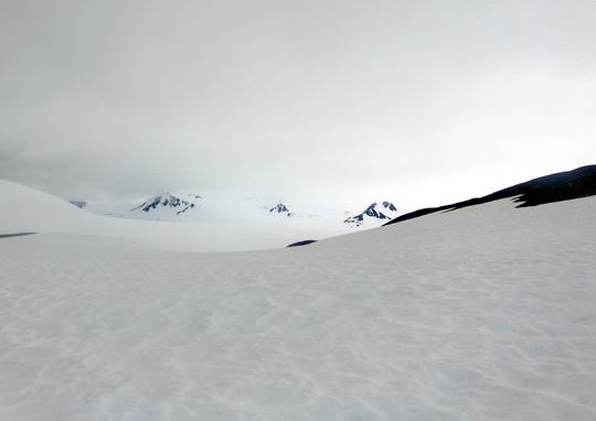
View of Harding Icefield from the trail (also under
snow!) on July 7, 2012
OK, so that looks really "cool." But all I could see up there was a vast
expanse of white with some black spots indicating the rocky peaks of
buried mountains.
I still think that the views of the ice field, Exit Glacier,
surrounding mountains, and Resurrection Valley are prettier when
it's sunny. Just compare the first photo of the nunataks in the ice field against
bright blue sky at the beginning of this entry (I took that one two days
later this year, on Friday) with the other pictures I'll show
later in this entry when clouds obscured most of the peaks like they did
three years ago.
Although I was disappointed that it was overcast again today, the clouds were
a blessing in disguise because Jim said later that he wouldn't have gone all the way up the
trail -- 4˝
miles to the point where he turned around -- if it had been
sunny. And I really wanted him to experience the rewards of this hike.
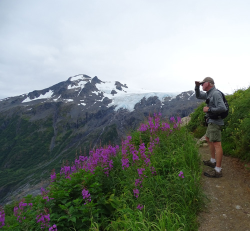
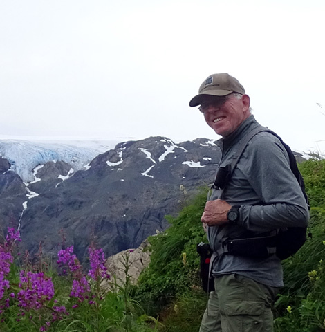
Above and below: Jim having fun as we're
climbing up the trail; the blue ice in
the background is part of a hanging glacier at the
edge of the ice field.
I was happy when he said he'd try to go up a couple miles to Marmot
Meadows, one of the overlooks above Exit Glacier. I was thrilled when we
reached that point and he agreed to continue to The Cliffs. I couldn't
believe it when he then wanted to go all the way to the end of the trail
above the ice field! He hasn't done a nine-mile hike for several years
because of the knee he injured in a bike accident.
Jim
loved the views from the trail and the unique scenery up at the ice
field. He said it's now one of his best memories of Alaska, too.
I'm glad I finally got to share it with him. Bring on the clouds, if
that's what it takes.
FROM VERDANT VALLEY TO A WORLD OF ICE
The only road access to reach the Harding Icefield Trail is Exit Glacier
Road. This paved road intersects with the Seward Highway a few miles
north of the town of Seward. It parallels the scenic Resurrection River
for several miles and dead ends at the visitor/nature center in Kenai
Fjords National Park:
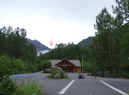
Kenai Fjords NP Nature Center, with Exit Glacier in
the background (arrow)
The good news is, there is no entry or parking fee to visit this park.
That's unusual for a national park. You can see the nature center, go hiking on a network of trails at the
bottom of Exit Glacier (one trail is handicapped-accessible), attend
ranger talks and hikes, and/or go up to the ice field -- all for
free!
The only bad news is that dogs aren't
allowed on the trails. That IS typical of our national parks.
Jim and I hiked a paved and crushed rock path 4/10ths of a mile to the
trailhead for the Harding Icefield Trail. From there, the sign says it's
4.1 miles to the top end of the trail (= 9 miles out and back) but you can continue
farther than that if you wish, depending on trail conditions. Jim
stopped at that high point and waited for me while I wandered a little
farther down the trail toward the ice.
This is the best I can do to piece together the trail map from the sign
so it's large enough to read on your computer (probably not a smart
phone):
Following are photos from the Harding Icefield trailhead in the valley
up to the ice field itself.
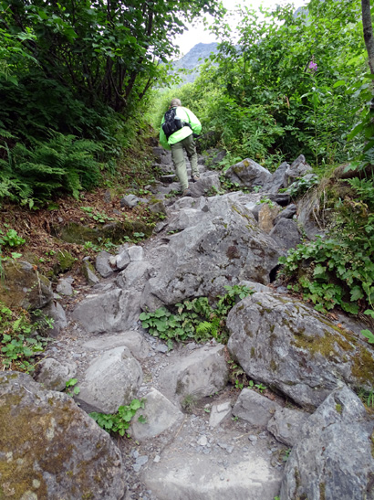
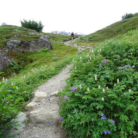
The trail is almost all single-track and much of it is rocky in the first
three miles. It doesn't smooth out until after it crosses a boulder field just
above the top of "The Cliffs."
As on any mountain the trees get shorter and more sparse the higher you
climb. This time of year the trail is very lush, almost jungle-like,
with numerous flowers and berries.
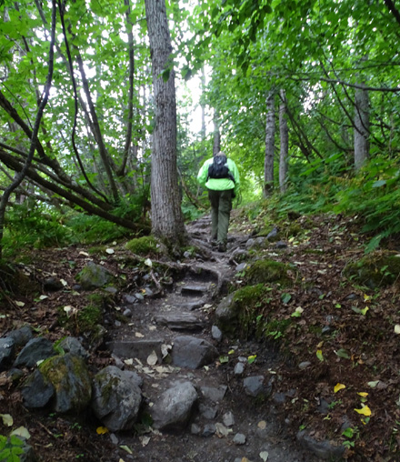
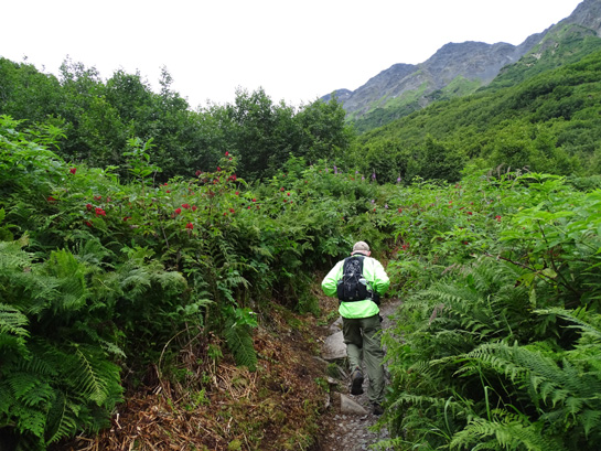
Rainforest jungle, but only for a couple months of
the year
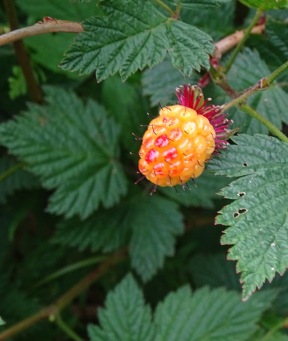
There are lots of salmonberry bushes along the trail. We thought they
were a type of red raspberry until a local told us what they really are.
The berries don't taste good to us but black bears reportedly love them:
Another hiker showed us where his family found blueberries. They weren't
as plump and sweet as the ones I found on the Twin Peaks Trail above
Lake Eklutna.
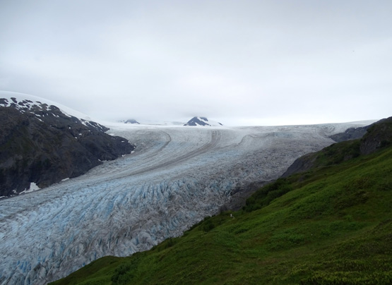
We could see Exit Glacier all of the way up the trail after reaching
Marmot Meadows:
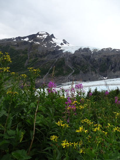
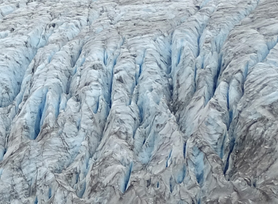
There's a hanging glacier extending from the ice
field above Exit Glacier;
about 40 glaciers extend down from the ice field
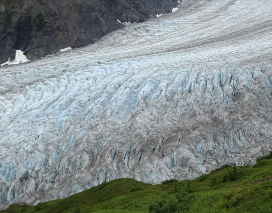
Above and below: Without a reference point,
like a person, it's impossible to know
how deep these crevasses are. I love the blue
glow in the ice from reflected light.
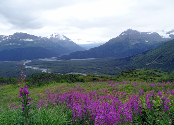
An advantage of going up the trail later in the season than I did three
years ago is that there were more flowers everywhere this time,
especially above tree line. You'll see them in many of the photos
in this entry.
There were lots of tall and dwarf fireweeds in the second and third miles, cream
and yellow Indian paintbrush, blue geraniums, monkshood, harebells, and
forget-me-nots, white bog orchid and yarrow, yellow mountain sunflowers/daisies,
pale pink mountain heather, and lavender asters. Those are just the
ones I know.
Tall
fireweed usually grows at lower elevations (above), dwarf at higher
ones.
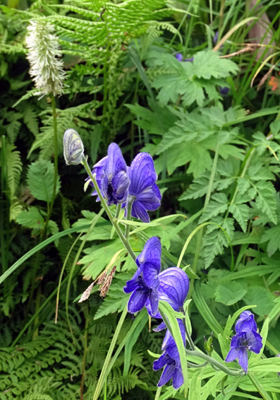
Monkshood and bog orchid
Bog
orchids, geraniums, fireweeds, etc.
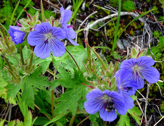
Northern geranium
I'll include other flower photos where I saw them as we climbed higher.
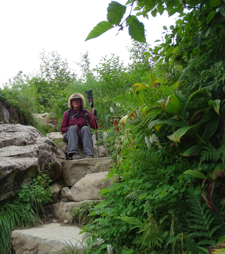
Most of the hike Jim was walking ahead of me, which is why you see so
many pictures of his backside! As we were approaching a long flight of
rock steps near the top of "The Cliffs" he asked me for the camera and
took this picture of me sitting while I waited for him to climb up to me:
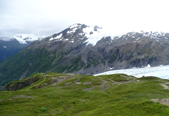
From what we heard and from what I've observed on three trips up this
trail, most hikers stop at the top of "The Cliffs" at a broad, grassy
overlook.
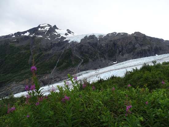
This spot is about 2.8 miles up from the visitor center. It has
excellent views of Exit Glacier and is the first place where you can
really see the edge of the ice field and the nunataks poking up
through the ice and snow:
This view looks down on the overlook from another half mile up
the trail:
Continued on the next page: more
scenes from the ascent + the big contrast in the upper half of the trail between
snowy 2012 and much less snow this year
Happy trails,
Sue
"Runtrails & Company" - Sue Norwood, Jim O'Neil,
Cody the ultra Lab, and Casey-pup
Previous
Next
© 2015 Sue Norwood and Jim O'Neil
