The third hike I took at Sweetwater Creek State Park this year was in
early March when some tiny leaves were beginning to sprout on the trees but
there was minimal shade on that sunny day. Temps were in the 70s F. by
the time we finished hiking that weekday morning so I made sure to carry
plenty of water in my Camelbak for Dapper Don and me.Almost half of
this 5.36-mile hike was on the Orange Trail and new to me.
Although I had read the trail description on the back of the park trail
map, I really didn't know what this trail would be like. That was fun
-- the not knowing!
Here's the route highlighted in purple that I hiked this time:
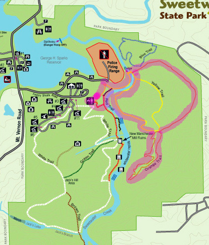
Unfortunately, the purple highlighting makes the Orange Trail look
red (upper right arc) and the Yellow Trail look orange. <sigh>
There are three loops. I did all of them in the clockwise direction, if
that helps to clarify my hike narrative below.
I started from the parking lot (purple dot) near the visitor center,
found the beginning of the Yellow Trail (where it arcs below the police firing
range on the map), and walked down to Sweetwater Creek.
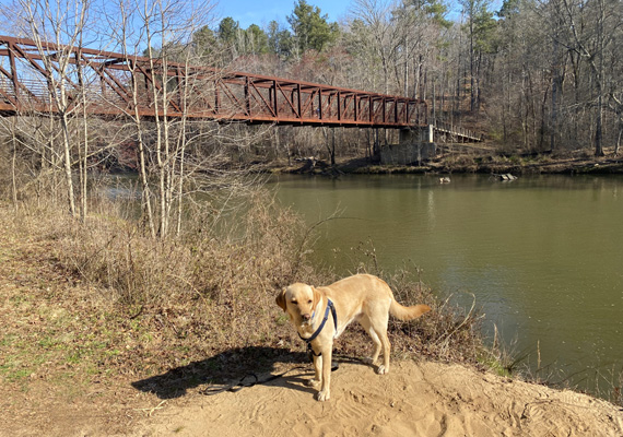
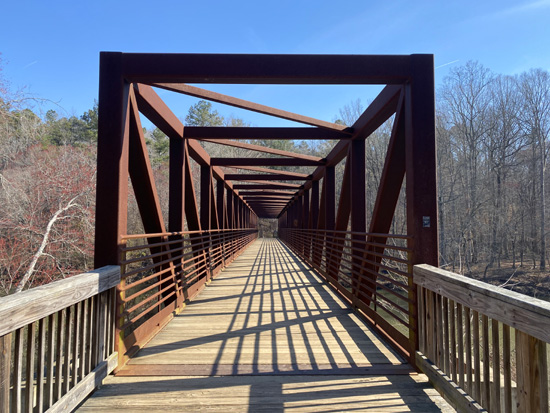
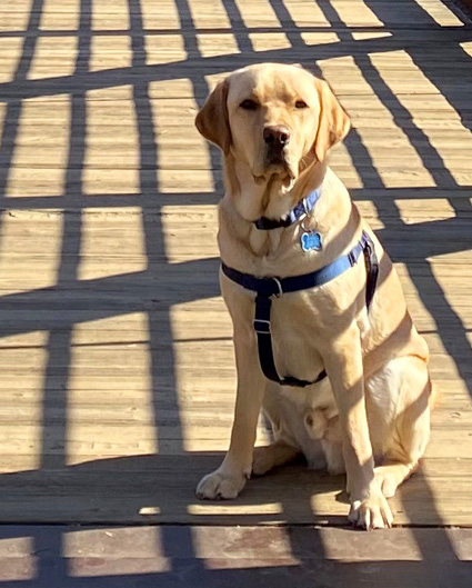
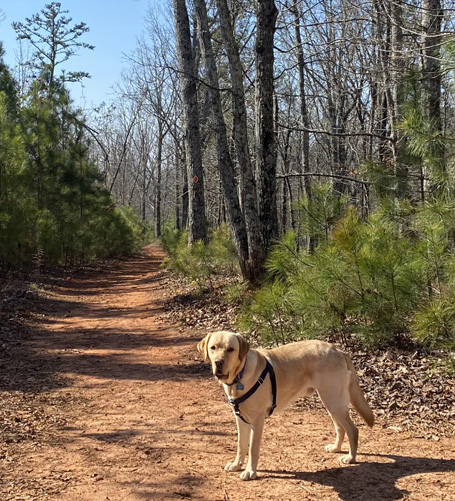
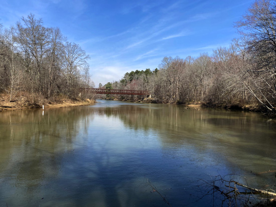
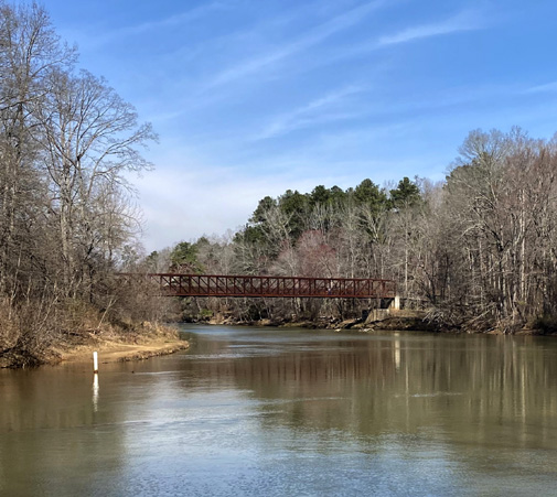
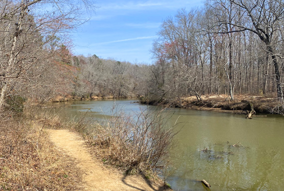
I turned left (south) and followed the flat sandy path for a quarter mile to the handsome bridge across the
creek. These are some of the photos I took that day of the bridge
and Don-Don:
Once across the river, hikers have two options -- go straight on a
Jeep road on the Orange Trail, or go right on the Yellow Trail like I did
in the first hike in this series two months earlier.
This time I went straight ahead (uphill) on the Orange Trail until
it made a sharp right onto single-track trail. Along the way I passed
the trailhead for the Blue Trail loop, which I hiked later in March. All
of these intersections are well-marked.
There is a big half loop and a long, skinny full loop on the Orange
Trail on the far side (east) of the creek. I did both on this hike and it
was all new to me.
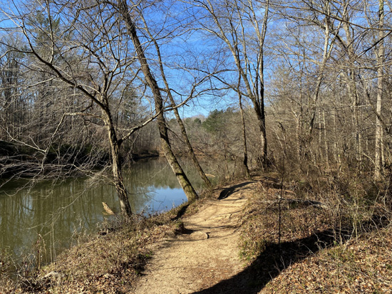
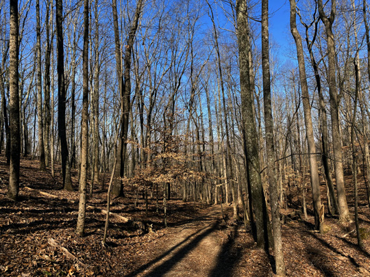
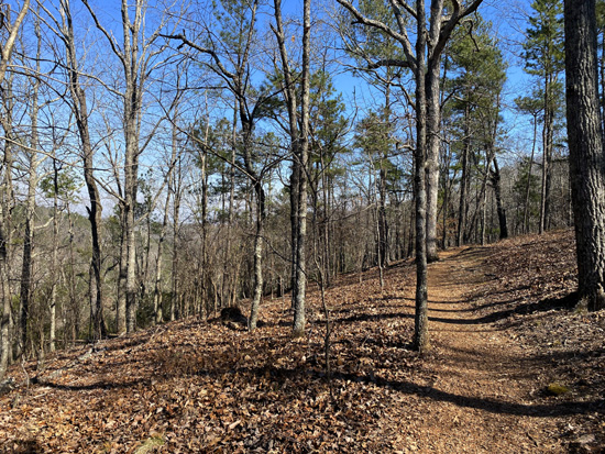
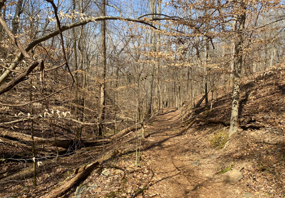
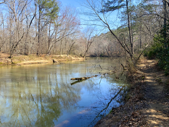
It's about a mile around the upper half loop portion of the Orange Trail.
I loved the relatively smooth dirt single-track through hardwoods,
as in the picture below:
The only part of this hike I did NOT like was about a quarter mile
uphill on an exposed gravel 4WD road just before I got to the
intersection of the southern end of the Yellow Trail.
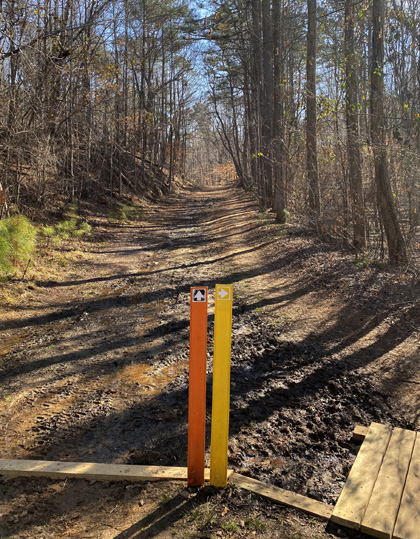
At the top of that ridge I turned slightly to the left to hike
clockwise around the long, narrow loop portion of the Orange Trail.
Don is standing at that intersection in the next photo:
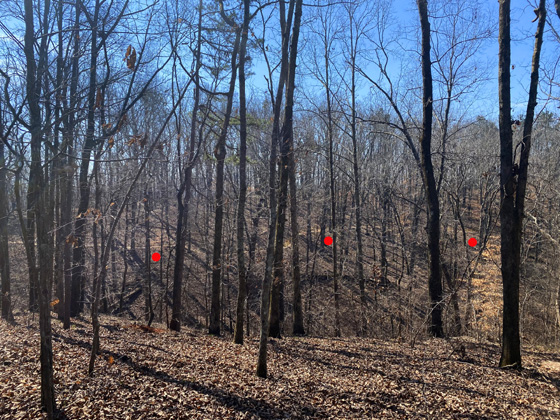
I absolutely loved this loop.
With all the leaves down and going clockwise, I was higher on the
ridge and could look below me in various places to see parts of the
trail where I'd be hiking several minutes later. The red dots on the
second picture below show the other side of the loop in one place.
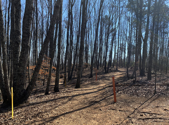
When I finished that long, thin loop on the Orange Trail I came out
about a hundred feet from the point where I entered the loop a little
higher up the ridge. That was a bit of a surprise.
This is what the lower intersection looks like from one
angle. I came out at the orange post on the right. When I started that
long, thin loop I was farther up the hill.
It was a little confusing at first but I knew I wanted to go left
(northwest) on the Yellow Trail above and next to Sweetwater Creek to
get back to the bridge across the creek. Once I started walking that
direction, I knew it was correct because I recognized the trail from my
hike two months earlier.I was soon going down the scenic and rather
steep, rocky, rooty slope next to a little stream.
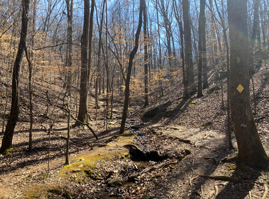
Before reaching Sweetwater Creek the trail is smoother,
then sandy and flat as it winds around close to the creek.

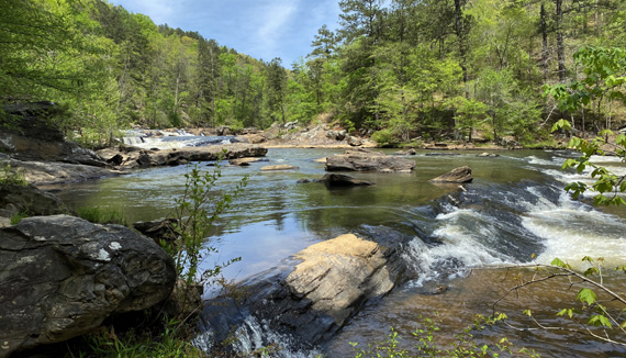
When I got down to the creek I turned to look downstream
and almost missed this view of the old textile mill ruins since I was heading the other
direction:
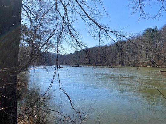
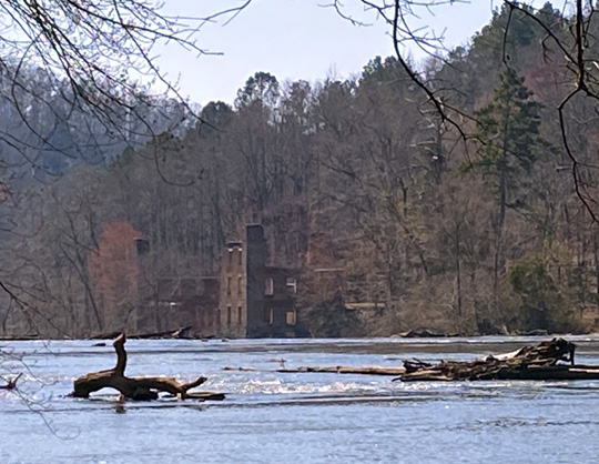
I had to look closely to see it, and zoom in with my camera. I
totally missed that when Steve and I were hiking this trail two months
ago, also going the opposite direction. Next time I do the Yellow Trail
I'll look it farther downstream.
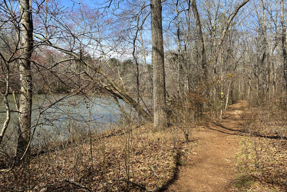
The path remains flat for about a third of a mile before the Yellow
Trail reaches the big bridge.
Once across the bridge, I turned left (south) and
followed the creek downstream on the flat, sandy Yellow Trail, the Black
connector trail, and a short spur of the Red Trail.
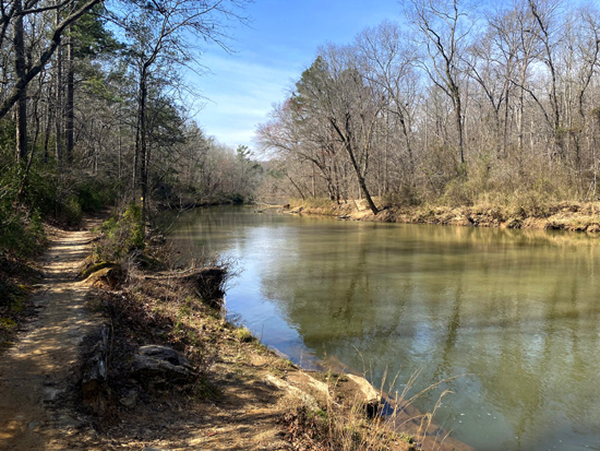
Red Spur Trail, looking back
After I posted that photo on my Facebook page, a friend sent me
the next two artistic renditions:
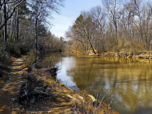
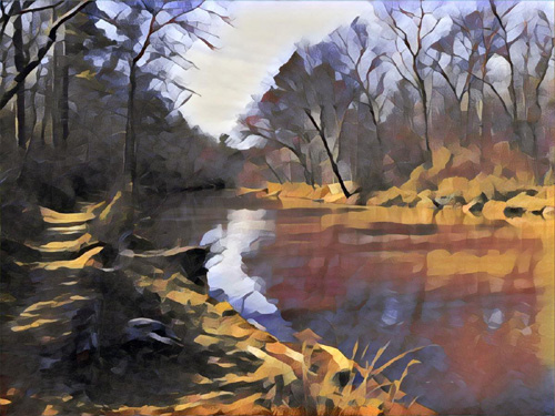
Cool, huh?
The next photo is near the intersection where I turned off the
Red spur trail onto the main Red Trail and headed back up the
hill to the visitor center and parking area:
Total distance was 5.36 miles on this hike. It was very scenic,
even with no leaves on the trees, and the footing was good most
of the way. Total elevation gain/loss was about 1,300 feet.
Our Georgia state parks pass expired before this hike so I got a
new one that is good until the end of March, 2022. They allowed both the
senior and military discounts again, so the $50 pass came down to only
$18.75. I thought maybe we lucked out last year but apparently
that's state policy, or at least at this park.
Next entry: Hike #4 in this series from Sweetwater Creek
State Park -- checking out another trail new to me, the Blue
Trail loop
Happy trails,
Sue
"Runtrails & Company" - Sue Norwood, Jim O'Neil,
Casey-Girl, Holly-Holly, & Dapper Don
Previous
Next
© 2021 Sue Norwood and Jim O'Neil