I love hiking the remote trails at Sweetwater State Park, located a
little southwest of Atlanta. Each time I hike there this year I plan to
try at least one new trail until I've covered all of the marked and
unmarked trails in the park.If I get lost, oh well. It won't be for
long because I already know my way around the network of marked trails pretty
well in this beautiful 2,549-acre park.
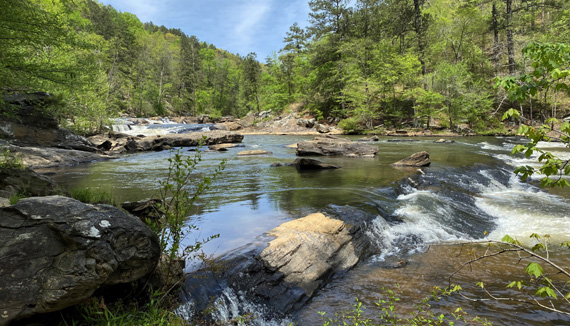
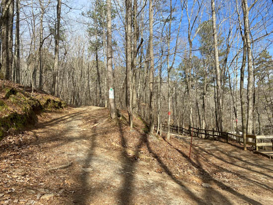
This photo from the White/Brown Trail intersection
at Jack's Creek is from a hike in April
but I was also here the day I hiked the route I'm
describing in this entry in late January.
This entry focuses on the 5.27-mile "lollipop" route I hiked with
Dapper Don one weekday morning at the end of January. It incorporated
two connector trails that were new to me -- the Green and Brown
Trails, both in the hills on the west side of Sweetwater Creek, which is
the main part of the park.
Although the Green and Brown Trails are well marked and shown on the park trail map,
there is no description there except the distances. I like the
challenge of exploring new trails and didn't do an internet search to
see if others had described them. It was more fun to find out myself!
My route on this hike is highlighted in purple on this segment of the
park's trail map:
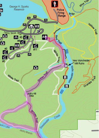
All trails in the park start at the visitor center. I
headed south on the wide, most-used Red Trail toward the old mill ruins
along Sweetwater Creek.
That Friday morning began with the wind chill in the 20s
F. Brr! I didn't start hiking until 10:30 AM, later than usual. By then
it was in the 40s, sunny, and quite comfortable to me. I pretty much had the
whole route to myself until I returned to the parking area on the Red
Trail three hours later.
Much of this hike was improvised as I went along.
When I got to the park there were several large CBS studio trucks in the
parking area loaded with 4WD "gators" and equipment.
Hmm . . .
I wonder what they're filming?
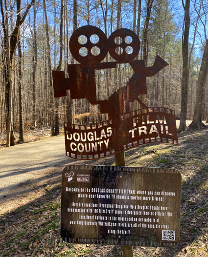
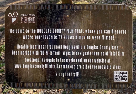
Above and below: sign for Douglas County Film Trail on the path
to the visitor center at Sweetwater Creek SP
It's not that unusual for us to see film companies
around Peachtree City and in Fayette County. One time recently
a large crew staging area was set up at Line Creek Nature
Area in PTC and I was able to hike past some photographers and actors during my hike.
Douglas County is close, and I've seen this sign each time I've been
to Sweetwater Creek.
The south metro Atlanta
area was a booming place for film companies before the pandemic began
but at the height of it in January, there wasn't much filming of movies,
TV shows, or commercials due to COVID restrictions.
That was the surprise on this day --
not that the crew was at this location, but the fact they were there during the
height of the pandemic. So I was more than curious
what they were doing, and I was willing to
alter my intended route to find out.
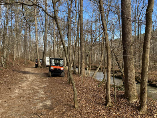
Gators by the mill raceway
(channel of water); Sweetwater Creek is to the right and not shown here.
On the way to the ruins some of the gators passed Don and me, carting
large spindles of electric cables. Some cables had already been spaced
out along the trail, still coiled up.
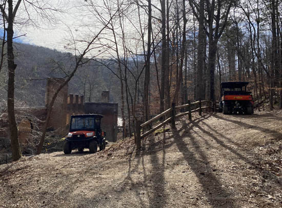
I walked on the Red Trail to the ruins to see what they were doing,
explored the Green, White, and Brown Trails, then came back to the ruins
at the end of the hike to see their progress.
By then some of the cables were stretched out along the ground along
the mill raceway on the Red Trail and up the hill on the White/Green
Trail but I didn't see anyone working.
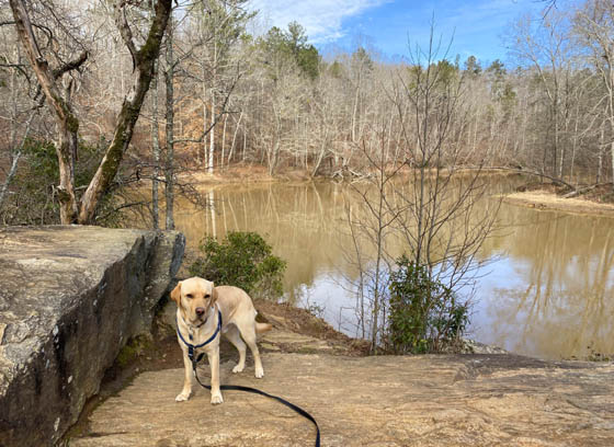
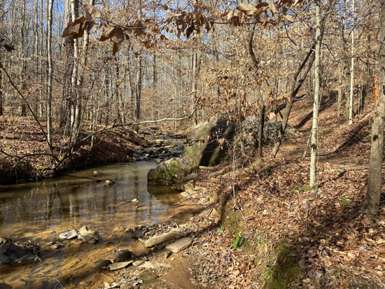
I stopped to get some pictures of Don,
my favorite canine hiking buddy, on these boulders
overlooking a
quiet bend in Sweetwater Creek about halfway to the mill ruins.
I also saw some lights mounted on a wooden bridge near the ruins, and
figured some work and/or filming would be done after dark.
I never did ask what was being filmed because I didn't
see anyone stationary to ask.
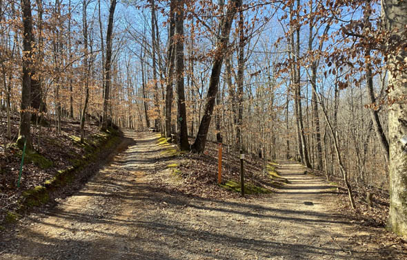
UP THE GREEN TRAIL
I knew how to get to the Green Trail because I'd seen the eastern
end of it two weeks earlier when I was hiking with our friend Steve. To
reach it, I turned right (west) on the White/Green Trail near the ruins.
The two trails are contiguous for several hundred feet. This is a wide 4x4 dirt
and gravel road:
The trail markers are hard to see
in this photo. Red Trail is on the right, looking north; the
mill ruins are nearby, farther to
the right. The White/Green Trails are on the left, going uphill.
The Red Trail to this point is fairly wide and smooth. The
White/Green Trail starts out wide, too. Although it has more ruts,
roots, and rocks, it's not difficult to run or walk on.
About a quarter mile up the hill the Green Trail continues west when
the White Trail takes a turn to the north at this intersection:
All intersections of color-coded trails like this in the park are well-marked. No one
should get lost unless they aren't paying attention. Free trail maps are
available in the visitor center or online at the park's website and are
easy to carry if you don't have the park memorized yet.
The Green Trail goes about 3/4 mile west to the top Jack's Hill on
the far side of the big White Trail loop. You can see it on the map section above.
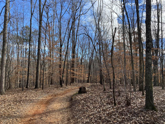
Going west, the Green Trail is primarily an uphill
climb but mostly gradual. There is one short, steep section with a
wooden bench at the top:
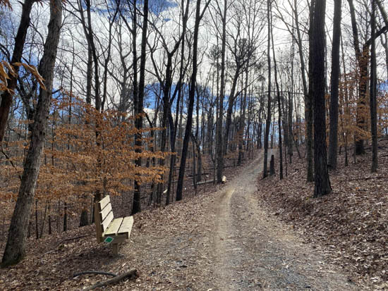
View going uphill (west)
View from bench looking back at
the steep part I just climbed (doesn't look steep in the photo!)
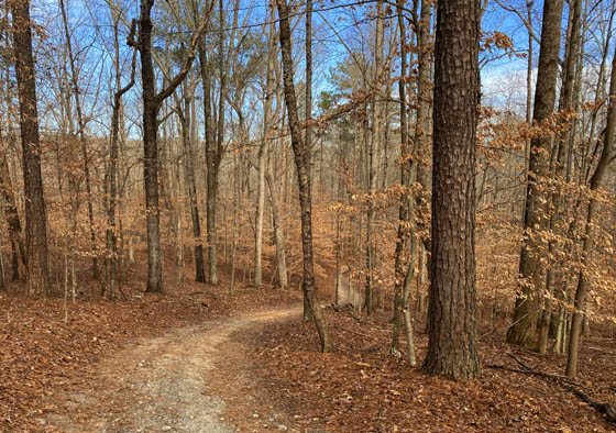
The dirt and gravel road surface is pretty easy to walk. The trail is
all wooded except for the meadow at the top of the hill:
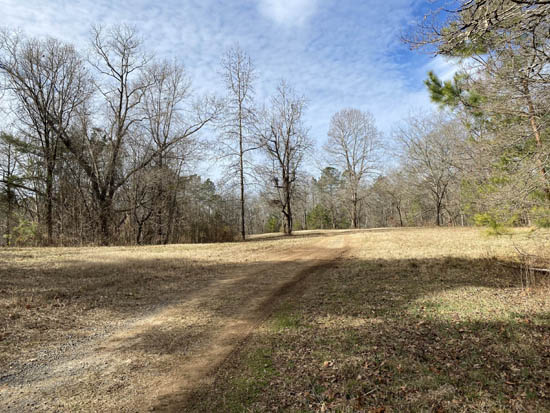
DOWN THE WHITE TRAIL
The Green Trail dead ends into the White Trail loop a little past
that meadow. That area is called Jack's Hill.
Turning left, we hiked south on the White Trail for about a mile. The
trail is wide until it reaches another meadow at the intersection with
the "top" (high end) of the Brown Trail connector, which I took on the
way back during this hike. Outbound, I turned right and stayed on the
White Trail down to the big creek.
After the intersection with the Brown Trail, the White Trail passes
through another high meadow area, then takes a gradual descent through
mostly hardwood forest.
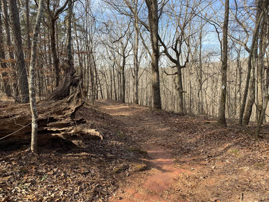
Near the start of a long descent
going westbound
Looking back up the trail
on the way downhill; Jack's Lake is down to the left.
There are views down to long and narrow Jack's Lake, which is easier to see
with no leaves on the trees. I didn't take a picture of the little lake on this hike.
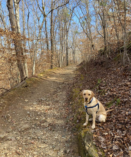
At the lake outlet the White Trail takes a hard left and goes down some wooden steps to
a single track path along Jack's Branch. The pretty little creek flows into
Sweetwater Creek farther down the path.
This is one of my favorite
trail sections in the park. It's not as easy to hike because of the
rocks, roots, and elevation loss or gain (depending on the direction you're
going), but it is scenic any time of the year.
Don waits ahead for me. He was off-leash
for some of this hike
because there were so few people around and
he doesn't chase wildlife.
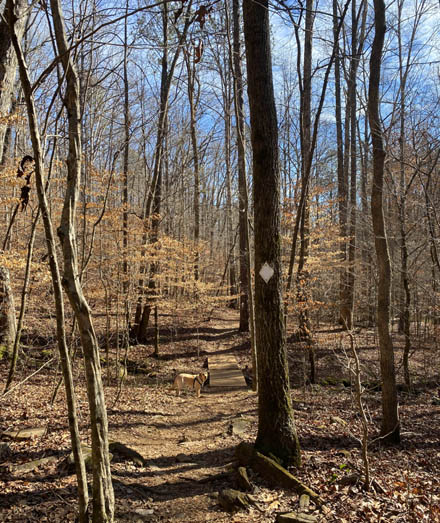
Looking back during my hike (this is what
you'd see going the uphill direction)
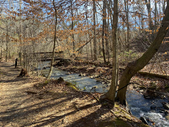
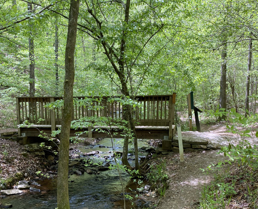
The little bridge in the photo above is the southern intersection of
the White loop and Brown Trail. Jack's Branch runs into big Sweetwater
Creek a little past the bridge.
At this point I was about halfway through my hike.
EXPLORING THE BROWN TRAIL
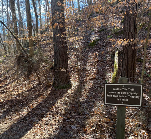
The single-track Brown Trail connects two parts of the big White Trail loop.
It also goes south from this bridge along a thin strip of park property
next to the creek for about a mile before dead-ending on private property
downstream at Nickson Creek.
I decided to go over the bridge and walk south on the Brown Trail,
knowing that it would dead-end in about a mile.
I walked only about a quarter mile downstream on the narrow but
smooth Brown Trail until I came to a drainage area full of water --
and no bridging. Sweetwater Creek wasn't as interesting here so I decided to
turn around and go back to the "connector" part of the Brown Trail.
Sweetwater Creek continues another three miles, approximately, before
flowing into the Chattahoochee River. You can see it on the large trail
map but not on the map segment at the beginning of this entry.
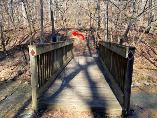
I crossed back over Jack's Branch on the little wooden bridge and
continued straight ahead on the Brown Connector Trail. Before proceeding
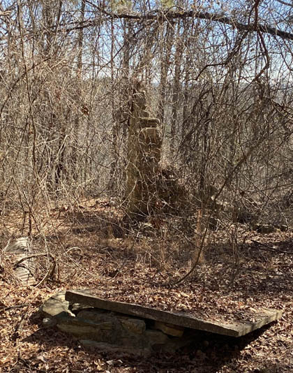
up the hill I stopped for a water break and snack at
the bench shown in the photo below:
Taking a short break was a good plan, because the Brown Trail is quite
steep at this point! It's easier, however, for me to hike up a steep grade than down,
so I don't know that I'll ever go the other direction on this trail.
The Brown Connector Trail is about 1.2 miles long. On the way up to
the Jack's Hill area it passes through an old homestead. About all that
remains on the overgrown property are a crumbled chimney, covered cistern or
well, and some daffodils blooming nearby.
At the top (north) end of the Brown Trail I came to the open
area where it intersects with the White Trail loop. I had closed
the "lollipop" loop part of this route.
BACK TO THE START
The rest of the hike was a repeat of the first part, going the other
direction -- north on the White Trail for a few hundred yards to
the Green Connector Trail, right (east) through another meadow in the
Jack's Hill area, down the Green Trail to its intersections with the
White and Red Trails, and left (north) near the old mill ruins on the Red
Trail back to the visitor center and parking area.
Green Connector Trail
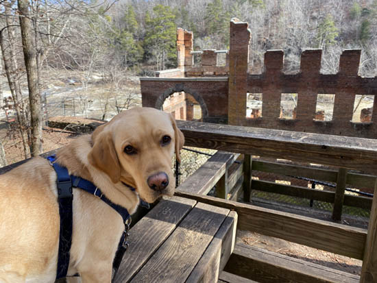
Obligatory picture of Don on a bench
overlooking the New Manchester Mill ruins
I enjoyed most of this route. The Brown Trail was the least interesting part
to me but really, there are no bad trails in this park (although
there are a couple gnarly or exposed sections I'm not fond of). The weather was great
(40s-50s F. and sunny) and there were very few people on the trails
even near the ruins when I got done about 1PM.
Next entry: another day, another scenic 5+ mile hike
with Dapper Don at Sweetwater Creek State Park (early March, third
entry in this series)
Happy trails,
Sue
"Runtrails & Company" - Sue Norwood, Jim O'Neil,
Casey-Girl, Holly-Holly, & Dapper Don
Previous
Next
© 2021 Sue Norwood and Jim O'Neil