One of our puppy raising friends, Steve, re-introduced us to this beautiful
park southwest of Atlanta in late 2019 and I've visited about a dozen
times since to enjoy miles and miles of hiking trails with Dapper Don. Jim has
gone several times with either Holly or Casey.
The first time Jim and I visited this park was in
April, 2010
when he ran the Sweetwater Creek 50K trail race. Cody (black Lab who has since
died) and I crewed for him and did some additional hiking that day.
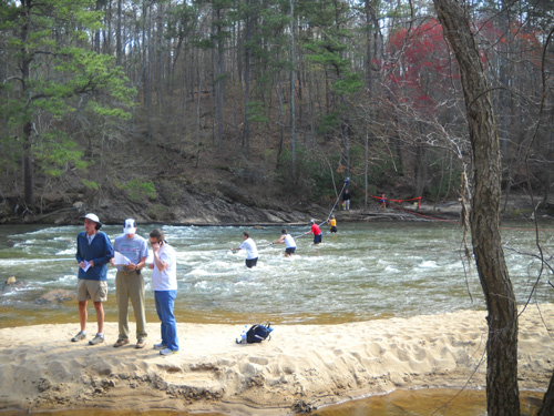
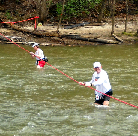
Floodwaters had destroyed the bridge across the wide creek several
months before the race so runners
had to ford the stream out-and-back to do the Yellow Loop on the east
side of the park. Here are two photos from that race. Jim is in
the second one:
A new, much sturdier bridge was constructed in 2012 but neither of us
had seen us until this year:
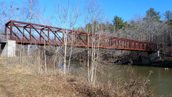
Here's a
link to an interesting story about the
construction and installation of the new bridge.
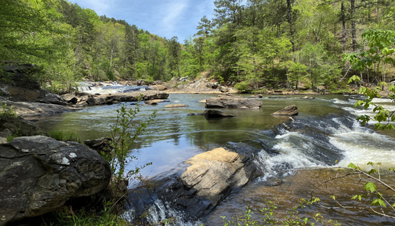
Sweetwater Creek is the closest state park to our home, about a
45-minute drive. I go early to hike in the morning on weekdays to avoid
both heat and more crowded conditions.
Trails are mostly hilly. Some are single-track and some are wider for
park staff to drive trucks or Gators so they can maintain the place.
Surfaces range from smooth dirt to very rocky or rooty. There's really
something for every level of hiking ability.
My goal at Sweetwater Creek this year (besides getting in some good hikes!)
is to walk all the marked and unmarked trails in the park that I didn't
hike in 2019 and 2020. I've mostly accomplished that.
HIKE #1 ACROSS THE NEW BRIDGE
This is the first of a series of six hikes at the park from January to
May this year. Jim went with me on a pretty day in mid-January and we
met Steve there. We each had a dog.
Well-behaved pet dogs are welcome everywhere in the park except the
visitor center. I've never had a problem with other dogs at this park.
We let our dogs loose to play in the creek if no one else is nearby but
otherwise keep the girls leashed all of the time, and Don most of the
time, so they don't scavenge or bother anyone.
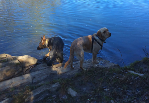
Buzzy (L) readily gets into creeks but Don isn't
fond of wading or swimming.
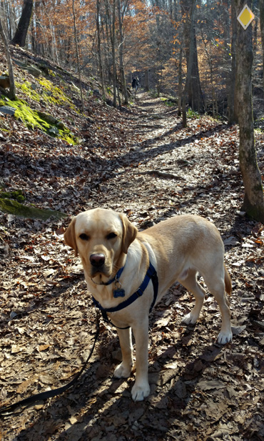
Dapper Don and I hiked with Steve and his young female German
shepherd, Buzzy. These two pups do well together because Buzzy knows Don
and isn't afraid of him.
After a bad experience with a dog when she was
little, Buzzy has fears and gets somewhat reactive with most other dogs. So does
our Casey, so Jim took her on a separate 6.5-mile route that we've done
before. You can read about our previous hikes in the
2020 web journal.
Jim didn't take any photos on his hike. The pictures in this entry
are ones I took on a route that was mostly new to me, highlighted in
purple in this map section of the park:
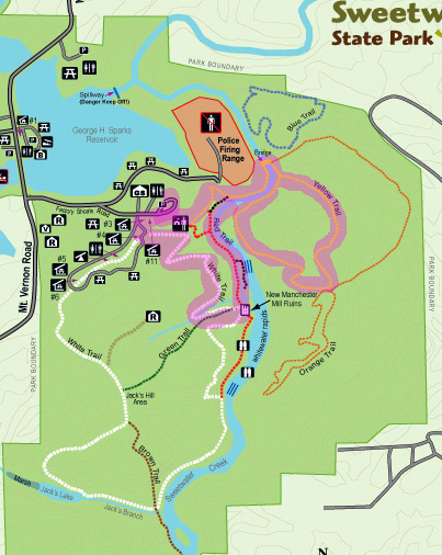
More than half of this six-mile route was new to me. I'll describe it
as we go along . . .
We parked in the large parking lot, walked past the visitor center,
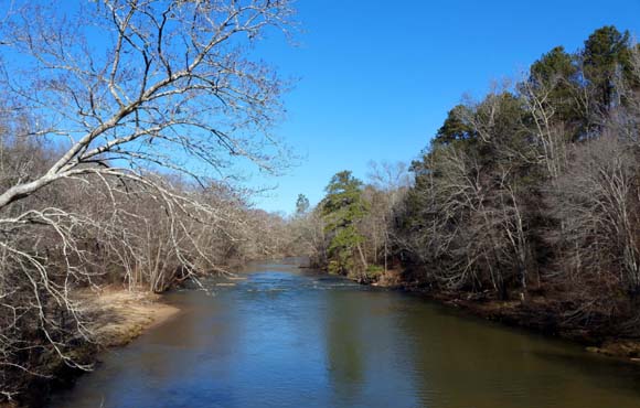
and followed the Yellow Trail about half a mile down to the river, I
mean creek. This creek is
wider than some rivers I've seen!
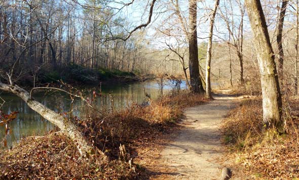
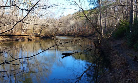
The trail along the west side of the creek is sandy, smooth, and
scenic:
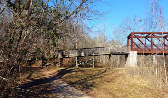
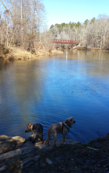
In less than a mile from the parking area we could see the long
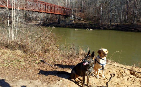
bridge spanning the creek.
We stopped to take some pictures of the dogs and bridge before
crossing to the east side of the creek to continue following the Yellow
Trail.
There's a long wooden approach to the bridge on the near (west)
side of the creek:
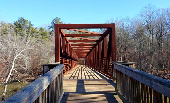
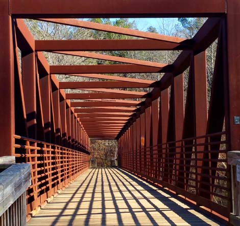
This side of the bridge is very photogenic. I like to play with
the angles and shadows when I'm taking pictures of it:
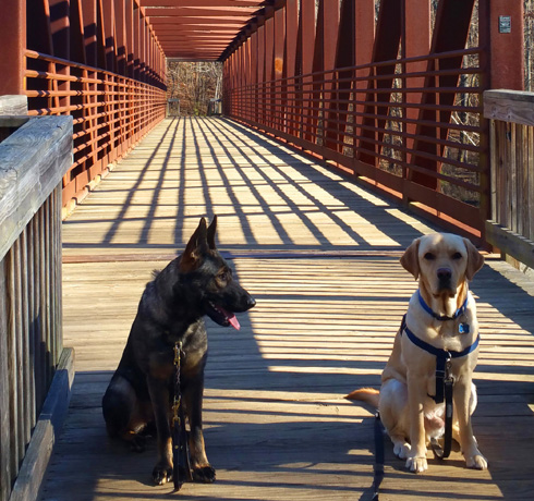
Buzzy (L) and Don
View of creek to the north
from the foot bridge
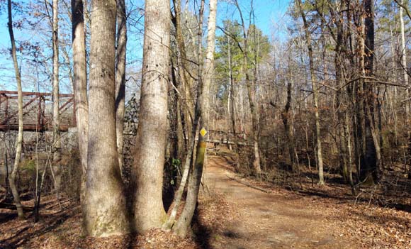
On the far (east) side of the bridge the Orange Trail is straight ahead
and the Yellow Trail is to the right.
All the major trails in the park -- the ones on the map --
have color names and are well-marked. I've also noticed a network of
unmarked trails that aren't on the map. Those intrigue me, so I want to
explore them on future hikes.
We turned right and followed the creek downstream on the Yellow
Trail. This view is looking back at the bridge:
In a little while we came to a fork in the trail. At this
juncture the trail becomes a big loop and you can go either left (CW) or
right (CCW). The trail map rates this section as difficult. If you're an
experienced hiker and used to hills, I'd call it moderate. Everything at
creek level is easy.
We chose to go left up a long hill in the CW direction. This is the same direction
as the trail description on the back of the park map. My quote at the top of
this entry describes part of this loop.
Here Don is watching Steve and Buzzy, who were ahead of us most of
the way because I was taking photos:
I take even more photos when I'm not walking with another person!
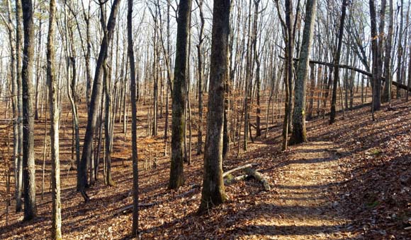
I love this loop. It is hilly (more interesting than flat) as it
undulates between ridges, and it is full of mostly hardwood trees.
When the leaves are down in the cooler months, the sun shines
through and you can see the surrounding hills and down to the creek in
some places from the ridges. When it's warmer and the leaves are out,
the shade keeps hikers cooler.
The trail is single track and mostly smooth on the east side of this
loop, then gets a little rougher as it curves around and follows a
ravine back down to the creek.
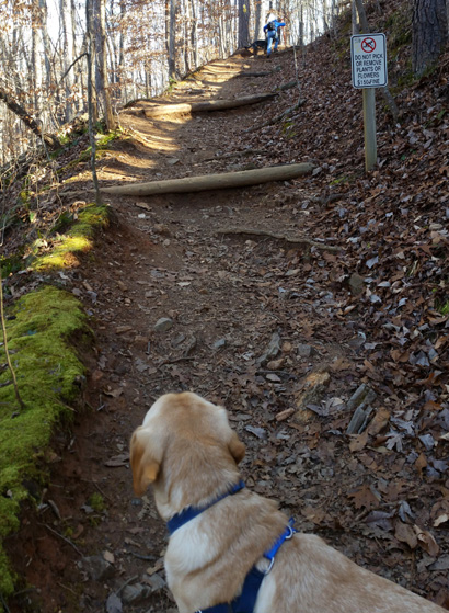
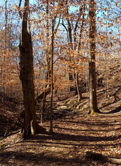
This is the roughest part of the Yellow loop. It's a long way down
and a little steep near the top, but very pretty.
Looking back (up) the steeper part
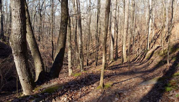
The lower half of the trail by the ravine
isn't as steep or rocky/rooty as you're approaching the creek again.
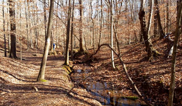
The Yellow Trail again follows close to the creek for about half
a mile. It is sandy and smoother here than the hill along the
ravine. We could see the bridge well before reaching it:
We crossed the bridge, turned left (south), and retraced our
steps on the Yellow Trail on the west side of the creek.
Here's another view of the trail and creek on that side:
We wanted to hike a couple more miles so instead of continuing on the Yellow
Trail up to the visitor center, we took a short spur trail along the creek
and joined the Red Trail to the ruins of the old textile mill.
I've shown the mill in previous entries but didn't take any more
shots this day. Here's one with Buzzy and Don on a hike in late 2020:

Near the mill are two intersections of the White and Red Trails.
I've been on about four miles of the White Trail loop but not
the section that is between the mill and visitor center.
That segment is about a mile long, and a nice ending to Steve's and my
hike. It's hilly and undulates through the treed slopes high above the
creek. I also like that it's not as heavily traveled as the Red Trail.
We met Jim back at the parking area and compared notes on our
hikes. We all had a good time.
The route described here is almost six miles and has about 1,300 feet total
elevation gain and loss. Most of the trail is relatively smooth and
single track. I loved it!
Next entry: hike #2 in this series, two weeks later with just puppy
Don and me on some more trails new to us at Sweetwater Creek SP
Happy trails,
Sue
"Runtrails & Company" - Sue Norwood, Jim O'Neil,
Casey-Girl, Holly-Holly, & Dapper Don
Previous
Next
© 2021 Sue Norwood and Jim O'Neil