Some races are pretty much defined by a certain section of the course
that is memorable in some way. Think Hope Pass at Leadville, or Rucky
Chuck at Western States.
Mention either one of those features and most ultra runners
immediately know the race you're talking about.
The same thing happens at shorter races that have a distinctive
feature. At this interesting 50K, the signature location is Sweetwater
Creek. New entrants approach it with some dread after seeing photos and
hearing runners' stories about their adventure. Veteran Sweet H2O
runners come back year after year for more:
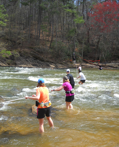
Runners forded the creek with ropes twice this year as they went
over to a hilly section of the park at 17.3 miles to run a 2˝-mile
loop on the Yellow Trail, and then they crossed it again on their way back at 19.8 miles.
Sweetwater Creek, which looked more like a
river to me, wasn't real high (thigh to waist deep at the deepest point)
but it was very wide and the strong current dictated two ropes for
safety -- one for outbound runners and one for the return trip.
It was a great spot to spectate, crew,
and take photos:

Volunteers and crews keep tabs on
outgoing runners on the left and inbound ones on the right.
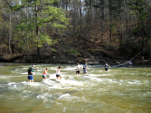
Sometimes there were half a dozen or more runners
on each rope at once.
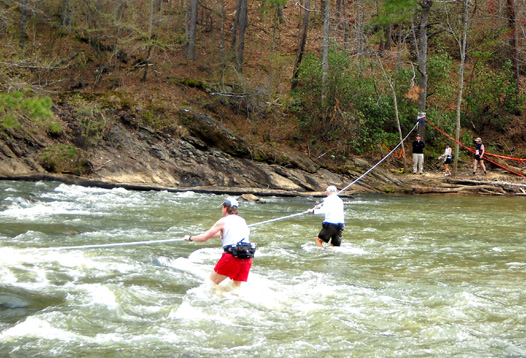
Jim (in dark shorts) had a little more space when he crossed
outbound. Note the strong current.
Some folks approached the crossing very
tentatively, backing up runners behind them. Others ran right into the
water and crossed as quickly as they could, letting go of the rope to
pass people who were going slower:
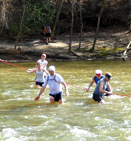
Jim was seriously under trained for this
race but he still looked great at the creek crossing in both directions. He
mostly had fun and is glad that he ran the race. He did the best he
could on the gnarly course and
finished in 8:58 hours, just under the official
9-hour finish cut-off.
That's the short story. Keep reading for
more information about the race and the scenic park, or just scroll down
to enjoy the photos. Because I wanted to include so many pictures (95 in
all), I divided them into four pages so they'll load faster.
INTRODUCTION TO SWEETWATER
PARK & THE RACE
Although I lived in the Atlanta area
from 1974 to 1999 I'd never been to this little state park on the west
side of town before yesterday's race. It's a nice venue for a trail
race.
Sweetwater Creek State Park is relatively small
(about 2,500 acres) but it has nine miles of scenic, hilly trails, a
pretty reservoir for fishing and boating, historic ruins, and a wide
creek full of turns and rapids and shoals. Jim got to see the whole park during the
race; while he was running, Cody and I got to do some exploring
on our own.
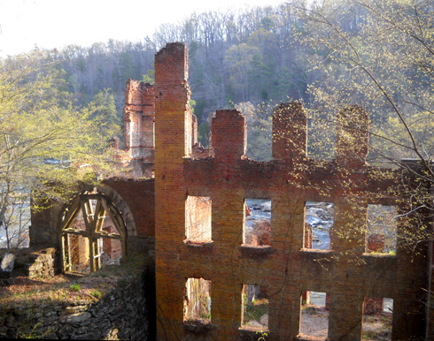
Ruins of the New Manchester
Manufacturing Company, a textile mill
that was burned during the Civil
War. Sweetwater Creek flows in the back ground.
Jim found this race while doing a web
search. We remembered reading positive reports written by runners who enjoyed
the first three years of the race. The timing and location were good for
us as we wound down our winter trip, and it made a good training buildup
for the races Jim plans to run the rest of this year.
It helped that we'd know several of the
runners, too -- Steve Michael, Rob Apple, Abi Meadows, Rich
Schick, Jim Emig, Sally Brooking, Christian Griffith, and Francesca Conte are southern ultra
runners I've known for several to many years. The majority of the
runners in the race were from Georgia. It was also fun to meet some
other runners like Spurgeon Hendrick, who we
"know" from the ultra list.
THE COURSE
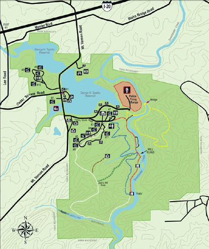
Here is a little map of the park;
you can find directions to the park
here and a larger pdf. map
here.
The course map and elevation profile are on the
race
website.
This small version of the course gives you an idea of the configuration of
the two loops used in the race:
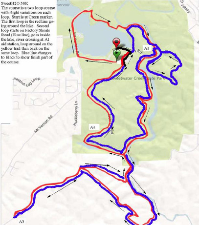
The course uses almost all of the park's
red, white, yellow, and blue-blazed trails,
some roads, and some gnarly trails outside the southern park boundary,
including the challenging Powerline and Top of the World (TOTW) areas.
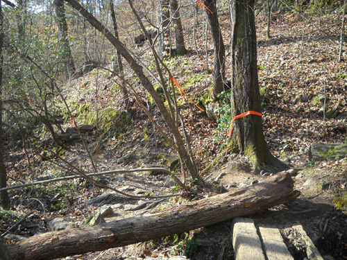
Rough trail heading toward the
TOTW loop
Much of the terrain is hilly. There are
some flatter, sandy trails along the creek . . .
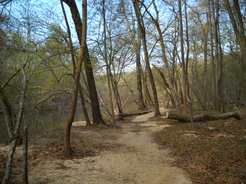
. . . but most of the time runners are either
going up or down, as evidenced by the course
profile.
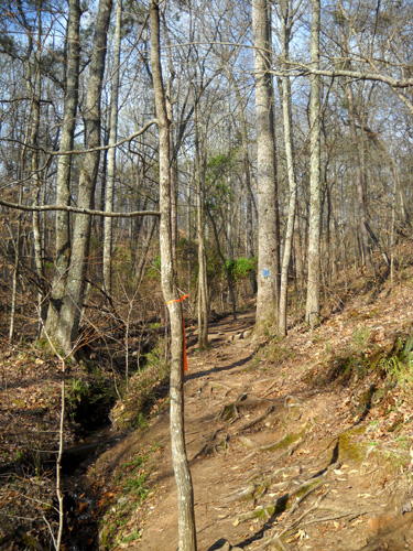
Rooty, hilly section of the blue
trail
Trail surfaces range from smooth to
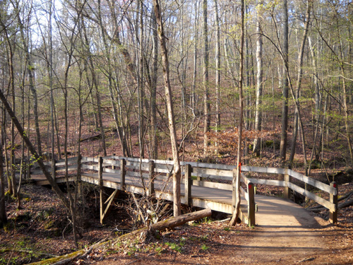
rocky and rooty. Some of the streams and ravines have wooden bridges.
The large trail map shows a bridge where
the runners ford Sweetwater Creek; this is all that is left of
the bridge after a flood destroyed it:
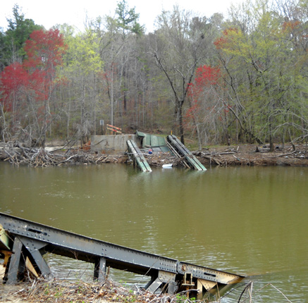
That was also the location of one of the aid stations:
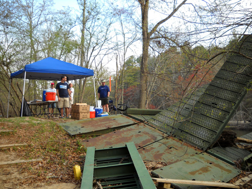
There were three other aid stations along the course but I
didn't go to them.
PRE-RACE
Race start was at 7:30 AM. Since we were camped about 50 miles
away at Lake Allatoona and had not been to the park before, we
got up at 4:45 on race morning to be sure we got to Sweetwater
Park on time to get a decent parking place.
We did. In fact, it was still dark when we got there at 6:25 AM.
Most of the miles were on I-75, I-285, and I-20, with a few
miles of county roads at either end. Directions on the race
website are good and we had no trouble finding where to go. We were
early enough to snag a parking space pretty
close to the group shelter where the race started and finished.
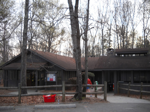
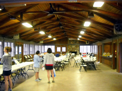
Note that Sweetwater Creek State Park doesn't have overnight
accommodations or a campground. It is a day-use park. It does
have nice picnic shelters and the large group shelter, which
makes a great place for race HQ. I took these pictures after the race began:
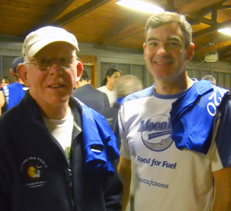
We mingled with friends after Jim checked in and got his number
and blue short-sleeved race participant shirt. He and Spurgeon
Hendrick both have them draped over their shoulders in the photo
below:
The starting line was about a quarter mile back down the road so
we headed that way about 15 minutes before the race.
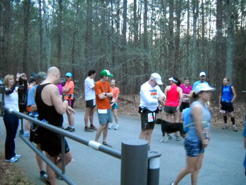
Jim (in white shirt and hat) checks his GPS
before lining up at the start.
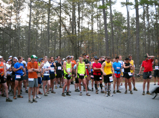
There were about 175 runners who started
the race.
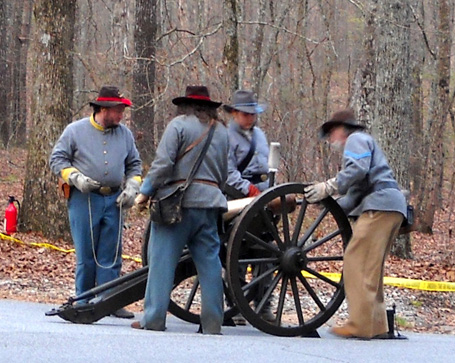
We were in for a surprise when we realized there would be a
Civil War-themed start with re-enactors setting off a VERY LOUD
cannon:
I wanted to get closer for better pictures but the park rangers
made sure everyone stayed a safe distance from the cannon:
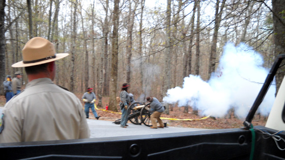
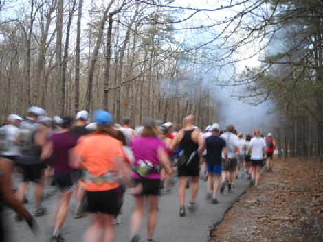
You can still see the smoke in the air as the runners take off
down the road (cough, cough):
The day was already warm (about 60°
F.) and would get up to about 80° in the afternoon. Jim was
probably more prepared for the heat than many of the other
runners, but he wasn't as well trained for all the elevation
gain and loss after a winter in southern Texas and Arizona.
Continued on the
next page (so photos will load more easily)
. .
.
Happy trails,
Sue
"Runtrails & Company" - Sue Norwood, Jim O'Neil,
and Cody the Ultra Lab
Previous
Next
© 2010 Sue Norwood and Jim O'Neil
