(Continued from the
previous page.)After the race began
I knew I had a few hours to kill before I could see Jim at the river (er,
creek) crossing. That gave me the opportunity to wander around
the start/finish area -- to see how runners would be coming into
the finish -- and to take a hike with Cody on some of the nice
trails at Sweetwater Creek State Park.
Here's a section of the
map that shows the blue, red, yellow,
and white-blazed trails within park boundaries:
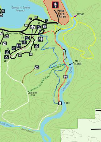
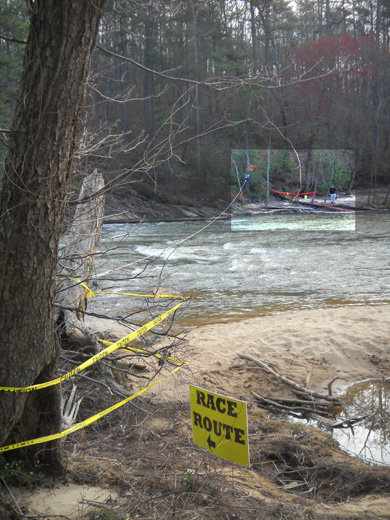
Race participants run on most of those trails, and more outside the park.
Cody and I only had time to do part of the yellow, red, and blue trails
along the creek and ridge above it.
All of the photos on these two race pages are ones I took on my hike
and while watching the race. Jim didn't take a camera with him during
the event.
YELLOW TRAIL TO CREEK CROSSING
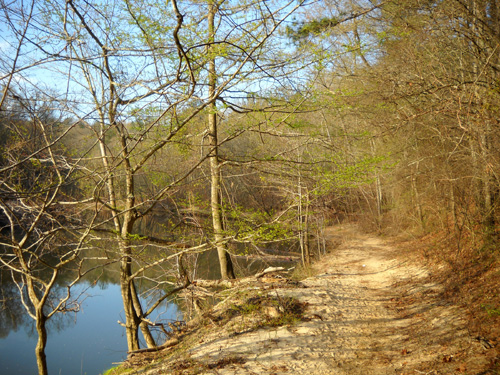
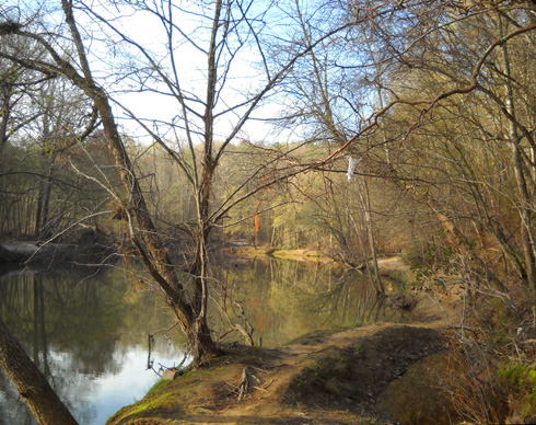
I first walked northeast from the start/finish area on the red and
yellow trails, downhill to the creek and the location of the aid station
at the demolished bridge (photos of that on first page). The soft trail was mostly
smooth through the woods and along the curvy creek shore:
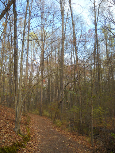
Part of the red-blazed trail
Sandy yellow trail along the
creek
Volunteers had already set up the aid station and were ready for the
runners:
About two hundred yards past the aid station volunteers were waiting
for the first runners to reach the creek crossing:
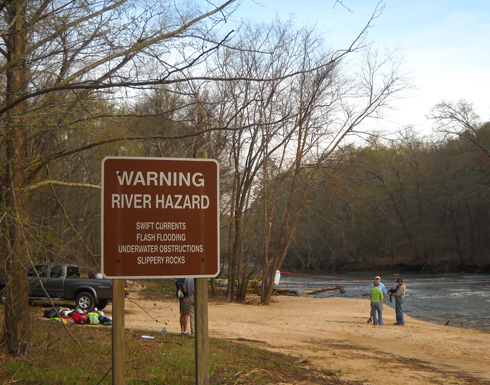
Note the cautionary sign re: swift currents, flash flooding,
underwater obstructions, and slippery rocks! Folks in some rugged ultras
like Hardrock (or on the Appalachian Trail in New England) see much
worse than this, but for many 50Kers, this is their first experience
fording a potentially dangerous stream.
Two ropes had been strung across the wide creek and volunteers had
forded to the other side to assist runners coming and going on the
yellow-blazed trail loop on that side:
I highlighted the volunteer who was stationed by the ropes on
the other side of the creek.
I wasn't interested in hanging around to see the front-runners
reach the creek crossing 17+ miles into the race (runners passed
through here earlier in the race but didn't cross the creek the
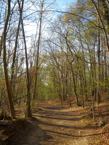
fist time) so I set out on my own exploratory hike on the red
trail along the creek
and the blue trail on the ridges.
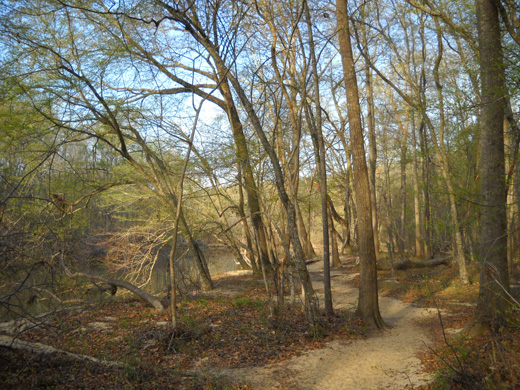
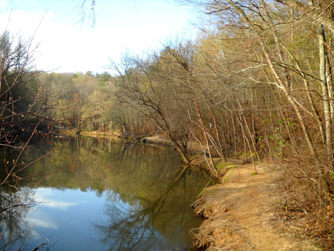
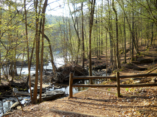
YELLOW AND RED TRAILS TO THE MILL RUINS
This is a scenic section of trail that gets right_up_next_to the
creek in some places:
Note the shredded white plastic bag hanging
high in the tree over the trail.
The water was at least that high during a
flood!
The surface of the creek is very placid in this area, in contrast to the shoals
and rapids farther downstream. It always makes me wonder how a
stream can be so seemingly-still in one place and rushing an
another place where there is more of a slope. Shouldn't it all
look like it's moving at the same rate???
It's fun to ponder things like that when I'm hiking!
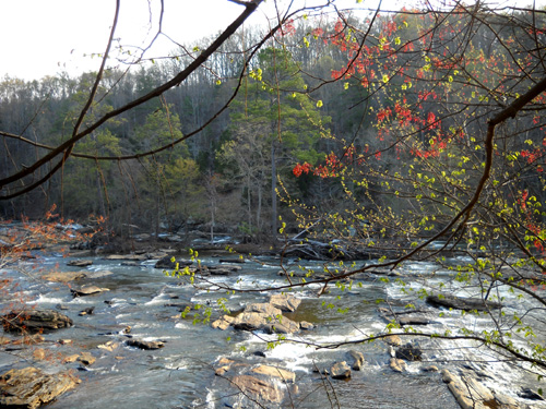
Some of the shoals farther downstream
After being deprived of the pleasures of swimming in creeks and
lakes at Brazos Bend for the past month (alligator territory),
Cody was a very happy Labrador retriever when I let him jump into Sweetwater Creek
along here a
few times.
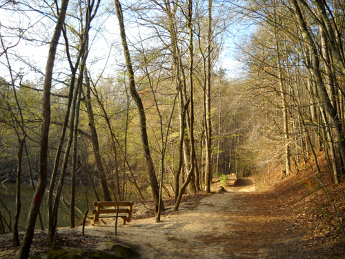
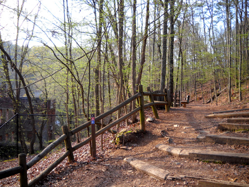
Cody and I continued walking along the red trail at it gradually
ascended a hill and got a little farther away from the creek
before reaching the first interpretive sign for the old textile mill. A few benches
invite visitors to stop and enjoy the scenery along the way:
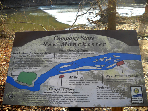
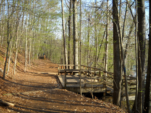
By now I had reached the mill race, a 1,525-foot trench that
slaves dug parallel to the creek. You can see it in the diagram
above and in this photo where the trail switchbacks farther up
the hill:
Mill race and spillway
I continued up the hill past the previous location of the
company store (no longer visible) and toward the ruins of the
old mill.
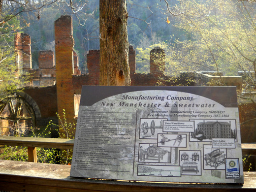
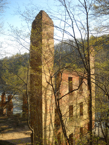
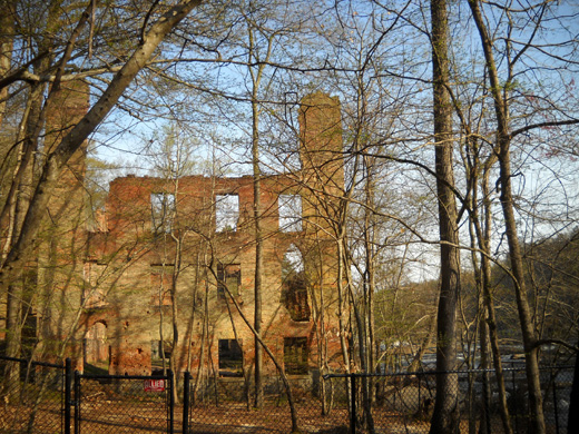
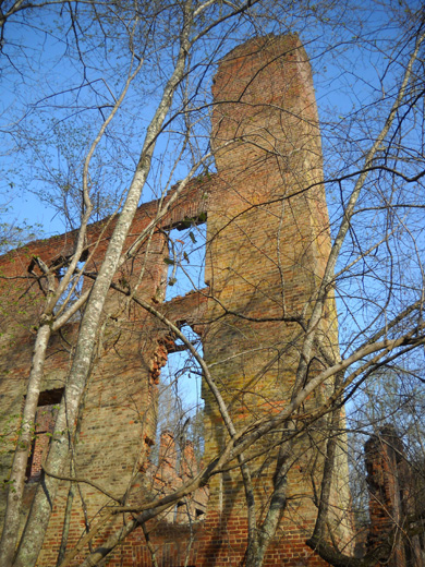
RUINS OF THE PRE-CIVIL WAR TEXTILE MILL
I am fascinated with the ruins of old structures like ancient
Native American cliff dwellings and other remnants of buildings
that have been preserved through history so we can understand
more about the way people lived in other times and places.
So I was naturally drawn to the interesting remains of the New
Manchester textile mill, which was burned by Union troops during the
Civil War. This was a pretty big operation that included a brick
manufacturing area, a large sawmill, a three-story company store
that also sold shoes and dry goods and included a post office
and two floors with living quarters, a dam to facilitate the
mill's operation, and the mill itself.
The park does a great job interpreting the construction and
operation of the business venture and what
occurred to the buildings and workers here during the war:
Long story short, the Confederate mill workers were detained and
sent to prison in Louisville, KY until they pledged allegiance
to the Union. Then they were transported across the Ohio River
and ordered to remain there until the end of the war. Few of
them ever returned to New Manchester.
I hope Jim and the other runners in the SweetH2O paused long
enough to read some of the information about the business as
they ran or walked these hills, or at least glanced over to see
what was left of it.
If nothing else, I thought the protruding brick walls of the
five-story
mill were pretty interesting from various angles:
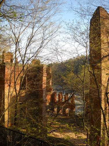
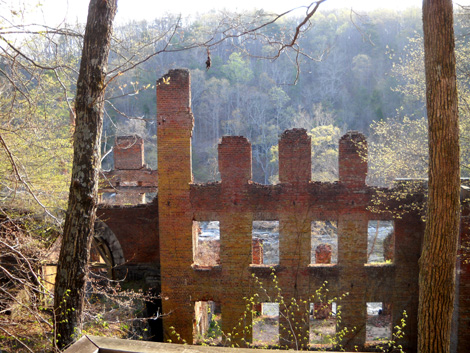
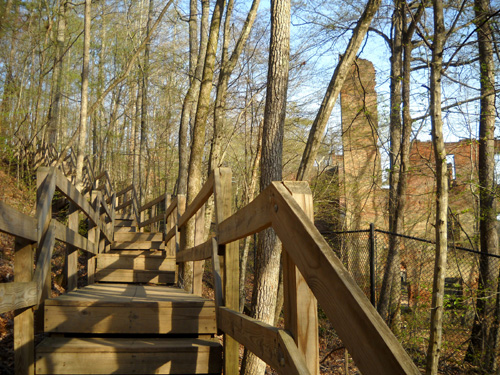
The terrain around the mill is very hilly. The park has built
wooden observation decks above the skeleton of the building and a series of steps down to
the lower level. Even though I have some knee pain going down
steps like these, I was so curious I descended anyway!
The mill is down to the left, between the
trail and creek.
Nice deck at the upper level
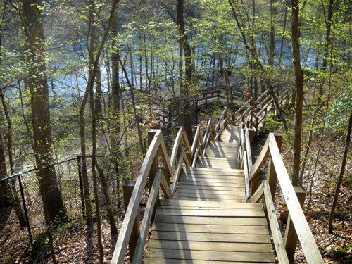
What, no elevator??
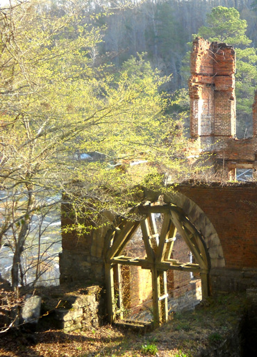
I took the next series of photos of the ruins on the way down the
stairs and at the bottom, at creek level. Note the tall
chain-link fencing preventing curious visitors from entering the
dangerous building. Nor can you walk in front of the remains
along the creek.
And then I got to go back up all those stairs, which for me is
much easier than coming down:
OK, I abbreviated the history lesson so I don't lose readers who
are only interested in the race. The photos do show what the
runners see (at least, from the level of the trail), if they care to look
anywhere besides where their feet are going to land.
Race report continued on the
next page . . .
Happy trails,
Sue
"Runtrails & Company" - Sue Norwood, Jim O'Neil,
and Cody the Ultra Lab
Previous
Next
© 2010 Sue Norwood and Jim O'Neil
