This is another Georgia park within an hour's drive of our home that
we visited for the first time this year. And it's right across the
Chattahoochee River from McIntosh Reserve, a Carroll County park I
featured in the
previous entry!You can't just drive
across the river to get there, however. There is no bridge connecting
the two parks and they are in different counties. The state park has a
Newnan address and is in Coweta County. Both parks are southwest of
Atlanta and in the greater metro area.
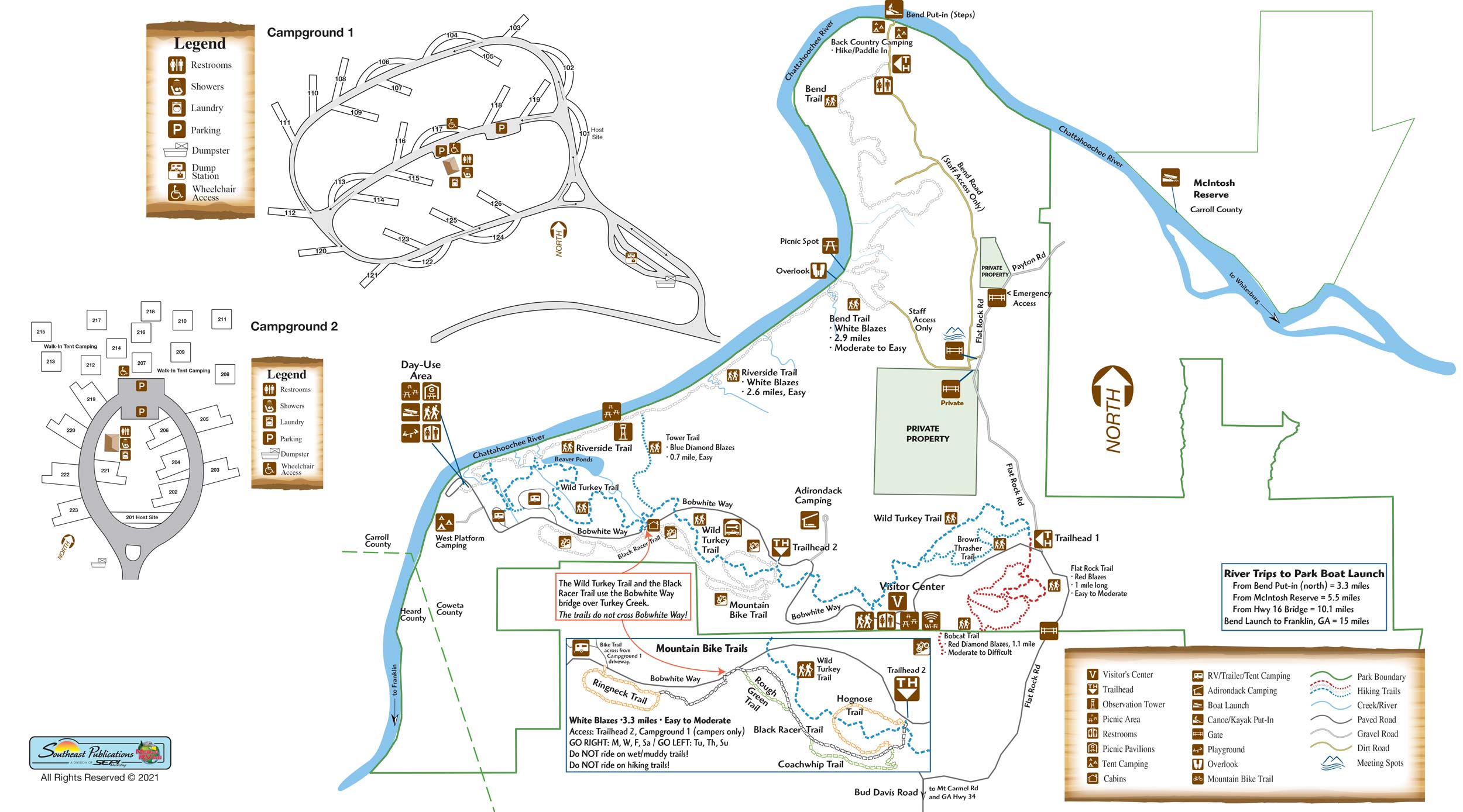
Here's a map that shows their proximity to each other:
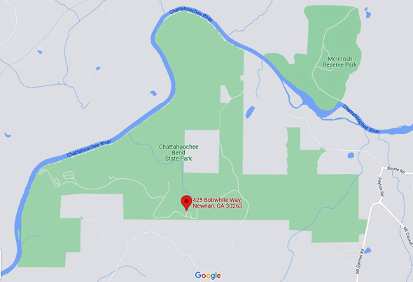
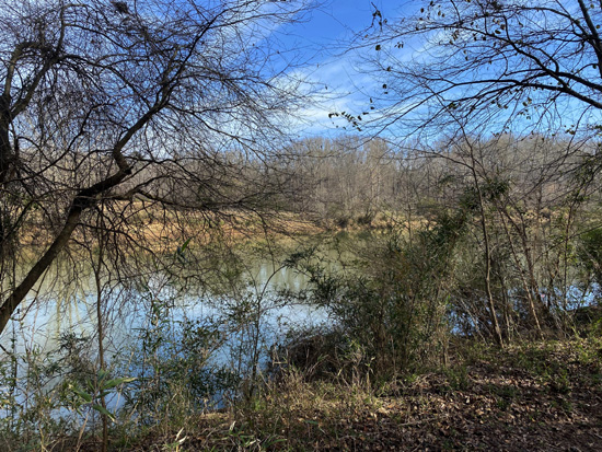
At 2,910 acres, Chattahoochee Bend SP dwarfs McIntosh Reserve in size
but doesn't have as many miles of trails as the smaller county park. It
has considerably more river frontage, however -- about seven
miles.
Popular activities include hiking, running, mountain biking,
picnicking, camping, watching wildlife, fishing, boating, kayaking,
canoeing, paddling, and geocaching. Accommodations include two
campgrounds for RVs, tent sites (some with platforms), and three
cottages. Check the park
website for fees, reservations, and
other details about activities and accommodations.
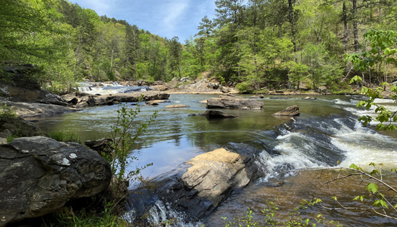
RIVERSIDE TRAIL
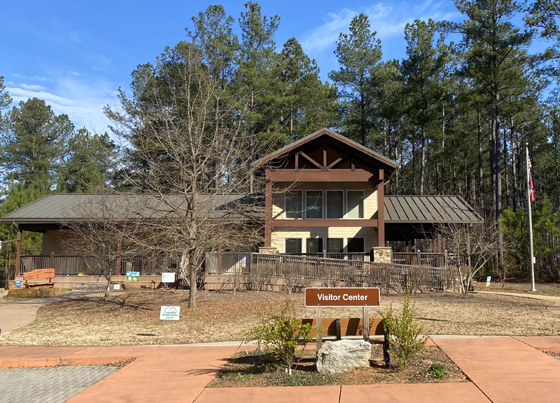
Jim and I have been to Chattachoochee Bend SP only once, on a weekday
the second week of March. We stopped at the visitor center first for
brochures and other information:
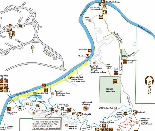
Then we drove the hilly, paved park road all the way to its end at
the day-use area by the river. You can see it at the far left on the
park map below. We began hiking mid-morning, going a
little over two miles out and two miles back on the Riverside Trail.
Here is a section of the
park map that shows where we hiked out
and back along the river:
We saw very few people that day until we were almost back to the
day-use area. The park is much busier on weekends and in the warmer
months, of course.
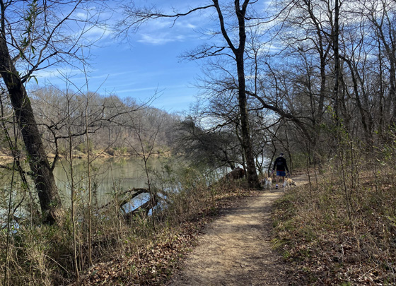
Jim walked Holly and Casey and I had Don. The trail
was mostly flat and smooth for the two-mile section we walked. It's a
very easy trail; I've read
that it is more hilly farther out.
Total distance one way for this trail is 2.6 miles but you can
increase the distance by doing other trails it intersects. The Tower,
Wild Turkey, Brown Thrasher, and Flat Rock trails appear to be more hilly.
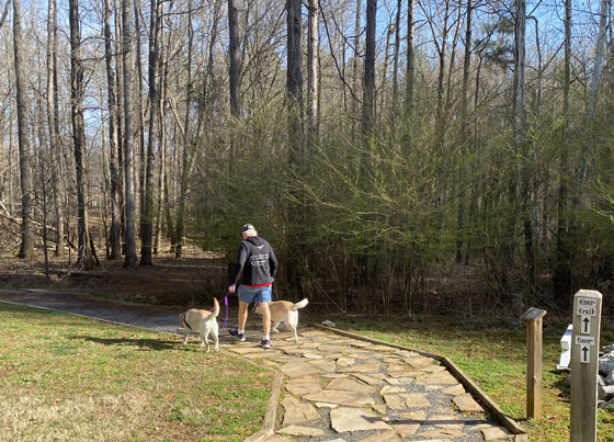
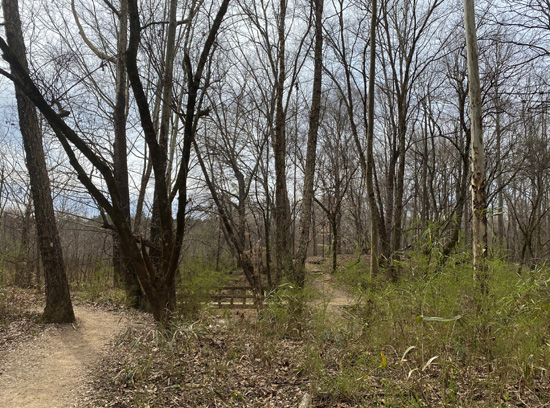
These photos are in chronological order going outbound from
the trailhead (photo above), past the observation tower, and to the
two-mile mark where we turned around.
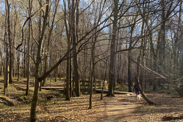
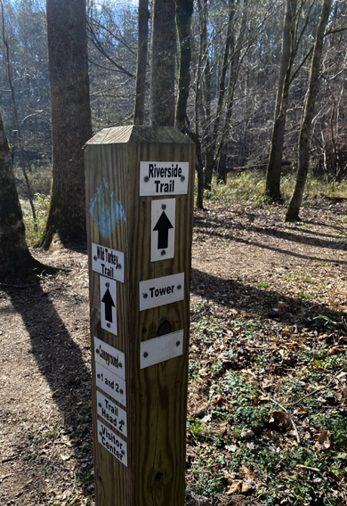
The trail intersections we saw
were well-marked.
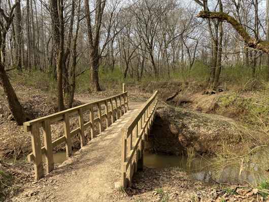
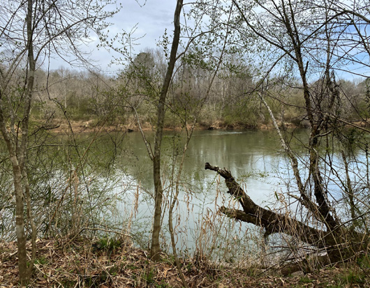
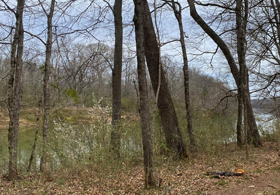
This first long bridge is between the river and a
large wet area. It probably gets flooded occasionally.
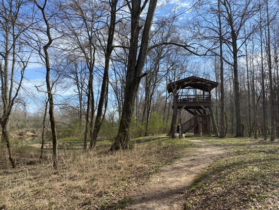
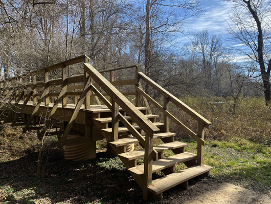
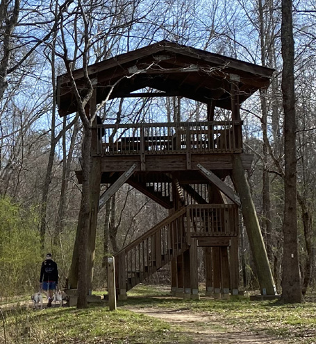
Above and below:
observation tower
Above and below: looking at
another bridge from both directions
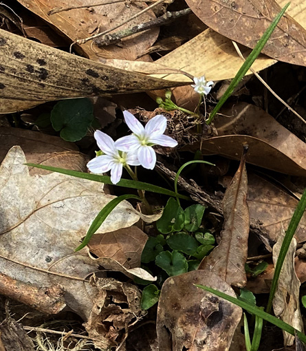
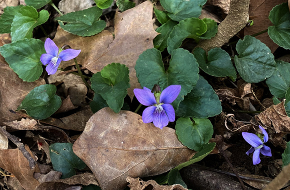
Above and below: some early
spring flowers
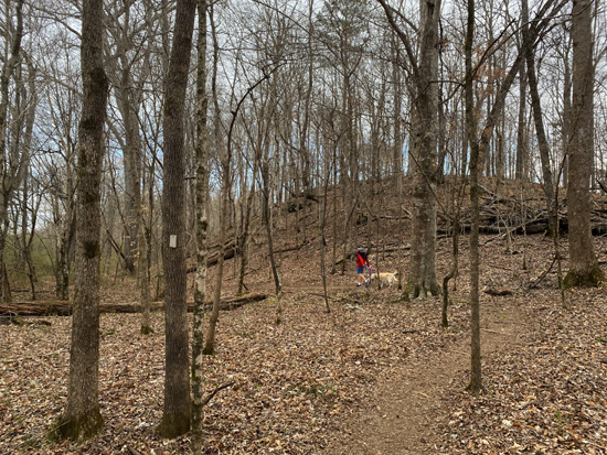
Jim and the girls ahead of Don
and me a little before the two-mile mark
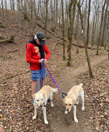
Jim re-starting his GPS after our
break at our 2-mile turnaround
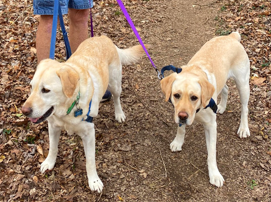
After a snack and some water,
Casey (L) and Holly are ready to head back to the car.
I should wait to pass judgment on this park until I've walked more of
the trails. I think the others are probably more hilly and would
interest me more than the Riverside Trail. And it might be more scenic
when the leaves are out. But neither of us was that impressed after this hike.
One problem we have with both Chattahoochee Bend and McIntosh Reserve
is that the shortest ways require us to drive through congested traffic
in both Peachtree City and Newnan. It's mostly rural highways all the
way from our house to Sweetwater Creek.
So far, Chattahoochee Bend is our least favorite of the three state
and county parks I've described in recent entries. Sweetwater Creek SP
is definitely our favorite, followed by McIntosh Reserve. YMMV!
I'll have more photos from subsequent hikes in these parks at the end
of the year.
Next entry: new (2021) photos from my favorite local park,
Line Creek Nature Area.
Happy trails,
Sue
"Runtrails & Company" - Sue Norwood, Jim O'Neil,
Casey-Girl, Holly-Holly, & Dapper Don
Previous
Next
© 2021 Sue Norwood and Jim O'Neil