Our buddy Steve has recommended several good places southwest of Atlanta
for us to hike, including Sweetwater Creek State Park and also this
smaller Carroll County park that is less than an hour's drive from our house.
Dapper Don and I met Steve and his young female German Shepherd Dog, Buzzy,
for my first hike at McIntosh Reserve on a weekday morning in early
March. Steve had talked so enthusiastically about the place that I went
ahead and purchased a half-price annual senior pass when I entered the gate.
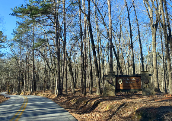
Entrance sign to the park
I enjoyed it so much I went back with Jim and all three of our dogs the next day.
This entry covers both hikes on the River Trail, a bit of history, and
general features of the park. I'll start with the park's namesake.
WHO WAS MCINTOSH?
Steve, Jim, and I all enjoy learning about the historical
significance of places we visit. Since the park's namesake, Chief McIntosh, is buried
there I figured I'd better brush up on his significance to the area.
William McIntosh AKA The White Warrior was the son of a Scottish-American
father who was a British Army captain and a full-blooded Creek Indian mother;
the town of Senoia in Coweta County bears one version of her name.
That dual heritage gave McIntosh some advantages in life but also led
to his death at age 50 by his own native tribe.
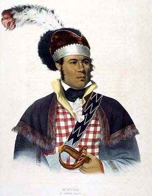
Painting of Chief McIntosh from the park website.
Chief McIntosh owned a plantation and several taverns, trading posts,
and ferry crossings on the Chattahoochee River from middle Georgia to
middle Alabama. "Chattahoochee" is the Creek Indian name for
"painted or stained rocks."
The site of his former plantation lies within the boundaries of this
park.
McIntosh was involved in several skirmishes and treaties between his
tribe, the state of Georgia, and the U.S. government in the early 1800s.
The last one in 1825 ceded much of the Creek lands to the United States
in violation of Creek Nation laws.
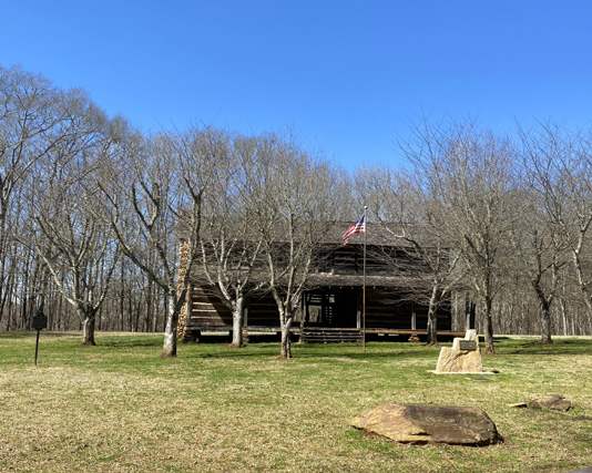
He was executed by the tribe and his grave is close to the site of
the reconstructed log cabin where he lived. The cabin is open to park
visitors:
You can read more about McIntosh's life and legacy by clicking on the
"park history" link at the upper left corner of the park's
home page.
I don't know how many other places in the area are named for Chief McIntosh
but McIntosh H.S. in Fayette County, whose slogan is "Home of the
Chiefs," is an obvious one.
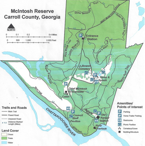
PARK FEATURES
McIntosh Reserve "combines recreational
activities, preservation of cultural heritage, public education, fish
and wildlife management, and conservation of the Chattahoochee River Corridor."
The park has about a mile and a half of Chattahoochee River frontage with
two overlooks on hills and a mostly-flat trail close by the riverbank.
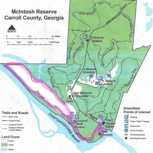
This
map is from the park website:
Several flat, mostly shaded, primitive campsites near the river can accommodate tents
or RVs of all types but there are no utilities. The river is popular for fishing, rafting,
canoeing, and bird-watching. It's also a scenic place to run, hike,
bike, or ride a horse.
As you can see in the park map above, the River Trail
makes a long loop by the river and around a large grassy field that can
be used for various activities.
Other trails go past beaver ponds in wetlands and up to higher ground
around McIntosh's log cabin and gravesite, a separate
cemetery, several picnic pavilions, and a kids' playground and splash park.
Various festivals and other events are often held at the park, which
is open all year and closed only for a few major holidays.
HIKE #1 W/ STEVE, BUZZY, & DON
My focus in this entry is primarily the River Trail and the two overlooks.
About fourteen miles of trails are open to pedestrians, cyclists, and
equestrians. So far, I've hiked only the River Trail and none of the
trails up to and on the higher ground that visitors pass through from the
entrance station to the old ranger station parking area at the end of
the paved road.
On the first hike, Steve and Buzzy were already half a mile down the
River Trail before I figured out where I was supposed to meet him
(the Council Bluff hill, not the River Overlook hill).
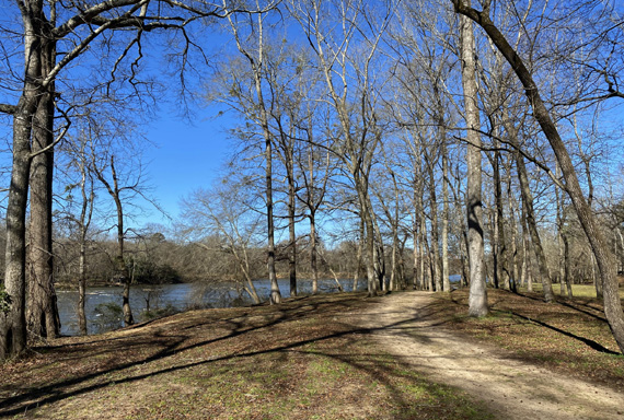
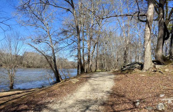
I walked down to the River Trail from the parking area, taking photos at a bend
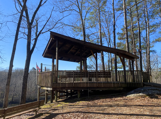
in the river and amphitheater below the River Overlook pavilion:
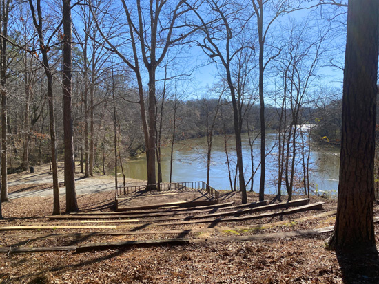
Dapper Don on the amphitheater deck
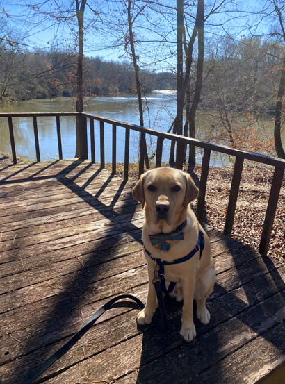
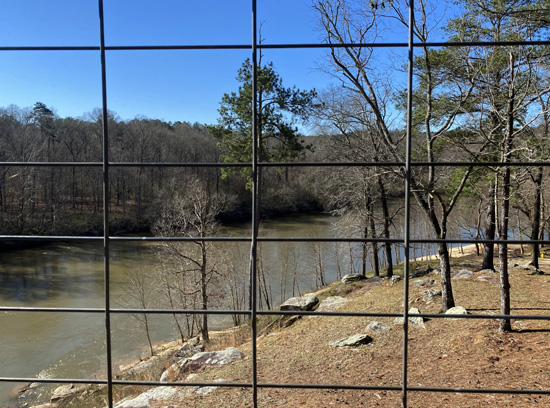
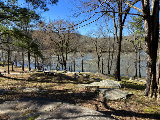
Then Don and I climbed up to the River Overlook
pavilion for more views and photos:
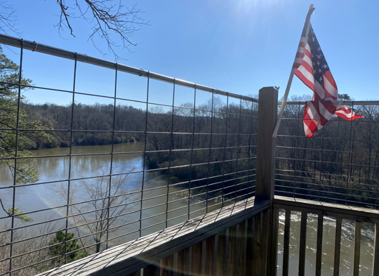
I called Steve from the overlook to see if he'd arrived. That's when
I realized we were at different overlooks!
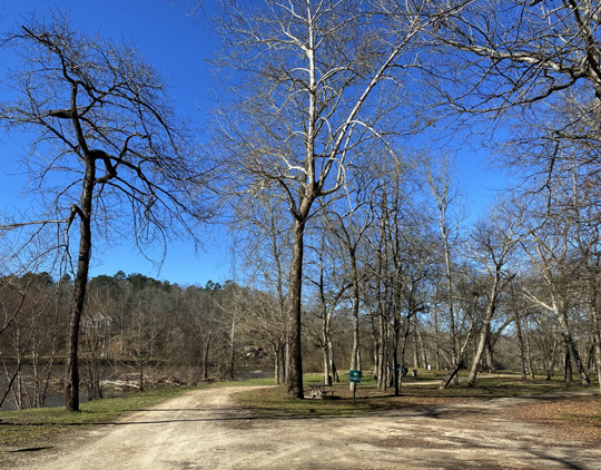
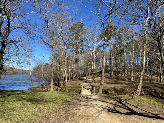
I walked down past the River Overlook and through the picnic area
near the creek on the River Trail:
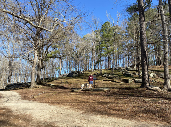
Steve came back toward me from Council Bluff and we met halfway.
Buzzy and Don were happy to see each other again. They are almost
evenly matched in size and weight so it's easier for Don to chase and
play with her than with our little Holly. Buzzy was 13 months old on
this hike and Don, 21 months.
Buzzy is fearful of most dogs and barks at them. Because Don is so
sweet and gentle, she isn't afraid of him. Steve likes Buzzy to be
around dogs like Don to help her outgrow that fear.
After the pups played for a little while and Don got some lovin' from
Steve, we all hiked NW on the wide trail along the river to Council
Bluff, where Steve had been waiting for us originally. The bluff is
ahead on the right in the next photo:
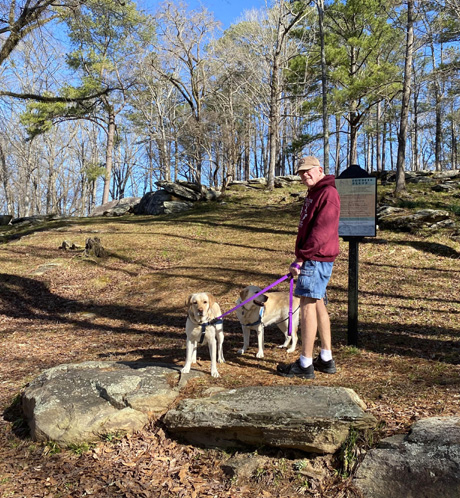
This sign explains some of the history of the bluff:
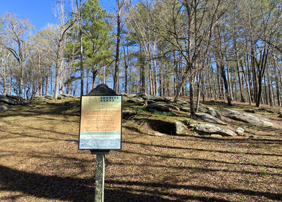
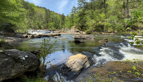
Chief McIntosh's cabin was at the top of this bluff. It
was an easily-recognized spot from the river because of the rocky hill
and the shoals in the water:
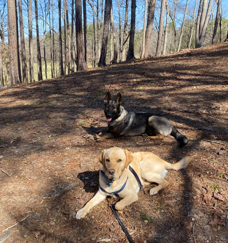
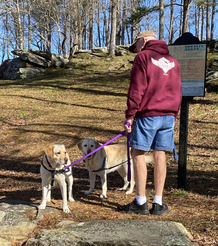
I took these pictures of Don and Buzzy while they were taking a break on
the hillside,
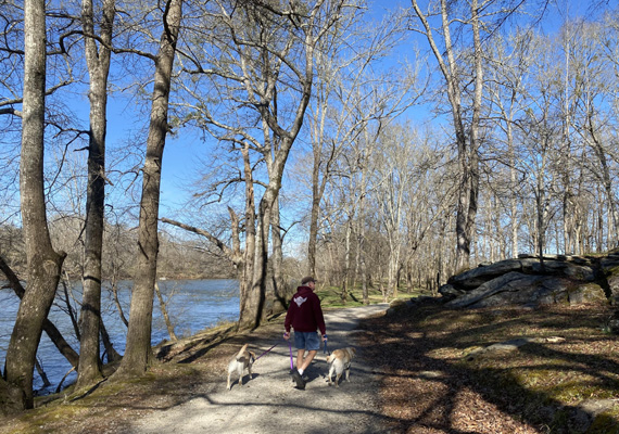
then we continued walking outbound along the River Trail:
The rest of the trail flattens out, narrows, and parallels a wider dirt track
farther to the right that
vehicles use to access the campsites. I didn't take any photos of the
camping area on either hike. They are flat, grassy, primitive, and
partly shaded. Only one site was occupied.
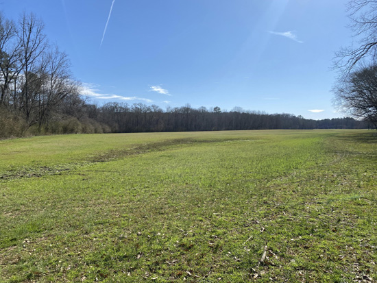
At the edge of the park's NW boundary the trail loops to the right
around the far end of a long grassy field:
On the return we passed wetlands (on the left in the photo above)
and the intersection with the Beaver Pond Trail. We headed toward Council
Bluffs and the trail we were on to the River Overlook.
This is what Don's and my 3.2-mile hike looked like on the map:
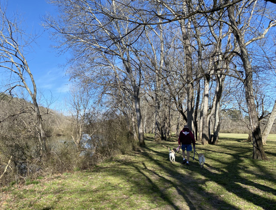
HIKE #2 W/ JIM, CASEY, HOLLY, & DON
I enjoyed that hike so much that I talked Jim into going back the
next day with all three of our dogs. We did the very same route that
Steve and I did the day before.
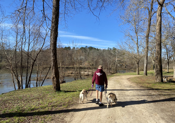
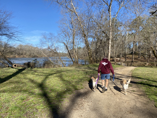
Here are some photos that show Jim and the girls walking along
the river from the picnic area to the bluff and approaching the
campground area, going outbound:
I'm looking forward to going back to McIntosh Reserve this fall and
winter when it's less crowded and cooler than in the summer. I've got a
lot more trails to explore there!
You can find more on the park's website about hours of operation,
fees, etc. If you're over 62, ask for the senior rate for the annual pass.
Next entry: hiking at Chattahoochee Bend State
Park, which is across the river from McIntosh Reserve
Happy trails,
Sue
"Runtrails & Company" - Sue Norwood, Jim O'Neil,
Casey-Girl, Holly-Holly, & Dapper Don
Previous
Next
© 2021 Sue Norwood and Jim O'Neil