Of all the trails at Sweetwater Creek State Park, this is the only one
where I agree with the difficulty rating -- it is
difficult! And that's why I've been avoiding it until this hike in mid-May.
Sixteen years ago after I had hiked the entire Appalachian Trail I
wouldn't have batted an eye at this rocky mess called a "trail," but I'm
that much older and less conditioned now. I'm not 56 any more. <grin>
I'll cut to the chase: I went as far on it as I could during
the hike described in this entry, but I've got about a one-tenth mile
section at the far end that I just couldn't face that day without a
human hiking companion (Dapper Don was with me, but he can't call for
help if I need it.).
So I've done every bit of every marked trail in this park except that
one tiny segment . . .
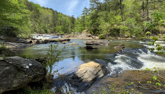
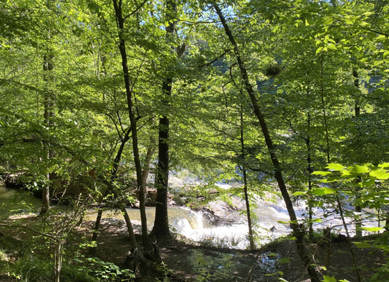
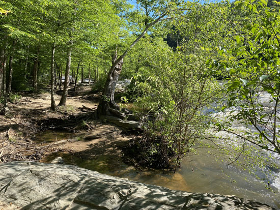
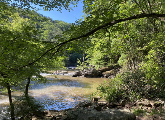
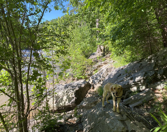
A view of creek before the point
where I turned around.
If you know me very well, you know I'm determined to complete that
section some day! It won't be with Jim, however. He hates hiking on
terrain like that.
I'll either have to hike it with a trusted buddy or do it by myself. I met
a young man on that section during this hike who offered to turn around and
stay
with me through the rockiest section but I declined. I just didn't trust
him enough, so we went our separate directions after a pleasant conversation.
He confirmed that I hadn't seen the worst yet!
It wasn't a wasted hike by any means. The weather was beautiful, the
leaves were all out, Don and I found about fifteen new people to
talk with, I explored two unmarked trails that were new to me, and I knocked
out four-tenths mile of that section of the Red Trail
by the creek that I hadn't seen before.
As you can probably tell from this map, my route (highlighted in
purple) was truly weird with some out-and-backs and unmarked trails.
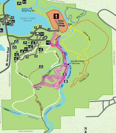
I'll try to keep the route description simple enough to avoid
confusing readers. It was just under 4 miles, with 850 feet of
total elevation gain and loss.
RED TRAIL TO THE RUINS
The first half mile of the route from the visitor center
to the New Manchester Mill ruins on the Red Trail is the busiest section
of trail in the park, but on the weekday morning in May when I did this
hike there weren't very many people around until I left about lunchtime.
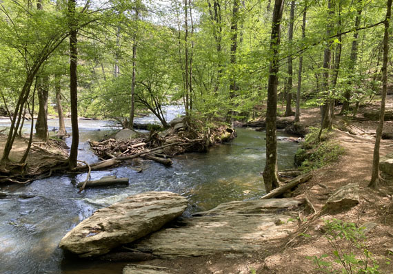
The trail is wide and mostly smooth as it drops down to
creek level. For part of the way it follows this old mill run
paralleling the wide creek:
Before reaching the mill, the run drops in a series of little
falls and merges with Sweetwater Creek:
The trail gradually ascends a little higher above the creek
before the ruins:
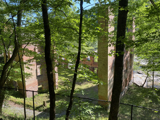
A little before reaching the mill ruins, the White Trail
intersects from the right (west) and runs contiguously for a few
hundred feet with the Red Trail to the far end of the structure.
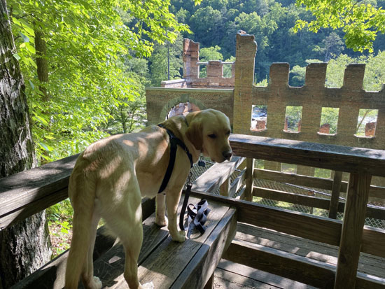
Almost every time I pass the ruins I take some pictures of Don
(or Casey or Holly) on the deck overlooking the five-story structure:
The Red Trail takes a sudden dive down to the creek at the far
end of the mill ruins and the White Trail continues straight ahead:
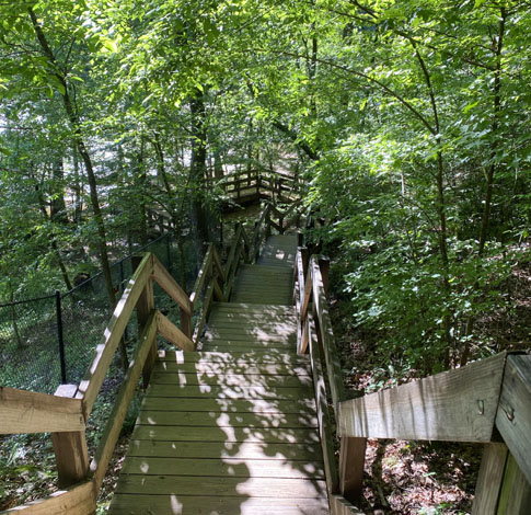
I counted the individual wooden steps one time -- about
100 of them before getting all the way down to the creek. There
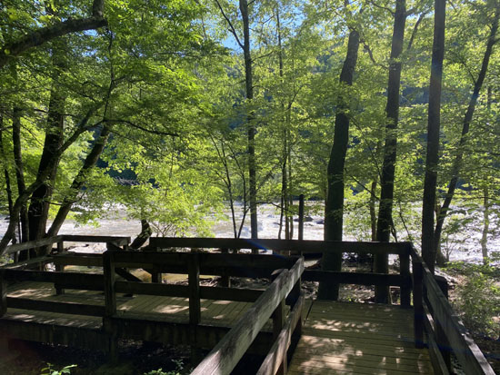
are intermittent platforms breaking up the steps and a nice deck
with bench seating at the bottom:
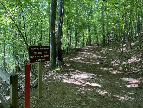
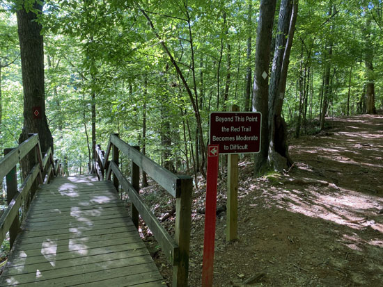
Those steps might deter some people. But wait, that's not even
the "difficult" part yet!
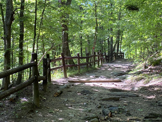
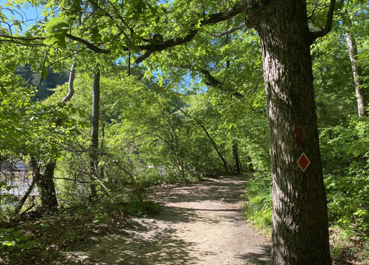
RED TRAIL ALONG THE CREEK PAST THE RUINS
The Red Trail continues to the right of the deck, close to the
edge of the creek. There are rocks and roots right away, with an
occasional sandy break to lull hikers into thinking it's not so bad
after all.
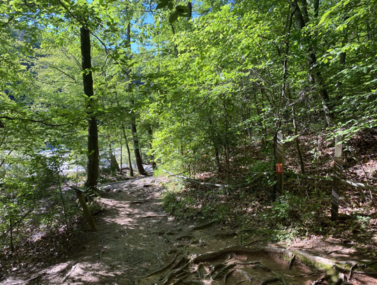
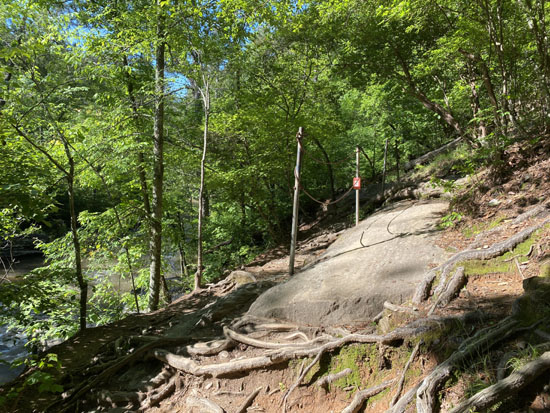
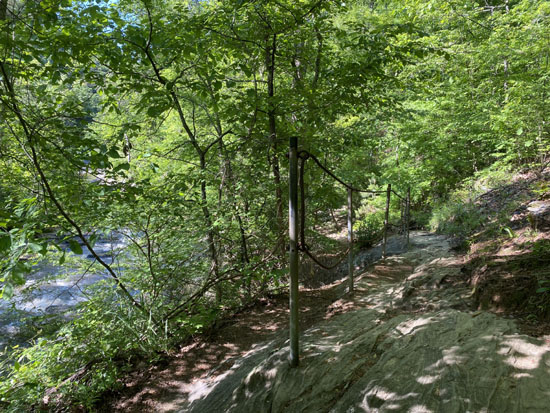
Then the trail heads up the hill to some long rock slabs with
posts and chains to help with footing. That's about where I realized folks
aren't kidding about this section being the toughest marked trail section
in the park:
Again, that's nothing compared to a lot of places on the
Appalachian Trail -- or Angel's Landing in Zion National
Park! -- but it got my attention because I'm not as well
trained as I was before I got my knees replaced.
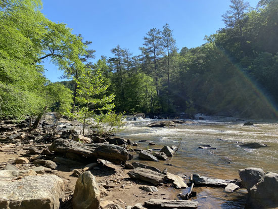
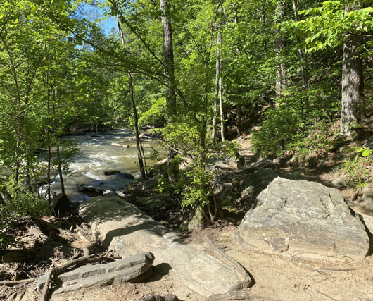
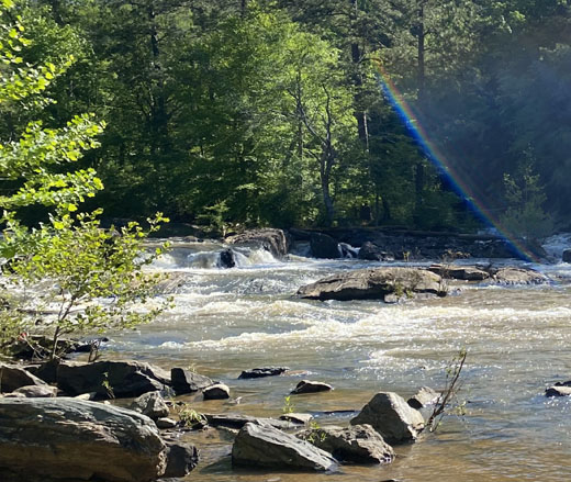
The trail drops backs down to creek level for a while before the
next rough section of rocks on the approach to that Class
IV+ shoals area in the quote at the top of this entry (I
don't have a creek-level shot of those shoals):
I turned around shortly after the rocks in the next picture
where Don is posing.
I felt it was just too treacherous for me to continue navigating
through large slanted slabs of rock without other people nearby.
I like hiking in peace and quiet unless it's somewhere I could slip
and get hurt too badly to walk out on my own.
I went back along the creek for about two-tenths of a mile to an
unmarked trail I saw while I was going outbound.
I knew the White Trail parallels the creek higher up on the hill so
I headed that way. It was steep but I did end up on the White Trail in a
few minutes.
EXPLORING UNMARKED TRAILS & MAKING NEW FRIENDS
While I was stopped for Don and me to drink some water and
take a little break, two older men approached me from higher up
the hill. They had just hiked down the continuation of that
unmarked trail from the Jack's Hill Area. Hmm . . .
These chatty fellas have been on most of the unmarked trails in the park
so I asked them lots of questions. We talked about the park and dogs mostly.
Don loved all the attention they gave him, then fell asleep at my feet.
That impressed the guys, how calm and well-mannered he is.
After about fifteen minutes we moved along. The men went down the
unmarked trail I'd just come up, and I turned south on the White Trail
to go look at the other end of the Red Trail again. Maybe I could go
in from that direction to the place where I'd stopped . . .
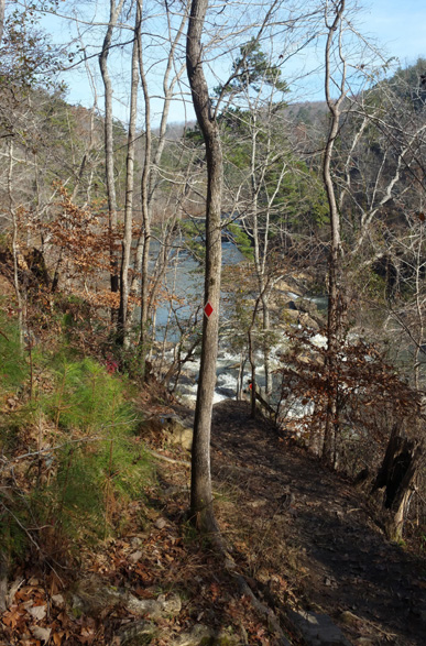
Or not. It looks even rougher from that perspective! I walked
down the rocky path and looked at the trail from the top of some rickety
wooden steps (next photo, from last year). When I saw the trail down
by the creek, I decided "not today" and went back up.
While I was debating my next move about a dozen younger hikers
came down a rather steep part of the White Trail with rock steps above that
intersection. I moved aside so they could pass. Every one of them
wanted to pet Don and remarked how handsome and/or well-behaved he is.
Of course, Don ate that up! He got more attention from other
park visitors on this hike than ever before.
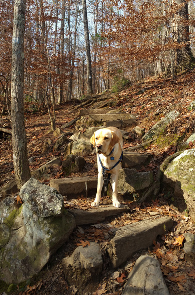
Photo of Don on part of
that steep section from last winter
On my way back to the visitor center I explored two different unmarked
trails that run between the White Trail and the Green Trail connector.
Both were decent trails, making me wonder why they aren't marked
and used more.
During my wanderings I ran into the two older fellas again. We
all laughed at the low odds of that happening since we were all just
randomly exploring that day. They petted Don again and we
went our separate ways, having fun discovering new trails.
RED + YELLOW TRAILS TO THE END
I eventually got back to the ruins and took the main Red Trail
north toward the visitor center.
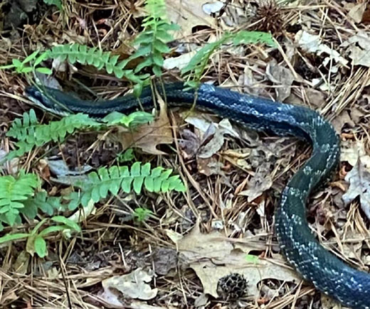
A little past
the ruins a large black snake crossed the path in front of us. Fortunately, I
saw it moving and kept Don away from it. He was more interested in it than
any other wildlife he’s ever seen. It was his first really big
snake:
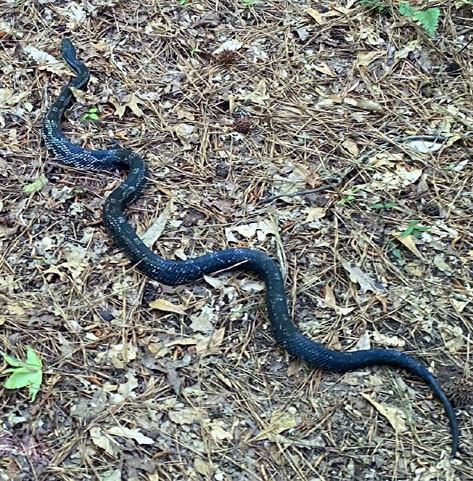
A young man walking toward me didn’t see it until I pointed it out
to him. He jumped in surprise. Neither of us knew what kind it was and whether
it's venomous or not.
I took some pictures of the snake before it got completely into the ferns.
A little while later I saw this sign and think maybe it was a venomous water
moccasin (cottonmouth):
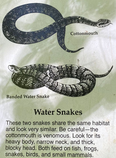
Further research on the internet seemed to confirm that, too.
This trail is close to the creek so it makes sense.
HOW MUCH IS THAT DOGGIE IN THE WINDOW?
Remember that song? It first came out in 1953 and was popular when I
was a little kid.
But I digress . . .
I went a little longer way up to the visitor center via the
Yellow Trail. When I got back to the car I took a picture of Don
by a vinyl window cling of a retriever that I had recently purchased:
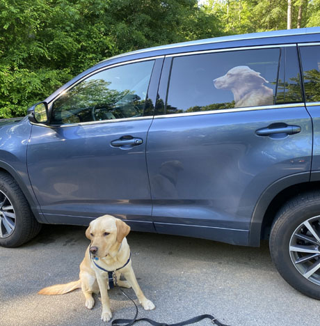
You'd be surprised how many people that image has either concerned or
amused! A group of women in the parking area that day were smiling and
commented on it. They wondered if it was a picture of Don and thought
it was pretty cool even though it isn't him.
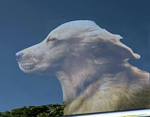
One of the Southeastern Guide Dogs puppy raisers posted his retriever cling
on Facebook and I just couldn't resist getting one for myself. It was
less than $5 at Walmart and easy to apply to the window. It looks fairly
realistic from a distance, especially when I'm driving the car, but is
obviously not real if you get close enough to see all the holes
in the vinyl:
One morning I was walking into Sam's Club at the early (7AM) pandemic
senior hour and had parked pretty far out in the parking lot. Two employees
could see my car from the entrance. One woman was concerned about the dog
I left in the car. The other woman realized it hadn't moved and
laughed when I told them not to worry, it was just a vinyl cling.
I kept it on the window for about two weeks but started getting
paranoid about some idiot smashing my window to free the dog so I took it
off. It was fun while it lasted and I may put it back on again sometime.
No one ever yelled at me or called the police. That would have
been even more fun! <smiley face>
I haven't been back to Sweetwater Creek State Park since this hike in mid-May.
It's just been too hot, especially for Don. I'll resume hikes there this fall
and post photos of the autumn colors. I love the trails in that park and
look forward to trying other combinations.
Next entry: exploring a park that was new to us --
McIntosh Reserve, a large Carroll County, GA park along the
Chattahoochee River
Happy trails,
Sue
"Runtrails & Company" - Sue Norwood, Jim O'Neil,
Casey-Girl, Holly-Holly, & Dapper Don
Previous
Next
© 2021 Sue Norwood and Jim O'Neil