We were very happy to rediscover this quiet, scenic park last
December when our puppy-raising friend Steve invited Jim to
go orienteering there. In the spring of 2010 Jim ran a 50k trail race
in the park but we hadn't been back in over ten years.
Now it's a favorite go-to hiking destination for me, less than an
hour's drive from home. I drove there only three times in 2020 but plan to go
back more frequently to hike in 2021. Sweetwater has a total of about 15
miles of trails. I have not hiked all of the trails but that's my plan
for the coming year. I love what I've seen so far and I want to see the
rest!
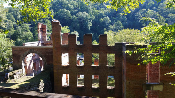
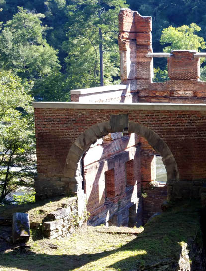
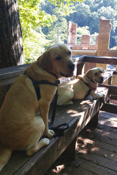
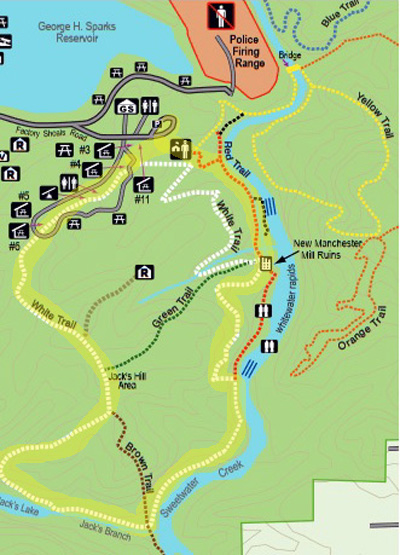
Above and below: ruins of
the old textile mill (Aug., 2020)
This entry includes photos from three hikes I've done at the park in
2020. One was in August, the other two in December.
HIKE #1
Our first trip to the park this year was on a weekday morning in
mid-August, where we once again met Steve.
Our goal was to see if any of the shelters would be suitable for an
outing for our Southeastern Guide Dog puppy raiser group. Because of the
COVID-19 pandemic our group hadn't met in person since February. New
guidelines from campus said puppy raiser groups could begin meeting
outdoors in small numbers once a month in September.
Our group hasn't met at the park yet, although we did find a couple
shelters with enough space for people to social-distance while training
the pups. It's just not a central enough location for our raisers, who
currently all live in the north metro Atlanta area. Sweetwater is south
and west, handy to Steve and us but not the majority of the group.
Jim holds Don and Holly while we
discuss the pros and cons of the first shelter
The more secluded setting for
this shelter farther back the loop
would be perfect for
our puppy group to meet someday.
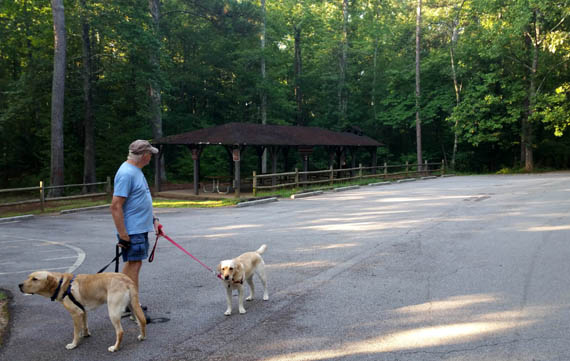
That day we took 14-month-old Don and three-year-old Holly with us.
Steve took his seven-month-old female German shepherd pup, Buzzy, who is
fearful of just about every dog except docile Don. Holly and Buzzy were
a bit reactive with each other at first but became tentative friends after a while.
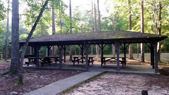
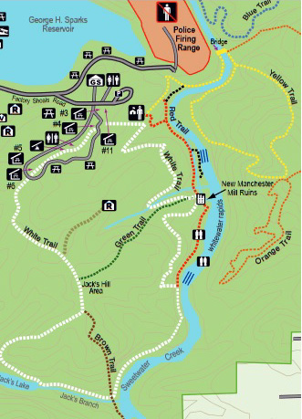
We spent most of the time walking around the large paved loop where
about a dozen shelters are located (highlighted upper left area on this
map section):
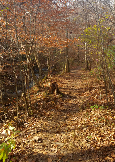
Then we all hiked on the Red Trail to the old mill ruins and back,
stopping for a photo with Don (L) and Holly on the bench above the old
structure:
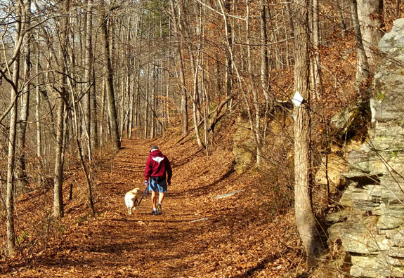
Jim (blue shorts) and Holly on
the Red Trail with Steve and Buzzy following
That day I had a total of 3+ miles of walking with Don. Jim walked another
mile with Holly while I was taking pictures.
HIKE #2
I went back to the park again on a weekday morning in early December
with Don, who was 18 months old. We hiked almost six miles that
day with Steve and Buzzy, now 11 months old and as tall as Don. They
got along just fine again. Buzzy is not at all afraid of Don like she is
of other dogs.
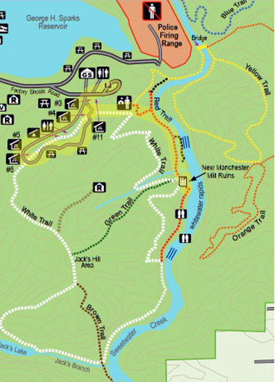
This time we did one large clockwise loop incorporating the Red Trail
to the mill ruins, then the majority of the White Trail back to the visitor center. Our
route is highlighted in yellow on this map section:
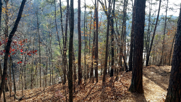
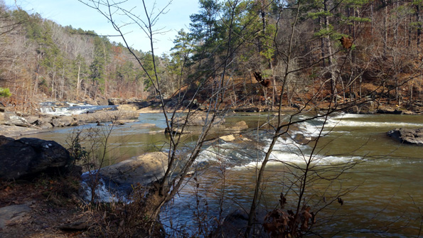
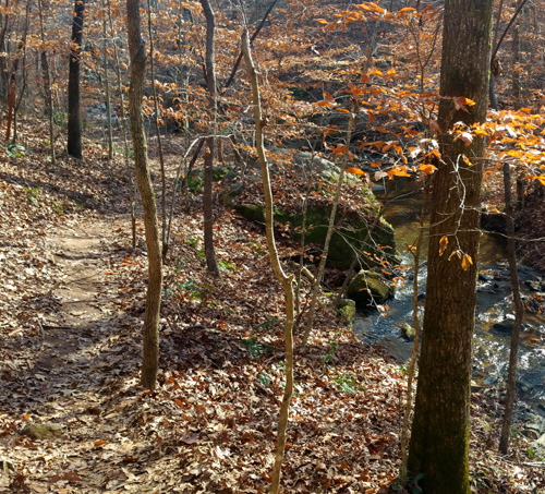
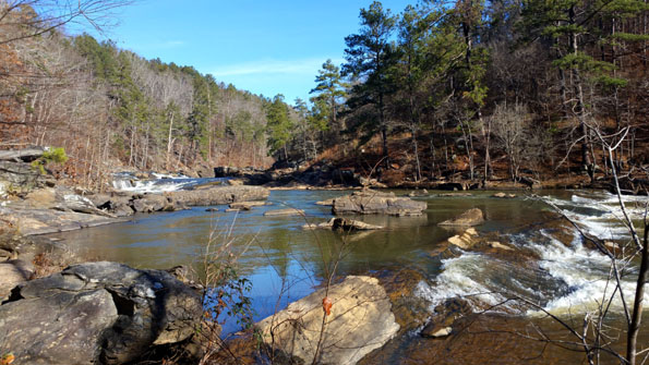
It was a beautiful winter day to hike. I loved being able to see the
shoals and waterfalls in the creek when we were high above it, without
leaves blocking the view.
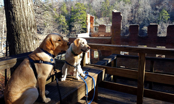
We paused at the ruins long enough to get some photos of Don and
Buzzy on the bench:

The look on Don's face cracks me
up!
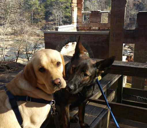
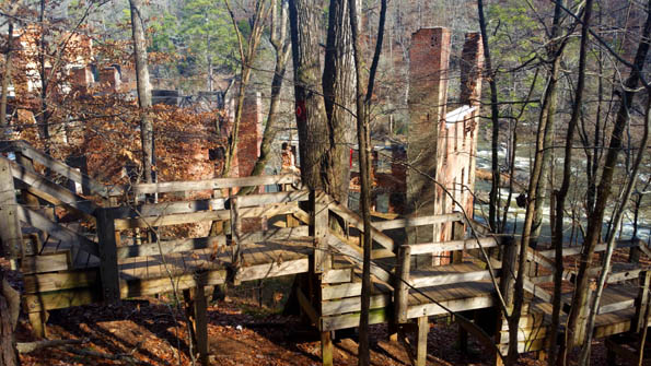
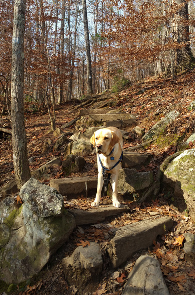
Just past the ruins a long series of wooden steps goes
down to a deck close to the creek. We went down there a year ago but not
this time. This picture of just part of the steps is from
December, 2019:
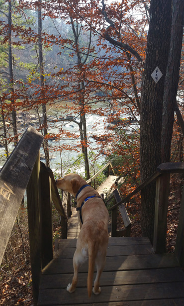
The Red Trail goes down those steps and continues south
along the creek. You can see the red arrow pointing left in the next
picture.
Steve and I continued straight ahead, high above the
creek, now on the White Trail. You can see a white blaze and white
diamond on the trees in the center of the photo:
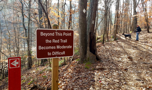
That's an easy turn for a hiker to miss if the intention
is to continue following the Red Trail.
The White Trail was mostly flat and easy to walk for about one-third
mile past the ruins. We had lovely views down to the river, er creek.
Even though the water was somewhat low on this day, the creek was still
quite wide.
The White Trail became rough as it descended to the creek where the
Red Trail intersects it half a mile below the mill. I was wishing I'd
taken a trekking pole with me. Both Steve and I had poles in our
vehicles but forgot to take them with us. I can climb UP steep inclines
but going down them is hard for me to keep my balance.
I let Don walk off-leash on the steep descent over rocks, roots,
and decaying wooden steps until we got down to the creek.
Buzzy got into the water on a long line but Don wasn't interested in
getting into either Sweetwater Creek, which is as wide as many rivers,
or a little feeder stream later on.
View from that spot looking looking back upstream
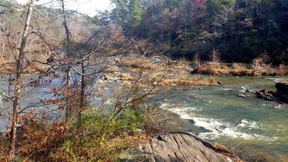
We had some interesting rock scrambling along the creek until we
intersected Jack's Branch (at the "bottom" of the loop). This
is the view from a large rock outcropping before we turned away from the
Sweetwater Creek and began climbing up to a gap:
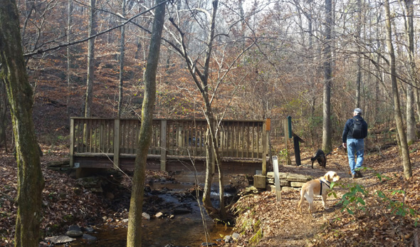
A wooden bridge on the Brown Trail crosses Jack's Branch as the
White Trail begins its gradual ascent on single-track trail along the
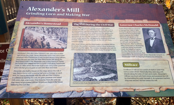
little stream. This was the site of a grain and corn mill in the 1800s.
This scenic trail along Jack's Creek is one of my favorite parts of the
whole White Trail loop:
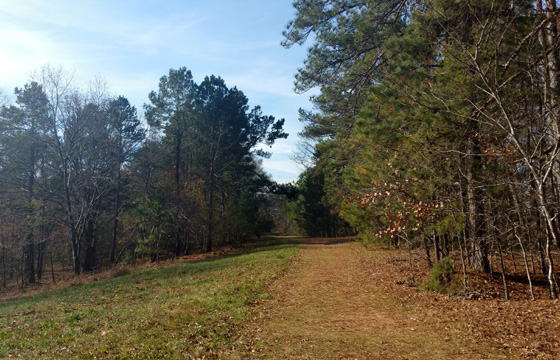
We continued climbing up a wider dirt roadway above Jack's Lake
to a field,
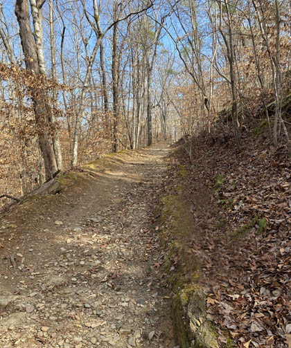
then up a forested gravel road to the shelter area, where we saw
this sign near the end of our hike!
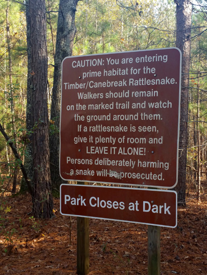
I can only surmise that more people begin the loop near the shelter area
and go the opposite direction we did, thereby seeing this warning sooner.
Of course, I've been on enough trails all over the USA to know about the
danger of venomous snakes but seeing this sign near the end of our hike amused me.
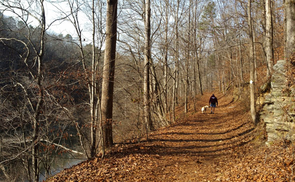
Going clockwise as we did, the White Trail then morphs to single-track dirt
and roots again through the shelter area and back to the visitor center.
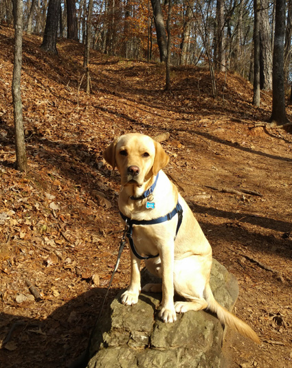
Don poses nicely for the puparazzi on a
rock along the White Trail.
This was a relatively hilly route with a fair amount of elevation gain and loss,
which I like. It had some rough spots -- rocks, roots, rock scrambling --
but for the most part it was good trail and had plenty of varied, scenic views.
I was eager to go back and do it again, perhaps in the opposite
direction, but definitely with a trekking pole next time.
HIKE #3
I was so enthused about the White Loop that I decided to go back with
Don a few days later on another sunny winter morning in December. Here's
the map section again that shows the loop highlighted.
Because there were more people in the park this time, I decided to go
clockwise again so we'd pass the New Manchester textile mill ruins near
the beginning of the loop and not the end when it would be more crowded.
Here's the obligatory "bench shot" above the ruins with
Don (L) and Casey this time:
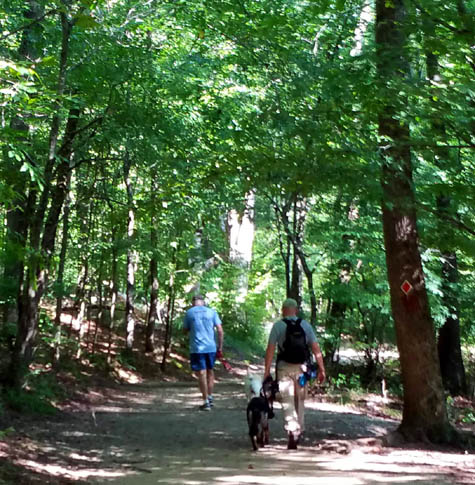
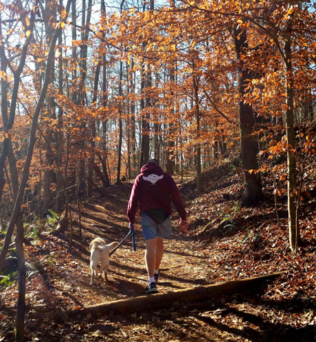
Jim and Casey start on the White Trail just past the ruins:
I'm glad I remembered my trekking pole this time because we still had to
negotiate rocks and the steep descent down to the creek. Jim wished
later he'd taken a pole, too.
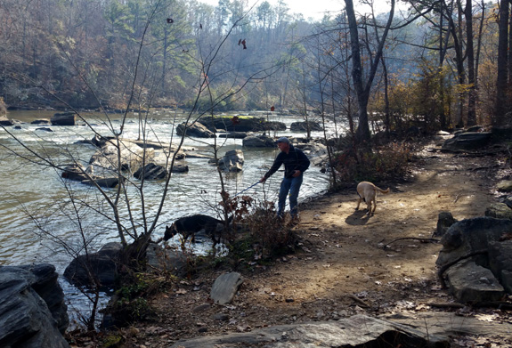
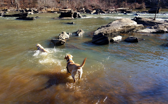
Once down at the creek Jim let exuberant Casey off her leash to swim.
She looooves to swim! She was not at all intimidated by the wide creek
as the water flowed over the shoals and around boulders at this spot.
She was having so much fun that Don decided to follow her
into the water a couple times, to our surprise!
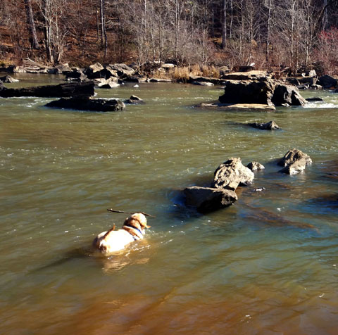
Don swims toward a stick in the water -- first time
we've seen him actually swim and not just
wade in water.
We continued clockwise on the south (bottom) part of the loop along the creek,
turned right to go past the bridge at the intersection with the Brown
Trail, and began the long but gradual climb along Jack's Branch and
above Jack's Lake:
We finished the loop just as I had a few days before -- up a
gravel road to the shelter area, then across the top of the loop on
single-track trail to the visitor center. We had about 5.4 miles again.
Although Casey is eight years old and not used to hiking on hilly trails
the past several years, she was still rarin' to go when we got done. Good girl!
Jim, however, was tired of Casey pulling him in the rocky places and not
so happy with all the elevation change. That hike would be easier
with Holly than Casey (and a piece of cake with Don). Jim did enjoy the
scenery and most of the trail.
This time I paid more attention to
the intersections with the Brown and Green Trails, which I haven't hiked yet.
There is also a section of the White Trail at the top right of the loop that I haven't
done, as well as the Yellow, Orange, and Blue Trails across the creek
. . .
Those trails are all on my list for 2021!
Don will love hiking them, and maybe I can talk Jim into going
back more times, now that he's getting his trail legs back.
Speaking of Don, the next entry will feature updated photos and
information since we adopted him in April. He's been career-changed
to not only a beloved family pet, but also a popular certified therapy dog!
Next entry: #DapperDon_TherapyDog (his Instagram hashtag)
Happy trails,
Sue
"Runtrails & Company" - Sue Norwood, Jim O'Neil,
Casey-Girl, Holly-Holly, & Dapper Don
Previous
Next
© 2020 Sue Norwood and Jim O'Neil