Today is the first time we have been to this park since Jim ran a
50K foot race on these trails back in April, 2010. I had recently been
forced to quit running because of my arthritic knees so I hiked a
few miles along the scenic course with our athletic black Lab, Cody
while Jim ran that race.
Recently Jim was talking with one of our puppy raiser friends, Steve,
and they discovered that one of several interests they share is
orienteering in natural areas, using a compass -- not GPS --
to find waypoints on a topo map.
Steve suggested we meet at Sweetwater Creek SP, where he's navigated
previously with a search and rescue group he's in.
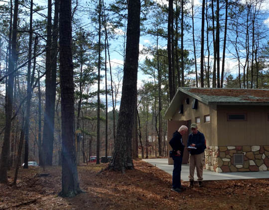
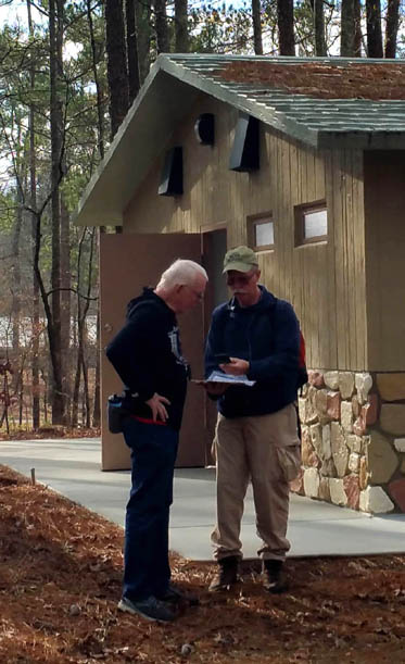
Above and below: Jim and
Steve plan which checkpoints they'll target.
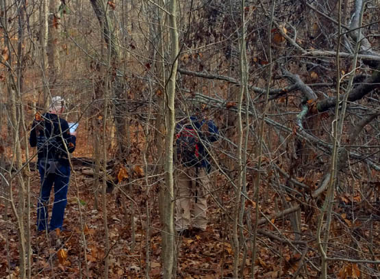
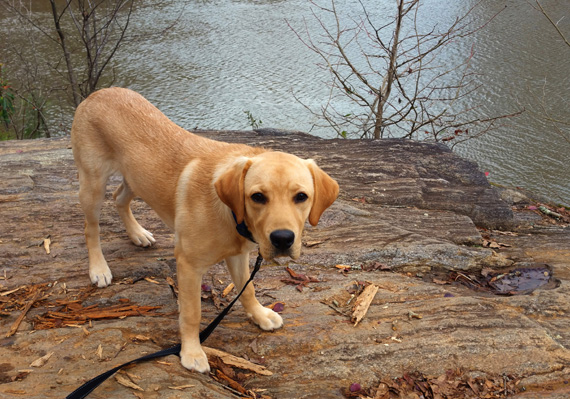
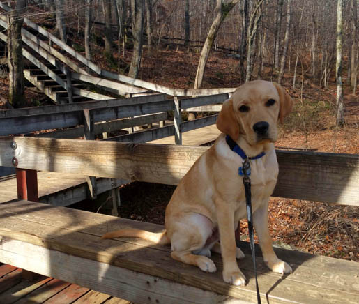
After Jim and Steve discussed their navigation plan, the three of us
and six-month-old guide-puppy-in-training Don set out together through
what soon became too rough terrain for me to walk with a 56-pound pup on
a leash. The next photo illustrates what I mean.
If he was our own dog I probably would have trusted him to follow us off-leash
and off-trail through the forest. However, I didn't want to risk him running
off since he belongs to Southeastern Guide Dogs.
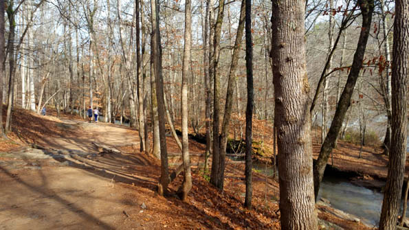
I returned to the trail system and hiked
with puppy Don on-leash past the visitor center to the popular Red
Trail. It goes down to and along the creek to the ruins of the New
Manchester textile mill.
Jim and Steve also had some difficulty navigating the rough terrain
off-trail and caught up to Don and me on the Red Trail at the mill.
This entry features a little history of the park and photos from the
Red Trail, creek, visitor center, and mill ruins.
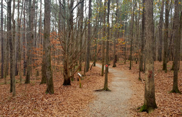
Diamond-shaped markers
match each trail's color name.
Sweetwater Creek State Park is one of forty-eight parks, plus some
state historical sites, managed by the Georgia Department of Natural
Resources. It is one of the most visited parks in the state because of
its proximity just west of metro Atlanta.
The park offers a variety of natural, cultural, and recreational
resources, including hiking, picnicking, fishing, boating, tent and yurt
camping, the mill ruins, and an interpretive center with interesting
exhibits. It's very scenic, even on a sunny winter day when the leaves are down.
There are about fifteen miles of maintained and clearly-marked trails.
They all begin at the visitor center and cover much of the 2,549-acre park.
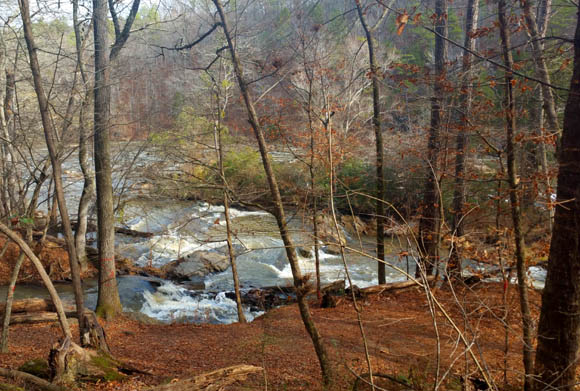
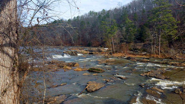
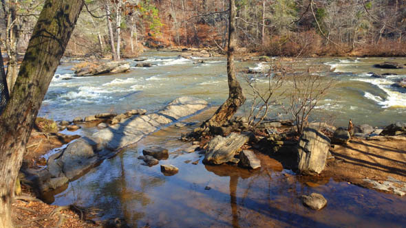
Sweetwater Creek, with its beautiful shoals and rapids, runs right through the
middle of the park and empties into the Sparks Reservoir.
You can see a readable version of the park map below at this
link:
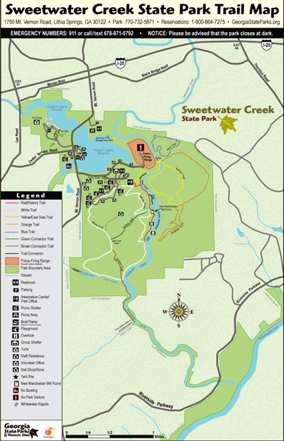
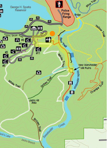
In the map section below I highlighted the trail sections I
covered today with Don from the parking area and visitor center to the mill
ruins and back. As you can see, the trail follows the creek closely.
The orange dot near the top indicates the general area where Jim and
Steve were initially doing compass navigation to find some waypoints:
With some back-tracking here and there I had a total of 2.5 miles
walking. With all the sniffing and stairs he did, that was enough new
things for puppy Don to experience in one morning. The guys
probably did more than that because they did more
navigating on the way back from the mill.
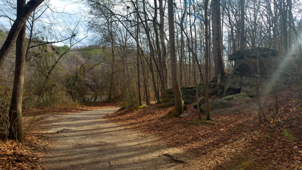
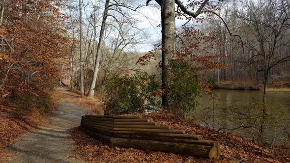
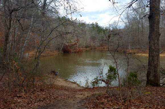
Here are some scenes from the Red Trail between the visitor center
and mill ruins:
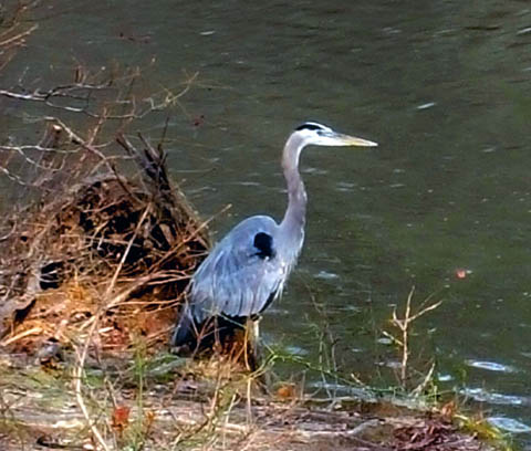
Big blue heron
Don loves to hike on trails, climb over boulders, jump
over downed trees, and enjoy nature! He hasn't had much experience with
water yet and wasn't interested in getting into the creek anywhere it
was close to the trail.
There are interpretive signs about the
New Manchester Mill and the community that developed around it about a
quarter mile upstream from the ruins of the old mill.
This diagram shows the general location of the brick
manufacturing area, first shoals and dam, company store, millrace
(channel of water paralleling the creek), spillway, and the mill itself:

This is part of the millrace:
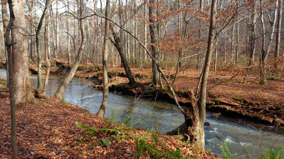
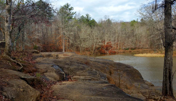
There are numerous shoals and little waterfalls in
the creek as you approach the old mill ruins. I'm glad the water level
was low enough to see some of the rocks:
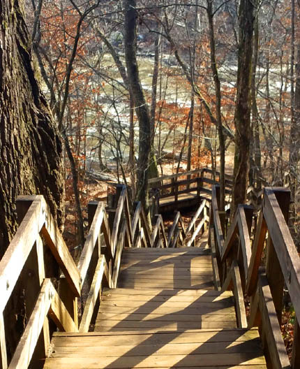
This is part of the first set of long wooden steps that go down
to or near the creek. It's located just as you reach the mill:
Since we don't have stairs or steps at home, I always look for opportunities
for Don to practice heeling by my side on steps when we're out and about.
This was good training for him today. Both sets of long steps were broken
up by landings so they are easier for people -- and pups -- to negotiate.
Don has been on open wooden steps before but not this many, so I
stopped at each landing on the way down and back up to praise him and
give him a treat when he kept my pace and didn't try to go faster. He
did great!
The next set of photos shows several different
views of the textile mill ruins:
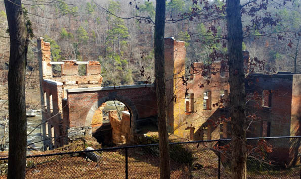
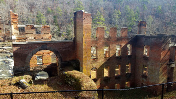
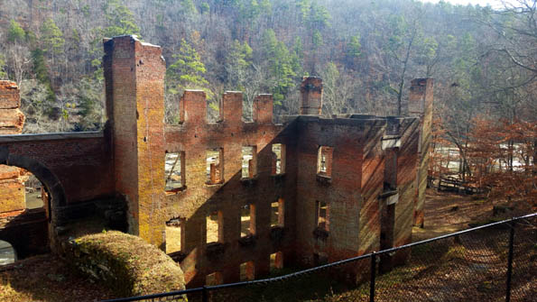
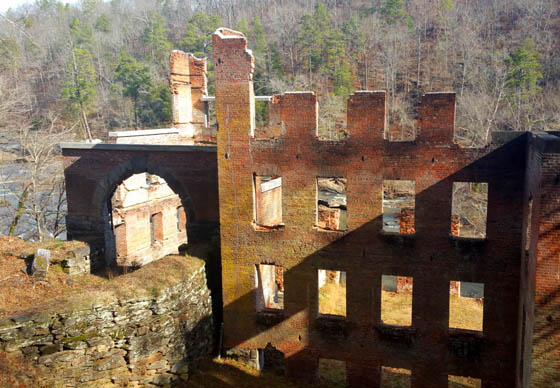
The New Manchester textile mill opened in 1849,
producing thread, yarn, and cloth. Slaves made the bricks, dug the mill
race, and built the five-story factory and nearby three-story company store.
The manufacturing company wasn't in business very
long. The buildings were destroyed by federal troops during
the Civil War in 1864. Mill workers were sent to prison in Kentucky.
After pledging allegiance to the Union they were sent to Ohio and
ordered to remain there until the war was over. The textile mill never
resumed operation.
Some restoration work has been
done in recent years to this structure but it remains fragile and a danger so
it is surrounded by high chain link fencing. Visitors have to sign up for
ranger-led tours if they want to get a closer look. We didn't do that.
There is another even longer set of wooden steps on
the far side of the mill:
These steps go all the way down to a deck next to the
creek. By the time I got to those steps, Jim and Steve had caught up to me.
This picture shows only a few of the many steps. You can see that
there are landings every few steps:
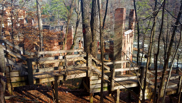
Don did very well going down those steps, too, but pulled ahead a little going
back up. I took it one landing at a time with him again so he can learn proper pacing.
We all took a snack break on the deck. Jim took these next three photos:
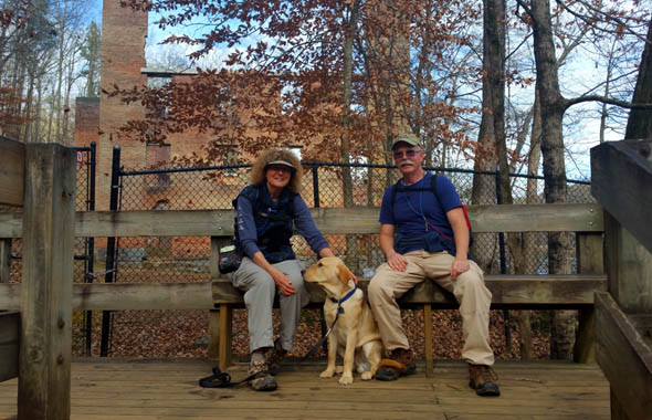
Steve is also raising a Lab puppy for Southeastern Guide Dogs but
didn't bring her on this hike because he wanted to focus on the compass work.
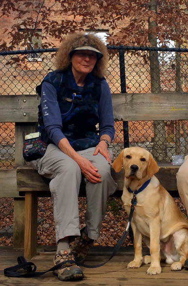
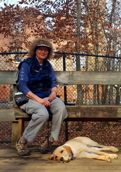
Don knows how to chill out
wherever he goes!
He had plenty of energy on the hike back the car.
I walked Don down to the edge of the creek to a shallow, calm eddy but he wasn't
interested in getting into the water. He's our first Lab to not love getting
into water. We aren't going to force him.
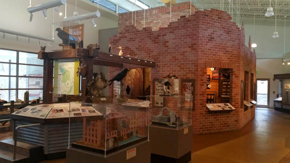
On the way back to the parking lot we went into the handsome
interpretive center/museum, which has exhibits about the historical,
cultural, and natural resources in the park and other information. This
environmentally responsible building as the highest possible LEED-NC
Platinum rating.
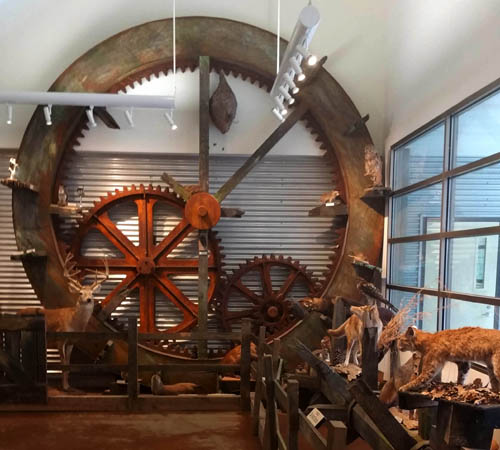
Water wheels and wild critters
We enjoyed the park so much we decided to buy an annual state
park pass at a very reasonable discount. We got half off the
regular price of $50 for being over age 62, plus an additional
military veteran discount! Our total was just $18 and lasts
until January 31, 2121.
This park is about an hour's drive from our house and we plan to
go back for more hiking. There are lots of other state parks we
can explore, too. I visited some of them when I lived in Georgia
from 1974-1999 but they'd seem new again to me after this length
of time. Jim got to see one or two of them at the beginning of
our Appalachian Trail Adventure Run/Hike in 2005.
Next entry: introduction to the 2020 journal. That's a
wrap for 2019!
Happy trails,
Sue
"Runtrails & Company" - Sue Norwood, Jim O'Neil,
Casey-Girl, and Holly-Pup
Previous
Next
© 2019 Sue Norwood and Jim O'Neil