Although we aren't Arizona natives, Jim and I have spent enough time in
the desert Southwest during wintertime to appreciate that sentiment.
Because we have lived most of our lives in the much-wetter eastern third
of the country we aren't used to such a dry climate. We usually welcomed
the occasional wet days we've had while visiting the desert states.
Since we were here at McDowell Mountain Regional Park for a few days
in late December it's apparent this area has gotten some welcome rain.
Now there is more green grass on the desert floor and more flowers are
blooming. The place looks rather lush!
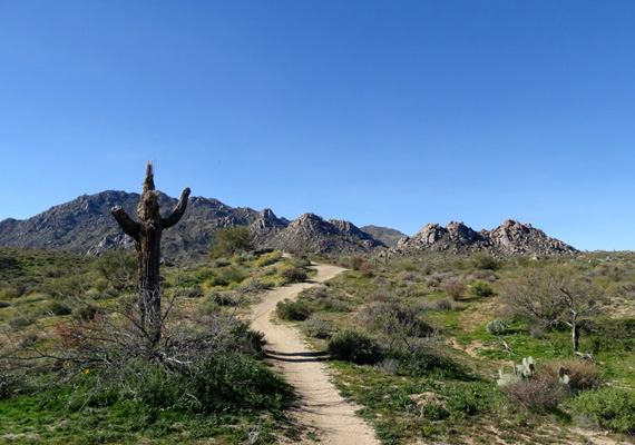
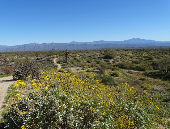
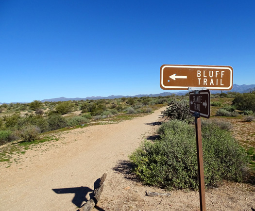
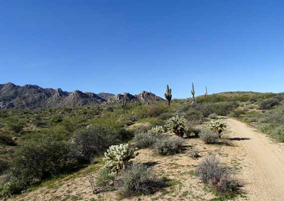
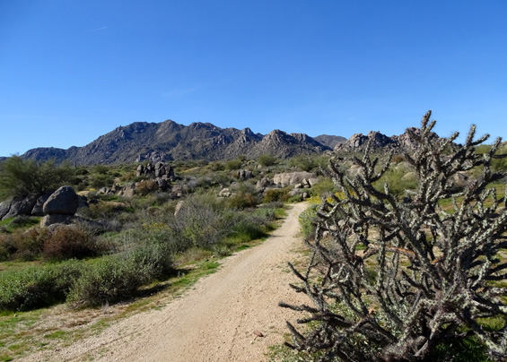
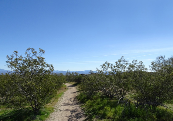
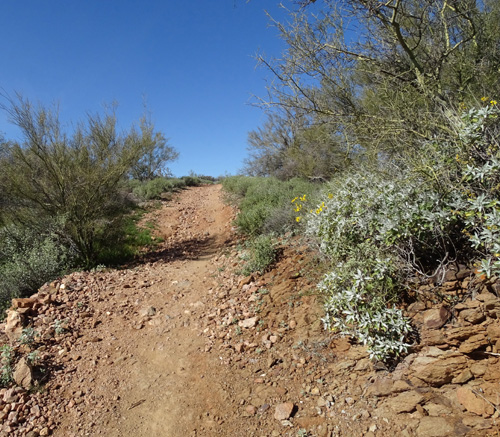
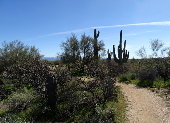
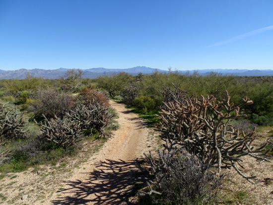
Above and below: Two scenes
along the Bluff Trail that show how green the desert is right now.
Today I did another moderately long loop hike to the west of our
campground in the park. It was a gorgeous sunny day with temperatures
only up to the mid-50s F. -- perfect!
None of the trails were new to me this time but by going the other
direction on the Delsie Trail it did seem somewhat new. A few days ago I
did my first hike on that trail, which has been built since we were here
for our last extended visit in 2011.
Here is the park trail map with my route highlighted in yellow and
start/finish with a red dot:
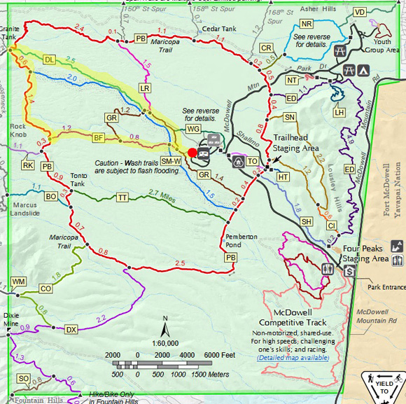
You can find a larger version of that map on the park's
website.
It was 8.4 miles to hike from our site in the south campground
west on two spur trails, a short distance on Granite Trail (GR), west on
Bluff Trail (BF), north on Pemberton Trail (PB), then southeast on
Delsie (DL) and Granite (GR) trails back to the campground.
This loop is just a little shorter but somewhat more difficult to
run, hike, or bike than the loop I described in the previous entry
because both Bluff and the part of the Pemberton I hiked today are
hillier and have more rocks and ruts. I'd rate it "moderate." There are
plenty of smooth parts, too, and it's every bit as scenic as yesterday's route.
The remaining photos are generally in order as I hiked the loop
clockwise.
BLUFF TO PEMBERTON
The Bluff Trail runs east-west for two miles between the
Granite and Pemberton Trails. "Bluff" is so-named because it is on a
little ridge above Stoneman Wash on one side and another lower area on
the other side for most of its distance.
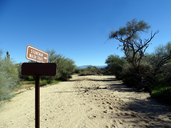
Just past the Granite-Bluff intersection near the
campground, the Bluff Trail dives down to Stoneman Wash.
The climb back up to the "bluff" on the other side of the wash is one of
the steeper hills on this loop. The next picture shows only the top part
of it, and the second one is looking back over the desert toward the
campground to the east:
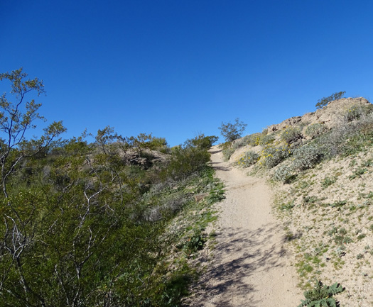
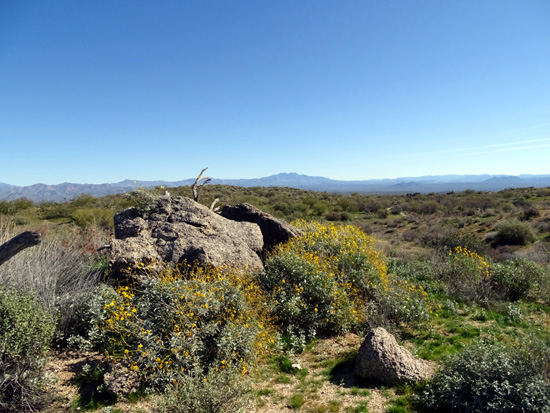
The Bluff Trail is one of my favorites at McDowell. It
is relatively smooth, it undulates and curves along a low ridge above
Stoneman Wash, and it has great views to all the mountain ranges
surrounding the park.
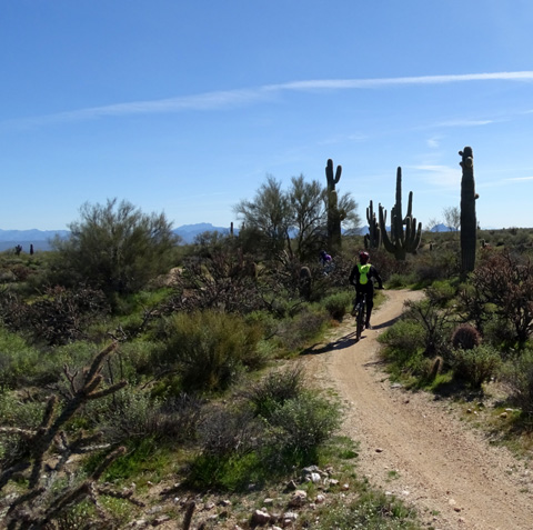
Cyclists love it, too, especially in
the downhill direction, so I'm always careful when hiking on it. I
rode it on a cyclocross bike years ago and really enjoyed it. Today there were
many fewer people on this loop than last Saturday. In 8˝
miles I saw only one runner, one dog, two hikers, and sixteen cyclists.
That may sound like a lot of cyclists, but it's less than a
quarter of the number that passed me in the same amount of time on Saturday!
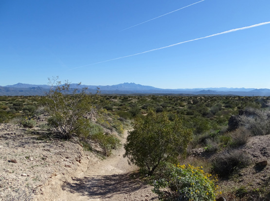
This view looks east toward Four
Peaks; Stoneman Wash is on the left (north).
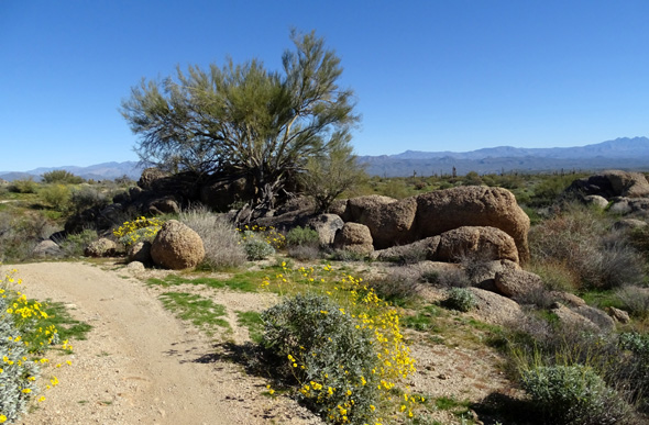
The yellow flowers are
brittlebush.
A lot of flowers are in bloom this month in the park. In
addition to the yellow brittlebush in several of these photos, here are
a few more I saw today along the Bluff Trail:
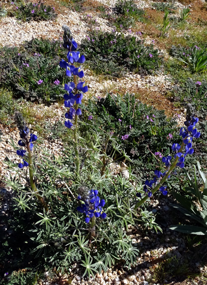
Tall blue lupines and short
purple filaree
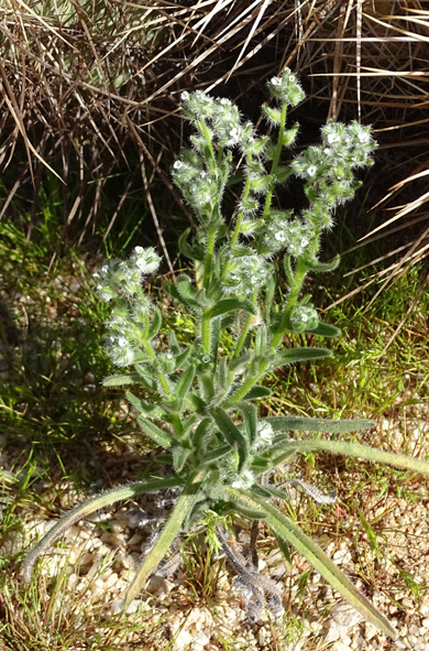
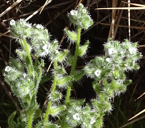
Above and below: Popcorn
flower
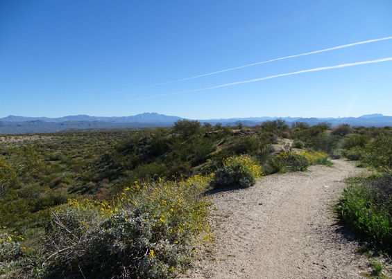
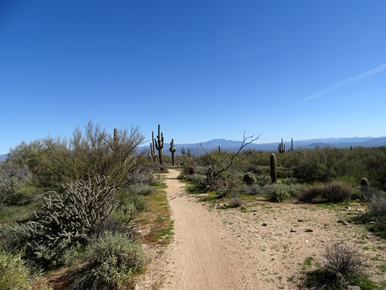
View SW to the McDowell
Mountains; Teddy bear cholla cacti
to the left of the trail, tall
saguaro cacti up ahead
Approaching a scenic boulder
area; another type of cholla cactus in right foreground
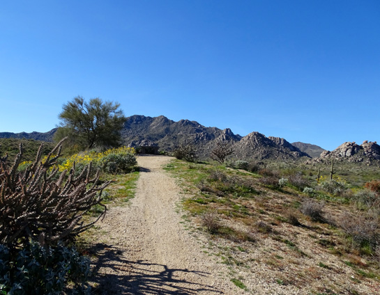
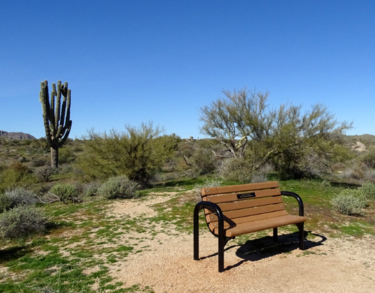
Up and over the little hill in the next picture (where
there is a bench and a great view), then the Bluff Trail goes down
150-200 feet to the Pemberton Trail:
PEMBERTON TO DELSIE
I turned right (north) at the end of the Bluff Trail and followed the
Pemberton Trail for about two miles to its intersection with the Delsie
Trail. This was the first I'd been on this section of the Pemberton Trail since 2011.
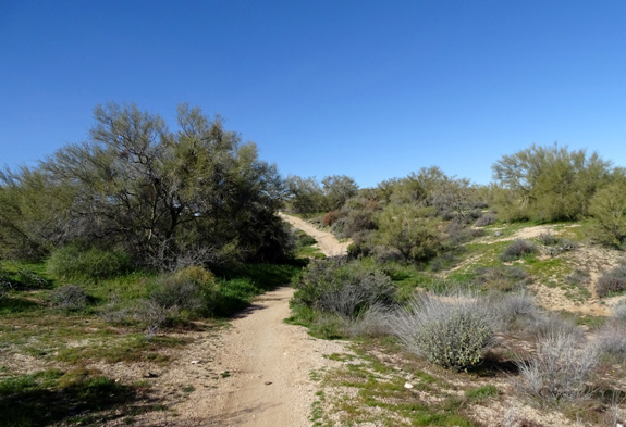
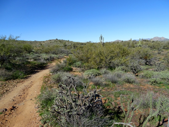
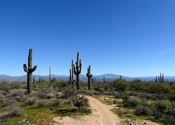
This part of Pemberton is moderately hilly, mostly smooth, and
generally wider than singletrack. It's high enough for good views in all
directions and has a nice variety of vegetation and surfaces.
More brittlebush in bloom; Four
Peaks in the distance
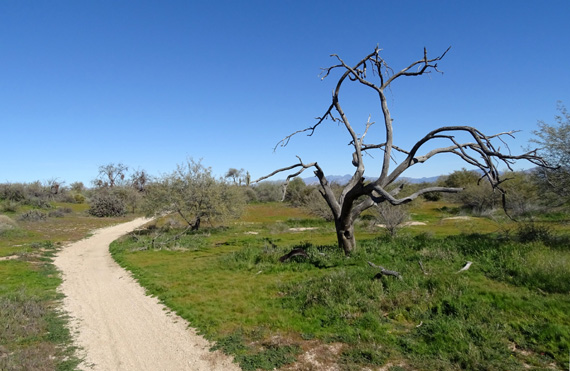
The grass is very lush in some
areas. Doesn't look like desert, does it?
Stoneman Wash "Trail" goes right
through the wash west to east in the park.
It's really only suitable for
equestrians because of the soft, deep sand.
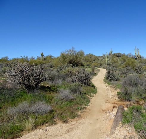
Pemberton Trail gets rougher in
the half mile between Stoneman Wash and the Delsie Trail.
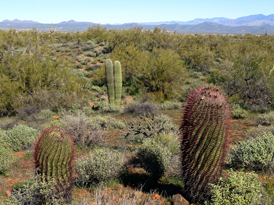
Two barrel cacti in the
foreground; the red spines almost glow in the sun.
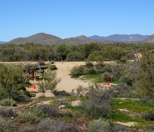
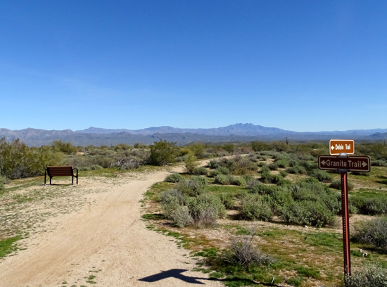
The trail climbs up (above) just
before reaching Jackass Junction (below),
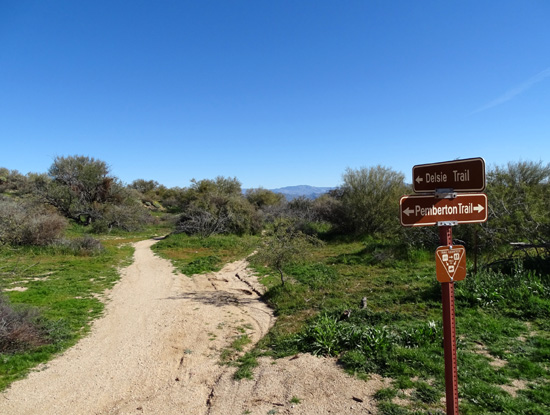
the intersection of Pemberton and
Delsie trails.
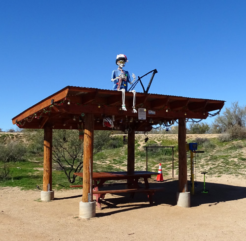
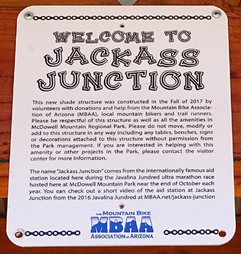
I talked about the new shade structure at Jackass
Junction in the previous entry, and the sign below explains why it's
there -- it provides a nice place to take a break when you're
running, hiking, or cycling.
DELSIE TO GRANITE
During the loop hike described in the previous entry I hiked
westbound on the Delsie Trail for the first time. It was built after we
were here in 2011 and spans a distance of 2˝
miles between the Granite and Pemberton Trails, sort of paralleling
Stoneman Wash to the north.
Today I hiked eastbound on the Delsie Trail, so it almost seemed new
again going the other direction. There were lots of scenic views to the
Four Peaks in the distance.
This direction is gradually downhill. Because the trail is relatively
smooth and has some fun dips and turns, it's popular with cyclists. Once
again, I was wishing we'd brought our bikes with us on this trip.
Several cyclists passed me.
GRANITE TO THE CAMPGROUND
I didn't take any pictures today past the intersection of Delsie
and Granite back to the campground, partly because I've taken so many
photos previously on this one and a half mile long section and partly because I was
in a lot of pain all of a sudden and just wanted to get done.
Up to this point I'd been having a great hike. Once I got onto Granite my
right heel began to hurt. I've got a pretty high pain tolerance (any ultra-runner does!)
but it hurt enough that I had to change my stride. That caused even more problems
later.
I recognized the burning sensation as plantar faciitis, which
I haven't had for many years. If I had been closer to a road I would have
called Jim to pick me up. Unfortunately, I had no choice but to continue hiking
back to our camper.
That definitely put a damper on this hike but I still liked this trail loop a lot.
GOOD-BYE TO ARIZONA
That was my last long hike on this trip but with ice, massage, stretching, and
other standard treatments for plantar faciitis, I was soon able to walk several
miles each day.
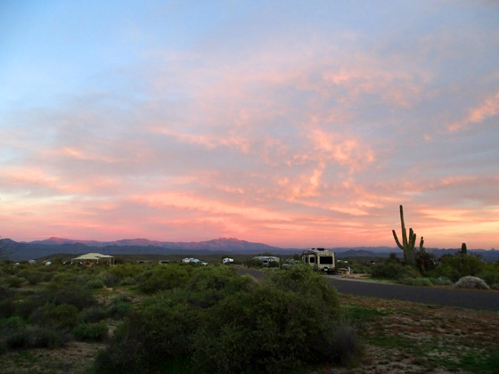
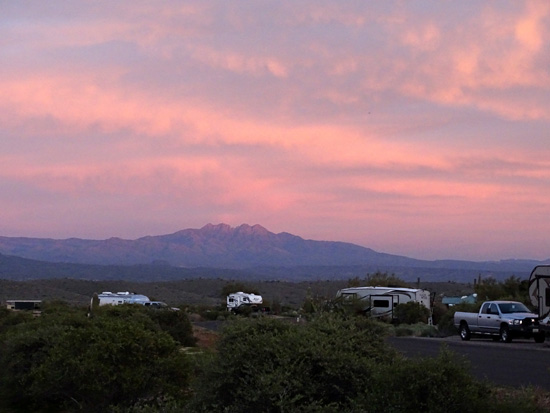
Above and below: More pretty sunset
pastels over the Four Peaks Wilderness
Except for work we needed to do on the Cameo and some other irritating
distractions, we had a generally good time at McDowell Mountain Regional Park.
I'll explain more about our RV and travel decisions in another entry.
A few days after this our two-week reservation at McDowell
was up and we headed back home, with another stop at Brazos
Bend State Park in Texas to break up the long drive.
Next entry: the trip back to Georgia
Happy trails,
Sue
"Runtrails & Company" - Sue Norwood, Jim O'Neil,
Casey-Girl, and Holly-Pup
Previous
Next
© 2019 Sue Norwood and Jim O'Neil