That quote is appropriate for the RV traveling lifestyle we've
experienced the past fifteen years or more.
We both love to see and do
new things, which is one reason why I enjoyed today's hike so much --
I got to hike two trails that were new to me at McDowell Mountain Regional Park.
I've run, hiked, and/or cycled almost all of the trails in this park
during previous visits between 2003 and 2011, except for a few trails
that have been built in the past eight years. So today I chose a loop
route that included the newer Delsie and Lariat Trails, which are
located in the northwest part of the park.
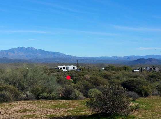
I highlighted the loop in
yellow and marked my start/finish with a red dot:
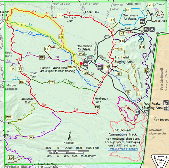
You can find a larger map on the park
website.
I did the loop part of this hike clockwise. I took two short
campground spur trails west to Granite Trail (GR), walked northwest on
Granite and Delsie (DL) to Pemberton Trail (PB), north and east to
Lariat Trail (LR), south on Lariat, and back to our campsite on Granite
and the campground spur trails.
Starting and ending at our campsite in the south camping loop in the
park, my GPS recorded 8.69 miles. For folks driving in from
outside the park and starting somewhere else, the distance may be longer.
The photos are generally in the order I hiked this loop and the
out-and-back section.
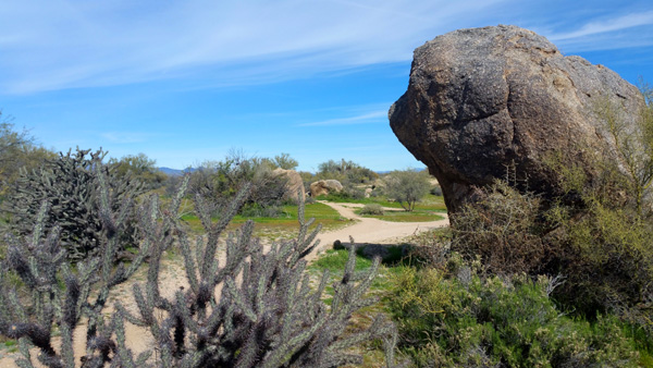
GRANITE TO DELSIE
I took two relatively short, smooth campground spur
trails about a quarter mile from our campsite, then followed the
equally-smooth Granite Trail a little over a mile to its intersection
with the Delsie Trail.
Going westbound from most places in this park is a
gradual uphill. There were no steep ups or downs on today's hike, and it
was a beautiful sunny day with some interesting clouds that you can see
in the photos. Temps were in the low to mid-60s F. while I
was hiking = quite pleasant.
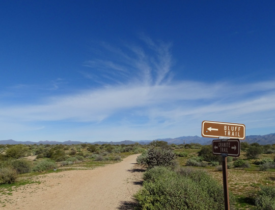
I didn't hike on the Bluff Trail
in today's loop.
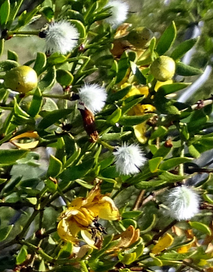
Creosote bush with blooms in
various stages
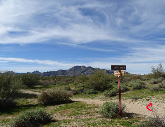
Southeast end of the Delsie
Trail
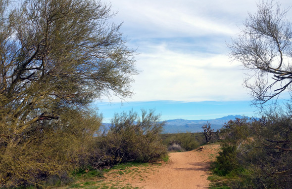
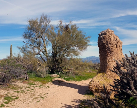
DELSIE TO PEMBERTON
I was excited to be hiking a trail that was new to me! As noted
earlier, Delsie and Lariat have been constructed since we were here
eight years ago and running, hiking, and cycling all over the park.
The Delsie Trail, which runs sort of parallel to Stoneman Wash, is 2.5 miles
of nice single-track between the Granite and Pemberton trails. It is 95% smooth and a
gradual uphill trek to the Pemberton Trail. It's a great trail for
cycling, running, or hiking.
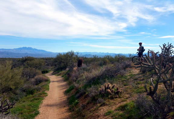
Because this was a gorgeous Saturday, mountain bikers were out in
droves. During my hike I stopped counting cyclists at 60. There were
more. Most were courteous and I could usually either see them coming
toward me or hear them crunching the sandy/gravely trails as they
approached from behind.
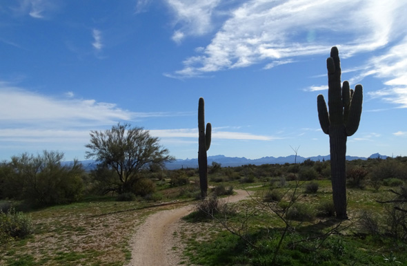
Two large saguaros guard the
trail.
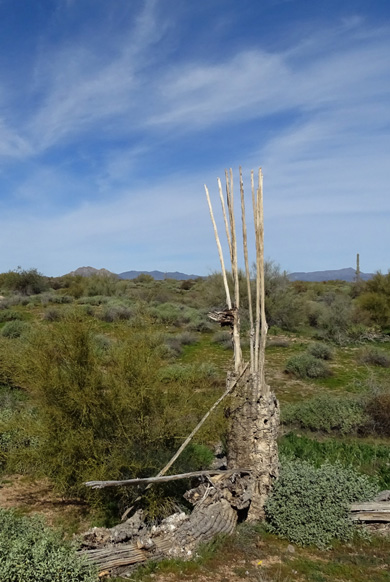
Dead saguaro, possibly from the
big fire in the park years ago

Looking back at some cyclists who
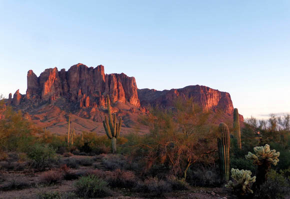
passed me; Four Peaks in the distance, left
The vegetation got thicker the
closer I got to the Pemberton Trail. Note all the
very green grass in these photos;
the park has gotten a fair amount of rain this winter.
JACKASS JUNCTION
That's the popular name of the intersection of the Pemberton and
Delsie Trails. It's also the location of Granite Tank, a low watering
hole that's been there a long time. It's on the other side of the trail
in the next picture (not visible from this vantage point).
As I approached the intersection from a distance I could see a figure
sitting high up on a wooden canopy. What the . . .??
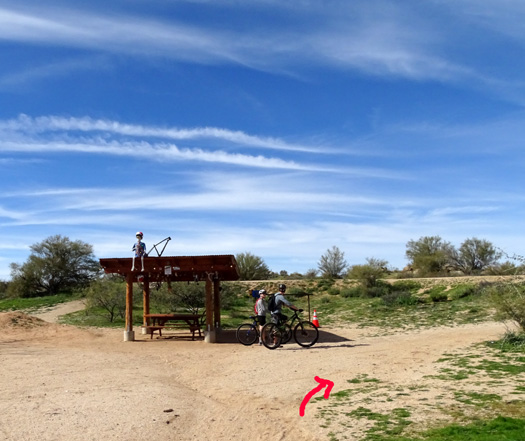
When I was closer I could see it was a plastic skeleton decked out in
cycling clothes and helmet!
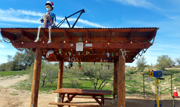
Although I've been at this point on the Pemberton Trail numerous
times in the past, this scene was new to me -- the wooden canopy with a
picnic table under it, all the cycling/running/hiking paraphernalia
dangling from the ceiling, the useful tire pump and other equipment
nearby.
There's even a mailbox for notes to friends, a la "tree mail" on the
Appalachian Trail, and this sign that explains the name of the junction
and who built the shade structure:
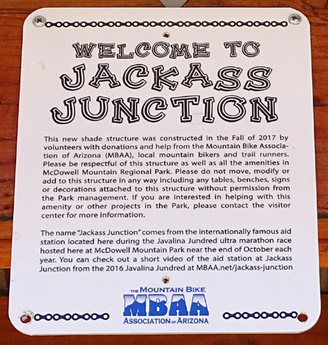
What fun!! I love trail humor.
I spent about 15 minutes there talking with cyclists and other hikers,
texting a photo to Jim, and eating a Clif bar before heading out again.
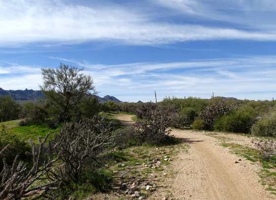
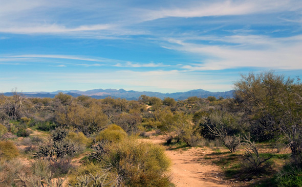
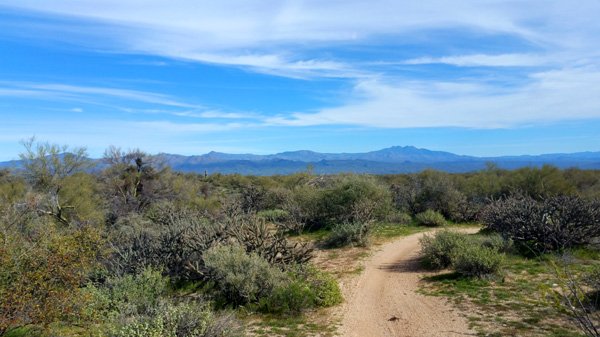
PEMBERTON TO LARIAT
The 2.5-mile section of the Pemberton Trail between its
intersections with the Delsie and Lariat trails curves around the
northwest corner of McDowell Mountain Park and drops gradually in
elevation as you're going clockwise on this loop.
This section is mostly smooth single-track that is
easier to negotiate (especially on a bike) than some other parts of the
Pemberton Trail on the western side of the park that are rockier and
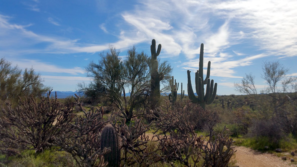
have steeper slopes. It is high enough to afford expansive panoramic
views of the desert and surrounding mountain ranges.
There is a section through some large boulders that I
like:
This looks a lot like Stoneman Wash but is a different
one:

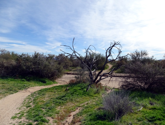
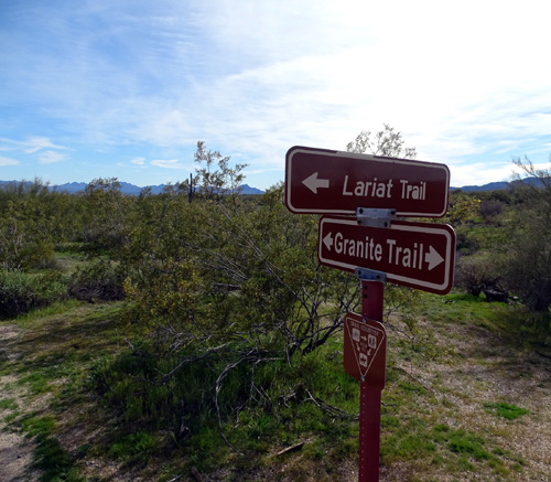
LARIAT TO FINISH
Lariat is single-track and runs mostly south between the
northern part of the Pemberton Loop (near the 150th Street Spur) to
Granite Trail, ending a little below the intersection with Delsie Trail.
This was the second trail I hiked today that was new to
me and I loved it as much as Delsie. It's even more smooth, a really
fast ride or run gradually downhill in the direction I was hiking.
Several cyclists came up from behind me pretty fast but I could hear
them in time to move aside. Made me wish even more that we'd brought our
bikes with us this trip!
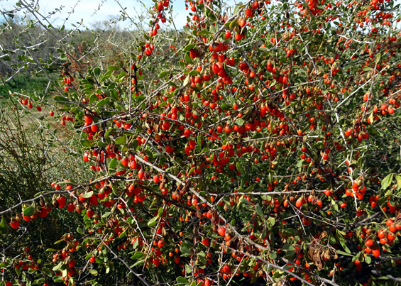
There were more red and orange berries on shrubs on this
trail than some others I've hiked this month, as well as a variety of
flowers in bloom:
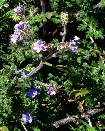
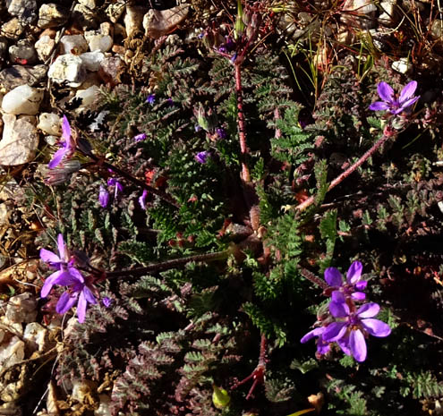
A type of Phacelia
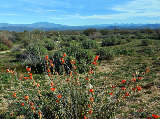
Orange globe mallow in bloom;
Four Peaks in the distance
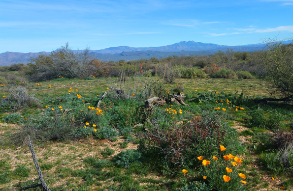
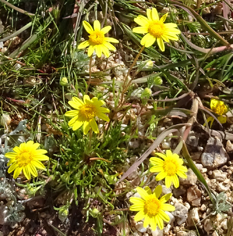
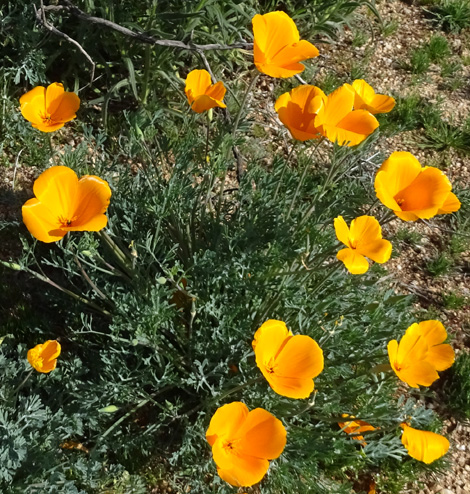
Above and below: lots of
poppies in bloom around the park this month
When I connected to Granite again I had about 1.4
miles to go before reaching our camper:
Filaree is listed as an invasive
plant in Arizona but it's pretty out in the desert.
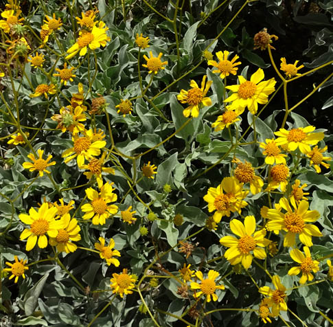
Brittlebush
Home!
Despite all the bikes I had to watch out for, I really enjoyed this hike.
I always like to explore trails that are new to me, the weather was perfect,
the scenery was great, lots of flowers were in bloom, and I saw interesting
colors of small rocks along the sides of the trails.
Next entry: 8.4-mile loop hike on the Bluff,
Pemberton, Delsie, and Granite trails
Happy trails,
Sue
"Runtrails & Company" - Sue Norwood, Jim O'Neil,
Casey-Girl, and Holly-Pup
Previous
Next
© 2019 Sue Norwood and Jim O'Neil