This is the first of three longer desert loop hikes I did solo while we were
camped in the park in January.
Why solo? Well, neither of our Labs is trained for 8+ mile hikes right now and
Jim is still resting up from his 100-mile walk at Across the Years in
late December. However, each day we walked the dogs two or three miles
in the campground and on nearby trails, so no one was slacking off!
I thoroughly enjoyed all three hikes and took lots of photos of
distant mountains, old saguaro cacti, pretty flowers, colorful rocks and
berries, and whatever else caught my eye. That's harder to do when
I'm hiking with another person or dog.
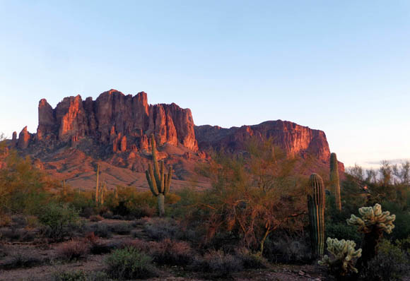
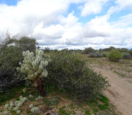
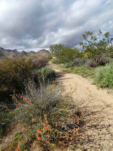
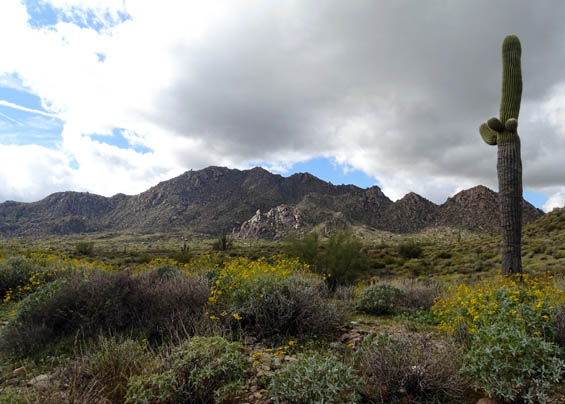
Bright brittlebush in bloom along
the Pemberton Trail
The weather was perfect all three times, too -- sunny and 60s
F. Not bad for January, eh??
TODAY'S ROUTE
The trails in this loop in the middle of the park are all
ones that I've run or hiked previously but I haven't done this particular
loop for seven or eight years. It measured 8.4 miles
long today from our campsite and back. It would be longer from the other
campground loop or from one of the parking areas at McDowell if you
aren't staying in the campground.
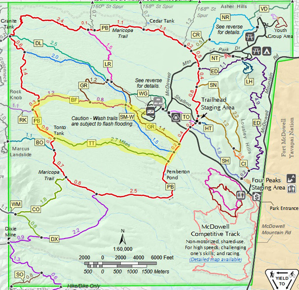
Here's the
park trail map with this loop
highlighted in yellow. Click the link for a larger map.
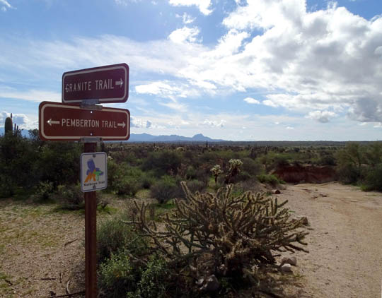
Today I went clockwise:
southeast on the Granite Trail (GR) to Pemberton (PB), south across Stoneman Wash
(SM-W) to Tonto Tank (TT), west to Pemberton (PB), north to Bluff (BF), and
back east on Bluff to the campground.
All these trails are fairly smooth packed sand except Pemberton,
which has a few more rocks and ruts. Elevations varied from about 1,800
to 2,400 feet, mostly with gradual climbs and descents.
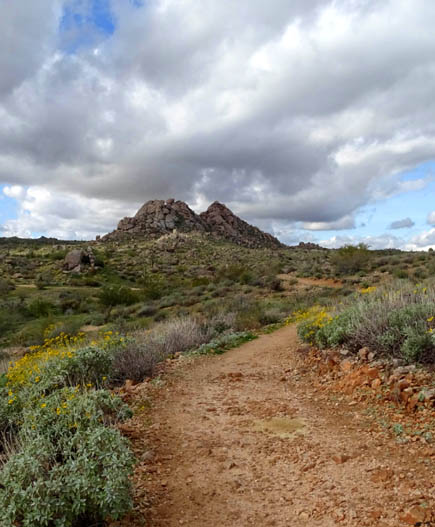
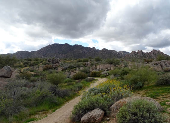
Near the top of one of the climbs
on the Pemberton Trail near Rock Knob
Both Pemberton and Bluff are popular with cyclists, especially Bluff
in the downhill (eastbound) direction. Years ago I rode Bluff on my
cyclo-cross bike and loved it.
Today I saw only eight cyclists, all riding singly, and just two
other hikers while I was hiking between 11AM to 2PM. There are a lot
more cyclists, hikers, runners, and equestrians using these trails on
winter weekends when the weather is nice.
In this entry I'll show photos from each of these trails, mostly in order as I
hiked CW around the loop.
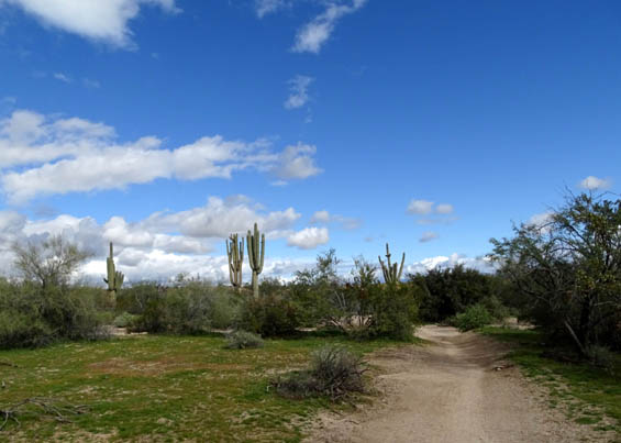
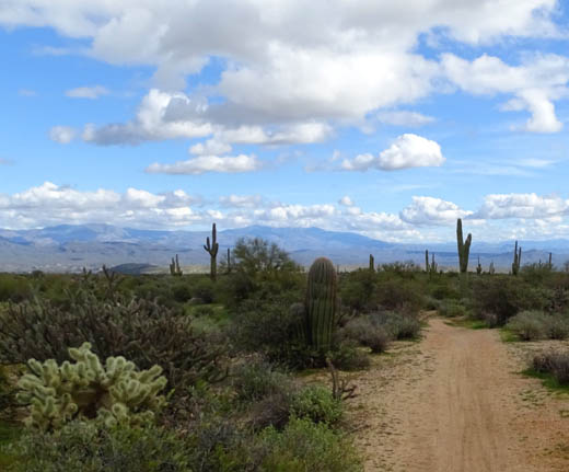
GRANITE TO PEMBERTON
It was about 1.5 miles from our campsite going
gradually downhill on the Granite Trail to its eastern terminus at the
Pemberton Trail. This trail is moderately wide and pretty smooth.
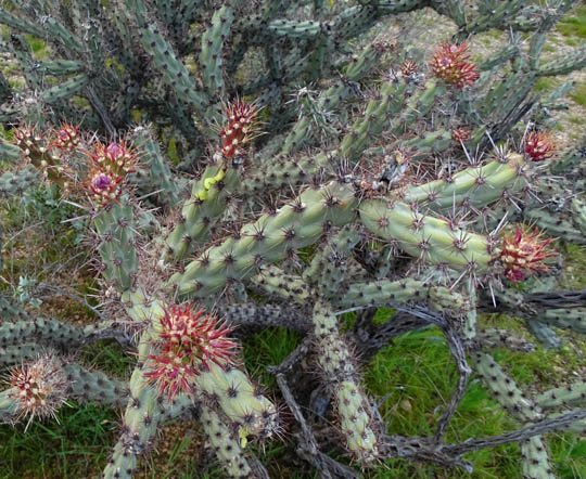
Teddy bear AKA "jumping" cholla
on the left, so-called because those little pieces
fall to the ground and get blown
around by the wind; the barbs are very sharp!
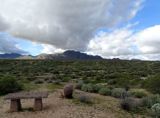
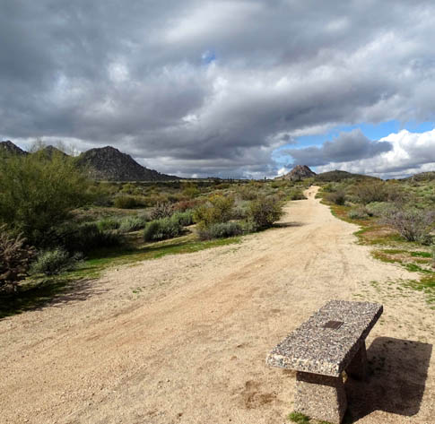
Bench with a view over Stoneman
Wash and toward the McDowell Mountains;
an interpretive panel out of view
explains the historical significance of this wash.
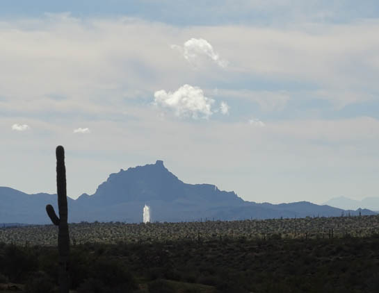
During this hike I could see the large fountain in the
town of Fountain Hills four different times that it was turned on. It
runs for about 15 minutes at the top of each hour. Although it is about
10 miles from the farthest point on the loop I hiked today, it is
visible from many locations in McDowell Mountain Regional Park.
The next photo of the fountain is from the Granite
Trail, the first time I saw it while hiking today. I used the zoom on my lens so it
shows more clearly:
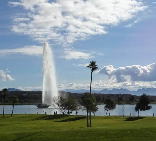
The next picture shows what the fountain looked like up close when we
took the dogs into town this morning to play at the nearby dog park.
It's about 260 feet tall here, not as high as it can go when
all the pumps are running on special occasions:
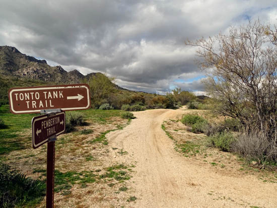
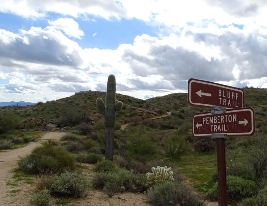
Before long I was at the end of the Granite Trail and
turned right on the Pemberton Trail, which loops through the park for
15.3 miles.
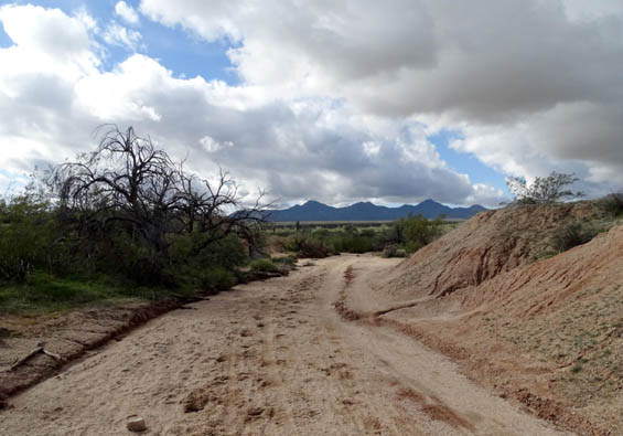
PEMBERTON TO TONTO TANK
I was on this eastern section of the Pemberton Trail for just 4/10ths of
a mile before reaching the Tonto Tank Trail.
This part of the Pemberton Trail has some loose sand because it crosses Stoneman
Wash and is located at the low end of the park's extensive natural drainage system.
The trail through here is fairly wide and had ruts in it today from recent rains.
It's also popular with equestrians, so I saw lots of hoof prints.
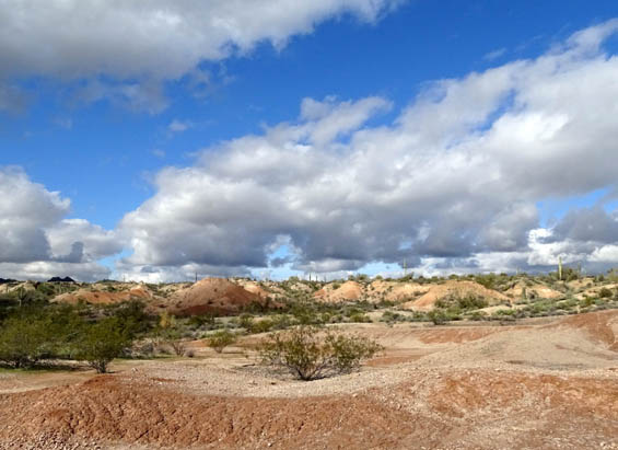
This is the only place in the
park I've ever seen mounds this shape and color,
almost like mine tailings.
Halfway through this short section of Pemberton Trail I
crossed Stoneman Wash, which also is a horse trail. You can hike on it
but it has deep sand that is hard to negotiate on foot:
Part of the wide Stoneman Wash
Trail; these old saguaros survived a fire that destroyed
lots of vegetation in the center
of the park (including part of the campground) several years ago.
When I reached the Tonto Tank Trail, I turned right
again and walked west toward the other side of the Pemberton Trail loop.
TONTO TANK TO PEMBERTON
Tonto Tank runs 2.7 miles, bisecting the southern part of the
Pemberton Trail loop (see map above). It's an easy, gradual uphill hike or
bike/horse ride going westbound as I did today and very fast on
a bike going downhill.
This trail is relatively smooth and more narrow than either Granite
or Pemberton. Not to worry; most days there aren't many people
using it.
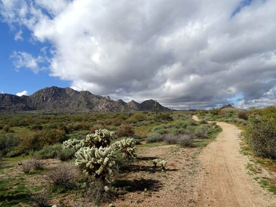
View SW toward the McDowell
Mountains; teddy bear cholla in foreground
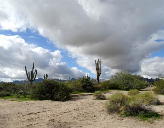
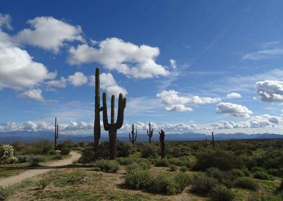
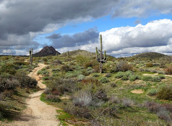
Above and below: A few
desert sentinels (saguaro cacti) guard the trail.
Orange globe mallow blooming in the
foreground, yellow creosote farther ahead
At the western end of Tonto Tank
Trail
PEMBERTON TO BLUFF
OK, we're back to the Pemberton Trail again.
As noted earlier, this 15.3-mile long trail forms a loop
through the middle of McDowell Mountain Regional Park. I've run and
hiked on all of it several times in the past but today the section I
hiked on the eastern side of the loop was just 4/10ths of a mile, and on
the western side about one mile.
I love this trail because the terrain is so varied -- smooth
and sandy here, rocky there; narrow here, wide there; flat
here, hilly there. The views and vegetation are also varied. This
one-mile section offered all of the above.
You won't get bored on any long segment of the Pemberton Trail. Here
are a few more pictures from this segment (I already showed two at the
beginning of this entry):
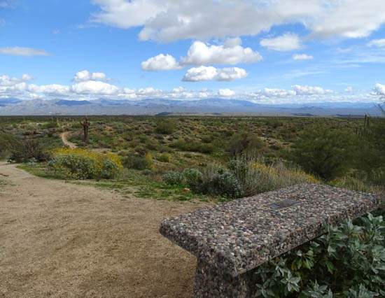
A bench dedicated to Geri
Kilgariff is located near the Tonto-Pemberton intersection. She is
an ultrarunner we know who
founded the Javelina 100-mile trail race that is run in the park.

Above and below: lots of
brittlebush in bloom on this segment today
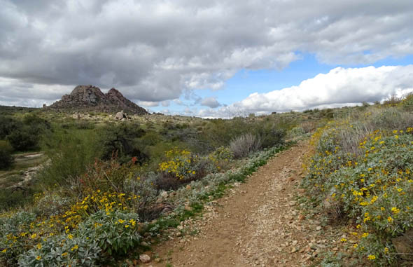
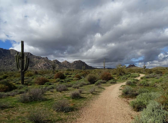
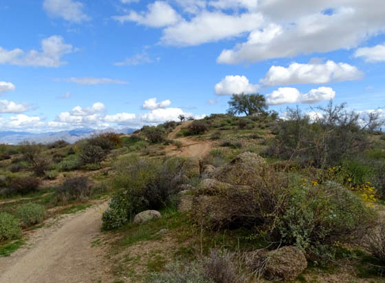
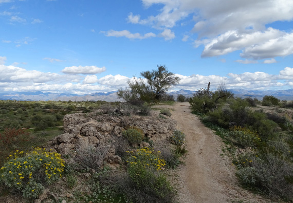
Going up a hill toward Rock Knob
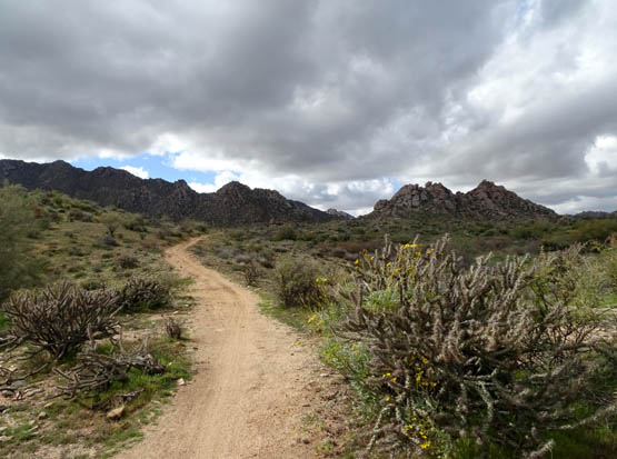
Looking back at Rock Knob and the
McDowell Mountains
Looking back (south) at the hill
I just came down on the Pemberton Trail
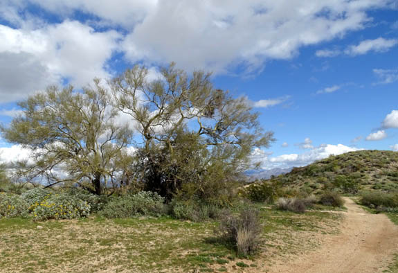
BLUFF TO GRANITE
Now we're on the home
stretch. Bluff is one of my favorite trails in the park because it's on a scenic ridge
and the views are great -- down into Stoneman Wash and small canyons, as
well as panoramas out across the desert to the various mountain ranges
surrounding the park.
This two-mile-long, smooth, easy trail
often undulates and curves around, making it particularly fun on a bike
in the downhill direction.
That's both a promise to cyclists . . . and a warning to hikers
and runners! I've been all three. I'm especially careful hiking in
either direction on this trail when I've got a dog with me because
cyclists love it and some go quite fast over and around blind spots.
Going eastbound from the
Pemberton Trail intersection is a short uphill (above) to a knoll
with a great view and a
bench (below); the remainder of the trail is mostly downhill.
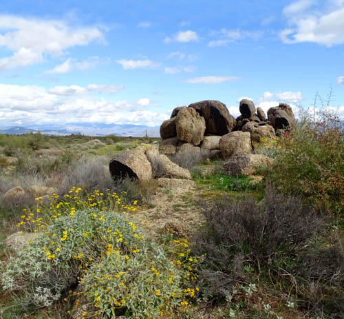
Above and below: The trail
winds through a section of boulders.
Good views in this direction to
the Four Peaks Wilderness
Another type of cholla cactus
Stoneman Wash is 25-30 feet below
the rim on the left (north).
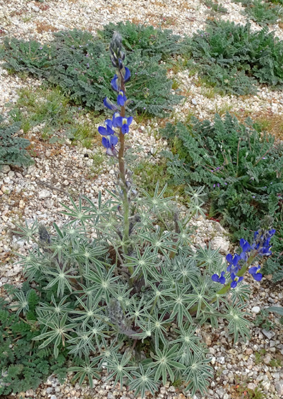
Some blue columbines were in
bloom along this trail (and in the campground).
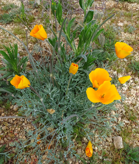
I saw bright golden poppies on
this and several other trails, too.
The Bluff Trail ends at the Granite Trail a little west
of the campground loops.
I took Granite and two campground spur trails about half
a mile further to get back home:
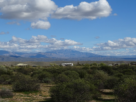
Our Cameo is in the center of the
picture.
That was a fun hike that took me almost three hours with
all the photos I took. But the next two loop hikes that included a
couple trails that are new to me were even more interesting . . .
Next entry: 8.7-mile loop hike
incorporating the Granite, Delsie, Pemberton, and Lariat trails
Happy trails,
Sue
"Runtrails & Company" - Sue Norwood, Jim O'Neil,
Casey-Girl, and Holly-Pup
Previous
Next
© 2019 Sue Norwood and Jim O'Neil