We came back to McDowell Mountain Regional Park for two weeks (January
13-27) and were able -- several months ago -- to reserve the same campsite we
had in
December.
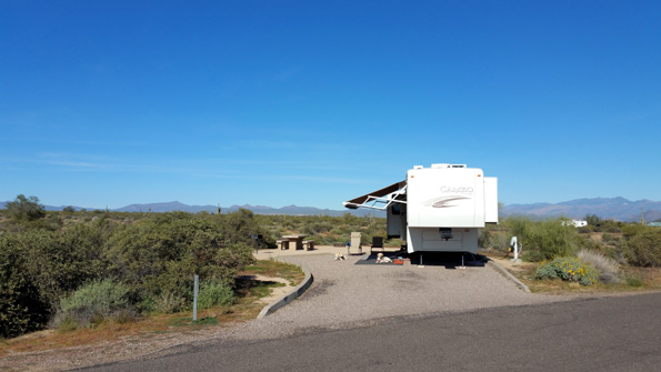
Our site on the outside of the south loop is large
enough for our 36-foot 5th-wheel coach and truck. It is located at the high
end of the campground so we have fabulous views, is close to trails, has
lots of room to walk the dogs behind the camper, and has more privacy
than most other sites.
It's our favorite campsite in the park
and was worth the extra effort we took to reserve it.
This entry is kind of a catch-all that covers the whole two weeks we
were here. It includes the drive from Nellis AFB in N. Las Vegas to the
far eastern metro Phoenix area, scenes like sunrises/sunsets from the
campground, and a hike
on Scenic Trail.
All the trails at McDowell are scenic,
but this one has that name.
Subsequent entries will cover three long loop hikes I did on other
trails in the park. Two of them have been built since we were here
several years ago so it was fun to see what they were like.
NELLIS AFB TO MCDOWELL MTN. PARK
We took pretty much the same hilly route through metro Las Vegas,
past Hoover Dam,
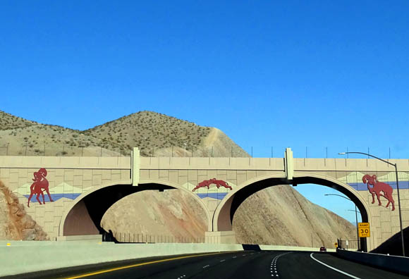
Freeway art (above) and glimpse
of Lake Mead (below) as we approached Hoover Dam
and southeast through Arizona on US 93 and US 60 that we did when we
drove to Vegas at the end of December.
We left from the Phoenix suburb of Goodyear that time, however. This
time we drove around the northern part of metro Phoenix to reach
McDowell Mountain Regional Park east of the city. Total distance was 333 miles.
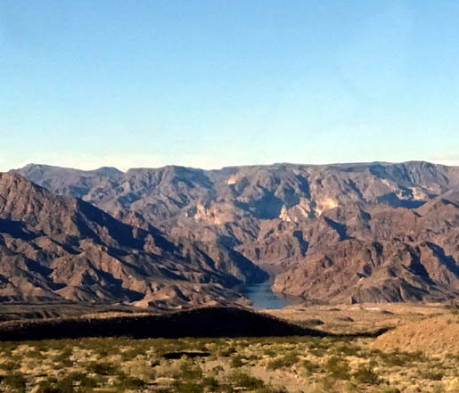
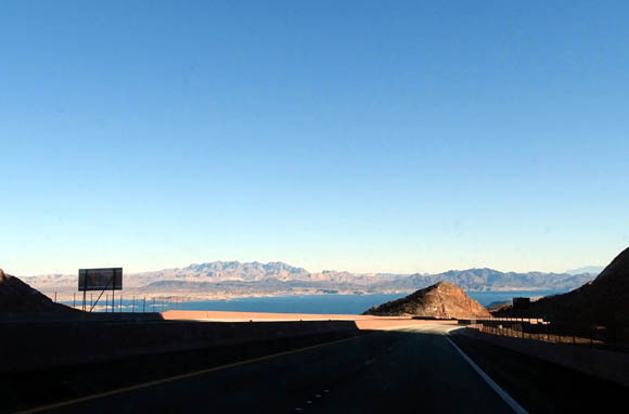
Quick glimpse of the Colorado River south of Hoover
Dam;
surrounding land is part of the Lake Mead National
Recreation Area.
Between Wickenburg and Kingman there is an interesting stretch of
hilly terrain with lots of Joshua trees; another section
has numerous saguaro cacti. This route doesn't have a rainbow of rock colors
or many unusual rock formations but it does have plenty of hills and mountains.
The weather was good and traffic was moderate on the Sunday we
traveled; Jim was able to maintain an average speed of about 62 MPH
with the Cameo on the two- and four-lane roads where they weren't bumpy.
We stopped twice in 6+ hours for all of us to stretch and potty.
MISCELLANEOUS SCENES FROM MCDOWELL MOUNTAIN PARK
When we arrived at McDowell Mountain Park we were able to check into
our campsite right at the gate, not at the visitor center like we always
have previously. It must be their procedure on Sundays now. It was fast and efficient
and we were happy to be back.
It didn't take long to get parked
and settled in. Soon we were out walking the dogs.
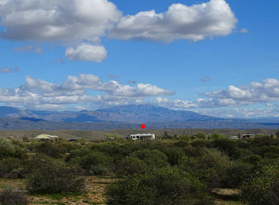
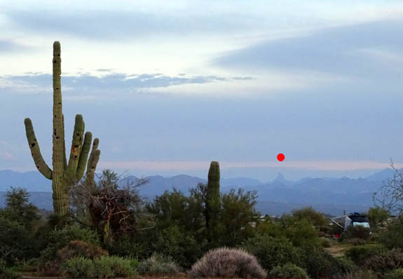
From the angle I shot this picture, our camper (under the red dot) is
"in front of" the Four Peaks, which are often under clouds because
they're the highest mountains in that range:
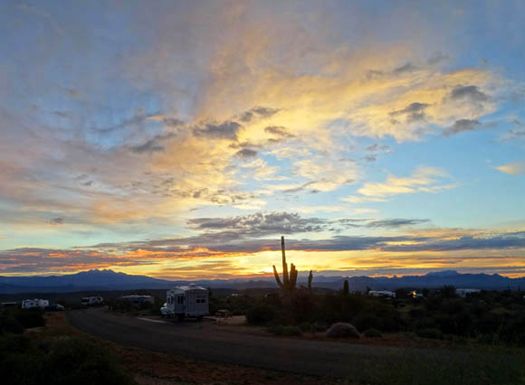
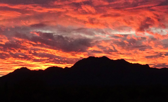
That evening I took the next two pictures from the back
of our campsite as the sun -- setting in the other direction
-- colored the Four Peaks Wilderness, the sky, and the clouds to the
east:
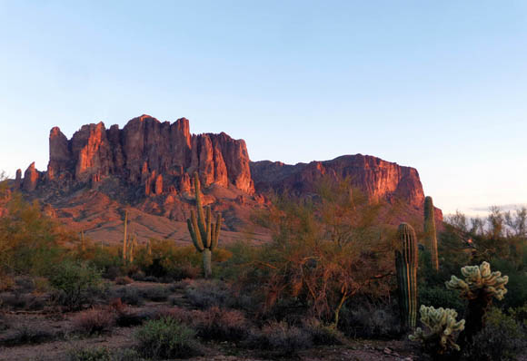
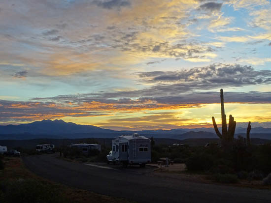
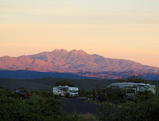
In addition to the iconic Four Peaks that are depicted on the Arizona
license tag, we can also see Weaver's Needle to the south from our
campsite (under red dot in next picture):
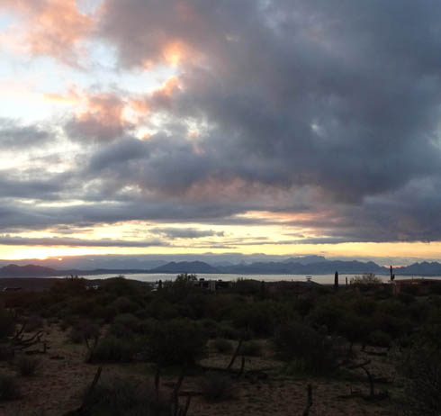
While I'm at it, I'll include a few more sunrise and sunset photos I
took from our campsite this visit. Some were subtle, some quite dramatic.
Here's a pretty golden sunrise facing Four Peaks to the east:
Another morning the fog was so dense in the valleys
below the park that it looked like we were on an island, surrounded by large lakes:
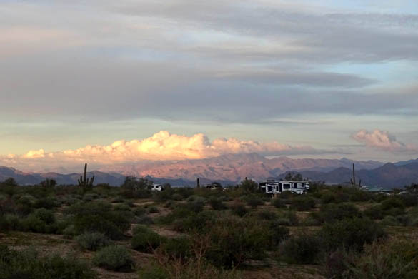
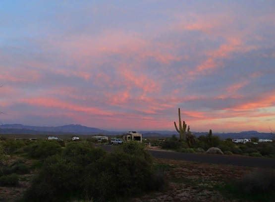
Sunsets were easier to photograph, although they often
interfered with supper preparation (supper was sometimes
delayed!):
Above and two below: Four
Peaks to the east; note the full moon
Weaver's Needle to the south
(pointed peak in the yellow)
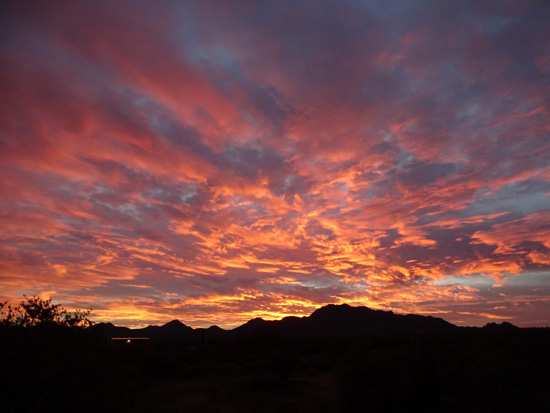
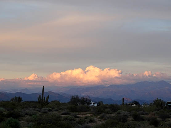
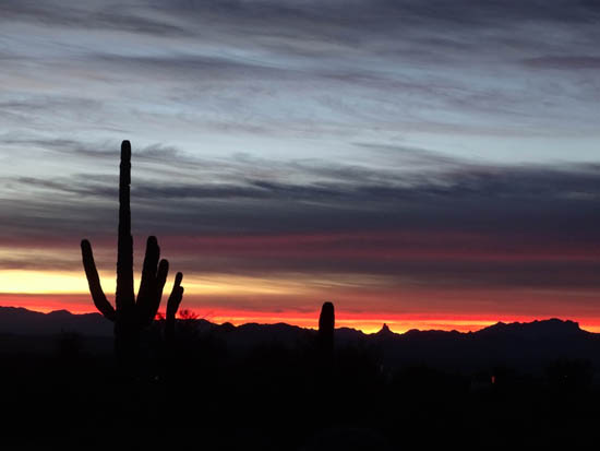
Above and below: a
"fire-in-the-sky" sunset over the McDowell Mountains to the west
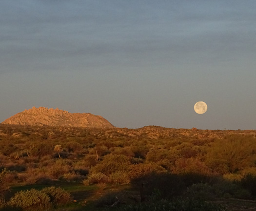
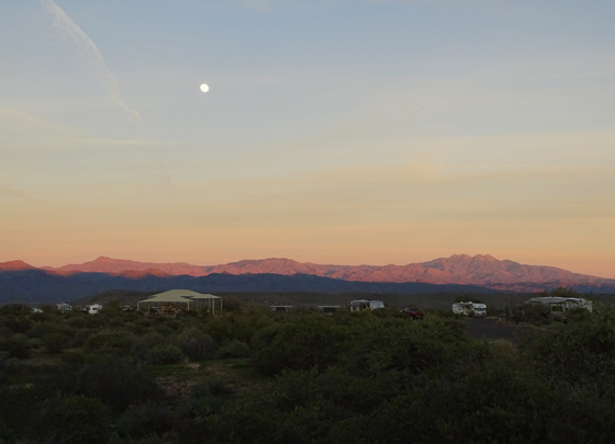
Full moon rising to the north
late one afternoon
See why we like this campsite?? All those sunrise and sunset shots were taken at
some point on or in front of our site. The panoramic views are great.
HIKING THE SCENIC TRAIL
On our first full day during this second 2018-9 stay at McDowell Mountain Park
we took the dogs on one of my favorite trail loops in the park, aptly called the
Scenic Trail.
McDowell Mountain Park has numerous trails. We've run and hiked on almost all of them
in our previous visits to the park. Several more have been built in more recent
years and are new to us. All the current trails are shown on this
park map (look at it online to
see it larger than here):
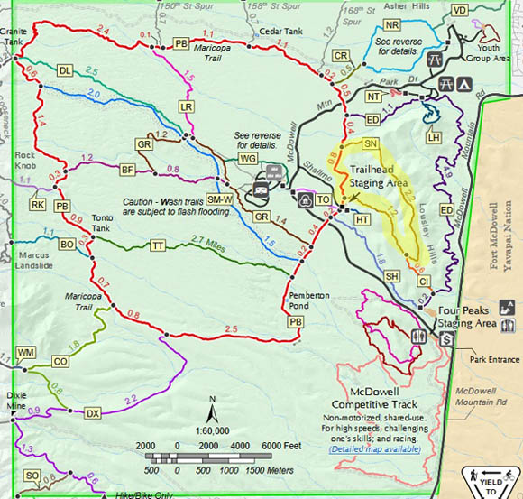
The 4.5-mile long Scenic Trail loop -- designated "SN" on the maps
and trails descriptions -- is shown at the upper right
of the map; I highlighted it in yellow.
This loop begins and ends on the Pemberton Trail at the large Trailhead Staging Area,
which has ramadas and plenty of parking space on winter weekdays:
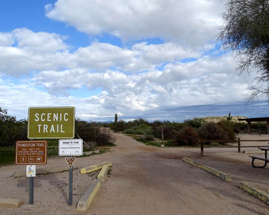
Pemberton Trail(head) at main staging area;
start here to access the Scenic Trail loop.
The staging area gets full on weekends, especially if there are several horse
trailers parked. Scenic, Pemberton, and other nearby trails are multi-use and open
to cyclists and equestrians, as well as runners and hikers. As far as I can tell
dogs are allowed on all the trails in the park.
Trail users can go in either direction on the Scenic Trail loop.
Over the years I've gone both directions but usually go CCW.
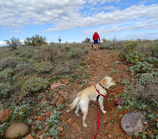
Whichever way you go, you have to start on the Pemberton Trail:
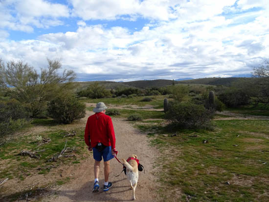
Jim led with Casey, who carried water for
both dogs in her hiking pack.
This time we went CCW with both dogs. In that direction we turned right onto the
Scenic Trail a short distance from the parking area. These photos are in
order going CCW.
Most of the loop is fairly smooth, hard-packed sand.
The lower part of Scenic Trail is through a wash with some looser sand. There are
more rocks up on the ridge. I carried a trekking pole but really didn't need it.
I couldn't remember how rocky it was since I hadn't hiked this trail for
seven or eight years.
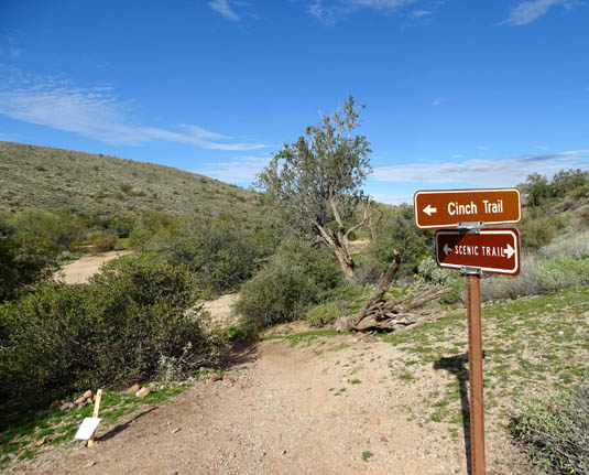
Part way through the wash the Scenic Trail
intersects with the Cinch Trail.
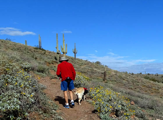
Climbing up the other side of the hill
About two miles of the loop are along a ridge, with good views
in all directions:
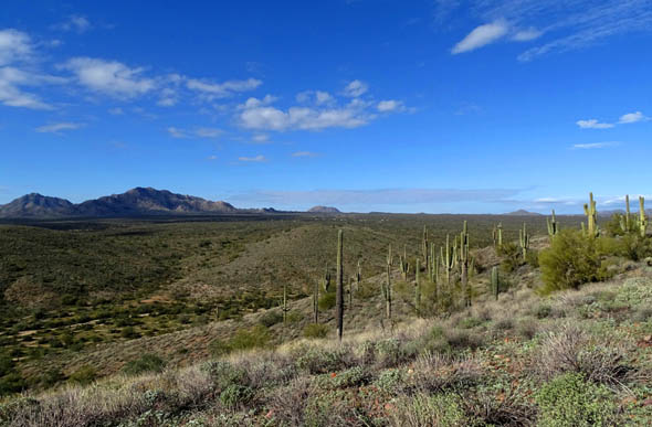
View NW to the campground and the McDowell
Mountains; there is a nice stand of saguaro cacti on the hill.
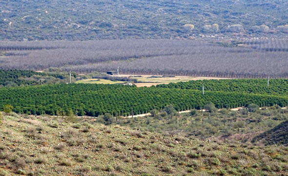
View south to orchards, some green and some
without leaves during the winter
Good girl! Holly waits patiently while I take her picture.
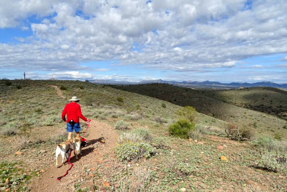
The ridge is rolling, with views in every
direction.
The Scenic Trail loop is a moderately easy hike or mountain bike ride with some elevation gain and a distance
of 4.5 miles.
The park has trails ranging from short, flat, and easy to long, hilly, and rough footing.
The next three loops I'll describe in subsequent entries were longer and more
difficult than Scenic Trail.
Next entry:
hiking the Granite-Pemberton-Tonto Tank-Bluff trail loop (8.4 miles)
Happy trails,
Sue
"Runtrails & Company" - Sue Norwood, Jim O'Neil,
Casey-Girl, and Holly-Pup
Previous
Next
© 2019 Sue Norwood and Jim O'Neil