That's often been the case on our previous RV trips when we had such a
great time, we really didn't want to go back to a sticks 'n bricks
house. We RV'd so much for thirteen years that the Cameo felt like our
"real" home and going back to our house in Virginia just meant a lot of work
like weeding!By the end of this two-month trip, however, I think Jim and I
talked more and more, not less and less, as we approached our house in Peachtree City
because we realized our enjoyment of RVing was seriously waning.
We had some important decisions to make about whether or how we'd
continue this lifestyle, and we played devil's advocate a lot with each
other between Arizona and Georgia, weighing pros and cons.
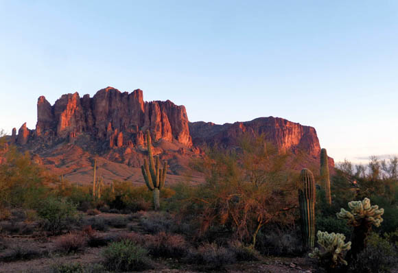
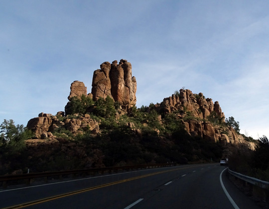
US 60 looking east to the Pinal Mountains
I'll write more about all that in the next entry. This one will focus
on the 2,048-mile drive back home and another short visit to Brazos Bend
State Park to break up the distance.
THE JOURNEY BACK HOME
After living in our comfy little house in Peachtree City for nineteen
months before taking another extended RV trip, our current house really does
feel like our home. The Cameo did not feel like home this time. So we
were both happy to be "going home."
That didn't make the trip from Arizona to Georgia any shorter or
faster, however. It's never as fast -- or shouldn't be! --
or easy hauling a 36-foot 5th-wheel as just driving a passenger vehicle.
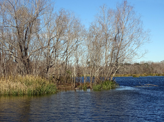
The pictures in this section are all from Arizona. One indication of
how tripped-out I was is that I didn't even take any other photos
along the way except at Brazos Bend. That's gotta be a first! I'm
always taking pictures.
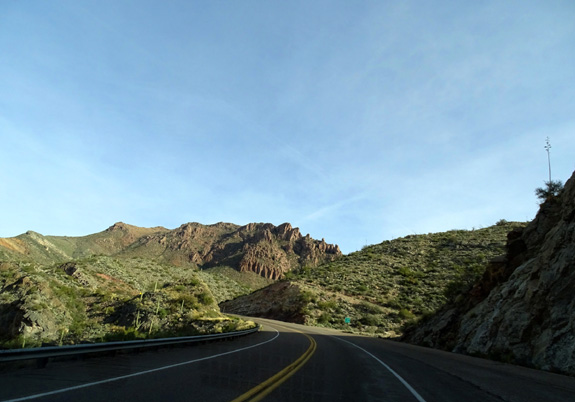
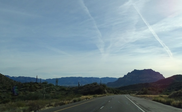
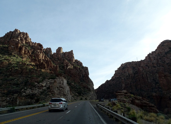
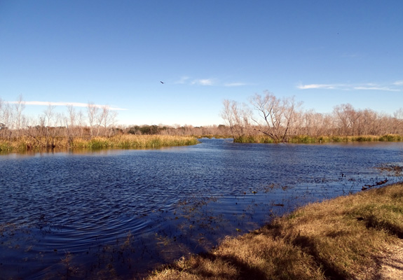
Above and below: ascending
into the Pinal Mountains east of Globe, AZ
The good things about the drive home: the weather was good,
the scenery in Arizona was interesting, traffic wasn't too heavy except
in cities near morning rush hour, we didn't get into an accident
(although we saw a few nasty ones), we had no vehicle problems, and we
got home safely after five days driving and one rest day in the middle.
The bad things: I-10 simply sucks in eastern Texas and western
Louisiana because of all the bumps, we had some long days on the road
and got real tired of driving even with a rest break in the middle, we
had some navigational errors getting to Brazos Bend from the west, and
we were concerned about the truck transmission due to problems we'd had
in Arizona.
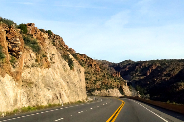
Above and below: More
scenes along Rt. 60 east of Globe, AZ
Our route was pretty simple:
- McDowell Mountain Regional Park east of Phoenix to US 60.
- East on US 60 through the
mountains of Tonto National Forest to Globe, AZ.
- Southeast on US 70 to Lordsburg, NM. East on I-10 though NM and
most of TX.
- Divert south of Houston to Brazos Bend SP, then back up to I-10
after a day's break.
- Take I-12 bypass north of New Orleans, then I-10 through the rest
of LA and MS.
- North on I-65 at Mobile, AL.
- North on I-85 at Montgomery, AL. East on Rt. 74 at Newnan, GA to
Peachtree City and home.
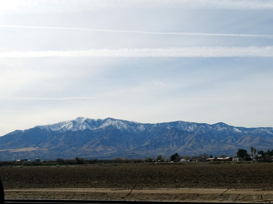
Snow on 10,720-foot Mt. Graham near Safford, AZ
Overnight stops: Walmarts at Las Cruces, NM; Kerrville,
TX; and Saraland, AL just north of Mobile. Two nights at Brazos Bend State Park the
3rd and 4th nights in TX.
Distances per day ranged from 179 to 534 miles during the five days
we were on the road. The two long days with over 500 miles were easier
since we weren't driving separate vehicles like we did for three years recently when we
were full-time RVing. Those years Jim hauled the Cameo with the
truck and I followed behind in the Odyssey minivan.
We still got very
tired of driving/riding out and back on this trip, however, one of the
indications that maybe it's time to stop RVing for a while. Or forever.
BRAZOS BEND STATE PARK, TAKE #2
When we visited
Brazos Bend in December
on our way out to Arizona we paid for an annual Texas state park pass, which
includes four half-price campground stays with a minimum two-night stay each time.
A pass also waives the daily entrance fees, which can really add up.
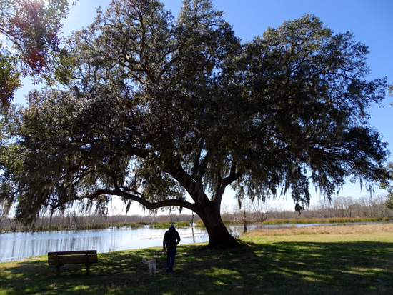
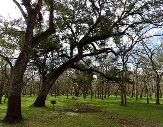
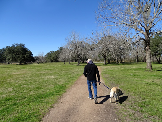
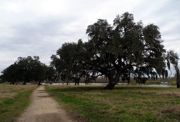
Jim walks Casey under a sprawling live oak tree at Elm Lake.
In two relatively short visits to the park during this trip we've
saved enough to more than pay for the cost of the pass.
We'll save even
more if we go back to the desert Southwest again next winter and stop at
a Texas state park along the way. It's a great deal for people who visit
the parks more frequently or stay for longer periods of time, like we did back in 2010 and 2011
when we camped at several parks around the state. It's a very nice --
and very large -- state park system.
Our campsite in the Burr Oak campground loop
was the regular fee of $25 for one night and $12.50 for the second
night. Sites in this loop are spacious and have 50-amp electricity and water, but no sewers.
Sites in the Buckeye loop are smaller, have 30-amp service + water
hookups, and cost
less.
We chose a different site this time that was larger than the one we
had in December and easier to back into because it's around a curve in the loop. It's
a more isolated site than some of the others, and no one was in the
adjacent sites the two weeknights we were there:
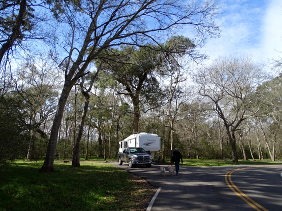
Jim walks the girls toward our
camper. Love this site!
The only downside of this site was a weaker WiFi and phone signal
from our Verizon Mobile connection than we've had in other sites we've
occupied previously in this loop.
Otherwise, we loved it. I mean, look at that picture! What's not to
like??
HIKING AT BRAZOS BEND
This was our fourth visit to Brazos Bend, and the shortest --
just two nights. Back in
early spring of 2010 and 2011 we stayed about two months each time as
campground hosts. We had plenty of time then to thoroughly explore the
park trails on foot and bike. Our
third visit
was a few days this past December when the river and some trails were flooded.
We arrived at the park before noon last Tuesday and left on Thursday
morning. That gave us one afternoon and another full day to hike and
relax.
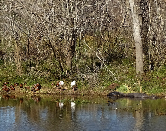
Because of the colder
temperatures last week, we saw many fewer alligators sunning on the banks
of the lakes this visit. I counted
only four the first afternoon, and none the second day.
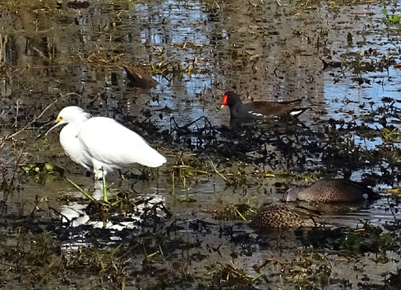
Above and below: There were
plenty of birds, though!
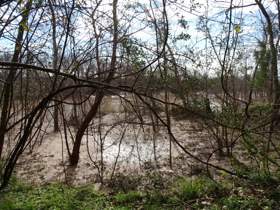
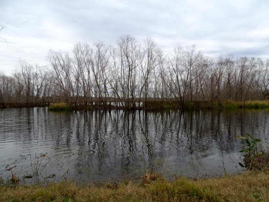
When we were here in mid-December the area had just gotten an
abundance of rain and the Brazos River was flooded. About half of the
trails in the park were closed due to mud, standing water, or being
completely under water. We've seen it wet here before, but nothing like that.
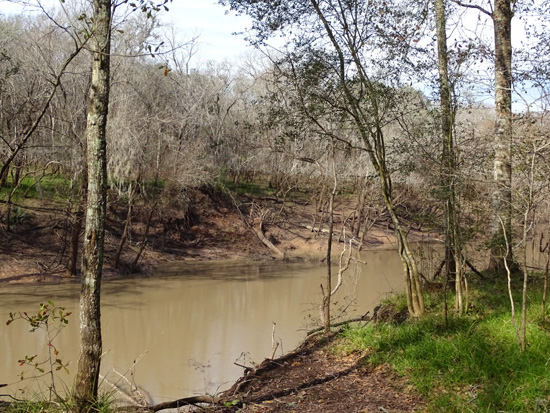
This time the water in the river and Big Creek was at more normal
levels but some of the trails were still marked closed to hiking, cycling, and
equestrian use and others remained muddy.
The water in the Brazos River
(above) and Big Creek (below) was about ten feet lower during this visit
than when we were here in
December. You can see plenty of mud in both of these photos.
Although the grass was more green this time than in December, more
flowers were in bloom, and it was mostly sunny, temperatures were well
below normal the days we were here -- highs just in the 40s and
low 50s F.
It was cooler than what we were used to at higher elevations and
latitudes in Arizona the last few weeks, and the alligators in the park
were reluctant to lie on the banks where they could be seen.
However, it was a whole lot better than other areas in the country
that were experiencing record-breaking frigid temperatures at the same
time. My brother had temps down to minus 10 F. and wind chill in the minus 30s F. near
Toledo, Ohio. My niece's family near Chicago had an actual temperature
of minus 33F. and wind chills even colder!!
When we heard that, we were quite happy with + 52 F. for a high
temperature near Houston!
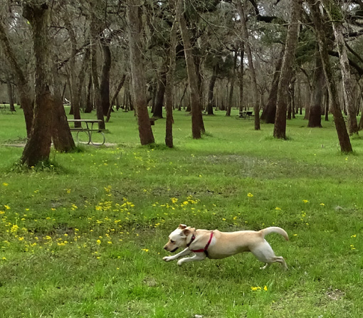
Above and below:
Holly was happy, too, when we let her and Casey
run free at the Lake Hale picnic area a
couple times.
In the day-and-a-half that we spent at Brazos Bend we did a fair
amount of hiking with the dogs on several trails -- around Elm
Lake twice (that's the best place to see the alligators and birds),
Spillway Trail and around 40-Acre Lake, around Hale Lake, and on the White
Oak and Buckeye Trails.
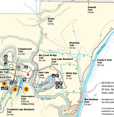
Here are two maps showing the trails at Brazos Bend. They are too
small to read on anything but a large-screen laptop or PC so here's the link to
trail map on the park's official website.
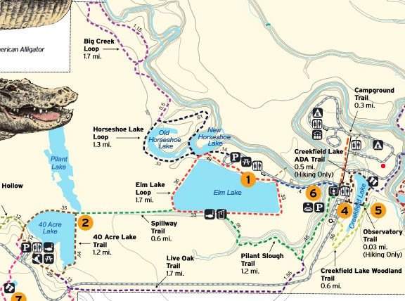
Left side of map above and right
side below; little red dot = our campsite this visit.
Following are some photos from these trails.
LAKE HALE AREA:
Lake Hale is one of several horseshoe-shaped lakes in the park that
were formed naturally when large loops in the meandering Big Creek got
closed off when the water decided to take a straighter path. As you
can see on the nearest map above, there are trails around the outside of
the U-shaped lake, as well as one in the middle.
Most of the trails near and around Lake Hale were closed in December
because they were flooded or too muddy, and the pier was closed because
the lowest level of the structure was under water:
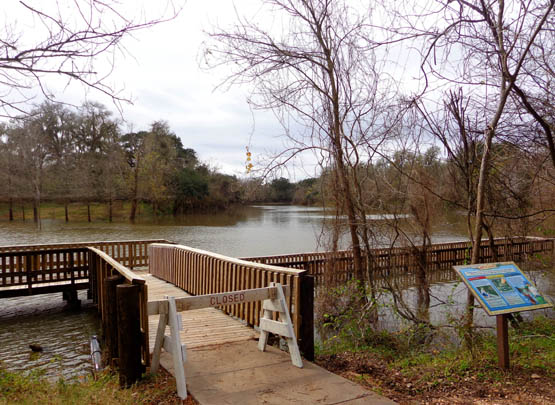
Flooded lake in mid-December
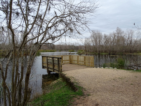
The pier and the trails around Lake Hale were open last week (next photo)
but some of the trail was still -- or again -- muddy:
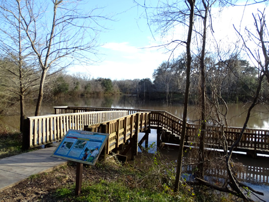
The lake level was still relatively high
last week but no longer
covering the lower part of the pier to the right.
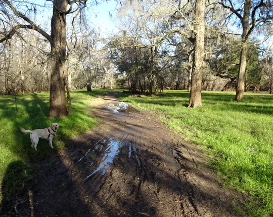
Holly-pup usually went right through the mud and puddles!
She needed a
bath when we got back to the camper.
Above and below: Other parts of the
trail were more dry.
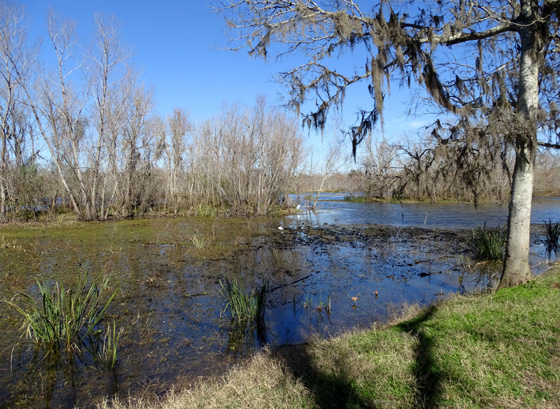
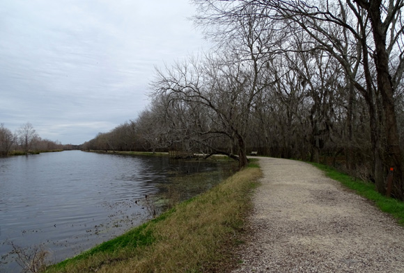
ELM LAKE
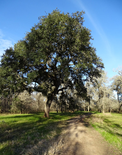
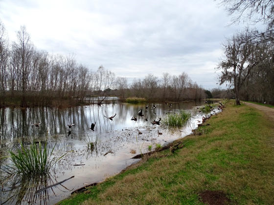
The two-mile loop around Elm Lake is my favorite place to walk at Brazos Bend
because of the beautiful scenery and all the birds and alligators that congregate there.
Jim and I took the dogs around the lake our first afternoon in the park last week.
That was the better day for photos because it was sunny but I didn't take very
many pictures -- I was trying to keep up with Jim.
The remaining pictures on this page are from the next day when I was walking
CCW around
the lake with Holly and could stop frequently for pictures. However, that day was
very cloudy so the photos don't include pretty blue sky and water.
It was also quite chilly that day -- only the low 50s F. for the high.
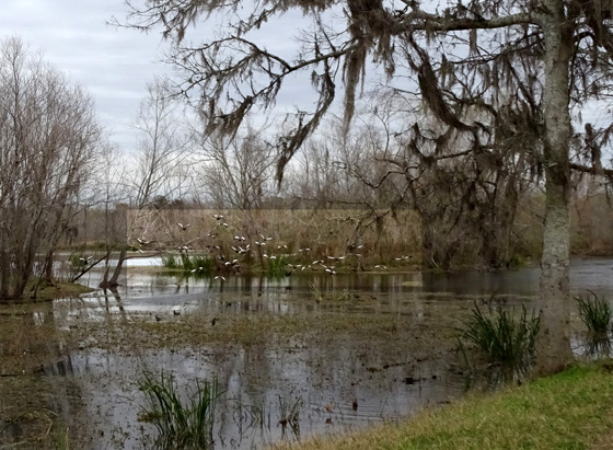
The 'gators were hunkered down in the water to keep warm but there were lots
of interesting birds to watch and photograph instead.
I'll show some of the birds here and add a second page featuring close-ups of them.
Path along the north side of the lake through
the Elm Lake picnic area
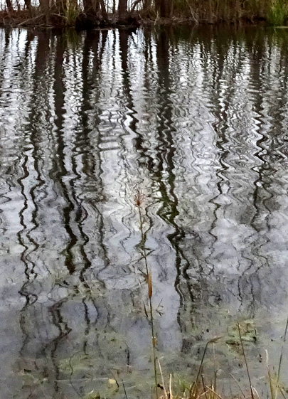
Above and below: reflections in the
water along the western side of the lake
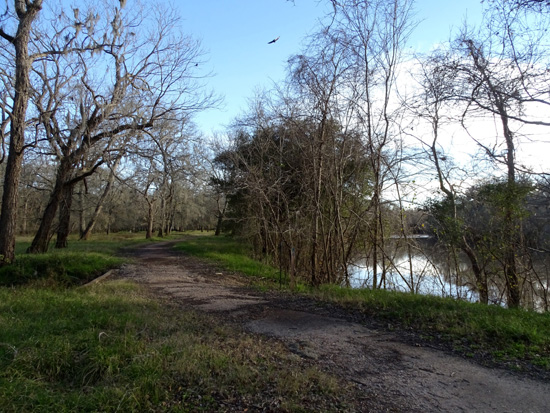
The next set of photos is along the southern shore of the lake,
where the most birds and alligators are usually to be found.
There are also several fishing piers on this side of the lake.
See the little red dot on the tree to the
right? Now focus on the dark tree trunks. There is a distinct
water line a few feet above the path that shows the
flood level in 2017 after Hurricane Matthew!!
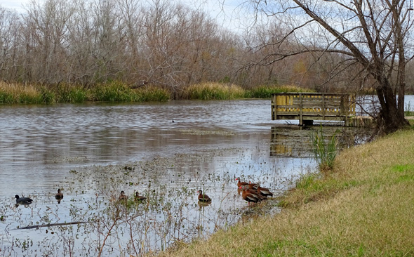
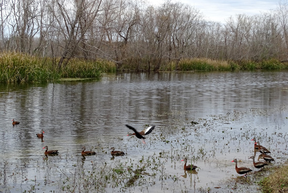
Above and below: The birds with the
reddish-orange beaks and black-white-brown bodies are
black-bellied whistling ducks. They usually
fly off when people approach and, yes, they whistle!
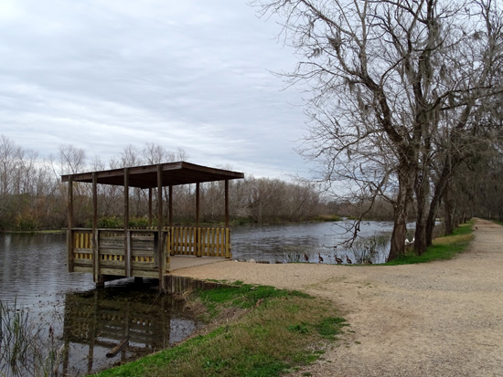
Above and below: two of the sheltered fishing
piers along the south side of Elm Lake
I highlighted the whistling ducks in the
center of the photo.
Path along the eastern side of the lake
Continued on the next page: scenes along the
Spillway Trail and 40 Acre Lake, plus close-ups of some of the
elegant birds at Brazos Bend
Happy trails,
Sue
"Runtrails & Company" - Sue Norwood, Jim O'Neil,
Casey-Girl, and Holly-Pup
Previous
Next
© 2019 Sue Norwood and Jim O'Neil