Oh great. Now I'll be humming that song the rest of the day!Well, it
took 20 months but Jim and I are back "on the road again" in our RV to
play snowbird for a couple of months in one of our favorite winter
hangouts, the desert Southwest. We'll see a few new places but mostly
return to old favorites that we haven't visited for several years.
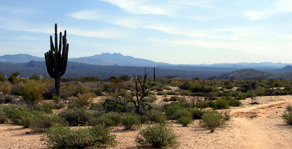
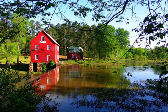
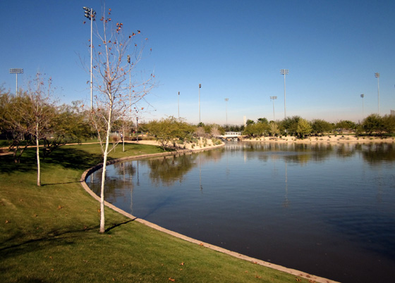
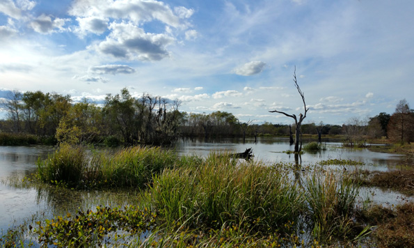
View of Arizona's iconic "Four
Peaks" from McDowell Mtn. Regional Park east of Phoenix (Jan.,
2008)
A little history . . .
We traveled around North America in a 32-foot HitchHiker
II 5th-wheel rig and then our current 36-foot Carriage Cameo 5th-wheel coach
(purchased new in early 2010) for thirteen years, from 2004 to 2017.
The first ten years we had a house in Virginia but traveled eight to
nine months of the year.
When the housing market finally recovered enough, we sold our house.
From 2014 to 2017, we were house-free, full-time RV travelers, still
exploring the continent in our rolling residence but spending an
increasing amount of time in each place instead of moving frequently.

One of my favorite destinations
was Denali National Park in Alaska.
We spent two summers up there. (August, 2012)
Because of the increasing popularity of RVing as the economy
improved, we had increasing difficulty making RV park and campground reservations.
By 2016 it became very difficult to have any kind of spontaneity
about when and where we stayed, both overnight in transit from one side
of the country to another and at our preferred destinations.
Public, private, and military campgrounds became very crowded and we
had to reserve sites many months in advance, which required
tedious planning, disappointments when we couldn't find a suitable place
to stay when/where we wanted to go (especially in or near national
parks), and some lost $$ when we cancelled or modified reservations we
had to make so far ahead.
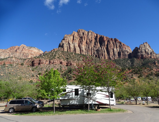
If we aren't able to get a site
inside a national park, we hunt for one as close possible
outside the park. This nice site
is in a private RV park just outside Zion NP. (April, 2016)
It also became more difficult but still possible to find some good
boon-docking (dry camping) sites on public lands. However, in our late
60s we had morphed to preferring sites with partial or full hook-ups
(electricity, water, sewer) because it was easier on us.
Decent TV and internet connections were nice, too!
We were also starting to repeat our destinations too much. We liked a
mix of favorite places we'd previously enjoyed because of the scenery
and hiking/cycling opportunities and also some new ones to keep things
interesting but we eventually found ourselves spending longer and longer
periods of time in the same places over and over again.

The longest we ever stayed in one
spot was this large site next to Lake D
at Kings Bay Sub Base in St.
Marys, GA just before we bought our
current house in early 2017.
We were there almost five months.
The fun for us was mostly gone from RV traveling by 2016 so we made
the decision, after tons of research re: where to "settle down,"
to purchase another house.
We're very happy with the community, neighborhood, and house we
chose. It's a great place to "age in place." We have
spent the last 20 months getting settled in and enjoying
a more relaxed lifestyle without the hassles of traveling.
HITCH ITCH
So what has changed? The same problems exist with more RVs than sites
to hold them. Why are we back on the road again now?
Mostly because of Jim's desire to compete in one of our previous favorite foot
races, the Across the Years (ATY) multi-day events in metro Phoenix,
Arizona. The event is held in a relatively warm place in late December
and RVs can park free onsite at its current location for the duration of
the race.
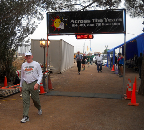
Jim at his last ATY 24-hour run
on 12-29-10
After being unable to run for six years Jim had a partial knee
replacement at the end of 2016. By the end of 2017 our new orthopedist
gave him the go-ahead to walk as much as he wants, as long as he doesn't
run -- "no pounding."
Jim was eager to resume training for ultra distances again. In the
previous entry I chronicled his comeback throughout 2018 as he completed
five events leading up to ATY, his goal race, reaching 100+ miles in two
of them.
He is registered for one of the 48-hour events in
Phoenix at the end of December.
The one-mile ATY loop skirts this pretty lake at Camelback
Ranch in Glendale, AZ,
spring training grounds for the Dodgers and White
Sox. (December, 2011)
As soon as we could reserve sites -- most were six months in
advance -- we made campground reservations at several regional
and state parks and one military base for this winter trip.
Some are places where we've stayed before, but not for several years
-- Brazos Bend SP in Texas, McDowell Mountain Regional Park near
Phoenix, Nellis AFB in N. Las Vegas. One is new to us -- Lost
Dutchman SP in Arizona.
As usual, we may make some modifications as
we travel. We have learned to be very flexible over the years
with this mobile lifestyle! You never know what can happen to change
your plans, even if it's just information that prompts us to go
somewhere new.
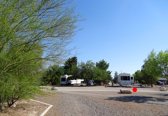
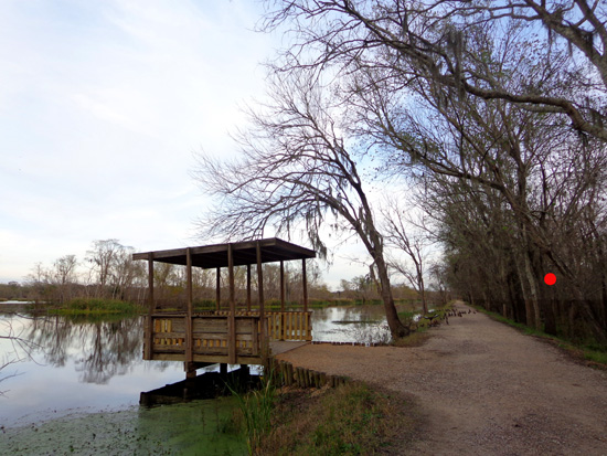
We had a spacious site (red dot) on our first visit
to the RV park at Nellis AFB in Vegas in April, 2016.
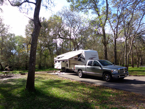
We decided to do a short "shakedown" trip in the Cameo in mid-October
to attend one of Jim's foot races in Alabama.
We spent two nights with
full hookups before the race at Uchee Creek Campground at Fort Benning,
GA, three nights dry camping AKA boon-docking at the race site in
Alabaster, AL, and one night with full hookups after the race at Fort
Benning (next photo) before putting the camper back into temporary storage on base.

That trip was enlightening, after not using the camper for 19 months!
We've gotten used to a larger refrigerator, bed, etc. in our stix-n-brix
house and had sort of forgotten how much smaller things are in the Cameo.
We did some cleaning and maintenance on the camper before parking it
in storage again, and made lists of
what was already inside and what we'd need for our longer winter trip.
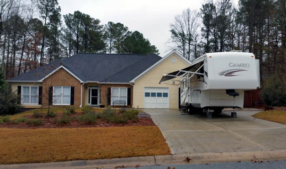
Two days before we left home in early December, Jim went down to Fort
Benning to get the Cameo so we could pack it for the trip. Although we
can't store it at our house, we can park it there temporarily before and
after trips:
We broke
the trip up by staying a few days outbound at Brazos Bend State Park
south of Houston, TX. This entry and another page will focus on the campground at
Brazos Bend, the network of hiking and cycling trails in the park, and
the alligators and birds for which the park is renowned.
DEJA VU AT BRAZOS BEND STATE PARK
This was our third, and shortest, visit to
Brazos Bend State Park.
Our first time there was in March of 2010 when we had a
reservation for several weekdays. We loved the place! There were lots of trails
to hike and bike, numerous flowers, birds, and alligators, and the campsites were
very nice.
The only problems were no available sites on weekends, the two-week
maximum limit for camping, and no sewers in the visitor sites, just water
and electricity. That's all typical for state parks.
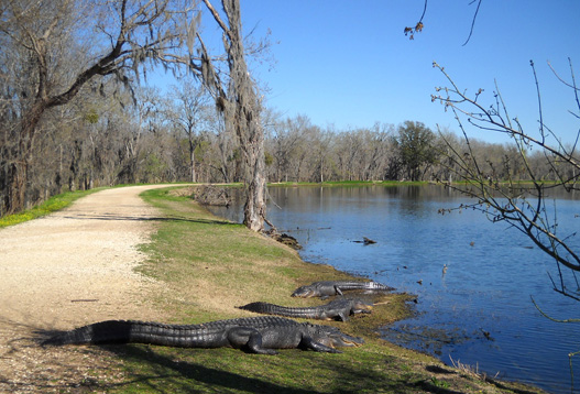
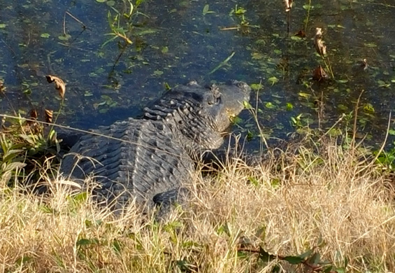
There are about 500 adult American alligators in
the park, plus babies in the spring.
They often lie in the sun right next to the trails!
(Feb., 2010)
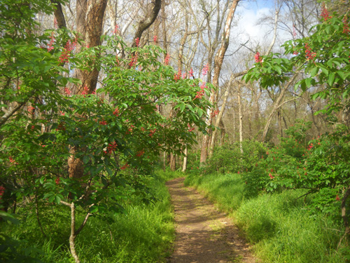
Pretty spring flowers along the
Red Buckeye Trail (March, 2011)
We wanted to stay longer so when I
noticed on the second day that one of the two campground host
sites -- with a sewer -- was empty in the loop where we
were parked, we inquired about the availability of that site for visitors.
We were told the only way we could stay in it was if we were
volunteer campground hosts.
The previous hosts had to leave unexpectedly a few days ago.
Do you want the job?
We had the same spacious
CG host site in the Burr Oak loop in 2010 and 2011.
(And we have the same truck and camper now!)
Hmm. That's something we'd never seriously considered before. We
wanted to be footloose and fancy-free that winter, when we could still
spontaneously find nice campsites just about anywhere we wanted to go
without making reservations weeks or months in advance.
But it was mighty tempting since the only way we could stay at Brazos
Bend longer than two weeks, or have a sewer connection, was to apply for
the campground host position.
After determining what was required of us, we applied and were
accepted. There was no pay for 20 hours of work/week (total for the two
of us) but we got our campsite with full hookups for free. That saved us
a good bit of money.
We promptly moved into the very nice CG host site
and had fun painting signs, cleaning up litter in vacated campsites and
out on the trails, and doing
light maintenance work the next four weeks.
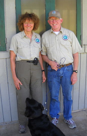
Us in our volunteer Texas State
Parks shirts;
that's Cody in front. (Feb.,
2010)
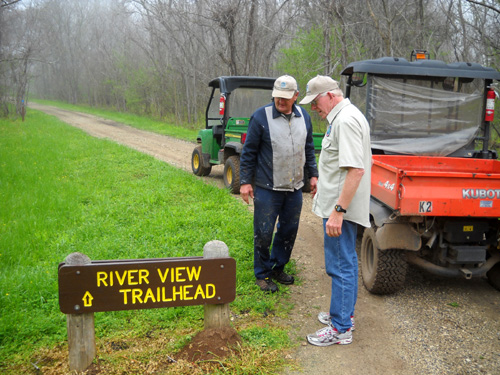
Jim and another CG host install one of the signs we
painted. (Feb., 2010)
We had so much fun that year we did the same thing in early spring of
2011 -- same site but different responsibilities that didn't
appeal to us as much that year, so we left after about six weeks.
This is the first time we've been back to Brazos Bend in almost eight
years. We made reservations for three nights so we could pause in a
relaxing, scenic location during our journey to Arizona and see what, if
anything, was new in the park.
CAMPING AT BRAZOS BEND
This 5,000-acre state park is both a nature preserve and a recreation
area.
The park is a convergence zone for a variety of habitats. Its
wetlands, lakes, prairies, and forests are full of wildlife, including 300+
species of birds, fish, deer, fox, armadillos, other mammals, and
hundreds of American alligators.
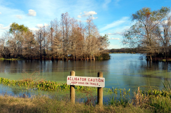
Above and below: 'gator and
nearby warning sign along Elm Lake (12-11-18)
Camping, hiking, cycling, horseback riding, picnicking, fishing,
geo-caching, wildlife and nature photography, and bird-watching are the
most popular recreational activities in the park.
Overnight accommodations include cabins, screened shelters, 39
"premium" campsites in the Burr Oak loop with 50-amp electric hookups and
water, 32 "standard" campsites in the Red Buckeye loop with 30-amp
electricity and water hookups, 15 walk-in primitive tent sites, 15
primitive equestrian sites, and two large youth group sites.
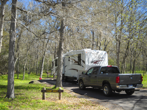
One of the very nice sites in the
Burr Oak loop; it wasn't empty for long! (12-13-18)
Current prices per night for the premium campsites are $25, and $20 for
the standard sites -- plus a daily entrance fee of $7 per person
age 13 and over unless you have an annual Texas state park pass.
Our 50-amp site cost $25/night. In order to avoid an
additional $14/day fee we purchased an annual pass for $70 that is good
until the end of December, 2019.
The pass also includes several half-price coupons for stays of two
days or more. We saved another $12.50 on this visit to Brazos Bend and
avoided the entrance fees for one night at South Llano River State Park after we left
Brazos Bend. We may stay at one or more parks in Texas on our way back
home and on next year's trip to the Southwest.
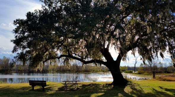
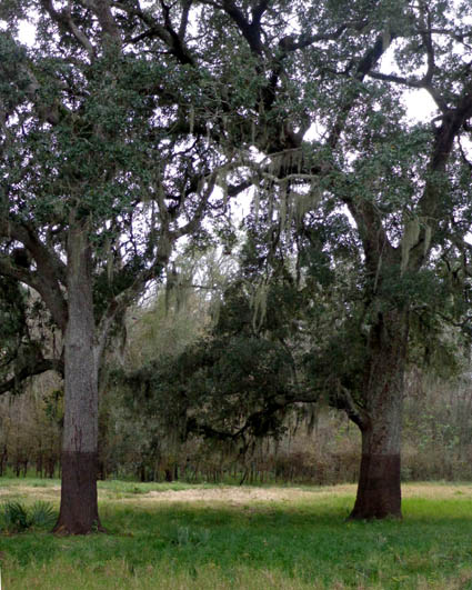
View to Elm Lake past one of the
sprawling live oak trees draped in Spanish moss (12-11-18)
We got to Brazos Bend before lunch on a weekday and had our choice of
about 60% of the sites in the Burr Oak camping loop with the 50-amp sites.
We chose a long, double-wide site that had no standing water -- the area
received at least six inches of rain right before we arrived, and some
of the sites were very soggy.
Despite all the trees surrounding us we had good
TV reception for a lot of stations with just our RV antenna and decent internet with the
unlimited Verizon mobile hotspot service we got for this trip.
Our current site
(12-11-18)
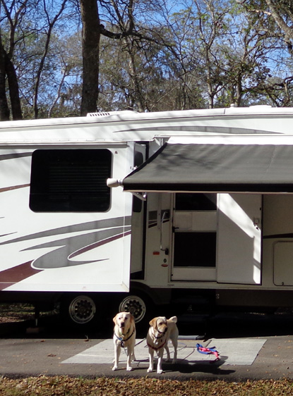
Casey (L) and Holly outside the
camper; this is Holly's first long RV trip.
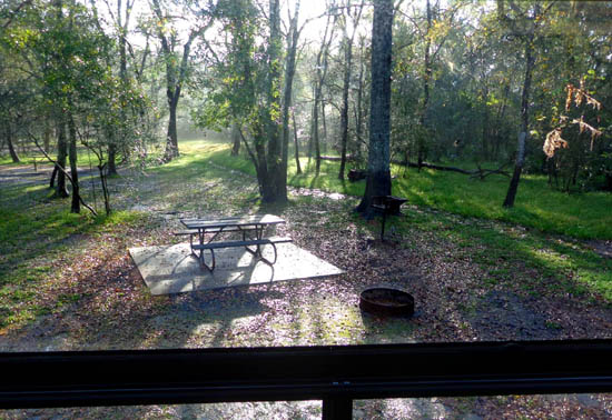
Scene outside our desk windows
NOT THE BEST TIME TO VISIT BRAZOS BEND
Our timing to visit the park wasn't as good in December as the other times we
were here in early spring, which comes in February this far south. Temperatures were colder, very few flowers
were in bloom, and the deciduous trees and shrubs had lost their leaves.
The park is at its finest in the spring, not winter, but it was
more green than most places around the country in mid-December so the
days we spent here were still a pleasant respite from "winter."
Lots of green grass and live oak
trees surround the nature center. (12-13-18)
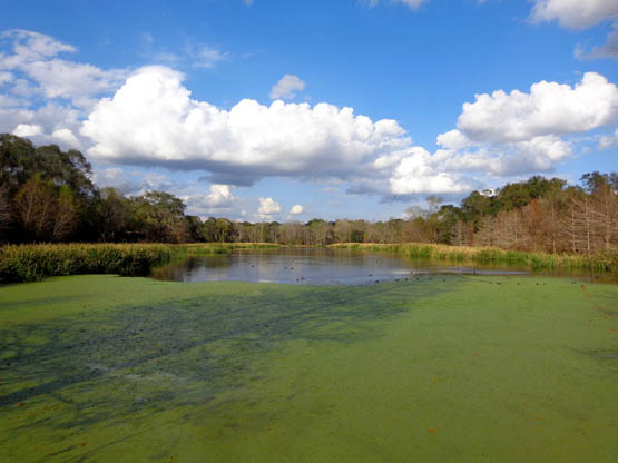
Green grasses and other water
plants in Lake Elm (12-11-18)
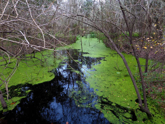
Above and below: Algae in
the wetlands and on lakes is green year-round.
Above: near Old Horseshoe Lake;
below, Creekfield Lake (12-13-18)
In addition, this week several trails were either a mess or closed
because of mud and standing water.
I mentioned earlier all the rain this area has gotten in recent days,
weeks, and months. Texas seems to really get slammed with excess rain.
We've never seen the park this wet and muddy or the river so high,
especially in the winter (we were here previously in early spring, when
you'd expect it to be more wet).
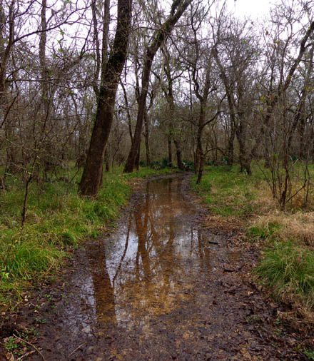
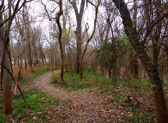
The White Oak Trail was "open"
but had more water than some trails that were "closed."
We saw serious erosion on the lower Red Buckeye Trail loop back in
2011. The trail has been re-routed since then because of other floods on the Brazos River:
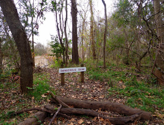
Very high Brazos River (12-12-18)
This week the flooding was so significant that the re-routed trail
at the bottom of the lower loop was totally under water at the convergence
of Big Creek and the Brazos River:
The river is on the left, the
creek on the right; the trail just disappears into the water.
(12-12-18)
That was one of my favorite trails when we were here before, partly
because the red buckeye trees had brilliant red blooms in early spring
and partly because there were nice views of the creek and river. It's
too early now for the flowers to be in bloom.
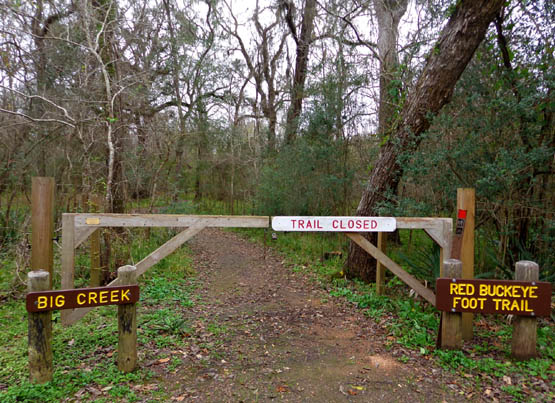
Although it was marked closed, I hiked the upper Red Buckeye loop
anyway and went down to the flooded part just to see it. The rest of the
trail was more dry than others that were officially open.
Other trails that were closed included Hale Lake, Live Oak, Bayou
Trail, Sawmill Trail, Yellowstone Landing, and the whole equestrian
campground.
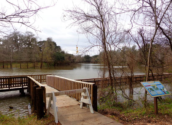
The trail to the pier at Hale
Lake was open but the pier itself was closed
because the bridging to the right
was under water.
This flooding is nothing, however, compared to what the park must have
looked like last year after Hurricane Michael.
I kept seeing what appeared to be water lines four to six feet above the
ground in trees in various parts of the park, including the south side
of Elm Lake (first picture below) and along the road to the large picnic
area on the north side of that lake (second picture):
Jim noticed them, too. Neither of us saw these light and
dark lines when we were here in 2010 and 2011.
So I asked a ranger and she confirmed they were, indeed, flood lines
from Hurricane Harvey in 2017, one of the worst hurricanes to hit
southern Texas in modern times The darker, lower areas were from
standing water.
Wow. That means many of the park roads and trails were completely under
water for a while!
Continued on the next page: more photos of scenery,
trails, and critters at Brazos Bend
Happy trails,
Sue
"Runtrails & Company" - Sue Norwood, Jim O'Neil,
Cody, Casey, and Holly-pup
Previous
Next
© 2018 Sue Norwood and Jim O'Neil