Continued from the previous page.Despite my whining about the mud,
standing water, and lack of leaves/flowers in the park in December, it's
still a beautiful place to visit -- even in the winter. Here are
more photos to prove it, all taken December 11-13.
PARK MAP
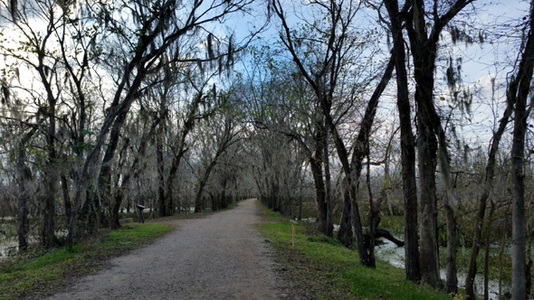
One reason we like Brazos Bend so much is all the trails that are
great for hiking, running, and cycling. Some are also open to equestrians.
New to us this visit are large maps at all the trail intersections
that show where you are:
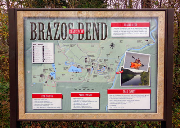
Even if you're carrying a paper trail map with you, it's nice to see
your location on these signs. Each sign also has additional
information about nearby activities to enjoy, alligator cautions, water
safety, etc.
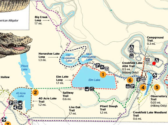
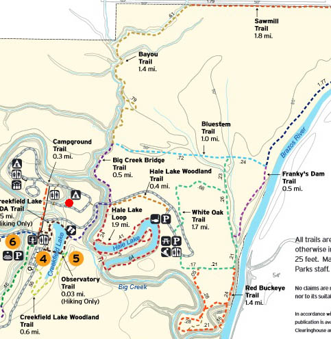
You can see various maps of the park on the official website.
This link is for the trail map.
Here are two map sections. The first one is the left side (to the west)
and the second section is the right side (to the
east). Due north is toward the top, as it should be on any map. I marked
the location of our campsite with a red dot. The campgrounds are fairly
centrally located for all the trails and large picnic areas at Elm, 40
Acre, and Hale lakes.
I'll refer to various lakes, trails, and other features in the
following photos, which I'll categorize by area.
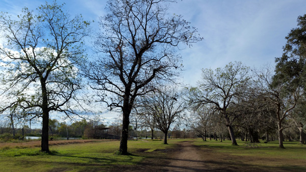
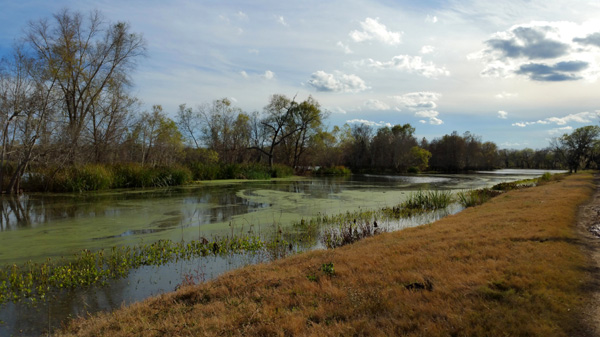
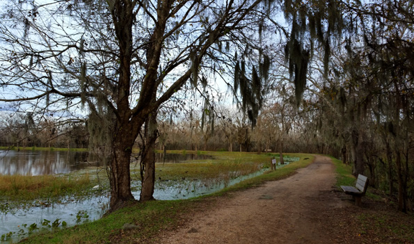
SCENES AROUND ELM LAKE
Elm is the largest of several lakes at Brazos Bend State Park and one
of the best places to observe birds and alligators. The trail
circumnavigating the lake is one of my favorites and very popular with
other visitors on weekends, even in the winter.
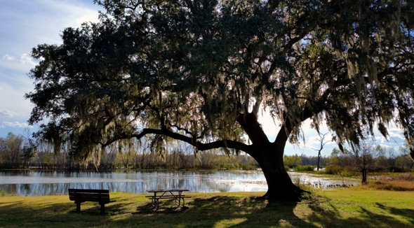
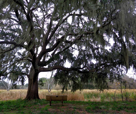
There are three large picnic areas in the park. One is on the north
side of Elm Lake:
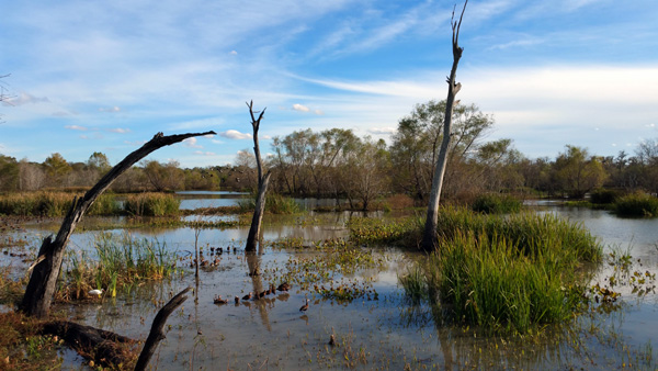
Lots of strips of land form narrow "barrier islands" in Elm
Lake about 75 to 100 feet from the shoreline, giving alligators, birds,
and other critters safe places to feed, nest, and sleep
-- while still affording excellent wildlife-watching and photography
opportunities to humans.
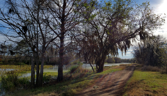
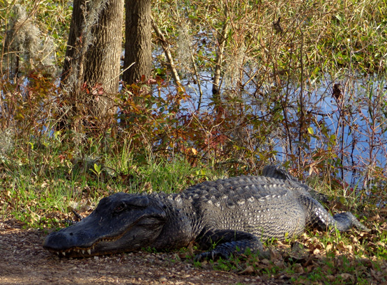
Above and below: trail along west
side of Elm Lake, where I saw this 'gator each day
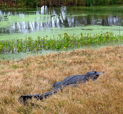
The little strips of land on the
south side of Elm Lake are one of the best places to spot alligators
because they like to lie in the
sun. It helps to have binoculars and/or a long camera lens.
Numerous species of birds either call Brazos Bend home all year
long or migrate here in the winter.
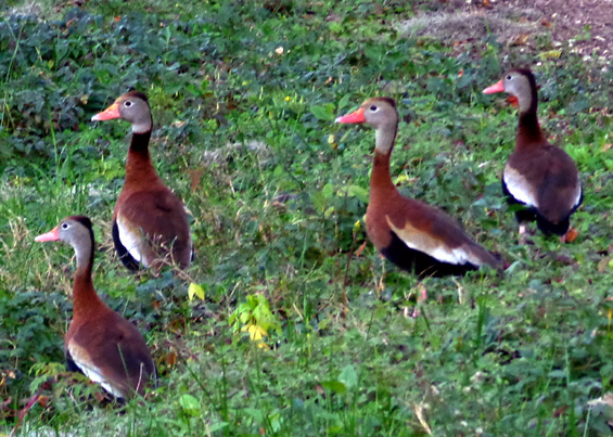
One of my favorite kinds of birds to watch was the Black-Bellied Whistling Duck.
I don't remember seeing them before but they were all around Elm Lake during
our visit this time. If a group of them was sitting on the path or
floating near it in the water, they'd all fly away when I got close to
them, making a whistling sound.
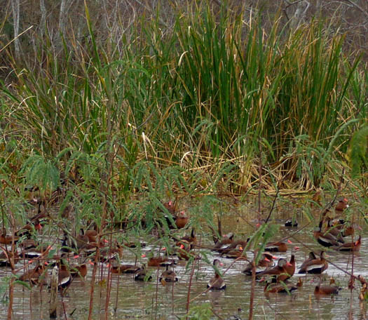
Above and below:
black-bellied whistling ducks
I got some videos of the sound and the white blur they made while flying
(the underside of their wings is white) but we haven't learned how to transfer
them from my cell phone to this website yet.
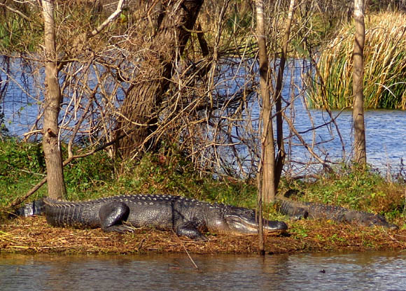
SPILLWAY TRAIL
The wide, flat Spillway Trail connects Elm and 40 Acre lakes. Because it crosses
wetlands, it's another great place to see alligators and water birds:
As long as you don't provoke
the large alligators on or near the trail,
they aren't prone to attack people
or dogs walking by.
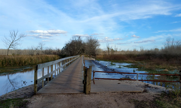
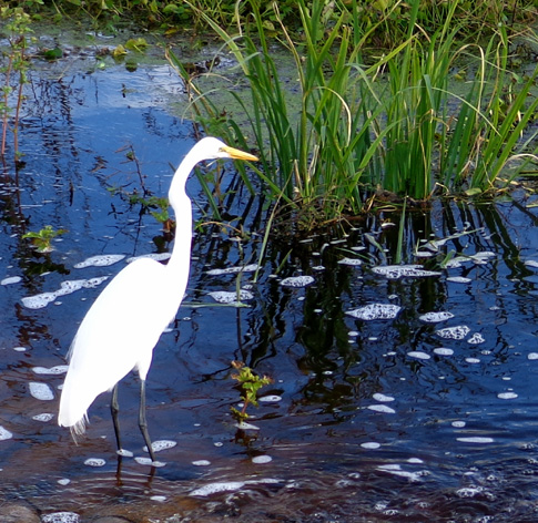
The water near this bridge on the Spillway
Trail must contain a lot of little fish
because I have often seen egrets, herons,
and other birds "fishing" here.
40 ACRE LAKE
Brazos Bend has at least seven lakes. 40 Acre Lake is the third largest
one.
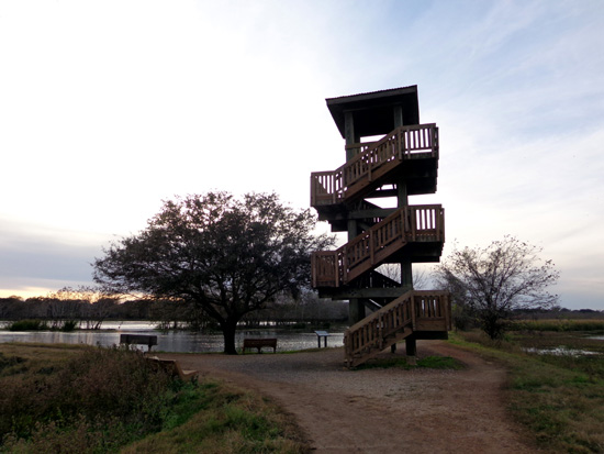
Like Elm Lake, 40 Acre Lake is also very popular with visitors. It is near the park
entrance, it has a large picnic area under sprawling live oak trees, and there is
a nice flat path around it. It's smaller than Elm Lake so there aren't as many nesting
areas for birds and alligators but it has its fair share of both.
It also has a wooden observation tower that you can climb:
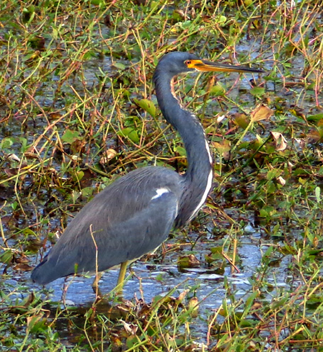
Blue heron
One day Jim and I were hiking separately and I saw him coming
toward me from a distance around 40 Acre Lake. I was near the
observation tower on this side of this pelican and silently pointed
it out to Jim so we didn't scare it away or provoke it:
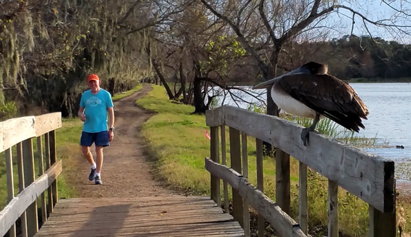
Since there wasn't any water under the little bridge, Jim just walked
around the bridge and the bird wasn't disturbed.
I don't remember seeing pelicans here previously, either.
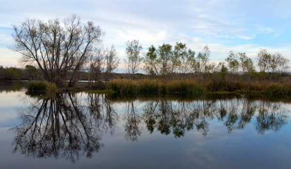
OTHER LAKES IN THE PARK
If you scroll back up to the maps of Brazos Bend near the top of this entry you can
see three U-shaped AKA "horseshoe" lakes that were cut off from the main
channel when the meandering Big Creek gradually made tangents caused by
erosion after big rainfalls.
This is a picture of New Horseshoe Lake that I took from the path around Elm Lake:
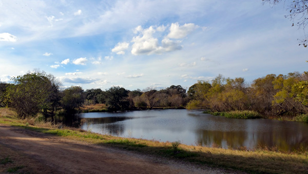
That one is full of water and very photogenic.
I hiked the muddy trail around nearby Old Horseshoe Lake. It is
so overgrown with cattails now that it looks more like a field than a lake:
In 2010 and 2011 I enjoyed hiking around the largest horseshoe
lake in the park, Hale Lake, but the trails around both the outside and inside of the
elongated U-shaped lake were closed this time because of mud and high water.
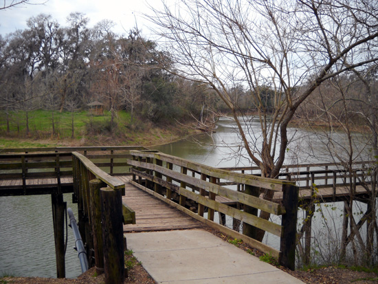
This is a picture I took from the pier overlooking the middle of
Lake Hale back in 2010:
This time the right side of that bridging is under water and the
pier is closed, as well as all the trails around Hale Lake:
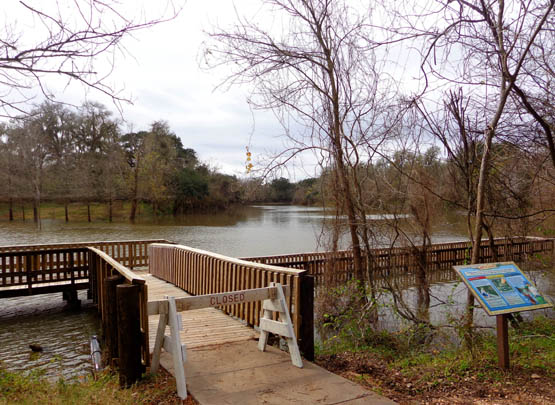
That water is at least six feet higher than it was in the first picture,
maybe more.
We might stop at Brazos Bend on our way back home at the end of
this trip. If we do, I'll have another entry with more photos if I can
get some good ones.
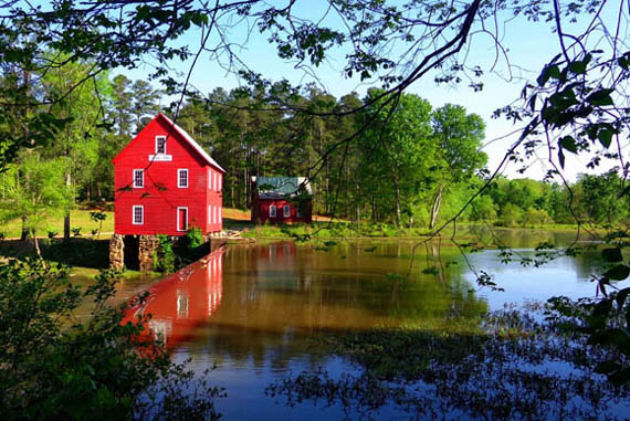
If you want to see prettier photos from Brazos Bend in the spring, there are several entries in our
2010 and
2011 web journals.
Next entry: overnight stop at South Llano River
State Park in Texas
Happy trails,
Sue
"Runtrails & Company" - Sue Norwood, Jim O'Neil,
Cody, Casey, and Holly-pup
Previous
Next
© 2018 Sue Norwood and Jim O'Neil