Continued from the previous page.
PROSPECTOR'S VIEW TRAIL #57
Another way to reach the Green Boulder is from Prospector's
View Trail, which runs 7/10ths of a mile between the overlook
above the boulder and the Siphon Draw side of Jacob's Crosscut Trail.
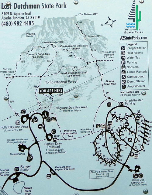
You can see it on the trail map below. This old map from one of
the signs along the Discovery Interpretive Trail doesn't show the mountain
bike trail and some other hiking trails inside the park, or even the newer
campground loop we stayed in. But it does show the nearby trails in
Tonto National Forest:
Let's start from the intersection with the Crosscut
Trail and go up the mountainside:
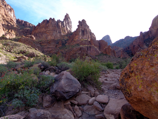
Prospector's runs above the Green Boulder and ends at
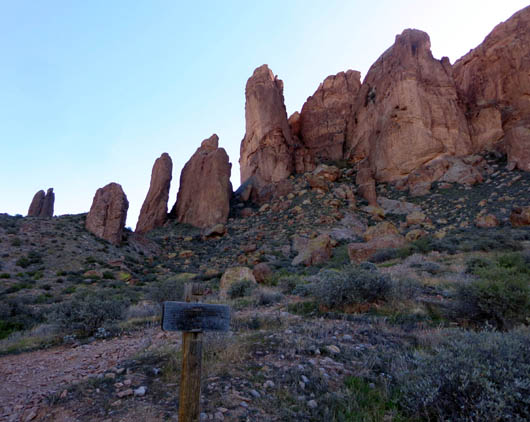
the overlook with the bench. The next view is a little before that:
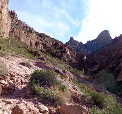
Prospector's View Trail is rated moderate; it is
single-track and rocky in some places but the slope is gradual.
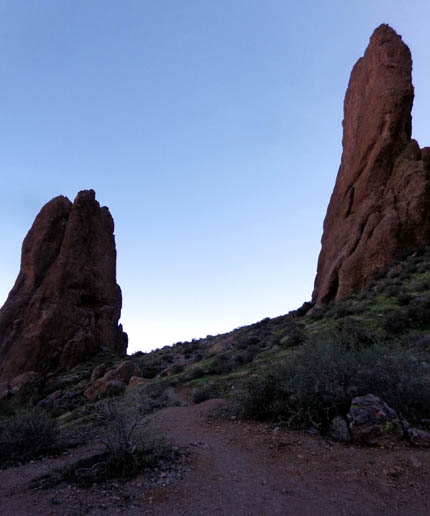
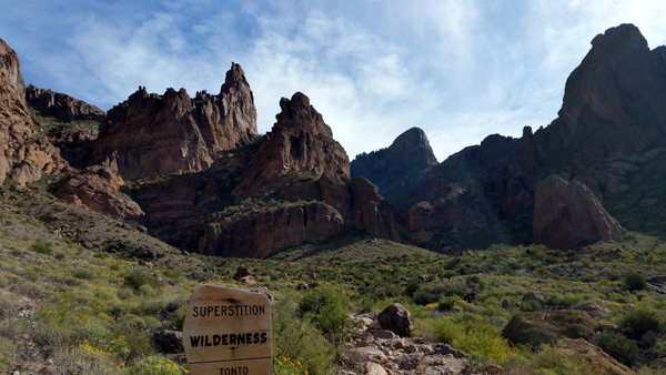
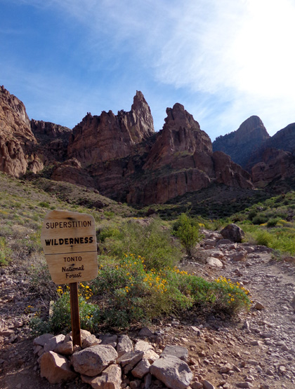
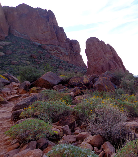
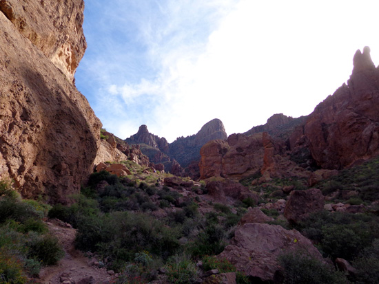
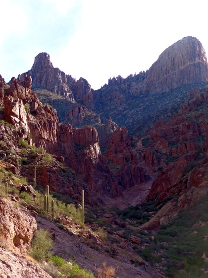
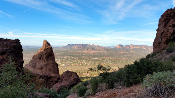
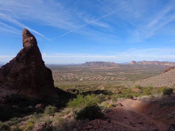
I was alone the day I hiked up Prospector's View. When I
got up to the overlook above Green Boulder, I decided to take a narrow,
rugged trail to what I hoped would be a great view higher up between
some rock pillars:
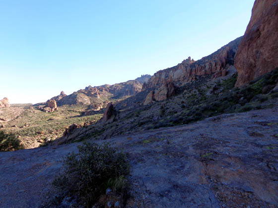
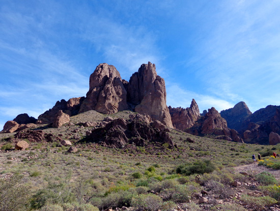
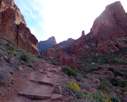
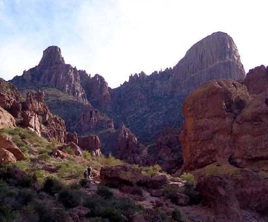
It was a fairly short but partly gnarly trail that continued
through the wilderness area past the saddle where I turned around. The
view in that direction was interesting; someday maybe I'll
explore the trail on that side:
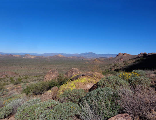
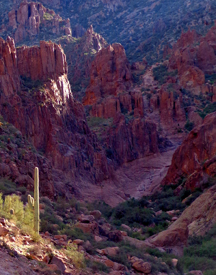
The views were also good down to the Green Boulder, Lost
Dutchman State Park, Four Peaks Wilderness Area, and the Gold Vein Range:
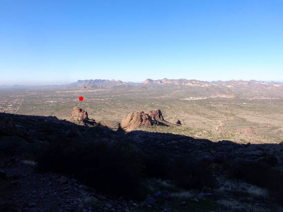
Looking down at the Green
Boulder, which I marked with a red dot
OK, now let's check out the Big Daddy of
Trails in this area:
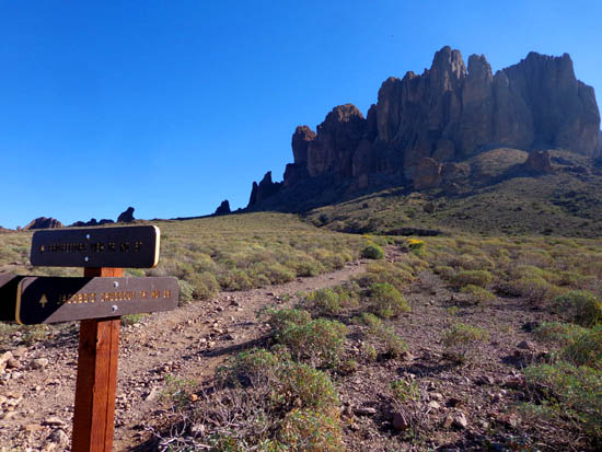
SIPHON DRAW TRAIL #53
If you scroll back up to the map at the beginning of this page you can
see Siphon Draw Trail on the right, running from the amphitheater parking lot up to the Flatiron
formation. I don't know for sure but Flatiron is probably the highest point in
the Superstitions or it wouldn't be so popular.
Siphon Draw is the most difficult trail in this network close to the park.
That's what makes it so popular with hikers -- the challenge to
try to get up to either the Basin, a 1,000-foot elevation gain in about
two miles, or the Flatiron, a 2,000-foot gain in the next mile beyond
the Basin.
Trust me, 2,000 feet of gain in only a mile is very steep.
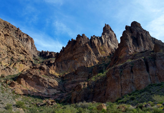
The Flatiron is 4,861 feet elevation. It is in the middle of this photo,
in the distance:
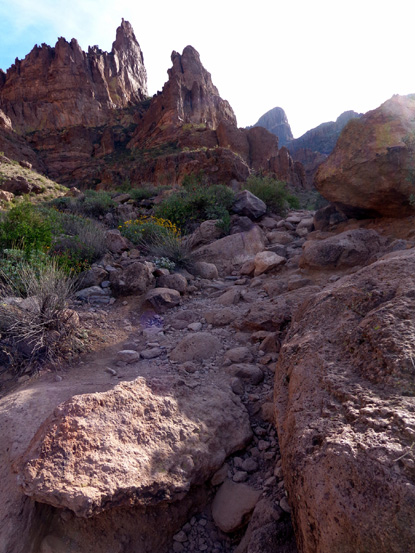
I went up to or near the Basin (3,100 feet elevation) on the first full day we were at the
park. I chose a weekday morning because I heard it would be heavily trafficked on the
weekend. I didn't take either dog with me.
This trail is more rocky than the others I've described, with both loose
rocks and large rocks/boulders. It's relatively wide until it gets to the two
intersections with Jacob's Crosscut Trail, then narrows to single-track as it gains elevation.
The upper parts of this trail that are in the wilderness area are even rockier,
with some steep steps required to get over or around boulders.
I used two trekking poles for more stable footing, but more agile folks
didn't use them. I had to use my hands in a couple places coming back down.
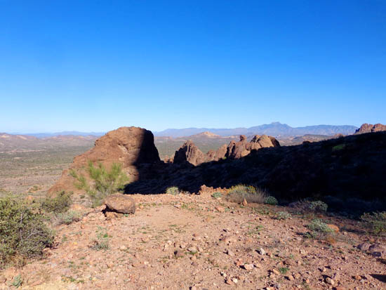
I'm not sure exactly where the Basin is but it may be the low
spot in the next two photos. I've looked at other trail reports on
various websites but haven't seen any photos that identify the Basin and
there weren't any hikers around that spot who I could ask.
My GPS already said 3,100 feet where I took the next two pictures.
That's the elevation on the map for the Basin,
so I turned around here to avoid a steep climb back up:
From the Basin area I could see a couple young men climbing a steep
rock face on the trail up to the Flatiron. I might have been able to get UP there
but coming back down would have been treacherous for me on any loose rocks.
I wouldn't try to go farther unless Jim was with me.
It was hard for me to get good photos on the ascent, facing southeast as I
went up through the canyon. Much of the mountainside was in shadow in the morning,
and when the sun popped over the peaks later I was facing it.
I got better photos in both directions on the descent when the
sun was higher and/or I was facing the valley.
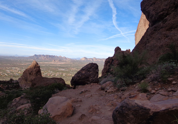
It's probably easier to get good photos on the ascent in the
afternoon or from ~ May to August when the sun is higher.
Despite the difficulty of this trail, I like a good challenge and I was
curious to see what all the hype was about. The views down to the valley
and toward other mountain ranges are very scenic.
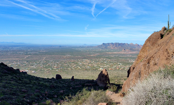
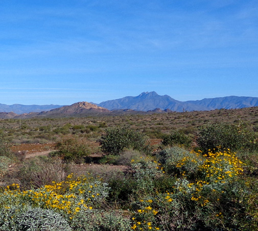
View of Apache Junction
area and Gold Vein Range
 >
>
Four Peaks in the distance
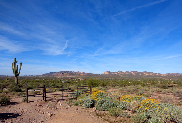
Approaching the park boundary fence
If we'd been here longer I would have hiked back up to the Basin
again, and encouraged Jim to go with me. He didn't do much hiking here because
he's tapering for his 48-hour run at Across the Years next week.
Next entry: day drive along the scenic Apache Trail
to Tortilla Flat
Happy trails,
Sue
"Runtrails & Company" - Sue Norwood, Jim O'Neil,
Cody, Casey, and Holly-pup
Previous
Next
© 2018 Sue Norwood and Jim O'Neil