Continued from the previous page.
Although Lost Dutchman doesn't have a lot of hiking trails within the
park itself, they connect to a larger network of other trails in the adjacent
Tonto National Forest and Superstition Wilderness Area. Trails in the
park are easy; those in the national forest range from easy to very difficult.
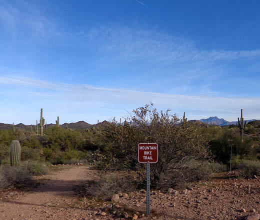
I believe the only mountain bike trail is a four-mile loop within the
park boundary. I hiked only a small portion of the narrow trail with Holly-pup
early one morning before the cyclists were using it:
On this and the next page I'll show pictures and briefly describe the trails within the park
first, then the national forest.
TRAILS WITHIN THE PARK
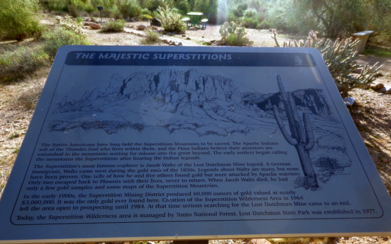
Here's a map from a sign in the park that shows the trail system in
and adjacent to the park. With a large enough screen, you should
be able to read the names of the trails. If not, you can find a larger,
more updated
map on the park website.
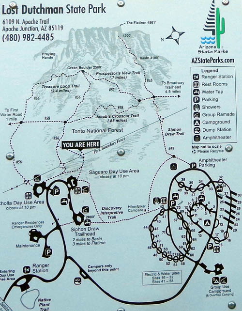
Not shown on this map are the bike trail loop, the new campground
loop where we parked, and an easy half-mile trail that goes from the
campground to the visitor station at the entrance to the park:
There is also a quarter-mile loop near the entrance called the Native
Plant Trail; we didn't hike on that one.
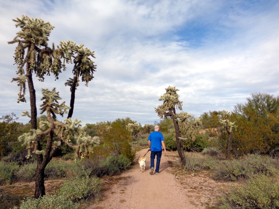
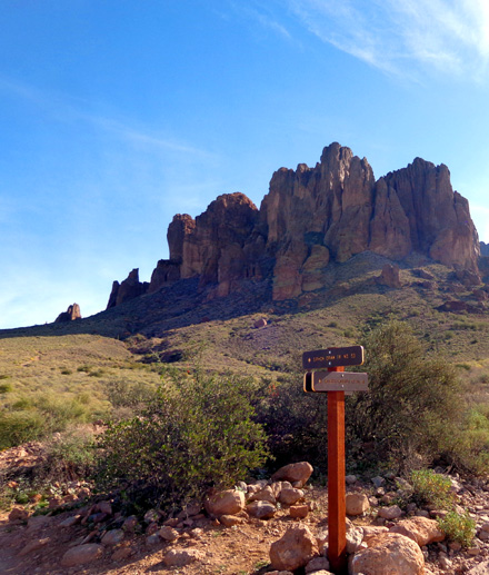
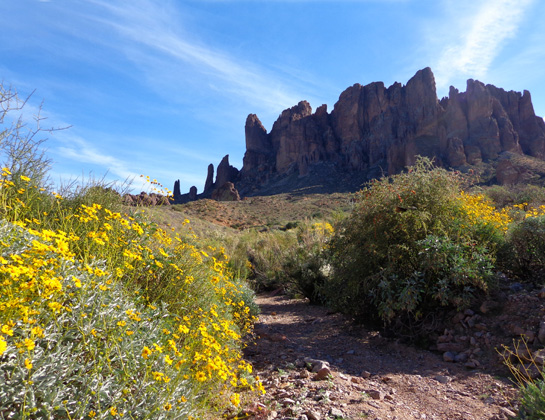
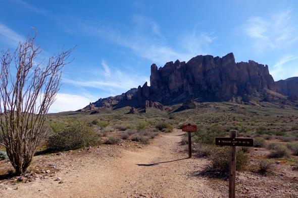
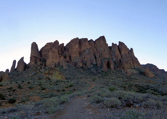
The main hiking trail within the park is the Discovery Interpretive
Trail, an easy path that connects the day use parking areas with the
campground loops and Siphon Draw trailhead. It's about a mile long, with
great views of the Superstition Mountains.
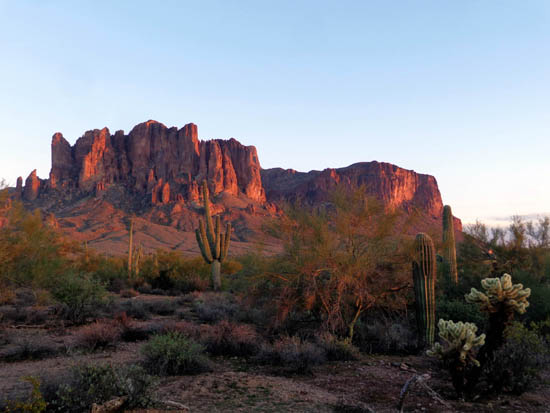
Sunset on the Superstitions
Majestic old saguaro cacti,
sentinels of the desert;
they don't grow "arms" until they are about 50
years old.

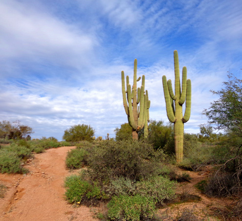
Cactus humor; the "head" was gone the
next day.
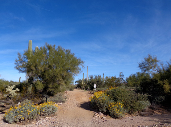
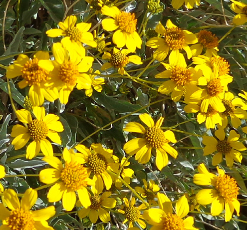
Brittlebrush flowers were in bloom all
over the place.
There are half a dozen interpretive signs along this trail with
interesting information about the geology, history, plant life, and
critters that inhabit this part of the Sonoran Desert:
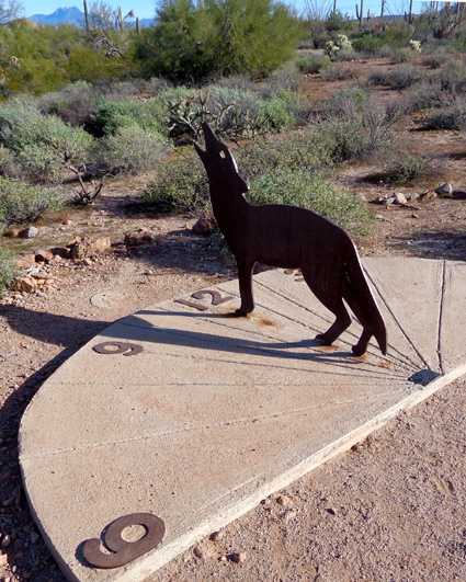
There is also a sundial along this path:
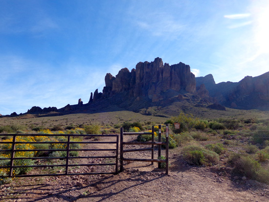
A fence separates park property from the Tonto National
Forest, with gates at four locations so hikers can easily access the
trails leading up into the Superstition Mountains.
TRAILS IN THE NATIONAL FOREST & WILDERNESS AREA
On the map above you can see the boundary line between the park and
national forest, with four gates that lead to several trails up the
north side of the Superstition Mountains.
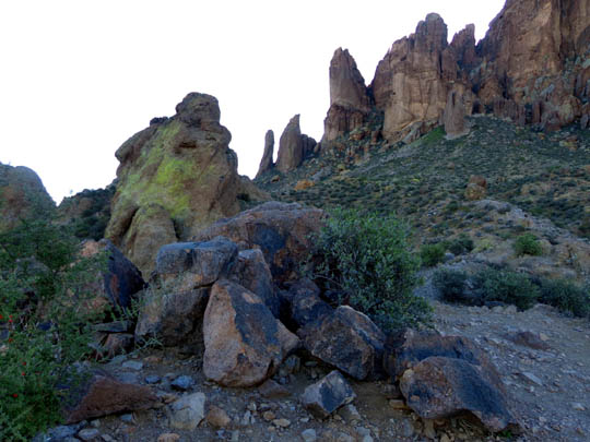
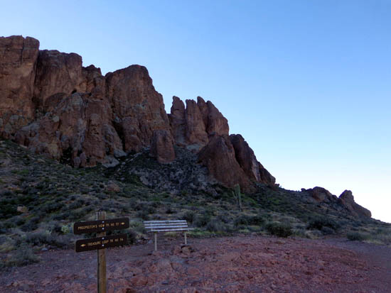
JACOB'S CROSSCUT TRAIL #58
This is the easiest trail to hike in the hillside network. It runs
a little less than a mile north-south along the base of the mountain. It
extends another mile to the north and 4.5 miles to the south
beyond the park area. Although I was on the trail two or three times I
hiked only the part shown on the map above.
You can access the trail from the Siphon Draw Trail or two sides of
the Treasure Loop Trail. The next two photos show the park boundary gate on the
Siphon Draw Trail and the intersection with the Crosscut Trail:
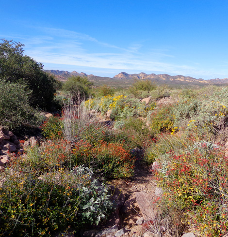
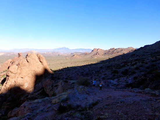
The Crosscut Trail is single-track, partly smooth and partly rocky. It
undulates gradually in and out of little washes that are filled with
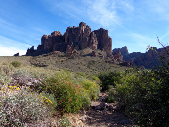
flowers right now. There are expansive views down to the valley and up
to the mountains:
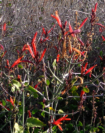
Chuparosa AKA Beloperone
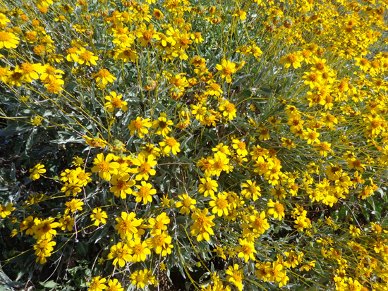
Above and below: ubiquitous
Brittlebrush
If I had done only a loop incorporating Jacob's Crosscut Trail from our
campground site it would have been about 2˝
miles long. When I used this trail it was always in combination with
other trails on the mountainside.
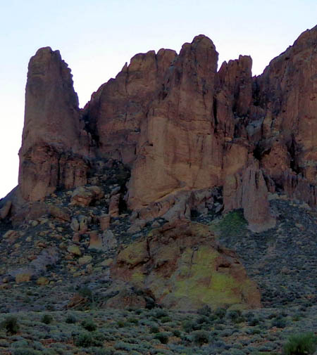
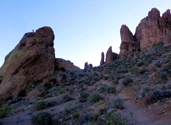
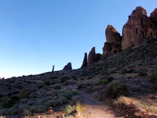
TREASURE LOOP TRAIL #56
This 2.4-mile long loop is an interesting trail of moderate difficulty. I
hiked to the top of the loop twice from different directions. It is
longer if you're hiking from one of the campsites.
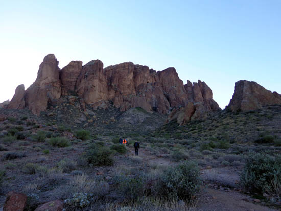
The first time I did the entire loop in the CCW direction with Casey,
our six-year-old Lab It was early in the morning and the whole
mountainside was in shade. The colors in the pictures I took with my old
compact Sony camera that day leave a lot to be desired. The photos with
better colors were taken later on another day.
The trail gains 500 feet elevation as it climbs up to and above Green
Boulder, so-named because of all the greenish lichens
growing on it:
Treasure Loop starts/ends at either the Cholla or Saguaro day use area.
It is pretty smooth and wide below Jacob's Crosscut
Trail, then becomes more rocky single-track as you ascend in
either the clockwise or counter-clockwise direction:
Circling around behind the Green
Boulder
Looking down at the back of the Green
Boulder
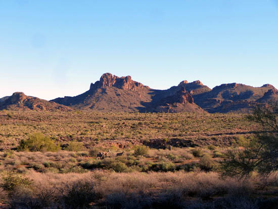
The bench on the overlook above Green Boulder (below) is at 2,600+
feet elevation, with even better views down to the valley and out to
several mountain ranges.
I took the next set of photos on the descent:
Looking back up the trail as
other hikers ascend in the CW direction
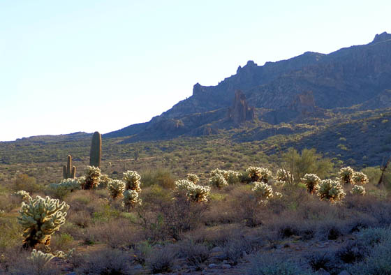
Backlit Teddy bear cholla cacti
glow in the early morning sun.
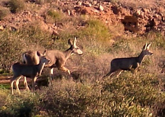
Above and below: mama deer
and her twins in the desert; papa was several hundred feet away.
Wider, smoother trail below the
Crosscut Trail
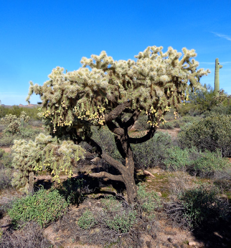
Unusual Hanging Chain AKA Hanging
Fruit cholla cactus
Continued on the next page: Prospector's View and
popular Siphon Draw Trail, which "draws" a large hiker crowd
Happy trails,
Sue
"Runtrails & Company" - Sue Norwood, Jim O'Neil,
Cody, Casey, and Holly-pup
Previous
Next
© 2018 Sue Norwood and Jim O'Neil