Continued from the previous page.
Despite the foreboding clouds full of snow that we saw on our way
south toward the road through Nine Mile Canyon and up to the Kern
Plateau, the sky miraculously cleared sufficiently before our turn off
US 395. We decided it was worth trying to see if we could get all the
way to Kennedy Meadows, where the Pacific Crest Trail runs through a
Forest Service campground.
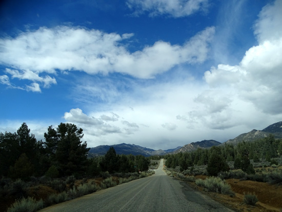
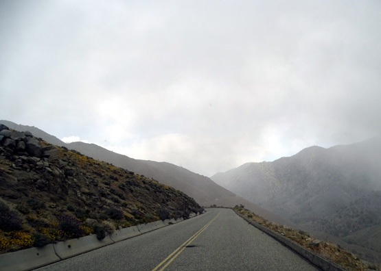
In a very short time we went from a near white-out in the Sierras
while we were still on US 395 to blue skies and great views as we wound
our way up through the canyon:
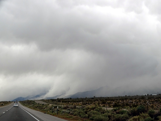
What
mountains?? Driving south on US 395, we could barely see the Sierras.
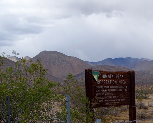
Sign for Chimney Peak Recreation
Area, which includes Kennedy Meadows,
near our turn off US 395; we
could see the nearby mountains much better now.
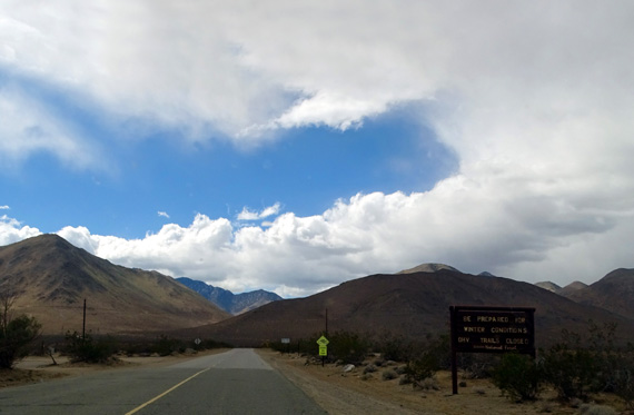
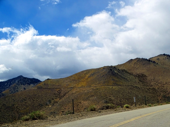
Blue sky on Nine Mile Canyon Rd.!
Inyo National Forest sign says
"Be prepared for winter
conditions. ORV trails closed."
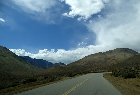
We'd be climbing up to 7,535 feet elevation at Pine
Pass, our highest point of the day.
Although there wasn't any snow near
the road even at that elevation today, we did get into some light
flurries this afternoon. A big snowfall is certainly possible even in late
March so the off-road vehicle trails weren't open yet.
WILDFLOWERS & VIEWS IN NINE MILE CANYON
We had several nice surprises on the winding ascent through the canyon --
some blue sky, the smooth paved road, great views, and lots of colorful
wildflowers.
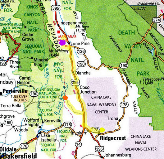
Here are two map sections to show the location of Nine Mile Canyon
and Kennedy Meadows Campground. There is a little community of Kennedy
Meadows 25 miles in from US 395; the campground is another three
miles west, just inside the Inyo National Forest boundary.
I've shown this map section before, with today's whole route to Lone
Pine and back. The yellow line going to the left (west) through the
mountains to the orange dot is the focus of this web page:
That's the bigger picture.
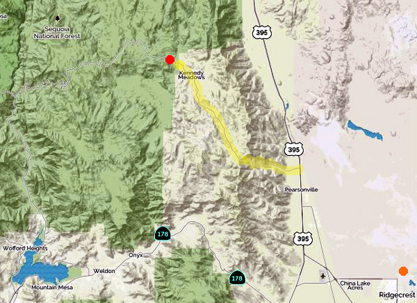
Next is a more detailed topo map from
Mapquest that shows this mountainous part of Tulare
County in the Inyo and Sequoia National Forests. This is the southern
end of the Sierra Nevada Mountains so it was a roller-coaster ride to
Kennedy Meadows CG and back out to US 395. It would be fun on a bike!
I highlighted the Nine
Mile Canyon and Kennedy Meadows roads in yellow, Kennedy Meadows
CG with a red dot, and our RV park at China Lake Naval Weapons Station
with an orange dot:
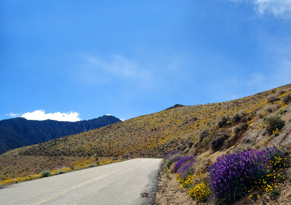
The serpentine drive up through the canyon was unexpectedly colorful,
with many of the rather barren high desert slopes covered in yellow flowers.
I didn't get close enough to them on this day trip to identify them
but I'm guessing they are Wallace's Wooly Daisies, the same thing I saw
blanketing the mountainsides when I hiked on the Pacific Crest Trail
south of here later in the week:
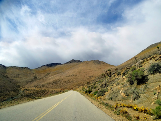
Within just a couple miles the
striped pavement (above) narrowed,
with no striping (below) the
rest of the way up to the village of Kennedy Meadows.
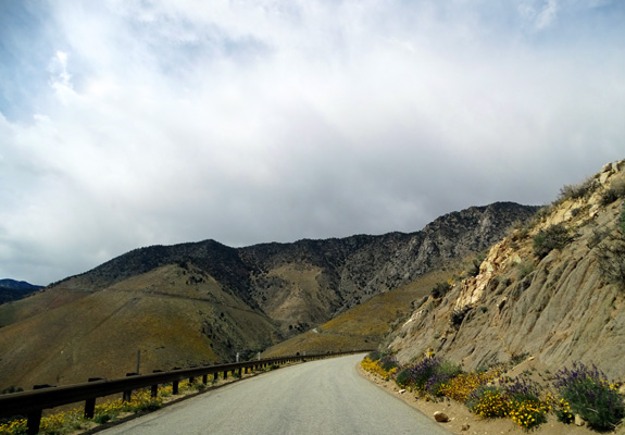
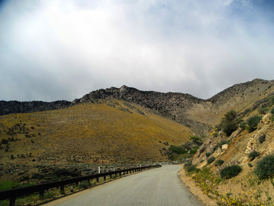
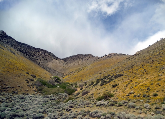
The blankets of flowers on the hillsides were even more colorful in
person than in these photos.
There were also lots of yellow
Wallace's Wooly Daisies, white Fremont's Pincushions and Indian
Tobacco (Lobelia family), blue Chia (Salvia family), and some sort of
interesting red-leafed plant right along the road, as well as large
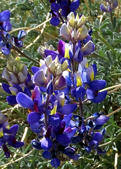
clumps of pretty blue lupines at their peak bloom:
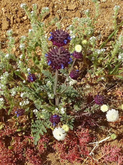
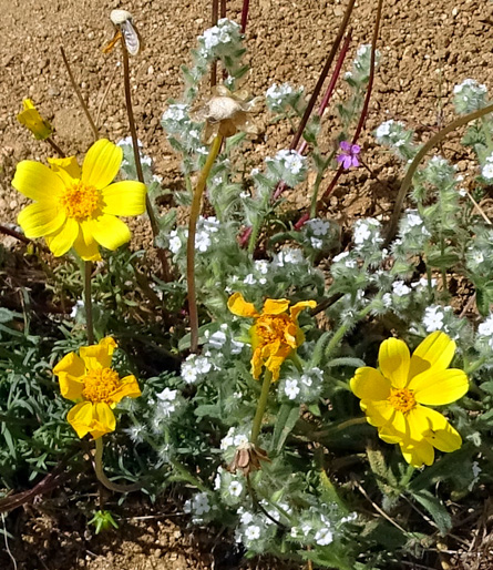
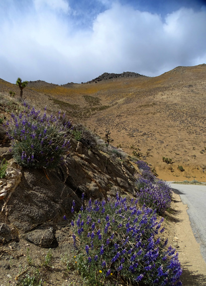
Above and two photos below:
Lupines
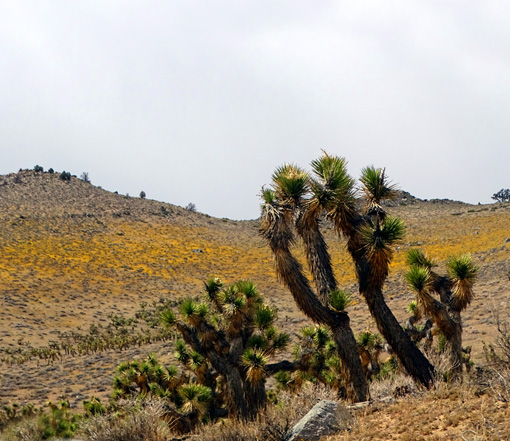
Between approximately 4,500 to 5,000 feet elevation there were a lot
of Joshua trees, some in bloom:
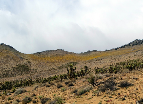
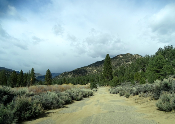
Above the rocky canyon we were in a completely different eco-zone
between 6,000-7,500 feet elevation on the rolling Kern Plateau, with lots
of chaparral (looks like sage bushes) and mixed conifer trees (pinyons,
junipers):
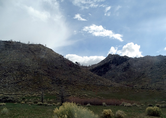
Probably an old burn area
The closer we got to the
campground, the more clear the sky became.
There have been some major fires in this area, including a
74,000-acre fire in 2000 and others more recently. A Forest Service fire
station is located up on the plateau.
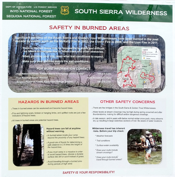
This sign
was posted at the Kennedy Meadows Campground showing areas that have
burned and warning people about the dangers of hiking and camping near
trees that may come down:
There were some rather barren areas on the plateau with no mature
trees, which may have been affected by one or more of those fires. I took
only one picture of a recently burned area:
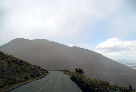
We got up to 7,535 feet elevation at Pine Pass and went
through several brief snow flurries. You can see some little white dots
of snow in the picture below:
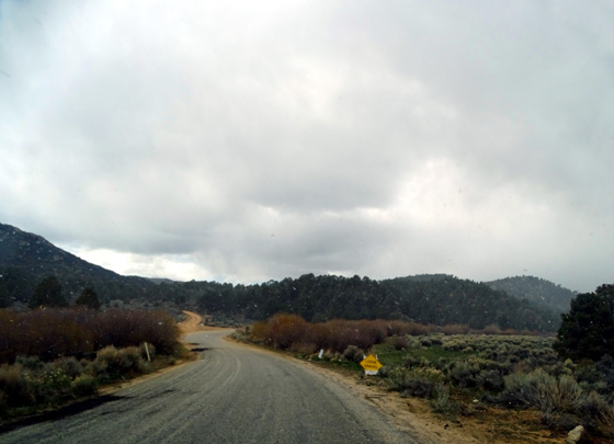
Considering all the clouds we saw dumping snow and/or rain in the
Sierras today, it's a wonder we got into only a few flurries.
The road drops down about 1,700 feet to the Kennedy Meadows
Campground, where we turned around.
The paved road was increasingly
narrow but good the first 25 miles to the village of Kennedy
Meadows. When we turned off the last three miles to the campground, it
was even more narrow and bumpy but still paved:
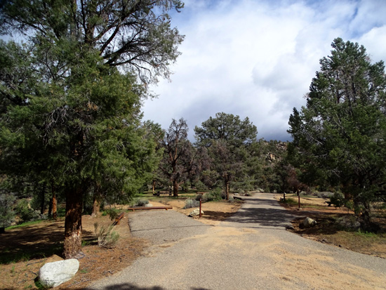
KENNEDY MEADOWS CG & THE PACIFIC CREST TRAIL
This campground is located in Inyo National Forest at about 5,800 feet
elevation.
We saw only one travel trailer when drove through.
There may be more people camping on the weekend but it's still cold at
this elevation.
The Pacific Crest
Trail runs right through the campground and people can park
nearby just to hike if they want:
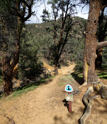
We didn't do a hike
on it today. There is a trailhead farther south that is closer to
Ridgecrest/China Lake NAWS where we're staying so I hiked from there
twice, later this week.
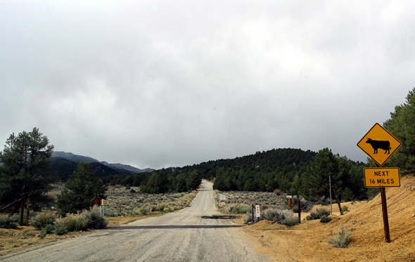
All the way up to the campground from US 395 the only other vehicles we
saw belonged to road workers filling in potholes.
Since no one else was around, Jim was able to stop in the road several
times so I could get out to take photos of flowers.
On the way back down we saw only four private vehicles. It was a good
day to be up there!
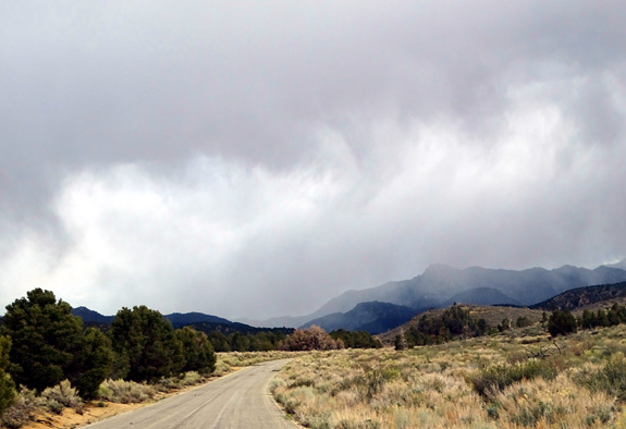
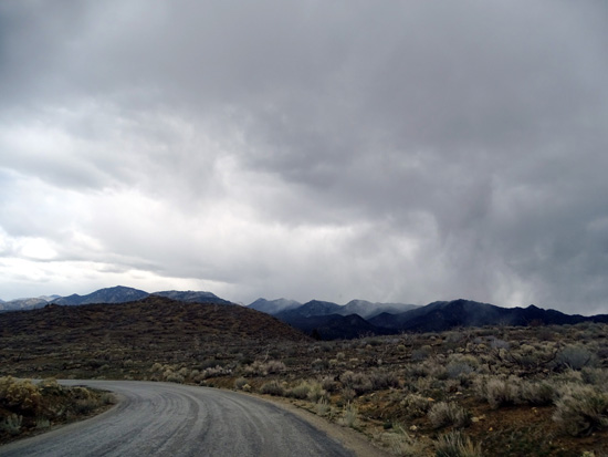
Above and below: Low clouds ahead of us on
the way back down to the valley
I'm also glad we went
up right when we did because it was more cloudy most of the way down to
US 395 and the flowers didn't look as spectacular as they did in the
sunshine.
FINAL THOUGHTS ON OUR DAY TRIP
We covered a fair amount of ground today and
saw a lot of diverse, scenic terrain.
I can recommend every bit of it, too. Each place we visited was worth
our while -- the handsome visitor center full of information in
Lone Pine, the colorful and historical Alabama Hills and Arch Loop
Trail, the drive up the Whitney Portal Road as far as we could go (the
last bit was closed due to snow), flower-full Nine Mile Canyon, the
Joshua trees on Kern Plateau, and Kennedy Meadows Campground.
The valley and China Lake were sunny when we got
down out of Nine Mile Canyon.
I'm guessing the PCT is scenic going either north or south from the
campground, too, although we didn't hike either of those sections.
Every place we drove today was suitable for a low-clearance 2WD vehicle
and for most smaller RVs. Much of it was OK for large rigs, too, but
they won't fit into the sites at Kennedy Meadows CG.
Next entry: an even longer day trip through Death Valley
National Park, also new to us
Happy trails,
Sue
"Runtrails & Company" - Sue Norwood, Jim O'Neil,
Cody the ultra Lab, and Casey-pup
Previous
Next
© 2016 Sue Norwood and Jim O'Neil
