Continued from the previous page.
MOVIE ROAD & THE MOBIUS ARCH TRAIL
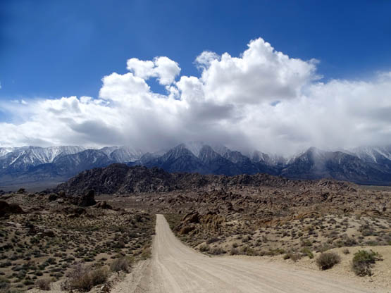
After driving down more than a thousand feet in elevation on Mt. Whitney Portal Road,
we turned left on Movie Road and wound around to the north and east for another
dozen miles to complete the rest of the loop through the Alabama Hills.
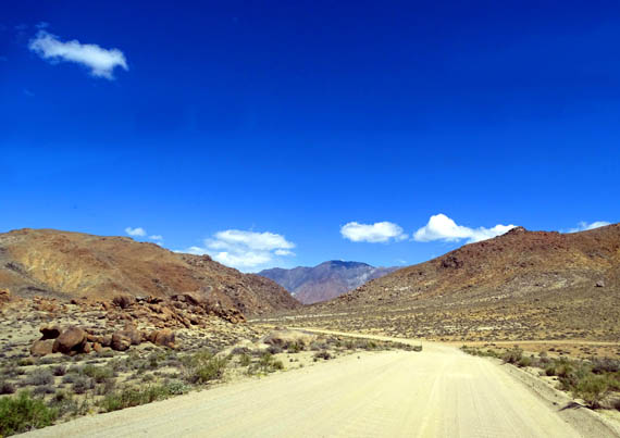
Although Movie Road is dirt, somewhat narrow, undulating, and curves
around a lot . . . it was pretty
smooth until we hit more wash-board bumps and larger gravel at the north end
of the loop.
The road was fun
to negotiate with our low-clearance, 2WD Honda Odyssey minivan, and even
large RVs can be driven slowly on Movie Road without destroying them.
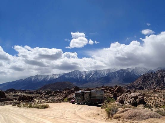
These folks found a fabulous boondocking site at a pulloff
(dispersed camping like this is first-come and free in the rec. area):
From the main roads in the recreation area you can see
lots of even more narrow dirt roads going in other directions. Many of
those require 4WD and/or higher clearance.
If you're ever in doubt at an intersection re: which
way to go in order to stay on Movie Road, just use your intuition, follow the widest
dirt road, and you should be OK. It's not marked well.
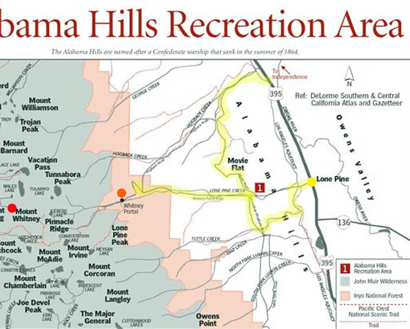
Here's the map section again of our route, highlighted in yellow:
The rest of these pictures are from the northern three-quarters of that loop,
going clockwise.
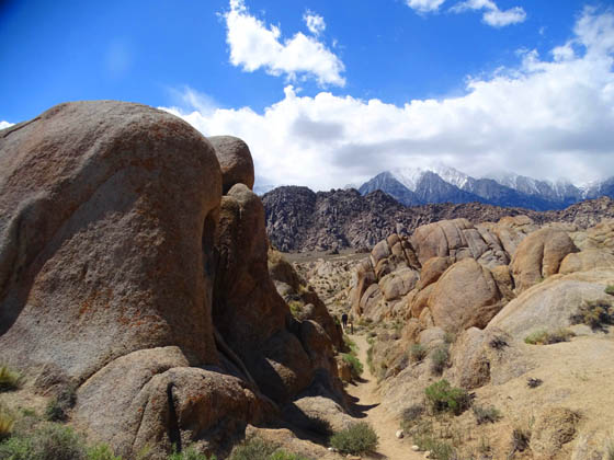
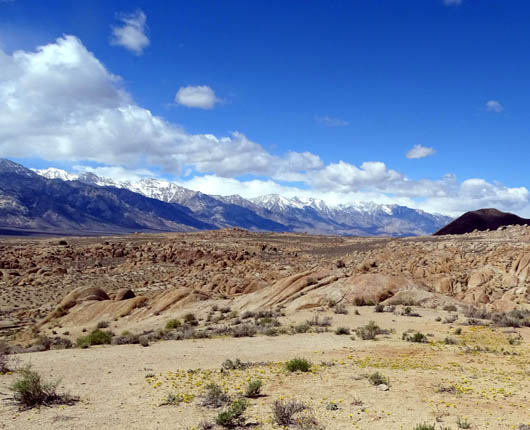
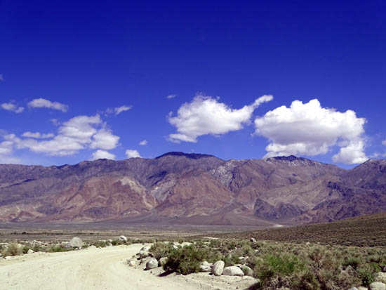
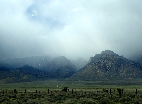
Although Movie Road twists and turns and dips down into low places, it is
also high enough much of the time to see both the Sierra Nevada Range to
the west and the Inyo Mountains to the east:
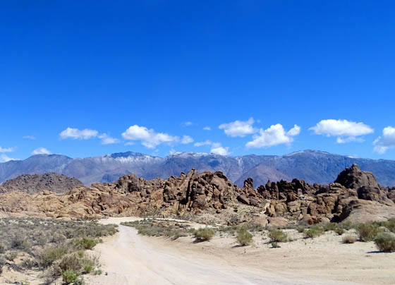
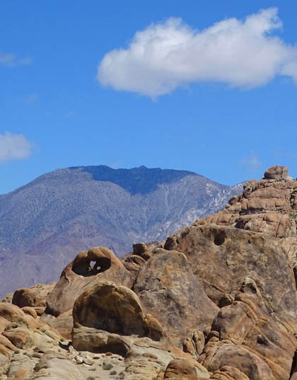
View toward the Inyos from an overlook on Movie
Road
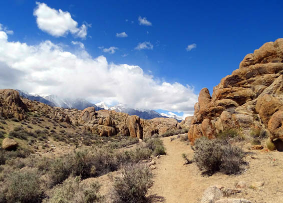
MOBIUS & MORE
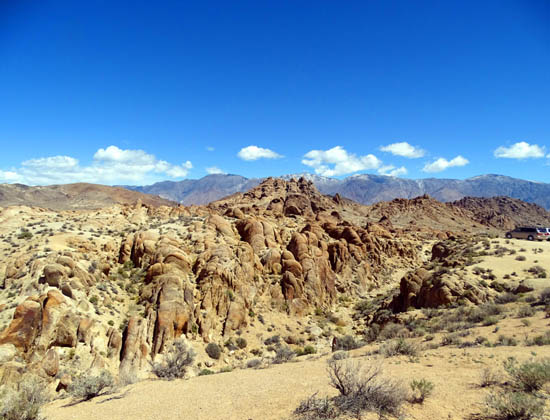
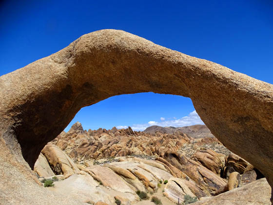
Soon we arrived at the parking area for the Arch Loop Trail, a hilly
one-mile trail that showcases popular Mobius Arch and several smaller arches
and windows in the rocks.
This is the most popular trail in the Hills but only a few cars were
in the large parking area when we were there on this weekday morning. We
saw a few people on the trail and waited just a couple minutes to
have Mobius Arch to ourselves for photos.
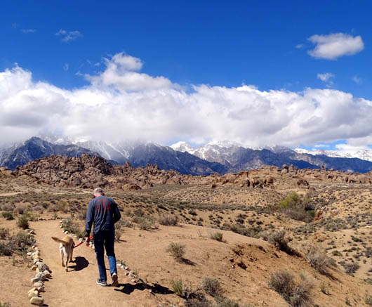
Since dogs are allowed on the trails in the Alabama Hills Recreation
Area -- and it wasn't too hot before lunchtime -- we took
Cody and Casey with us for this relatively short but interesting hike
clockwise around the loop.
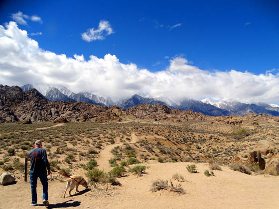
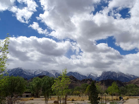
Jim's reading the trail marker
while Casey is straining to sniff something at the trailhead.
The Sierra Nevada Range is in the
background, still mostly under clouds.
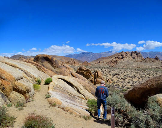
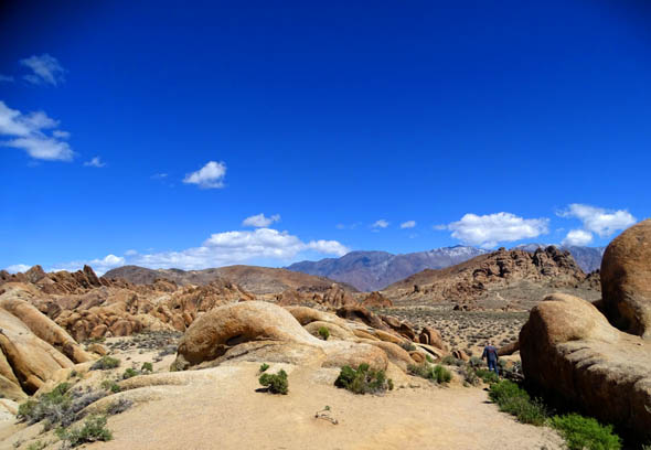
I'd rate this trail as easy or moderately easy.
It is one mile or less and undulates gradually between
4,600-4,700 feet elevation as it loops over the desert plateau, past
interesting boulder formations, and down into little canyons and washes.
Like Movie Road, the Arch Loop Trail is relatively
smooth dirt and winds around and up and down a lot. Unlike the road, the
trail is well-marked with rocks or signs whenever there is a question
about where to turn.
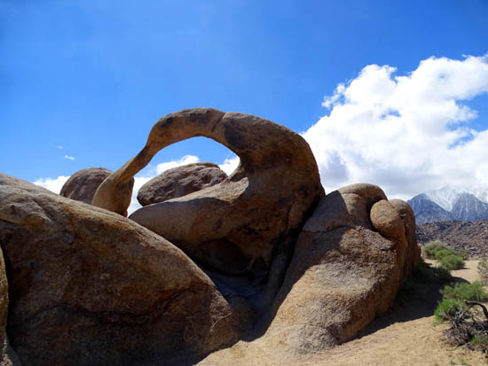
Going clockwise on the loop, we came to Mobius Arch in
about a third of a mile.
It's especially interesting because you can walk all
around it and take pictures close up or farther back. Each perspective
is different:
We approached Mobius Arch from the west.
One way to have fun with rock arches and windows is to
"frame" things in the background.
With Mobius, you can frame the Sierras to the west or
rock formations and the Inyo Range to the east -- or your hiking
companions:
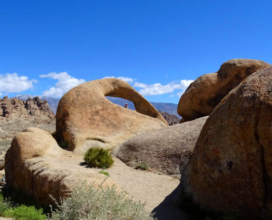
Jim's head is framed by the arch;
I didn't get a good close-up of him.
Nearby rocks + the Inyos in the
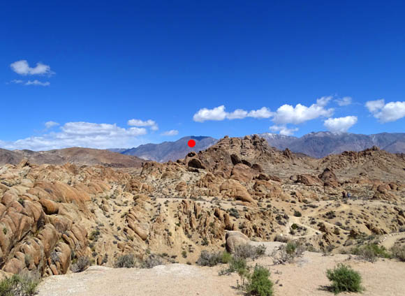
background
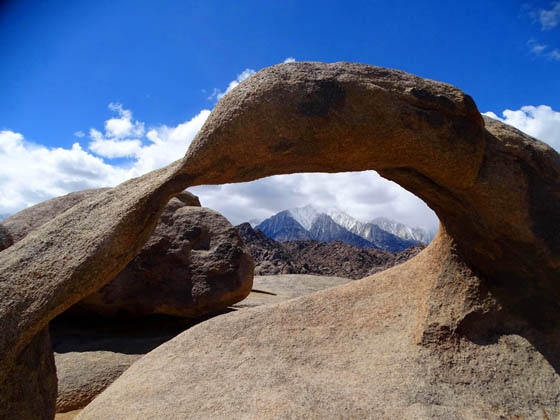
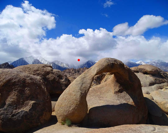
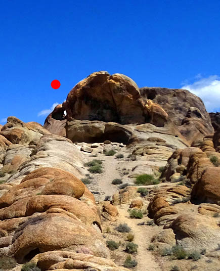
I think that's Lone Pine Peak in
the background above; Mt. Whitney can also
be "framed" but it was under
clouds when I took these pictures (red dot below).
Mobius Arch is so named because it is reminiscent of a
Möbius
strip, a simple geometric shape with only one surface and only one edge.
To see some interesting and colorful forms the strip can take, check out
this
website I found or do your own internet
search.
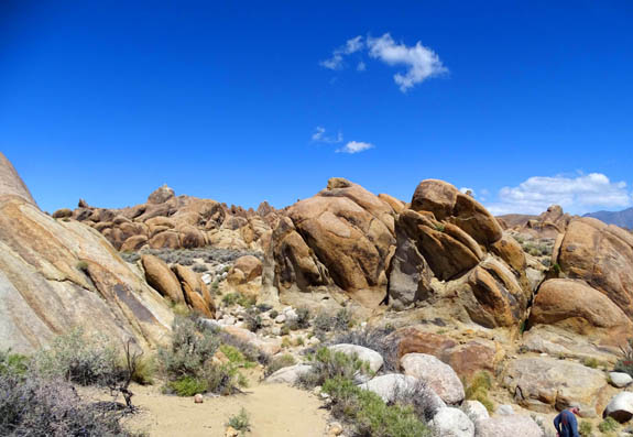
Some of the individual boulders and walls of rock have
eroded niches in them that could be the beginning of little caves or
eventual windows/arches. In the next picture I marked several with red
dots:
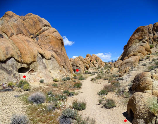
Just past and above the hollowed-out rock in the lower
right corner above, folks have made a path up to a rock formation that
looks like a bench or throne:
Note the little window in the rock below the red dot.
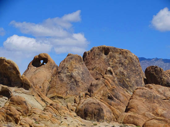
Along the loop I was on the lookout for more arches and windows. I found
three more, including the one above which is actually heart-shaped --
and has a smaller window next to it that you can't see from this angle.
As with the Mobius Arch, other arches and windows look
different from different perspectives. The window above looks like it's
part of the "bench" rock but it's actually behind and above it.
I didn't realize that until we were farther away and higher up, as we continued
along the trail and approached the other parking area trailhead.
Here are some other angles of the bench and that same
arch/window, which is heart-shaped:

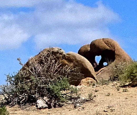
Above and below: same
"bench," heart-shaped arch,
and tiny window from a distance
I found one other small arch but we missed the larger
Lathe Arch; I saw it later on someone's website.
I'm sure there are more arches and windows along this
path -- and other areas of the Alabama Hills -- that can
be seen if you get off the established trails and poke around the
various rocks formations.
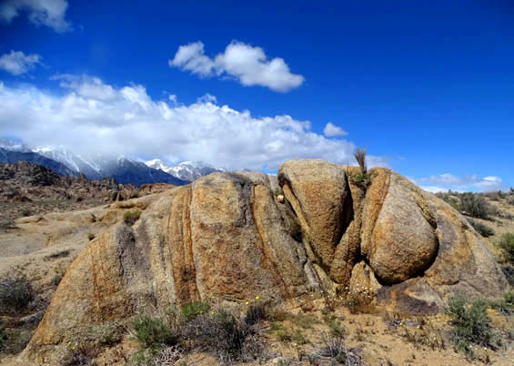
In addition to hunting for the arches and windows along
this trail, hikers can also have fun observing the interesting colors
and patterns on individual boulders and rock formations, like the one
below:
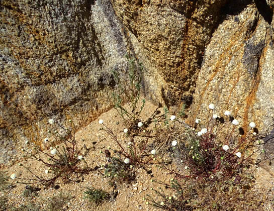
This is a closeup of part of that rock so you can see
the colors and mineral staining better. The little white flowers are new
to me -- Fremont (or Desert) Pincushion:
I spotted several other wildflowers that were new to me
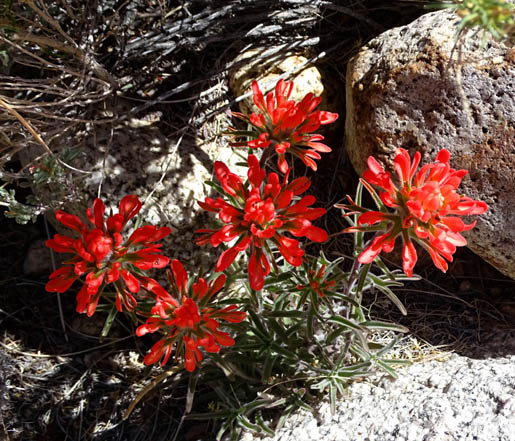
and some that were more familiar, like the bright red Indian Paintbrush below,
yellow Wallace's Wooly Daisy,
and blue Fremont Phacelia:
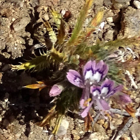
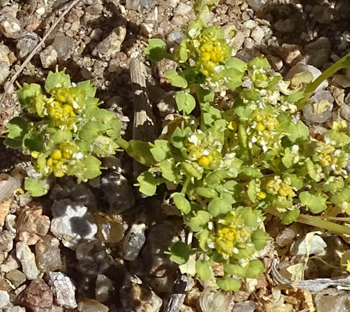
The next two flowers are new to me and I haven't been
able to identify either of them yet:
NORTHERN PART OF THE ALABAMA HILLS
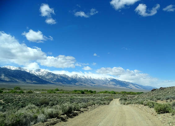
After we got done hiking the Arch Loop Trail we continued driving
north on Movie Road several more miles until the road
curved east and ended back on US 395 north of Lone Pine. We noted
several wide spots off the road that would be very scenic camping sites.
We continued to have excellent views of the Sierras on one side and
the Inyos on the other side, although the clouds obscured Mt. Whitney
even more than when we were closer to it on the Portal Road.
Looking back southwest toward the
Sierras
The the northwest, the clouds
weren't as dark or low over the Sierra Range
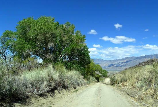
Above and below: must be a
stream here, with all these green trees
Getting closer to US 395 and the
Inyo Mountains
US 395 SOUTH TO NINE MILE CANYON ROAD
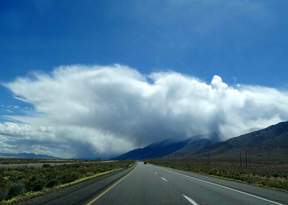
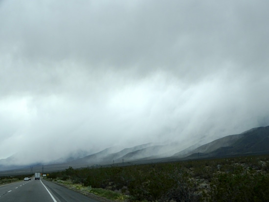
On the way back to Lone Pine and farther south on
US 395 to Nine Mile Canyon Road, the clouds were increasingly dense and
dark over the Sierra Nevada Range.
It looked more like it was snowing over the mountains than raining. Even
though the precipitation was pretty close to us as we got farther south,
and at one point we were under gray clouds instead of blue sky, we
didn't get into any rain or snow on the highway.
The Sierras near Lone Pine were
obscured as much by the Alabama Hills and trees as
by the low clouds.
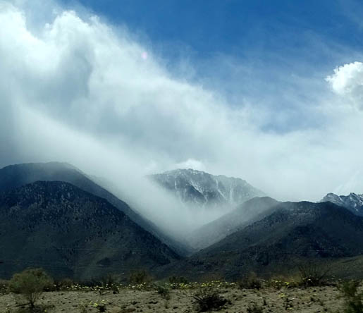
The farther we drove south, the heavier and more gray
the clouds became . . . until we could hardly see the southern
Sierras:
At that point I was starting to give up the idea of
going to Kennedy Meadows because we'd be going right through those
mountains on Nine Mile Canyon Road and high up on Kern Plateau for about 28 miles.
What if there was too much snow? What if we couldn't see
the scenery because of all the clouds and precipitation? After all, that was the whole point of going up there.
Continued on the next page: the
route through the canyon to the Kern Plateau and Kennedy Meadows (yes,
we went!)
Happy trails,
Sue
"Runtrails & Company" - Sue Norwood, Jim O'Neil,
Cody the ultra Lab, and Casey-pup
Previous
Next
© 2016 Sue Norwood and Jim O'Neil
