Today we had a long but fun and interesting day drive to several
scenic areas to the north of Ridgecrest on the eastern side of the
Sierra Nevada Range.
Although there were certain things we knew we wanted to see, my
pre-trip research wasn't exhaustive so we kept an open, inquisitive mind
to exploring other places we might learn about along the way. And we
found some of those, too!
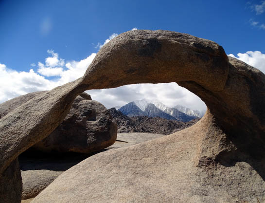
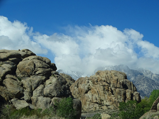
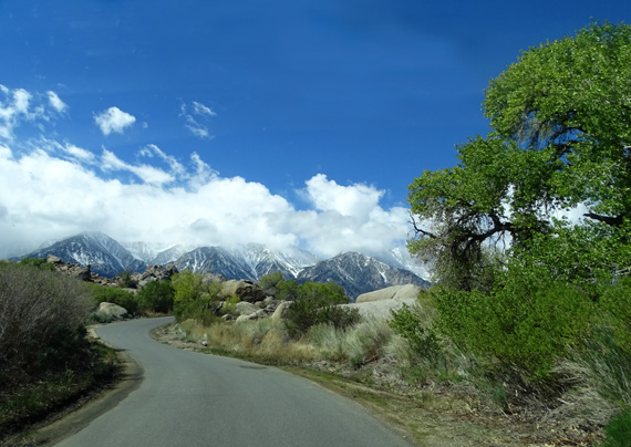
Snowy peaks in the Sierra Nevada
Range are framed by the Mobius Arch in the Alabama Hills.
OUR INSPIRATION: THE BADWATER 135
Lone Pine has been on my radar since 1990, when I began
training to run ultra-distance trail events. One of the most iconic ultramarathons
in this country is Badwater, a 135- to 157-mile foot race from
the lowest point in the Lower 48 states in Death Valley to the highest
point in the Lower 48 on Mt. Whitney.
Lone Pine is a small town near the end of the race before runners head up
the road to Whitney Portal, the official finish line at about 8,360 feet elevation.
That's 135 miles of running/walking and about 13,000 feet of elevation gain.
Some of the runners continue on up another 11 miles to the summit of Whitney at 14,497
feet -- if they have the desire and can get the necessary hiking permit
from the Forest Service. Then they have to descend back to Whitney
Portal, a total distance of 157 miles and an elevation
gain of over 19,000 feet from Badwater Basin. Total gain and loss
is even more than that.
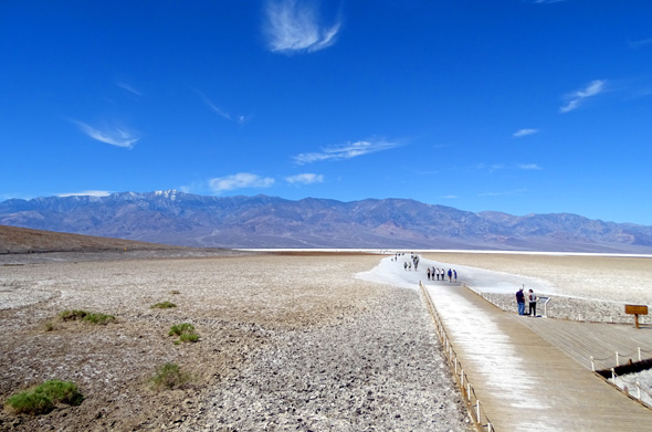
Ground level view at Badwater
Basin later this week;
282 feet below sea level = the
lowest point in the western hemisphere.
If this event sounds like fun to you, have at it! The only part that
appeals to me is the climb up and down Mt. Whitney. I love climbing
14ers that don't require technical gear.
Jim and I never aspired to run this event when we were still running
ultras. It's held in mid-July, when temperatures in Badwater Basin can
reach 130° F. It's run on even-hotter paved roads
where the soles of participants' shoes can melt, it requires more than one crew member, it is
difficult to gain entry, and it's doggone expensive.
Race management has morphed over the
years. Currently, a company called AdventureCORPS manages the invitation-only event. Some
veterans of the race, folks who can't get in, people who don't agree with
all the rules and regulations, and runners who just like to do their own thing
run the route solo -- with or without a crew -- at another
date.
Others like ultra legend Marshall Ulrich
challenge themselves even further by doing Badwater "doubles" or
"quads," going out-and-back on the course once or twice,
usually unsupported and pushing a cart with their supplies. That's
totally bad-ass, and they have our respect!!
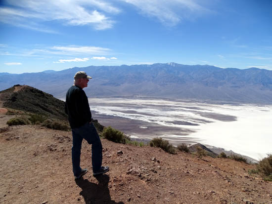
Jim looks out over Badwater Basin
from Dante's Overlook in Death Valley NP, even more
certain than ever that he doesn't
want to participate in a Badwater ultramarathon!
So even though the race itself (or a
solo run) never appealed to Jim or me, I've always wanted to climb Mt.
Whitney and we are both intrigued by the photos and stories about Death Valley.
Since neither of us has ever been to this area of California, we put it
on our "Go See" list this spring.
Today we got to see the little town of Lone
Pine and drove most of the way up the road to Whitney Portal; the
last part of the route was closed because of the snow pack. Then on
Thursday we took another day trip to visit Death Valley National
Park, driving on a lot of miles of the roadways runners use in the Badwater
Ultra.
Now we have even more respect for
all the runners who have ever completed the Badwater 135, 157, or
have done a double or quad!
OK, SHOW US WHERE YOU WENT . . .
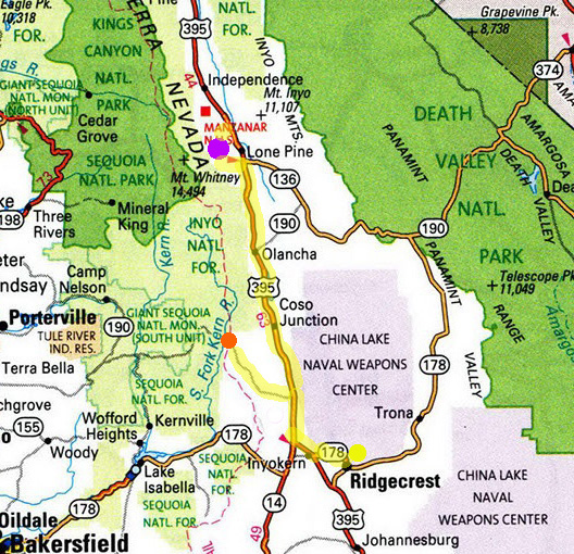
Here is today's route, highlighted in yellow. We didn't record the
total mileage but it was probably close to 200 miles.
The RV park on
base is marked with a yellow dot, the Lone Pine-Alabama Hills-Whitney
Portal area with a purple dot, and Kennedy Meadows via Nine Mile Canyon
with an orange dot:
It was only 42-63 F. at Ridgecrest/China Lake NAWS today at about 2,200
feet elevation and chillier at higher elevations where we traveled --
up to 7,535 feet on the way to Kennedy Meadows.
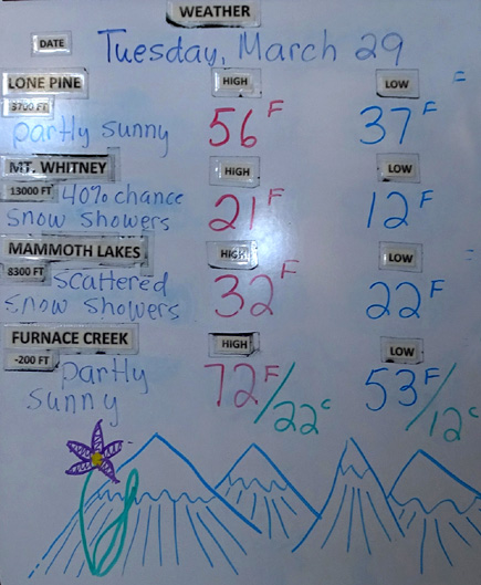
This is a picture of
the weather board at the visitor center in Lone Pine, showing predicted
high and low Fahrenheit temperatures for today at 3,700 feet elevation in town,
13,000 feet on Mt. Whitney,
8,300 feet at Mammoth Lakes, and 200 feet below sea level in
Furnace Creek/Death Valley NP:
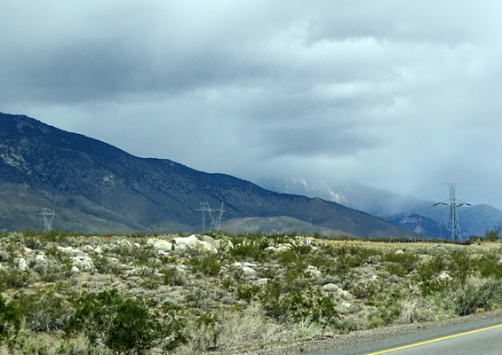
We got into several brief snow showers but there wasn't any snow
sticking on or near the roads. One disappointment today was not finding
any snow for Cody and Casey to play in.
The only places we could see snow on the ground were above ~ 8,000
feet in the Sierra Nevada and Coso Mountains.
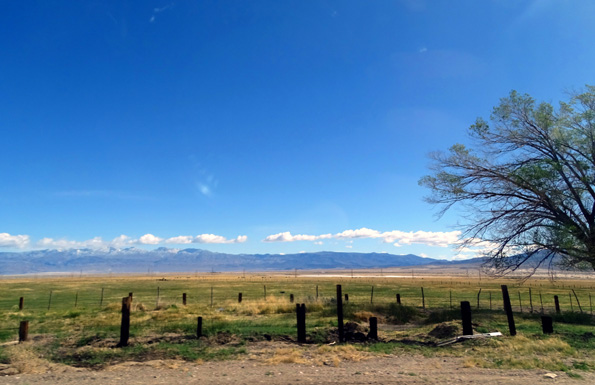
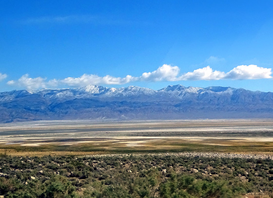
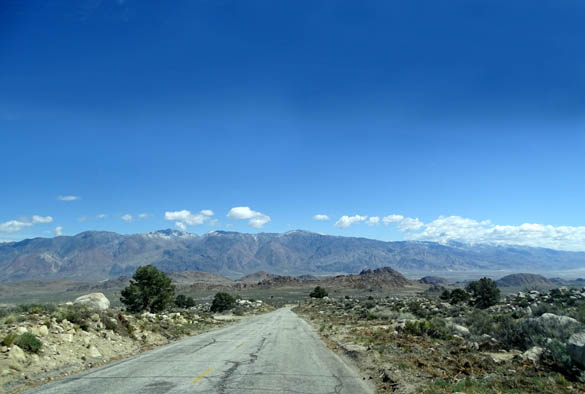
We saw some interesting terrain along US 395 to Lone Pine, including
volcanic rocks near the road. Some of the hills are more colorful
than others we've seen since we left northern Arizona in October.
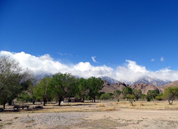
We enjoyed the farms, ranches, and mountain scenery on this route.
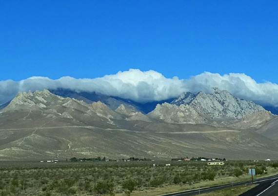
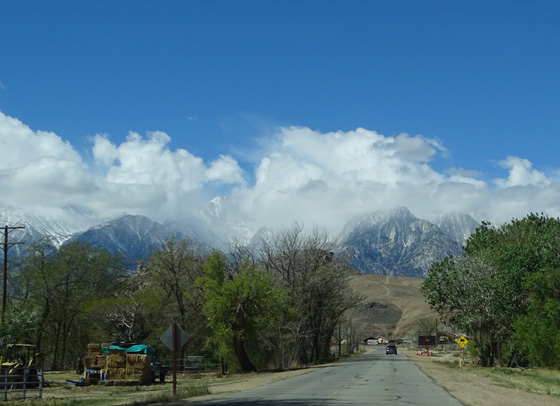
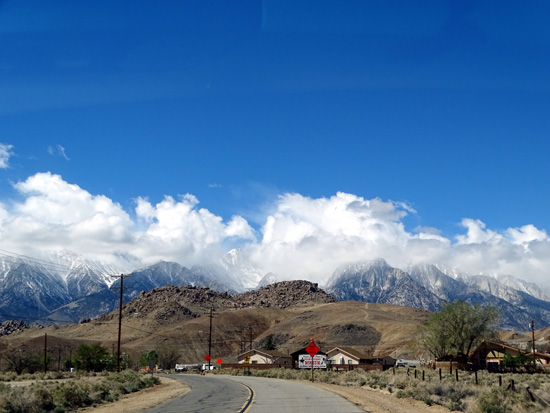
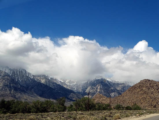
The clouds
were low over the southern end of the Sierras as we drove west
toward
US 395 from
Ridgecrest, and they hung over the mountains all the way to Lone Pine.
Snow showers
in the Sierras as we drove toward Lone Pine
Attractive
ranch on the east side of US 395; Coso Mtns. in the distance
We passed a long, narrow reservoir on the east
side of the road . . .
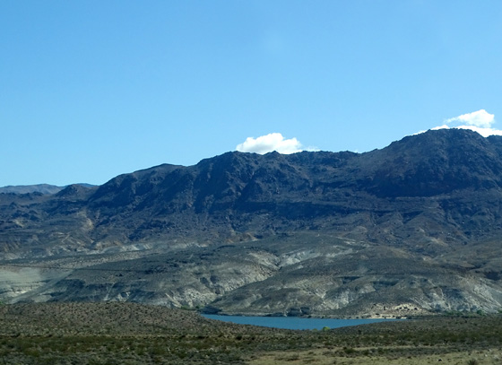
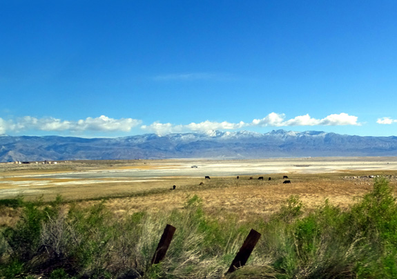
. . . and the large, mostly-dry Lake Owen, where cows were
grazing in several places down near the lake bed:
Some snow in the Coso Mtns.
When we got up to 4,000 feet near the town of
Olancha we saw some Joshua trees along the highway.
We noted four roads along US 395 where there are trails (Sand and Short
Canyons), a waterfall (Fossil Falls), and Nine-Mile Canyon to Kennedy
Meadows. We were surprised there wasn't more traffic on US 395, which is
part two-lane and part four-lane limited access divided highway.
Our first stop was at the visitor center in the little town of Lone
Pine so we could get more verbal and printed information.
WHERE IS THAT "LONE" PINE?
Sad to say, the solitary pine for which the town is named got washed
away from the bottom of Lone Pine Canyon during a storm. (Maybe they
should call it Lost Pine now?)
The town continues to thrive, however, mostly on tourism. This
area is a popular destination because of its scenic beauty, numerous
recreational opportunities, and history -- from mining to
making movies.
Heading west out of town toward
the Alabama Hills and the high Sierras
The valley in which Lone Pine is located was inhabited in the warmer
months for over 10,000 years by Native Americans in the Paiute and
Shoshone tribes.
The town was
founded in the 1860s to provide
supplies to gold and silver miners who had claims in the area.
Mt. Whitney was discovered in 1864
(nobody knew it was there before that???) and first climbed in 1873 by
three local men.
In addition to transient miners and folks who have ranches, orchards,
and other businesses, the town has been home to construction workers
building the California Aqueduct in the early 1900s and has hosted
people involved with the movie business since the 1920s.
During WWII, thousands of Japanese Americans
were confined seven miles up the highway in the
Manzanar relocation camp. Manzanar is
now a national monument.
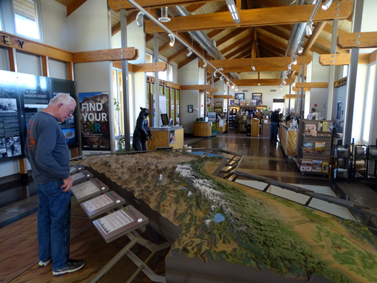
LONE PINE VISITOR CENTER
Our first stop in Lone Pine was at the handsome multi-agency visitor center so we
could get more information about the area.
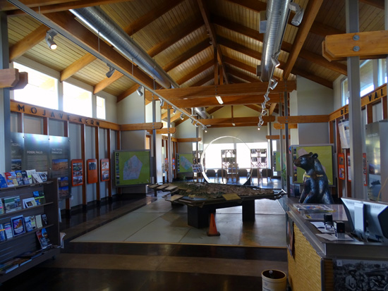
Richard, a National Park Service ranger, gave us lots of info about the
Alabama Hills Recreation Area, which is on BLM land, the road to Whitney
Portal, and other things he thought we might enjoy seeing.
We also spent time
browsing the exhibits and picked up several brochures.
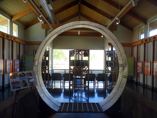
Sometimes there are fabulous views
of Mt. Whitney and its other high neighbors from inside the visitor
center and out on the grounds.
Not today, however. Despite all
the sunshine, complete views of the peaks were obscured by low clouds
moving in and out all morning:
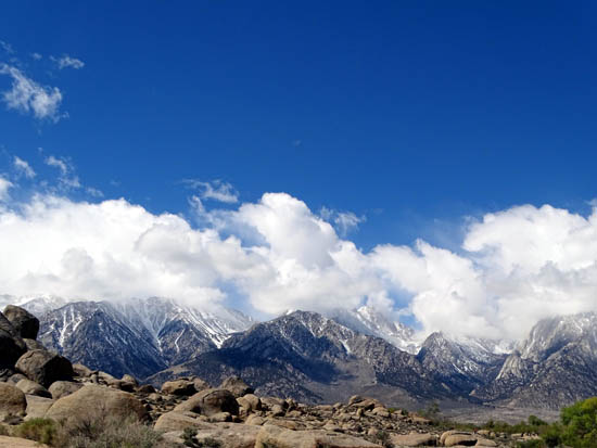
View of range with Mt. Whitney
from the visitor center
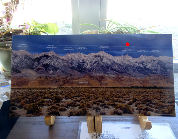
The next wide-angle shot that someone took
with no clouds over the mountains is a section of the Eastern Sierras
that is
displayed at the visitor center to help visitors identify the peaks.
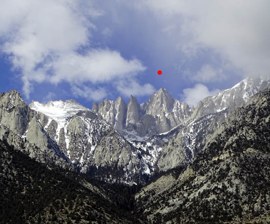
Since Whitney (under red dot I added) is behind some of the
other mountains, it appears to be shorter than some of them from the
viewer's perspective down in this valley. At 14,497 feet, however, it's
the highest peak in the Lower 48 U.S. states.
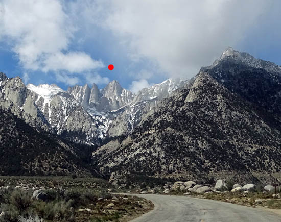
I kept my eyes on those peaks the
whole time we were going up Whitney Portal Road and looping through the
Alabama Hills but
I didn't know until later, when I was editing my photos and comparing them with that
picture above, if we ever saw Whitney's summit.
By gosh, we did! That's Mt. Whitney under my red dot:
Ironically, even
Josiah Whitney, leader of the California Geological Society's team that
discovered the peak in 1864, thought he was the first to climb to the
summit of "his" mountain in 1873 -- but he actually climbed Mt.
Langley, not Mt. Whitney. Langley and Whitney are separated by three
other mountains, as shown in the next picture below.
His later ascent of Mt. Whitney
became the fourth confirmed ascent of that mountain.
The next picture
is a section of that wide-angle photo at the visitor center that identifies some
of the peaks that can be seen from the valley near Lone Pine. I marked Mt.
Langley with a yellow dot and used two red dots for Mt. Whitney and
Whitney Portal, the trailhead to reach the summit:
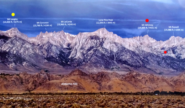
I can understand Josiah Whitney's confusion, with several 14ers close
together and views from the valley often obscured with clouds. Back then
there were no trails up the mountain and definitely no Whitney Portal
Road to guide him toward the right peak.
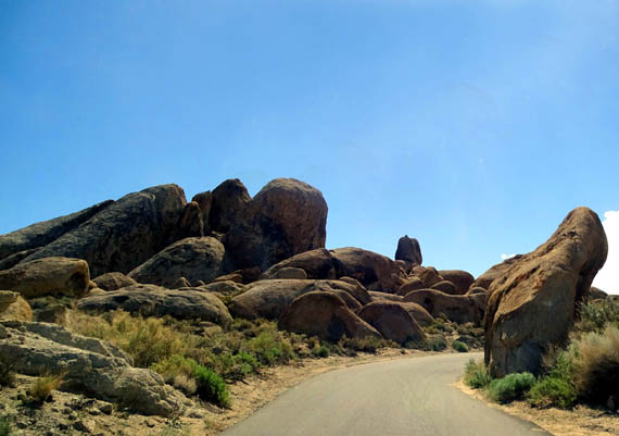
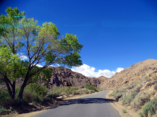
MOVIE MADNESS: THE ALABAMA HILLS
For us, driving through the Alabama Hills just outside Lone Pine was
more about the scenery and accessing Mt. Whitney Portal than about
searching for the locations where hundreds of movies, TV shows, and
commercials have been filmed in the last hundred years.
But if you're interested in finding those locations, you can find
maps online and various places in Lone Pine (visitor center, the movie
museum, etc.) that will guide you to the right places:
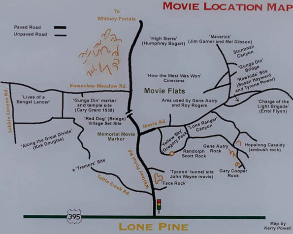
Even though I'm not a big movie buff I recognize the names of
many of those oldies, like "High Sierra," Gunga Din," and "Maverick,"
and famous stars such as Roy Rogers, Gene Autry, John Wayne, Gary
Cooper, and Humphrey Bogart.
And I did use to watch "The Lone Ranger"
on TV when I was a kid! More recent films in the "Star Trek"
series and other genres were also shot here.
The Alabama Hills Recreation Area covers thousands of acres of foothills
and low mountains with interesting rock formations between the eastern
Sierra Nevada Range and US 395 in the Owen Valley. The land is managed
by the BLM and stretches for about nine miles from south to north and a
few miles east to west.
Entry is free, dogs are permitted on trails, and dispersed camping is
allowed in obvious clearings.
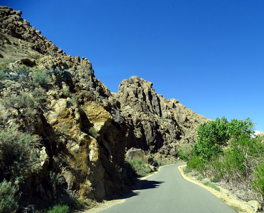
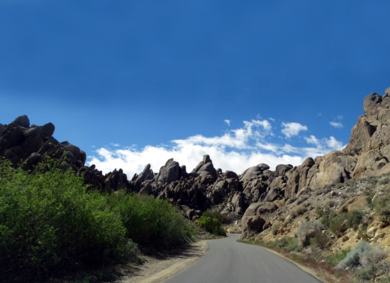
The photogenic rounded granite rocks in Alabama Hills are the same type
of rock in the chiseled, craggy Sierras but they have been worn down by erosion
over the last 90 million years, give or take a few. They remind me of
the boulder jumbles in Joshua Tree National Park but these have more
gold and brown colors to them. The dark streaks are a result of the
oxidation of iron minerals.
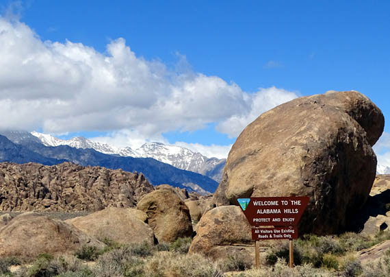
Many natural arches have also formed in the Alabama Hills over the
millennia, adding to the picturesque appeal of the area. The largest and
most famous is the Mobius Arch, which I showed near the top of this
entry. I'll show more pictures from the Mobius Arch Loop Trail in a bit.
It is these unique rocks and the spectacular mountain backdrop that have
drawn not only the film and TV industries to the Alabama Hills, but also
lots of tourists who are interested in photographing the scenic
landscape and pursuing recreational and other activities like hiking, running,
cycling, rock climbing, fishing, horseback riding, camping,
photography, star-gazing, bird-watching, auto-touring, and four-wheeling on
the dirt roads.
TODAY'S ROUTE THROUGH THE REC. AREA
Here's part of a map of the area from a Mammoth Lakes
website. I marked Lone Pine with a yellow dot,
Whitney Portal with an orange dot, Mt. Whitney with a red dot, and our driving route
in yellow:
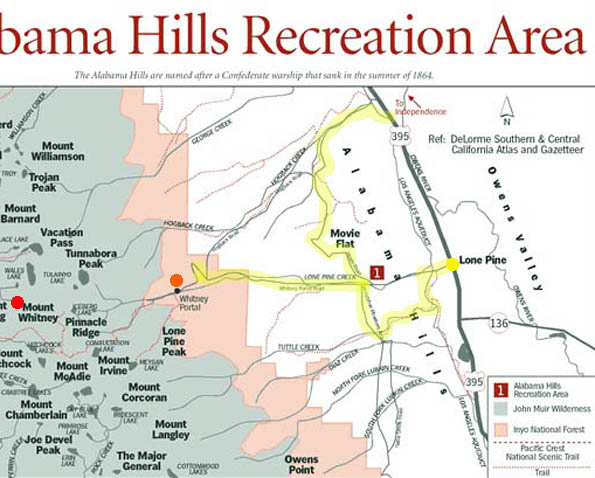
After visiting the impressive multi-agency visitor center in Lone Pine
we drove out the west side of town on paved Whitney Portal Road and made
a left (south) on Tuttle Creek Road to begin our convoluted clockwise loop
thrugh the Alabama Hills.
I've already shown a few pictures from this southern part of the loop.
Here are some more that I took as we wound around and up and down
through the rock formations until we emerged high enough to see the
mountains more clearly (?) through the low, thin clouds that kept
swirling around the peaks:
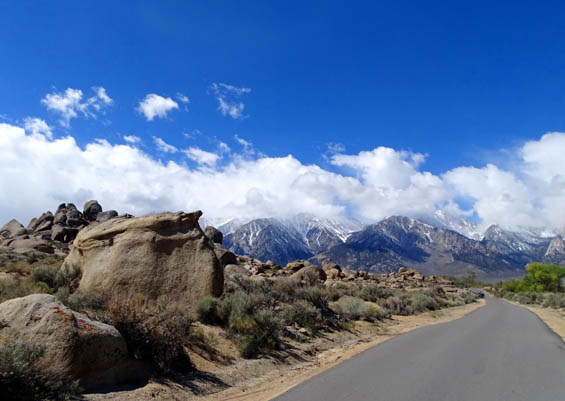
Edge of town, heading west --
what a fabulous view!!
This part of the loop is paved but narrow.
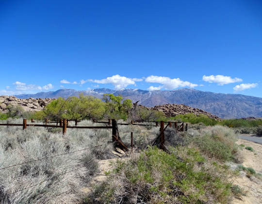
Old stock fencing and corral
When we came back to the intersection with Whitney Portal Road we turned
left and drove west several miles toward Mt. Whitney to the intersection with Hogback Road.
ALMOST TO WHITNEY PORTAL
I mentioned earlier that we weren't sure we could see Mt. Whitney
until we got back and I compared my photos with another photo from the
visitor center that identified the peaks. It was difficult to tell which
was which because they are so close together and the clouds often
obscured the summits.
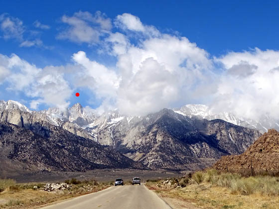
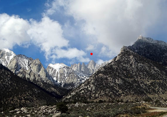
We were more sure which one was Whitney as we headed due west on the
Portal Road, however. In the next set of pictures I've put a red dot
above each shot of Whitney:
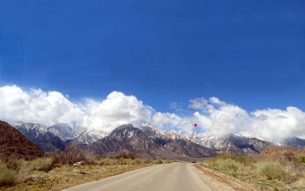
What a stunning panorama as we
head toward the Sierra Nevada Range!
You can see part of the Whitney
Portal Rd. in a sideways "V" as it zig-zags up toward the trailhead.
You can clearly see where the
Portal Rd. is going up ahead.
Zooming in; note the snow-covered
cirque to the left that looks almost like a glacier.
As we got closer to the intersection with Hogback Road we gradually
lost that perspective of Mt. Whitney and could only see its jagged south
flank when we had to turn around; the remainder of the portal
road was closed due to snow farther up the mountain.
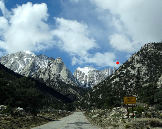
We came to the road closure sign a couple hundred feet past this yellow "Trailers Not
Recommended" sign and couldn't see even those jagged columns on the
south side of Whitney. Our elevation was about 6,500 feet.
I was disappointed that we couldn't get up to the
trailhead -- and didn't even see any snow for the dogs to play in
-- but grateful for the beautiful mountain scenery we were
able to enjoy today.
This was our view looking east and south toward the Alabama Hills,
Owens Valley, mostly-dry Owens Lake, and Inyo Mountain Wilderness as we
retraced several miles on the Whitney Portal Road on our descent to the
intersection with Movie Road:
When we got to Movie Road we turned left and stopped for a minute so
I could take a picture back toward Mt. Whitney and its neighbors:
The clouds were even lower then, but continued to move in and out the
rest of the time we were driving and hiking in the Alabama Hills.
Continued on the next page: scenes from Movie Road and the
Mobius Arch Trail in the Alabama Hills
Happy trails,
Sue
"Runtrails & Company" - Sue Norwood, Jim O'Neil,
Cody the ultra Lab, and Casey-pup
Previous
Next
© 2016 Sue Norwood and Jim O'Neil
