Obviously, in one day we couldn't drive to and from China Lake Naval
Air Weapons Station and cover 3.4 million acres of terrain in
Death Valley National Park . . . but we sure did hit the highlights!
Badwater Basin. Dante's View. Artist's Drive. Devil's Golf Course.
Mesquite Flat. Furnace Creek. Stovepipe Wells. Emigrant. Towne Pass.
Panamint Springs.
And more! I also did hikes at Natural Bridge,
Golden Canyon, and Mosaic Canyon and walked out to several overlooks.
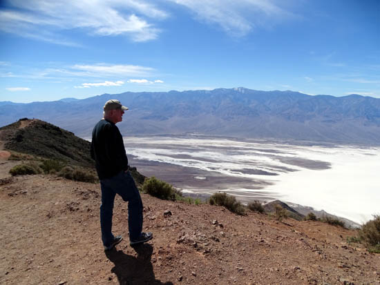
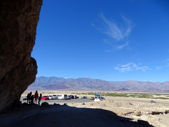
Jim looks
out over Badwater Basin from Dante's Overlook, a difference of ~5,757
feet elevation.
Some of these names are familiar to ultra-distance runners who have
either run or have read about the iconic Badwater Ultramarathon, a
135-mile foot race -- run in July, no less -- from
Badwater Basin, the lowest point in the entire Western Hemisphere, to
Whitney Portal at 8,000+ feet elevation.
Some of the runners continue up to the summit of Mt. Whitney, the
highest point in the Lower 48 states at 14,497 feet elevation, and
back down to the Portal for a grand total of 157 miles.
Now you know why the event is conducted in July. It may be hot
in the basin but at least there's a fighting chance that most of the
snow will be melted on Whitney.
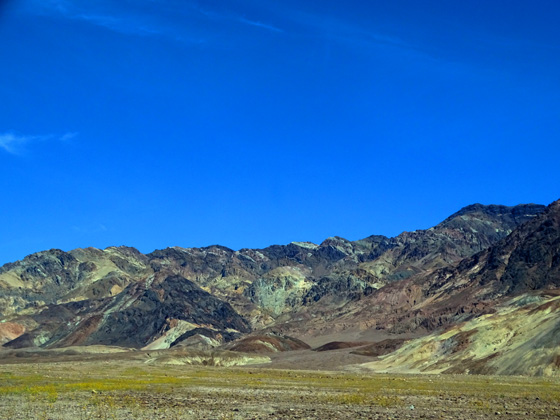
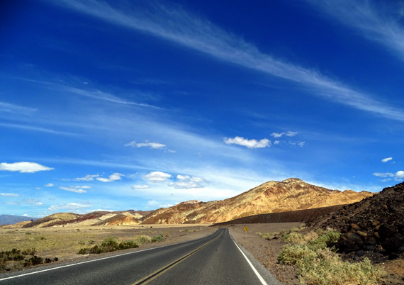
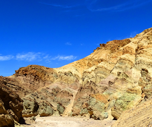
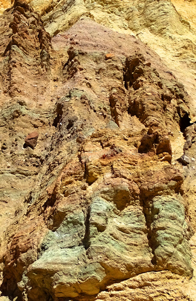
Colorful slopes and wildflowers
in the Black Mountains along Badwater Road
Other spots will be familiar to folks who have visited or read about
Death Valley previously. If you've been there, you probably won't ever forget
them.
Some of the names and images from our visit today will be seared in
our memories forever -- the expansive view of Death Valley from
Dante's View, e.g., the jagged crystalline salt pinnacles at the Devil's
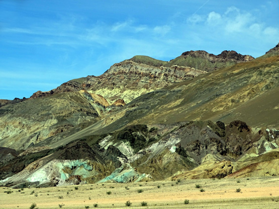
Golf course that look like a coral reef run amuck, or the multicolored
palette of mineral-rich hues in the rocks and canyons along Artist's Drive.
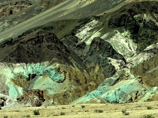
Above and below: Turquoise
and shades of green stand in contrast
to metallic colors of gray,
black, white, brown, tan, and gold.
I use the word "sear" in the previous paragraph with some amusement,
because on this last day of March it was already hot enough for us at
the lower, very exposed elevations that we were grateful for a bit of shade
on canyon trails and
air conditioning in our car.
In contrast, it was rather chilly in the wind on Dante's Point at
5,475 feet elevation.
Since we seek out moderate temperatures year-round in our RV travels
around the continent, we sure wouldn't want to be here in July when it
can get up to the 120s F. or even 130s in Badwater Basin. Rangers
encourage people to visit the park in the cooler months to avoid
actually dying in Death Valley, and even then to carry plenty of water
with them on hikes.
WHY WE VISITED THE PARK
Curiosity, mainly, because we'd never been there
in person. We enjoy adding to our list of units in the national park
system, although we're not likely to visit all 400+ of them in our lifetime.
We were also intrigued with this park in
particular because of the contrasts between high and low, the vast
expanses of desert, the variety of eco-systems, the stark images we've
seen of the dry salt bed in the basin -- and wondering why in the
heck so many runners would want to do either the Badwater ultra or the
same route on their own!
We know quite a few people who've run the official event or their own
version of it, sometimes going out and back once (a "double" = either
135 or 157 miles x 2) or twice (a "quad" = multiply those distances by
4).
Why would anyone want to do that??
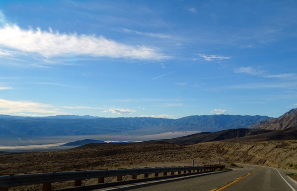
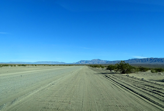
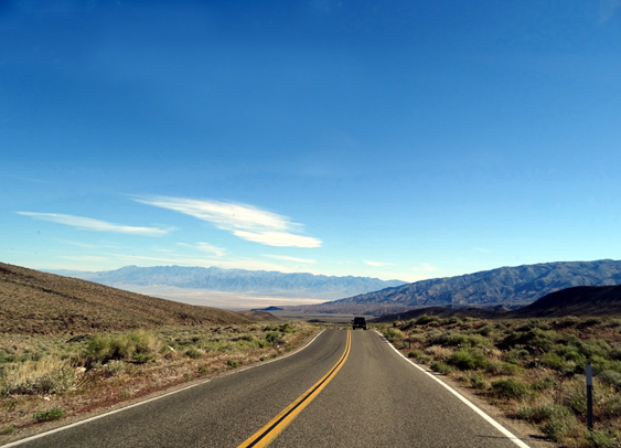
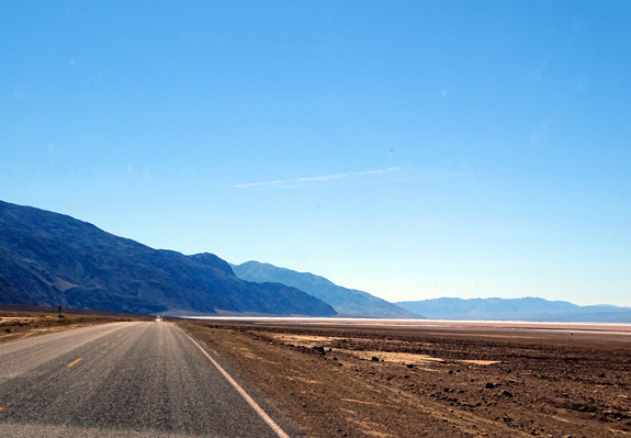
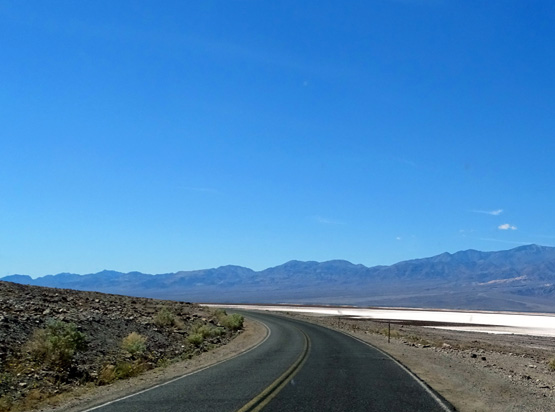
Relatively flat road through Badwater Basin at
elevations below sea level
Jim and I used to run 50 to 100 miles or more on scenic mountainous dirt
trails, or even around short loops for 24 or 48 hours at a time, but we
were never interested in this event for any number of reasons --
it's paved, too damn hot, too long, too boring, too expensive, you have
to have several people crew you, etc.
But we were interested in seeing where these folks run --
and now that we've seen most of the course, we're doggone impressed with
their efforts!
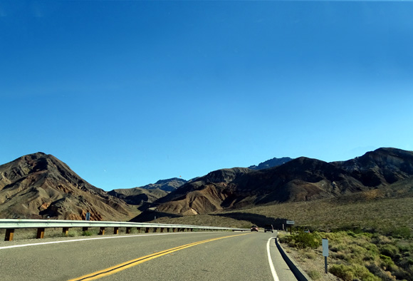
The route is more scenic than I expected and also more difficult because
of at least two passes the runners must negotiate in the second half of
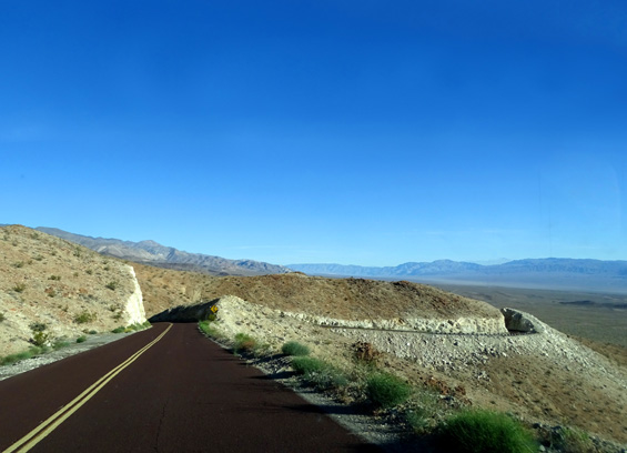
the race. Towne Pass (4,856 feet) would be tough to run or even drive
with a large RV because you're starting near sea level on either side.
Part way up Towne Pass
Then running/walking
up the Mt. Whitney Portal Road to 8,000+ feet elevation to the finish
line after so many miles, let alone continuing on to the summit, isn't a
picnic either.
Mountainous terrain doesn't scare Jim and me. In fact, that's the
only appealing part of the Badwater event for us -- going up the trail
on Mt. Whitney. It was mostly all that hot desert terrain and hard pavement that
prevented us from ever running this event when we were still able to run
ultras.
TODAY'S ROUTE
Here's a map of our route from China Lake/Ridgecrest (near the red
Google Map teardrop) to
Death Valley NP via CA 178 and Panamint Valley Road, east into the park
on the main route (CA 190), out and back on Badwater Road (we
turned around a couple miles beyond the boardwalk to the basin),
out and back to Dante's View, then home via CA 190 through Panamint
Springs, the vista point above Rainbow Canyon, over to the town of
Olancha, and back to the Navy base on US 395 and CA 178:
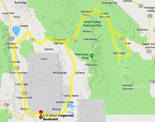
Whew! That was 390 miles of driving and sight-seeing in about 12
hours, including my three short hikes totaling 2˝ miles.
(We had the dogs with us and Jim opted to stay in the car with them
while I hiked. Dogs can't hike on trails in most national parks and it
was too warm for them at the lower elevations anyway.)
CA 178 north through the Searles and Panament Valleys to Panamint Springs
was less than ideal (two miles of rough gravel break, worse than any we've
driven over in Alaska!) but the paved parts were smooth and there was
minimal traffic on it this morning.
Mountains on
either side of CA 178 all the way to Panamint Springs
We were glad
we weren't hauling the Cameo through this rough gravel break.
We drove east and south on CA 190 through the park, noting the location
of a couple places we wanted to see on the way back out.
Going down the east side from Towne Pass
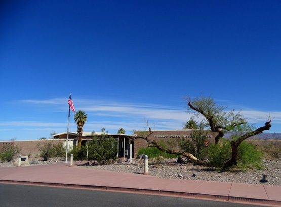
FURNACE CREEK VISITOR CENTER
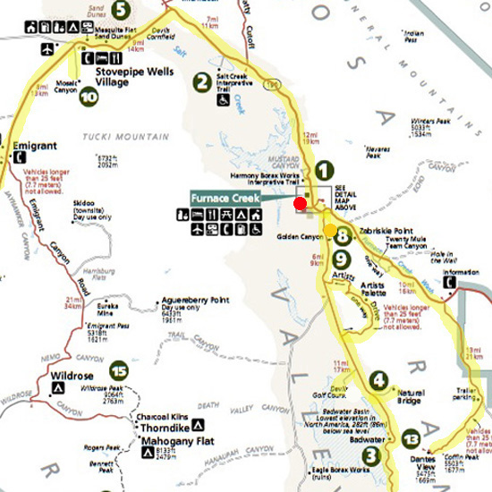
Here's a map section from the park website that I'll use on each of the
three pages of this entry to show the location of places we visited.
The yellow highlighting = the roads we were on. The red dot on this
first map indicates the Furnace Creek Visitor Center, our usual first
stop in any national park:
The visitor center has two areas with parking spots under roofs;
we parked there so the dogs didn't roast while we were inside. We got
a park brochure, looked at the exhibits, and confirmed what places we
wanted to see/hike.
We already had the large visitor guide (like a newspaper) and had done
research online so we pretty much knew what we wanted to see and do
before we got there. Our limitation was primarily time.
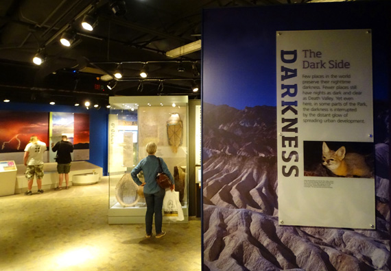
Clear skies + far from any lights = a great place
to see stars at night
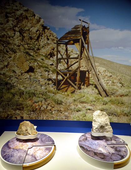
Gold (L) and Borax (R) are two of the minerals mined in
this area; borax is used
in a wide range of products from laundry detergents
to electronic touchpads.
A ranger at the visitor center indicated the park was pretty full today
(wildflower season + perfect spring weather) but we didn't have
much of a problem parking anywhere we stopped.
The roads in the park
were fairly smooth. However, there are virtually no shoulders for
running or cycling. Although we took my bike so Jim could ride it
from Furnace Creek to Badwater Basin this morning, he didn't cycle
because of all the traffic and narrow roadways.
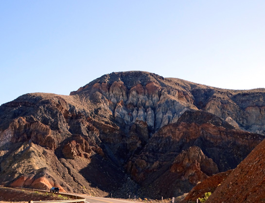
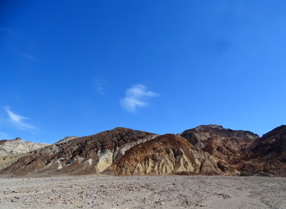
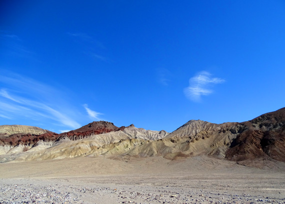
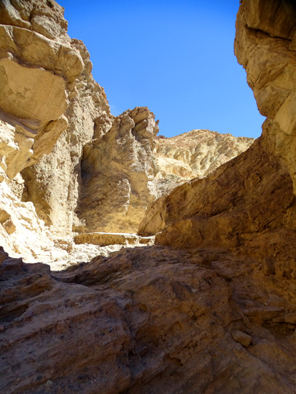
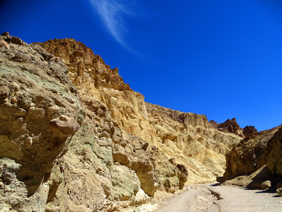
GOLDEN CANYON TRAIL
We drove
south on Badwater Road first, passing some colorful hills on the east
side of the nice paved road; they are part of the Black Mountains
in the Amargosa Range:
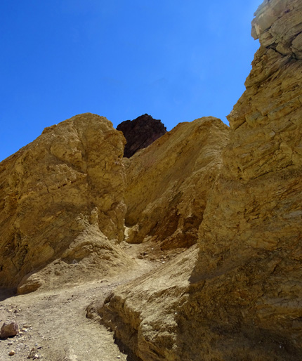
We stopped at the Golden Canyon Trail, where I walked in only 1/2 mile and back
out. Its location is shown on the map section above at the *gold* dot
I added near the number 8.
You can hike farther back than that to the Red Cathedral rock formations
shown in the picture on the sign below, or do a loop that is 4+ miles long.
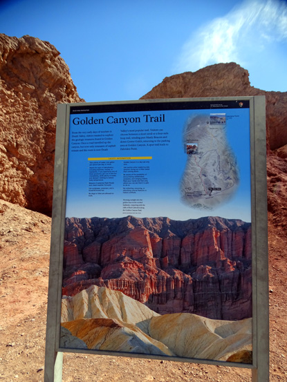
I was able to see the red columns in the distance
before turning around:
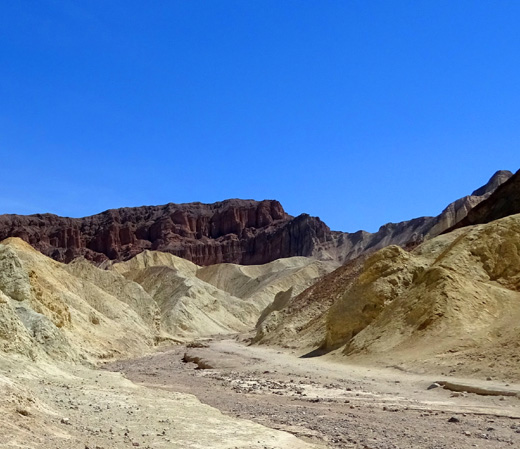
Although many of the
walls in the canyon are a pretty golden color that glows in the sun,
other colors can be seen in some of the rocks, too:
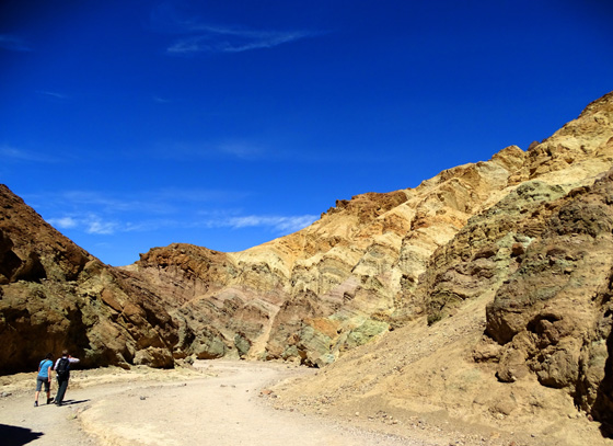
We also saw that same variety of pretty
pastel colors along nearby Artist's Drive, too. (Scenes from that loop
on the next page . . .)
Coming back out to the parking area:
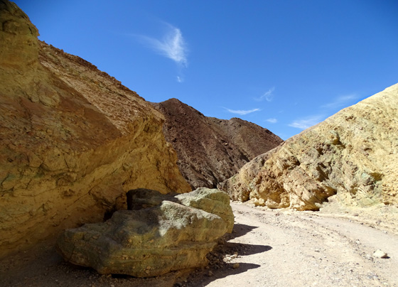
View across
Death Valley toward the Panamint Range
Jim stayed in the car with the dogs. There was a good breeze at all of
our stops so he didn't get too hot in the car while I did several short
hikes at various places in the park.
I encouraged him to go on any of
the hikes either before or after me while I watched the dogs but he declined
except to walk out to see the views from Dante's Overlook, Mesquite
Dunes overlook, and other
sights near some parking areas where we stopped briefly.
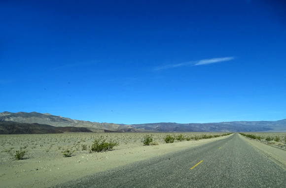
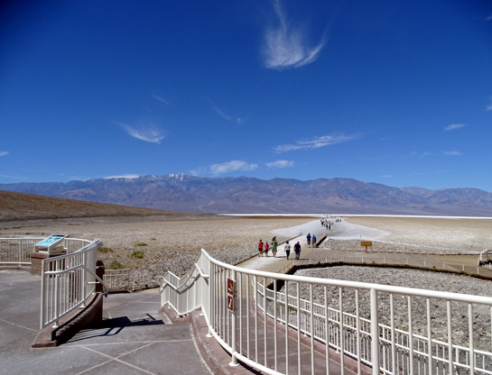
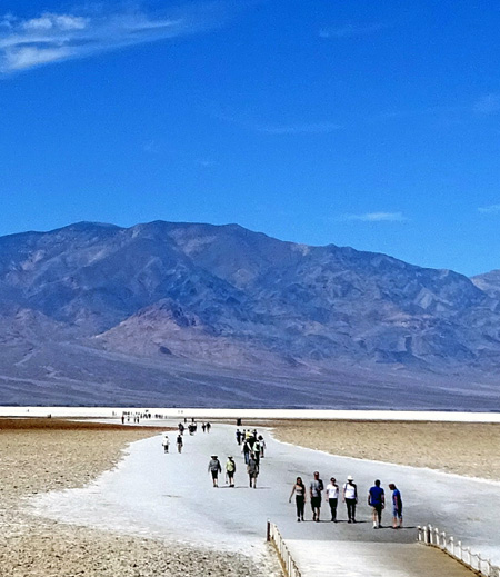
BADWATER BASIN
Next we headed down to the Badwater Basin viewing area, marked #3 at
the lower right on the map section above. The Black
Mountains were on our left and we could see the vast white salt pan in
the distance for ten miles or more:
There is a large
parking area on the right and a long boardwalk that leads visitors
toward the salt pan.
Because of the heat
and the dogs in our car, we parked
just long enough to read some of the interpretive panels
and take photos from the upper and lower viewing areas:
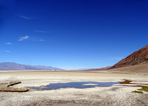
I was
surprised to see a bit of water on either side of the observation area;
bet it's salty!
Badwater Basin is 258 feet below sea level, the lowest place in the U.S. and
the seventh-lowest place on earth. The very lowest is the Dead Sea at
1,360 feet below sea level.
Visitors can walk across any or all of the five
miles across the basin if they want. It doesn't look like it's that far
but that's what one of the NPS signs says:
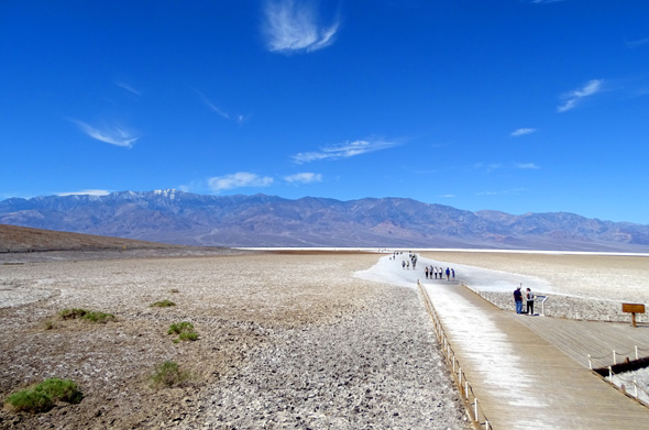
Above and
below: Several dozen people were out on the salt pan
while we
were there; we could see some who were out quite far.
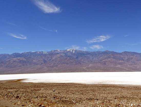
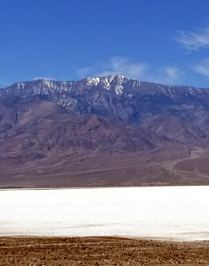
From this lowest point in the park
you can look west across the basin to the highest point in the park,
Telescope Peak at 11,049 feet.
I was surprised there wasn't more
snow on top:
We drove a couple miles south past the observation area so we could get
closer to the salt pan:
Badwater Road continues south for another 55 miles or so, curving east
in the southern end of the park and ending at CA 127 near Shoshone, CA.
Continued on the next page: Natural Bridge Trail, Devil's
Golf Course, and colorful Artist's Palette Loop
Happy trails,
Sue
"Runtrails & Company" - Sue Norwood, Jim O'Neil,
Cody the ultra Lab, and Casey-pup
Previous
Next
© 2016 Sue Norwood and Jim O'Neil
