On our first full day in Red Canyon in September, a Friday, I wanted
to hike the popular Thunder Mountain Trail because of what I'd read
about it prior to our visit.
However, when I went to the Red Canyon Visitor Center to get a trail
map, the Forest Service ranger who answered my questions recommended I
wait a few days to hike the Thunder Mountain Trail. It had been raining
and the bikes and horses had torn up the trail so it was less hiker-friendly.
For as long of a hike as I wanted to do, he suggested the Cassidy,
Ledge Point, and Rich Trails that day instead. As you can see from the
map, there are many possible variations so folks can hike any distance
they want and go either CW or CCW or make figure-8s on the
loops:

I marked the trails I hiked the
first time; I did a little less the second hike.
I'm glad I listened to his advice because even though those trails
are also open to cyclists and equestrians, they were in good condition
-- no bike tire ruts, no horse hoof divots, no hiking boot
impressions.
These trails are obviously used less than Thunder Mountain.
For a hiker like me who prefers solitude to lots of other trail
users, these three trails are a good choice. I saw only six people (no
horses, no dogs) on my first hike of about five hours on the trail --
on a perfectly beautiful Friday -- and no one on the second hike
of two-plus hours.
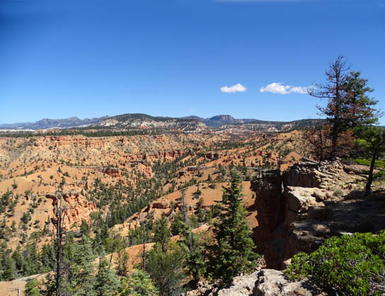
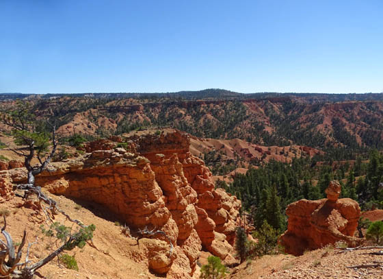
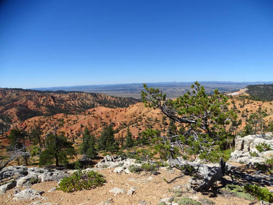
View NE into Losee Canyon from
Brayton Point on the Cassidy Trail
Jim was doing a 33-mile bike ride that first day so I hiked solo for
10˝ miles. I did all the Cassidy,
Rich, and Ledge Point loops, then went out farther north on the Cassidy
Trail (top of map and GPS track) before turning around. I didn't go as
far as the intersection with the Losee Trail that day.
My GPS recorded elevations of 7,277 feet at the trailhead to 7,900
feet at the highest point, with a total of 2,547 feet of elevation gain and
loss:
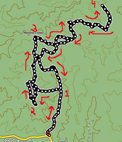
1= out and back section to first
trail intersection; 2 = Ledge Point
on first loop; 3 = Brayton Point on third loop; 4 =
turnaround
A few days before we left Red Canyon Jim and Casey joined me on a
pretty Monday morning for a 6.3-mile hike on these three trails.
Our high point was almost the same but the total gain and loss was less
(1,680 feet) because the distance was 4+ miles shorter.
The photos in this entry are from both hikes. I'll present most of
them in the order in which I hiked from the trailhead a little past
(east of) the Red Canyon Campground.
There is a large parking area at the trailhead and two different
trails that converge above the wash in about 100 feet. I prefer using
the horse trail through the wash because it's less hilly:
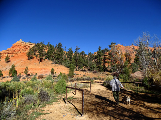
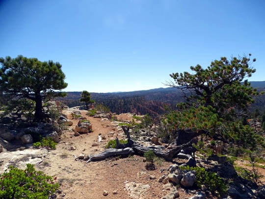
Jim and Casey walk through the
horse staging area at the trailhead
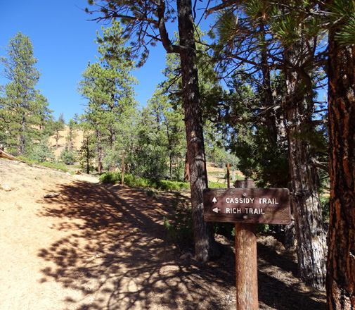
The configuration of these trails is confusing to me so I took the
Forest Service trail map with me both times. The signage is good at each
intersection but the Cassidy and Rich trails intertwine so much that it's
hard to tell, even looking at a map, which one is on the west side of each
loop and which is on the east side.
I found it easiest to go left at almost every intersection and do the
other side of each loop on the way back.
I'm glad I did it that way because the west (left) sides of the loops
are more interesting than the trail sections on the east. They are
higher in elevation, with more distant views. Some of the trail sections on the
east side are farther down in the canyon, mostly along and through a wash
where you can't see as much.
You can do all kinds of variations of these loops or just go out
whatever distance and back.
The most interesting short
option would be to turn left off the Cassidy Trail onto the Rich Trail
at the first intersection, go up the side canyon to the Ledge Point
Trail, turn left again and follow it clockwise as close to the edges
of the cliff as you're comfortable for great views down into the canyons,
Hwy. 12 corridor, and the Sevier River Valley, then turn right to loop
back on the Rich Trail to the Cassidy Trail (another right turn) and
return to your vehicle.
That's a little less than four miles and is a
good sample of what you'll see on the rest of these trails.
I turned left here, after about
8/10ths mile on the Cassidy Trail, and went up
the Rich Trail to the first
intersection with the Ledge Trail loop.
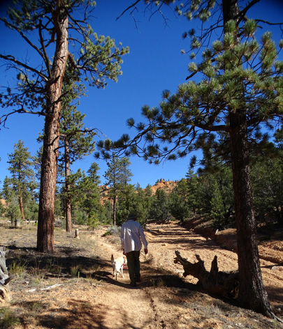
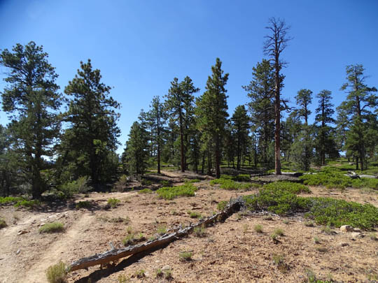
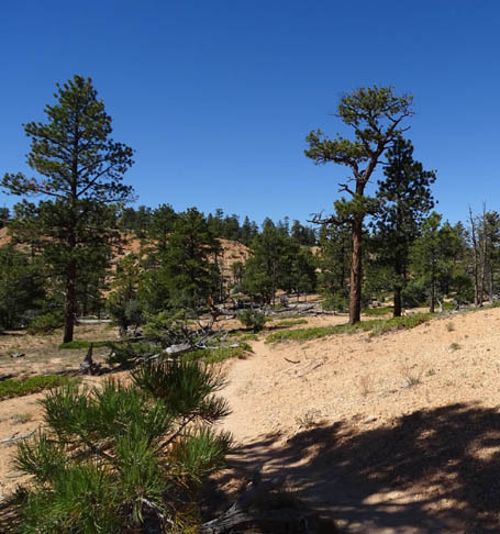
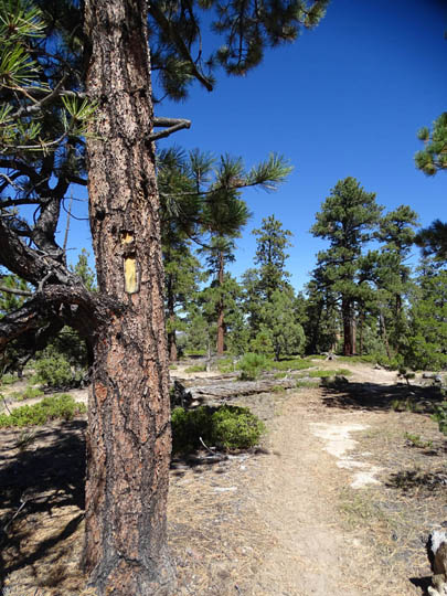
The next set of photos shows scenes from the ascent on the Rich Trail to
the Ledge Point Trail:
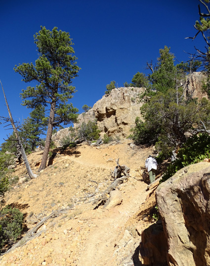
Jim and Casey climb up the
Rich Trail.
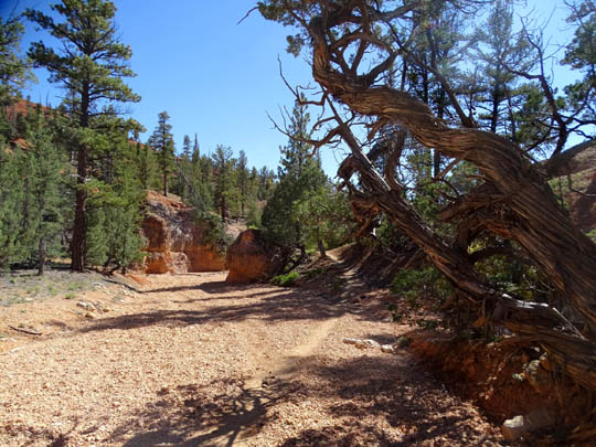
The Cassidy and Rich Trails are moderately difficult because of the
constant ups and downs, some roots and rocks, and loose rocks that make
traction on the steeper descents rather precarious.
There are also some very smooth sections, some flat spots, and
several places where the trail crosses dry washes on gravel. Those
sections would be great for running or cycling but they aren't the
majority of the trail surface.
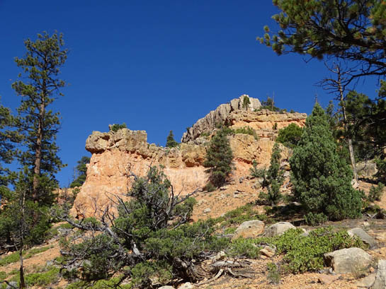
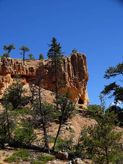
SCENES FROM THE LEDGE POINT TRAIL
Following this route, at 1.4 miles I turned left onto the Ledge Point
Trail and ascended just a bit higher to a plateau with great views to
the east, south, and west.
The Ledge Point Trail is the flattest of the three trails I'm
describing in this entry and has the
smoothest paths. It's an arc that is about half a mile long. I stayed as
close to the edge of the ledges around its three sides so I could get
the best views down into the canyons and river valley:
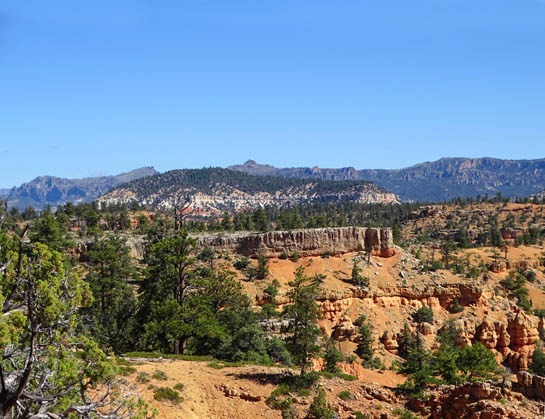
View NE
Above and below: views east
Trail to the point of the ledge
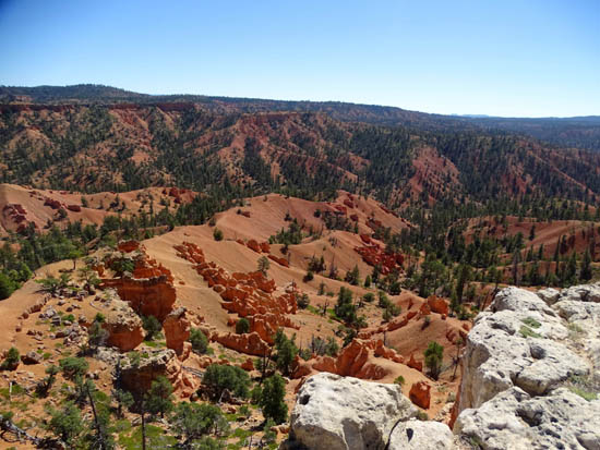
View east from point of ledge
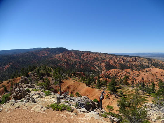
View south from point toward the
Red Canyon Campground
Above and below: views west
toward Sevier River Valley
After going out to Ledge Point the trail loops back to the Rich Trail.
At this point I'd gone 2.4 miles.
To shorten the hike, you can go right and drop back down to the
Cassidy Trail and return to the trailhead for a total distance of just
under four miles.
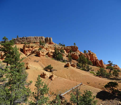
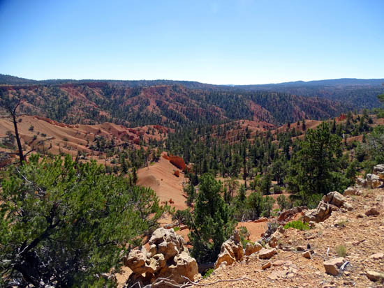
Both times I hiked these trails I went more straight on the Rich
Trail and stayed left on the next two loops. At the next
intersection I turned left on the Cassidy Trail (I mentioned earlier
that these two trails crisscross several times). The trail went up and
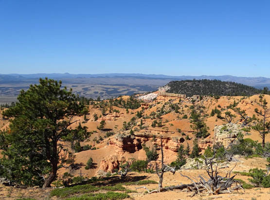
down through small side canyons for a mile to Brayton Point but stayed
fairly high through desert-like areas. The mesa in the second loop with
Brayton Point has more tall trees to provide some shade.
Here are some photos from the Ledge Point-Rich Trail intersection to
Brayton Point:
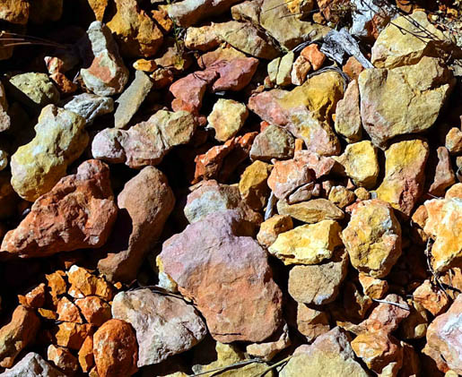
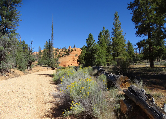
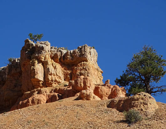
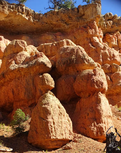
As in other areas of Red Canyon,
the rock formations and fragments
come in about every color except
blue.
Continued on the next page: photos from
scenic Brayton Point to the end of the hike
Happy trails,
Sue
"Runtrails & Company" - Sue Norwood, Jim O'Neil,
Cody the ultra Lab, and Casey-pup
Previous
Next
© 2015 Sue Norwood and Jim O'Neil
