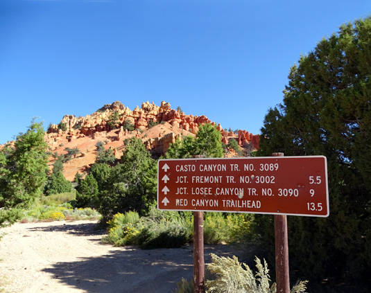
The Losee and Casto Canyon trails are both located back dirt/gravel
Casto Canyon Road, which intersects with Scenic Byway 12 about half a
mile before the "gateway" to Red Canyon as you're driving east toward
Bryce Canyon National Park.
Losee Canyon is about two miles back this
mostly-smooth Forest Service road. Casto Canyon is another mile farther. The
road to this point is fine for any passenger car, truck, or RV.
Here's a map section from the US Forest Service
web page for the Red Canyon trail system:
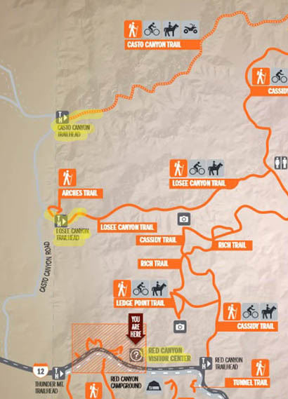
I marked both trailheads and the short distance I hiked back each
canyon one weekday morning in late September.
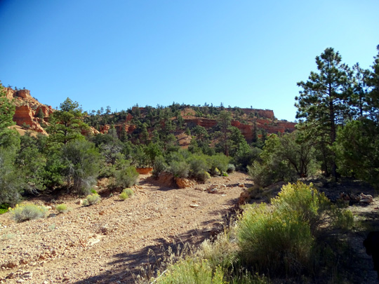
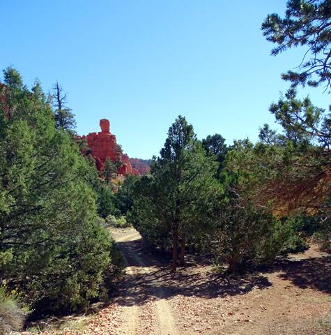
I had planned to hike back a couple miles in Losee Canyon that day
with Cody. I had my Camelbak bladder full of water -- but forgot
his water bowl. My bad. I went into Losee Canyon just half a mile and
out, gave Cody water from his container in the car, drove back to Casto
Canyon, and hiked half a mile into that canyon before turning around.
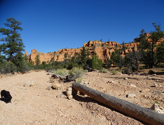
Casto Canyon Rd. just before the
Losee Canyon trailhead
That gave us a total of two miles but it didn't give me much of a
feel for either canyon except that I liked the first half mile of Casto
Canyon better.
I didn't go back to hike again in either canyon during our fall visit to the
area. In May, 2016 I did the whole Casto-Cassidy-Losee Loop (about 12
miles) so I'll report later with much more information and many more photos.
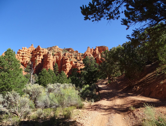
LOSEE CANYON
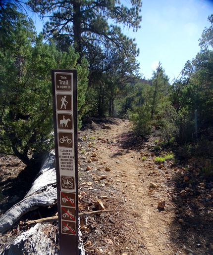
This trail starts on Casto Canyon Road, heads east, and gradually
rises 570 feet over three miles to the Cassidy Trail. It is open to
hikers, cyclists, and equestrians.
There is plenty of parking at the trailhead or across the road for
passenger vehicles and horse trailers. This is also the trailhead for
the Arches Trail so it may get crowded on weekends.
The day I hiked back
the canyon with Cody there was only one other vehicle at the trailhead
but I noticed both ATV and horse trailers at the beginning of Casto Canyon Rd. I
didn't see anyone else during the short time I was on both these canyon
trails that day, however (and surprisingly few when I did the whole
12-mile loop the next spring) .
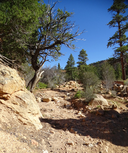
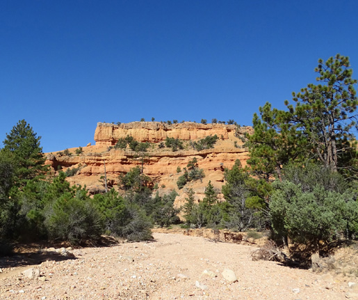
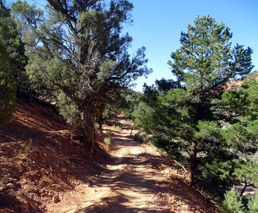
Some folks start the hike on a single-track trail in the
parking area (two photos above). I went out that way and came back in
the wash when I saw a trail going through it, too (photo directly
above). I think the trail through the wash is probably what the
equestrians use the most.
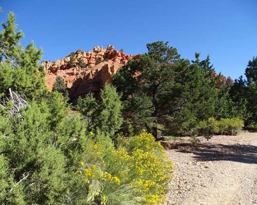
Here are more photos from the first half mile of this
trail:
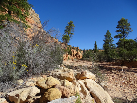
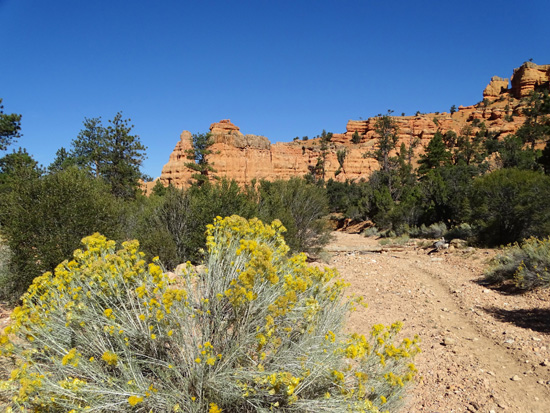
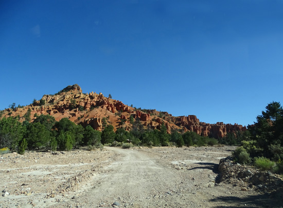
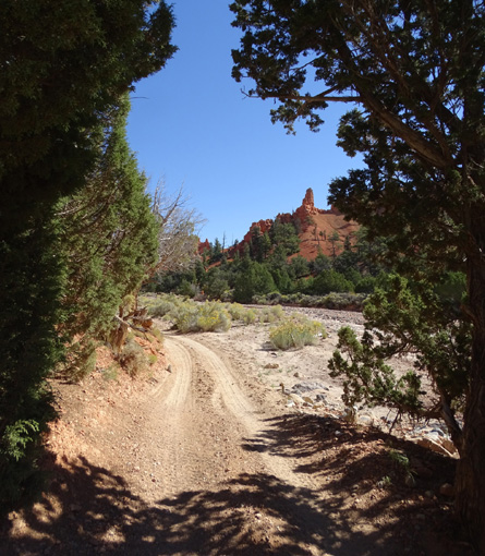
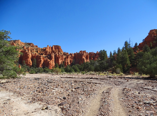
After that short hike I drove another mile on Casto Canyon Rd. to
Casto Canyon. The road gets a little rougher at the wash right before
this trailhead:
On this trip the wash was completely dry. In May of 2016
there was water flowing across the road but I crossed OK in our Odyssey
minivan.
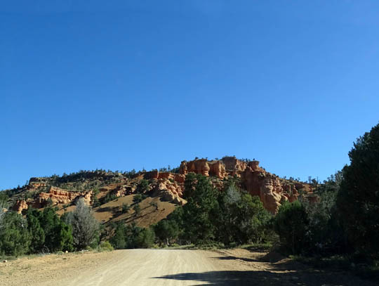
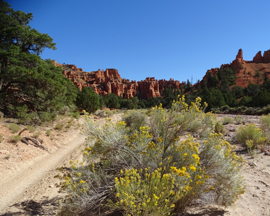
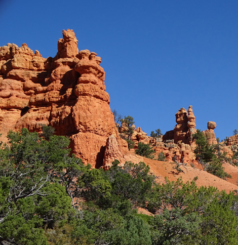
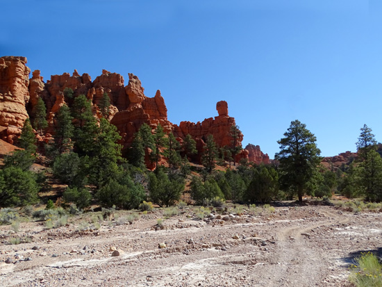
CASTO CANYON
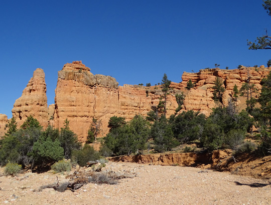
The web description of Casto Canyon Trail reads, "With colorful red
rock formations and classic canyon scenery, you won't want to miss this
one."
I did enjoy the first half mile of the trail this fall -- and the
rest of it nine months later.
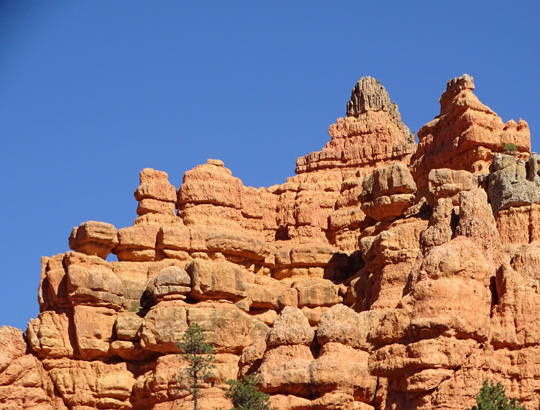
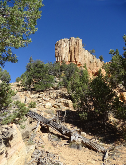
See the little "window" on the left? I look
for those on every trail in Red Canyon.
There is a little bit of parking on the right near the trailhead plus
a good-sized parking area on the left across the road.
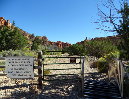
Casto Canyon is open to hikers, cyclists, equestrians, and off-road
vehicles (ORVs) -- ATVs, dirt bikes, etc. -- but a sign at
a gate near the trailhead says vehicles must not exceed 50 inches in
width. So that means no Jeeps or such:
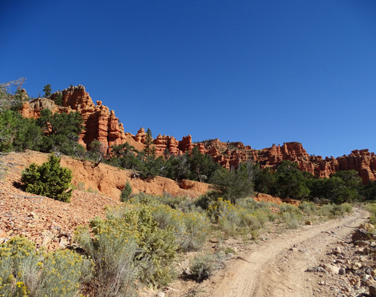
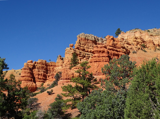
This trail very gradually ascends through the canyon for
5˝ miles to the Cassidy Trail,
gaining only 800 feet of elevation in that distance. The trail crosses
the wash a number of times and sometimes goes right through it.
ORVs can't ride on the Cassidy Trail so they have to
veer off prior to that on either the Barney Cove or Freemont trails. I
didn't show those on the map segment above but you can see the whole
trail network at the USFS website link.
Here are some photos from the first half mile of this
trail:
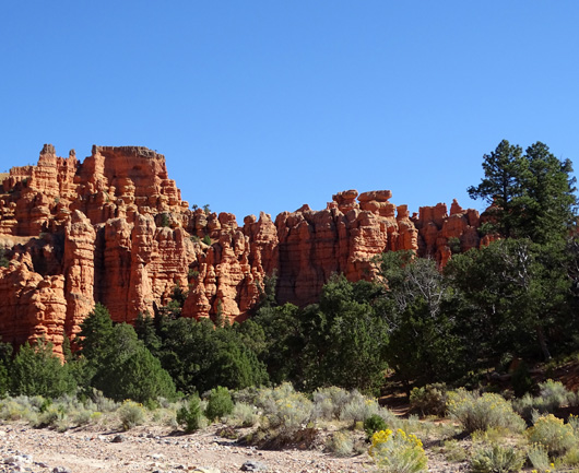
These two trails through the canyons are even hotter than trails
in Red Canyon that get up on mesas where there are some breezes, and there
aren't very many trees along the washes for a shady respite. Nor was
there any water in the wash in the fall (there was a little in the
spring).
So take plenty of water for you and your critters, if
you hike or ride with a dog or horse.
If you aren't able to hike, run, or ride these trails consider a
guided ATV or horseback ride so you can see these trails close up. There
are businesses in the area that provide these services.
Next entry: Cassidy, Ledge Point, and Rich Trail loops
Happy trails,
Sue
"Runtrails & Company" - Sue Norwood, Jim O'Neil,
Cody the ultra Lab, and Casey-pup
Previous
Next
© 2015 Sue Norwood and Jim O'Neil
