Continued from the previous page.
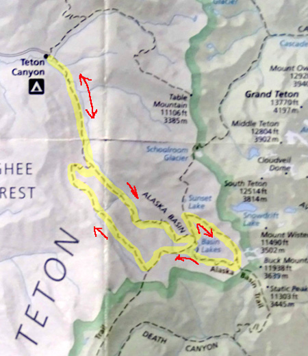
DESCENT TO THE LOWER PART OF ALASKA BASIN
Past the intersection with a
half-mile spur that goes up to Buck Mountain Pass, the basin loop trail
descends about 900 feet in elevation to the south and west on
switchbacks to the cluster of lakes in the lower part of Alaska Basin.
Again, I'm talking about the part of
the basin that's within the trail loop on this map, where it says "Basin
Lakes," not farther down where it says "ALASKA BASIN:"
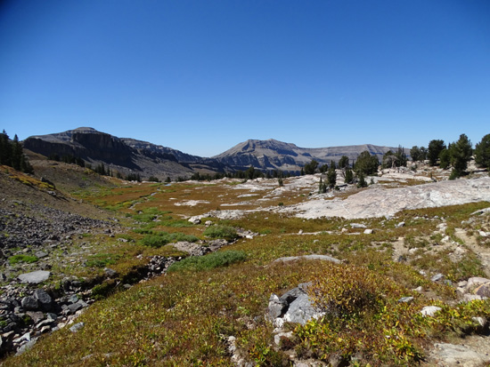
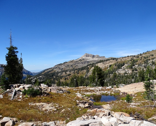
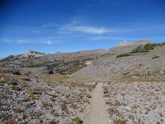
While you're hiking down the
switchbacks you can often see parts of the trail far ahead and below you:
The views looking back up toward Buck Mountain -- or ahead, if
you're going the other direction -- are scenic, too:
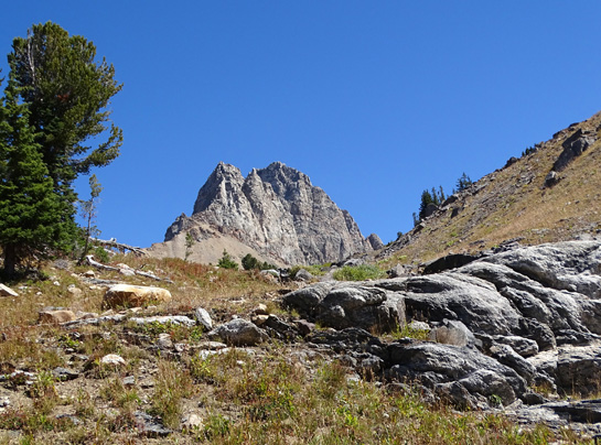
In that last picture you can see one of the major Teton peaks (South
Teton?) barely visible in the background toward the left.
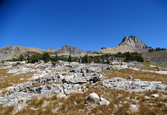
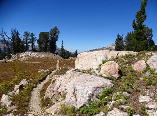
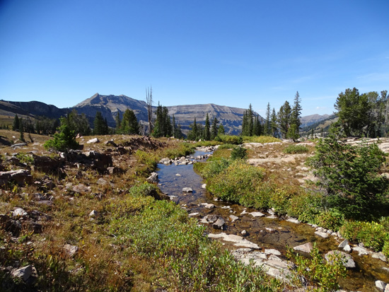
The trail passes or crosses several small streams
on its way down to the lower basin, including this area with very
colorful rocks, moss, and other alpine plants:
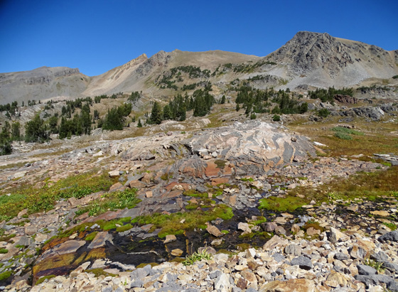
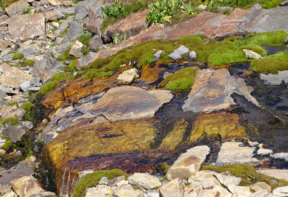
Other than the Basin Lakes, that was probably the prettiest spot on the
whole hike today.
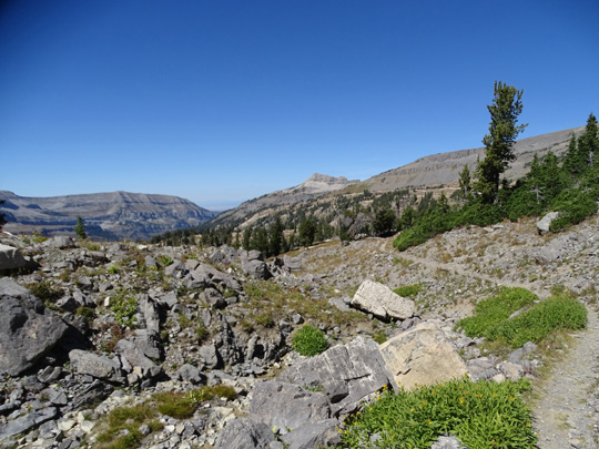
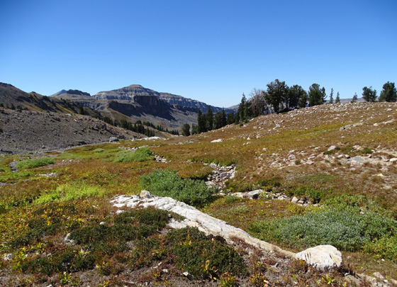
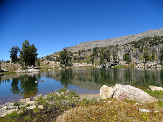
Here are some other scenes between there and the Basin
Lakes in the lower part of the basin:
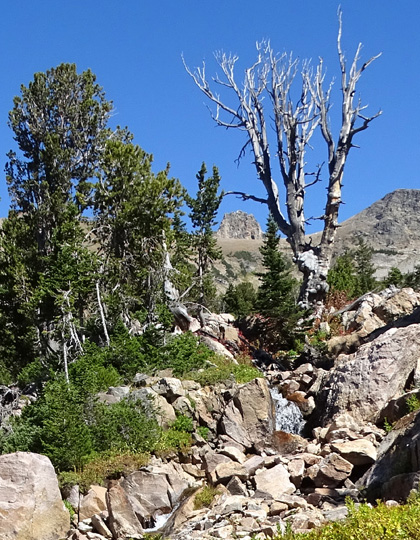
Little waterfall in foreground, Buck Mtn. in
background
Just past the waterfall and stream
crossing the trail drops down a little farther to my favorite part of the loop
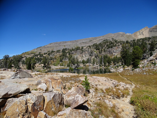
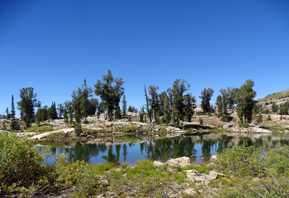
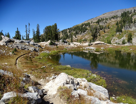
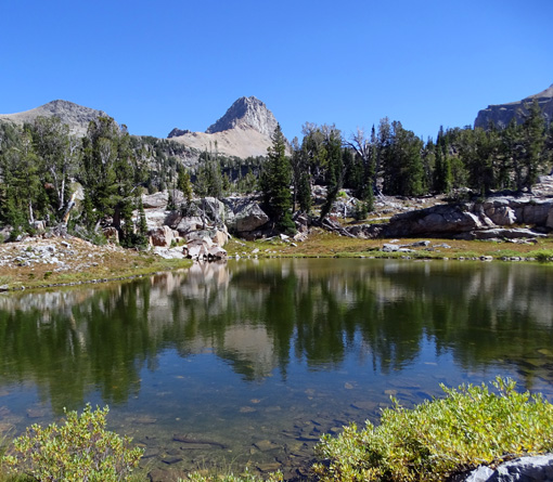
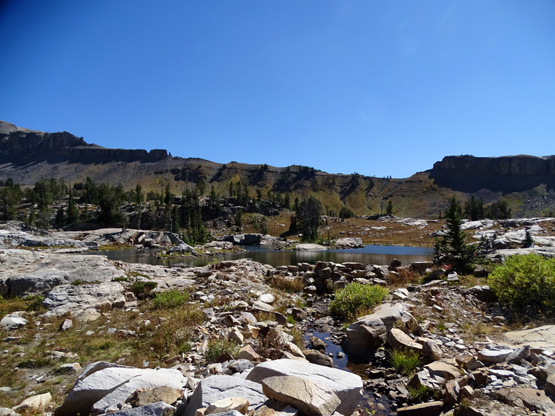
trail, which winds past the scenic Basin Lakes.
There are several small lakes clustered
here and, as you'd expect, it's a popular place for backpackers to camp
overnight:
On previous hikes that were
shorter, I've walked around all of these little lakes but I wisely decided
not to do that today.
TETON CREST TRAIL TO THE SOUTH
Just past the lakes, at 13.1 miles into the hike and about 9,522 feet
elevation, I came to another intersection with the Teton Crest Trail and had a
decision to make:
1) continue forward and back down the Alaska Basin approach trail
to Teton Canyon, the way I came up = about 7.9 more miles, or 2)
go left (south) on the Teton Crest Trail through another part of the
lower Alaska Basin to the Teton Shelf Trail and Devil's Staircase, which
intersect with the South Teton Canyon Trail, and back to the trailhead.
That option would add another two or three miles.
Well now . . .
The sky was still clear and I felt great -- I didn't know my
water was as low as it was -- so I chose the longer way, Option
#2, for more variety.
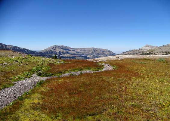
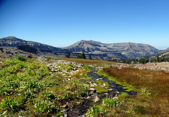
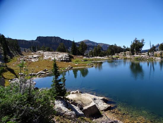
I've done this part of the Teton Crest Trail northbound in this section
but not southbound so it seemed almost like new to me. I like the
colorful bedrock, the stream
crossings and little pools of water, and the expansive views in all directions:
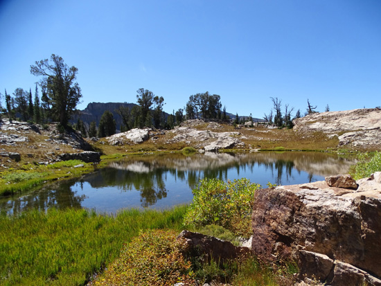
As I approached a pretty pool of water in the lower basin that I'd never
noticed when I've gone the other direction, I saw two young men getting
ready to jump into the water (next picture). One let out a big yell because
the water was so cold.
About two seconds later a very young brown black bear cub went racing
across the trail about 25 feet ahead of me, apparently scared when it
heard the yelling.
The cub disappeared before I could get a picture. I looked around
carefully for mama bear but didn't see her.
I walked over to the pond and talked to the young men across the water.
They saw the cub run away but didn't see the mother, either.
I kept going with my
bear radar a notch higher. I've never seen a bear up here, just in the
canyon.
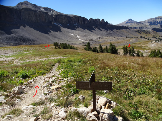
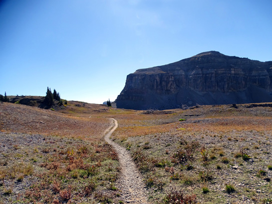
The trail switchbacks up a mountainside going southbound. It's fairly
smooth at first, then gets quite rocky. I got more distant views as I
climbed higher, including beginning to see the major Teton peaks (Owen,
Grand Teton, Middle Teton, and South Teton):
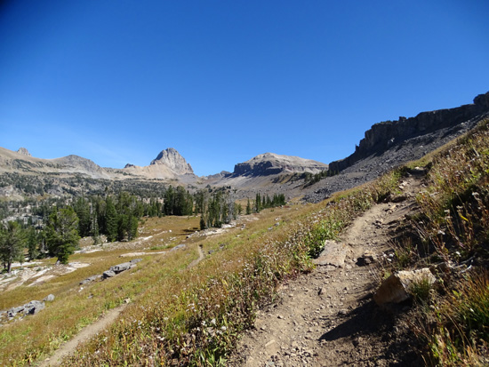
Buck Mtn. is in the distant center.
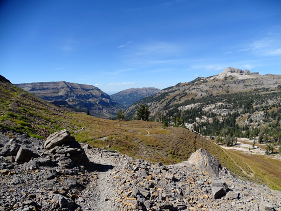
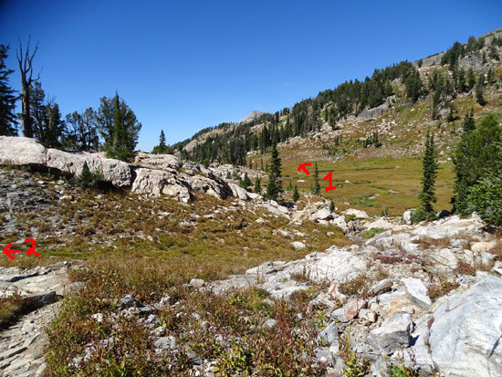
Teton Canyon is in the center background.
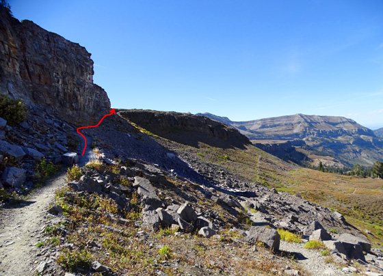
Trail makes a sharp left around the corner of that
rock wall at end of arrow.
After rounding the corner I could look back and see
the major Teton peaks finally.
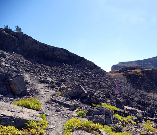
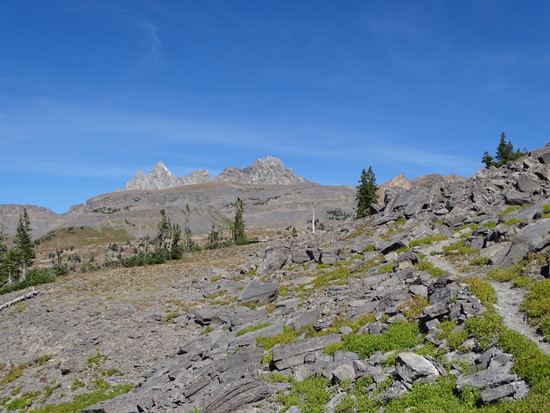
I still had to climb through some more rocks. These
black ones look volcanic.
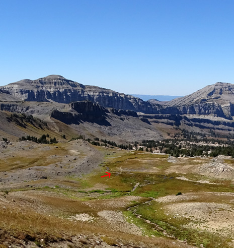
After climbing through the black rocky section I was up on the Teton
Shelf. My highest elevation on the Shelf was 9,734 feet before I began
descending again.
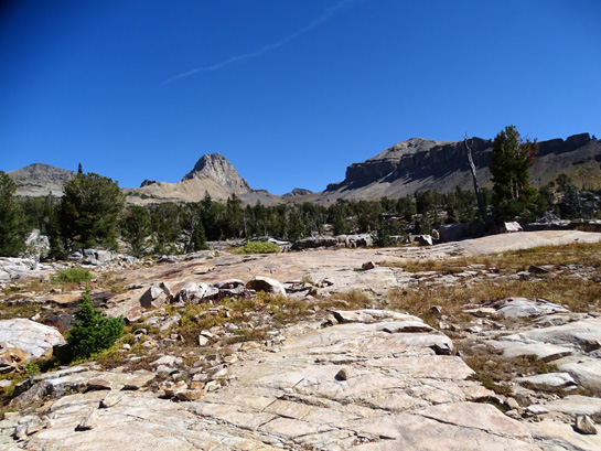
The distant views across the wide plateau to the north included (L to R)
Battleship Rock, Table Rock, and the major Teton peaks:
I continued to see all those mountains for at least a mile down the
Teton Shelf Trail.
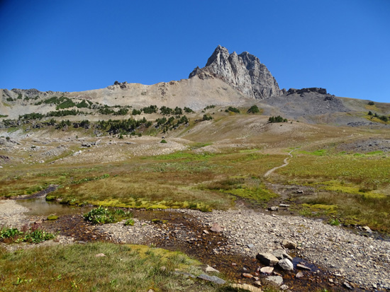
Before I turned off the Teton Crest Trail,
Mount Meek dominated my view to the south. If I'd continued going that
direction I would have come to Meek Pass. On a previous hike I went to
the pass and looked beyond but I didn't do that today.
Meek Pass is about 3/4 mile ahead. I turned right
before that.
After 2.3 miles on
the Teton Crest Trail I came to the intersection with the Teton Shelf Trail.
The Crest Trail continues south over Meek Pass and down to WY 22. I turned
right (NW) on the Shelf Trail.
Continued on the next
page: down the Teton Shelf Trail and Devil's Staircase to
the South Teton Canyon Trail and home!
Happy trails,
Sue
"Runtrails & Company" - Sue Norwood, Jim O'Neil,
Cody the ultra Lab, and Casey-pup
Previous
Next
© 2015 Sue Norwood and Jim O'Neil
