Continued from the previous page.
TETON SHELF TRAIL
From the Teton Crest-Teton Shelf trail intersection it was 4.4
miles, mostly down, to the South Teton Canyon Trail via Devil's Staircase,
plus another 2.7 miles to the trailhead = 7.1 more miles
to go.
The elevation dropped from 9,721 to 7,037 feet (total of 2,694 feet) in those seven
miles. The drop is gradual on the Teton Shelf and through the canyon,
about six of the miles. The steepest grades
are in the mile through Devil's Staircase.
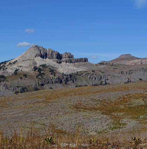
The Wedge is prominent for a couple miles going
either direction in this section.
I've gone up and down both the Shelf and Staircase trails several times
previously so I knew pretty much what to expect today.
The Teton Shelf Trail is easier to hike, except for
the Devil's Staircase, than the Alaska Basin approach trail that I went
up this morning and since it's mostly open, there are more expansive views.
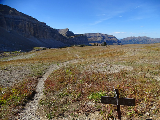
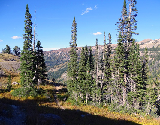
You can see the main Teton peaks (and a lot more) quite well from the upper mile
of the shelf:
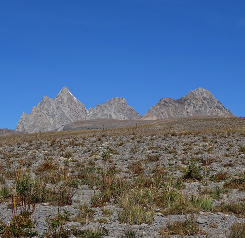
Grand, Middle, and South Teton peaks
Battleship Mtn. (L) and Table Mtn. (R)
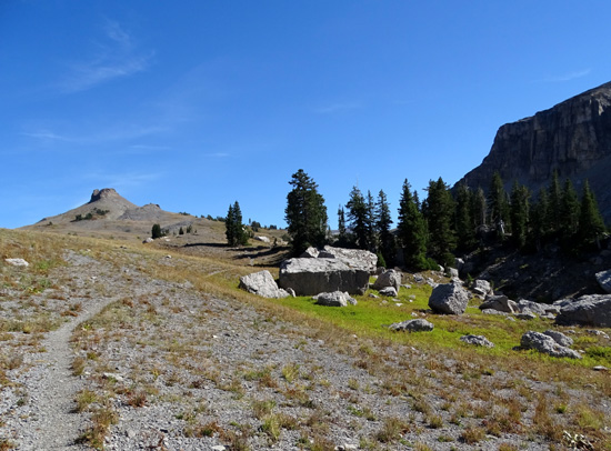
Looking back
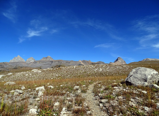
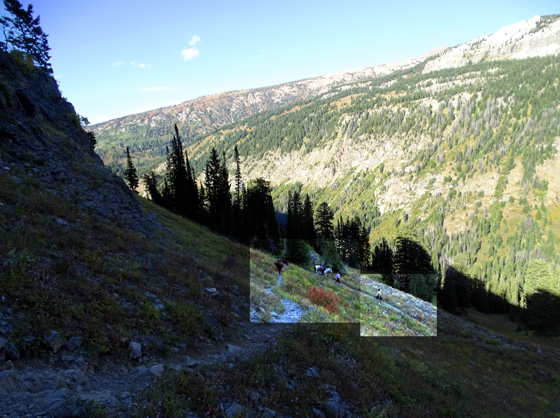
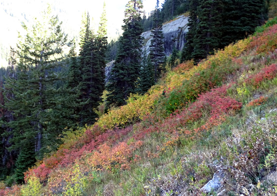
Barren through here today, almost like a moonscape;
the Teton peaks disappeared as I dropped lower and
lower.
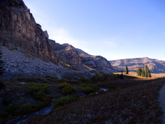
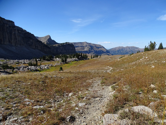
There's a creek through here, if you want to filter
some water or have a dog.
Above and below: approaching the top of
Devil's Staircase
In addition to
offering wide-open views, the Shelf Trail is also completely exposed to
whatever weather is occurring. (The Alaska Basin approach trail is mostly
forested.) I didn't have to worry about storms today, but the sun exposure
and low humidity all day sucked me dry.
Although I was
carrying 100 oz. of water in my Camelbak I could have used double that
-- and I didn't have a filter for any of the streams.
I rationed my water throughout the day but still ran out before I got
to the Devil's Staircase, with at least two more hours of hiking to go.
Despite taking electrolyte caps regularly I still had some leg cramping
after 13 miles due to the lack of fluids.
DEVIL'S STAIRCASE
Going this direction the trail drops dramatically through the rocky
staircase area and on down to the Teton Canyon Trail for almost a mile.
The beginning of the descent isn't so terrible but it gets much worse:
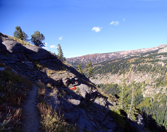
The first time I hiked it with Cody in the uphill direction I had
trouble following it. There was a sharp left turn I missed and we clawed
our way up the mountainside for a couple hundred feet until finding the
trail again:
I drew arrows on this 2011 photo of where I
missed an unmarked, non-intuitive turn.
I walked back down until I could see where I missed the turn. Since then I've gotten it right. Going down it's easier to know where to go
because you can easily see the trail below you.
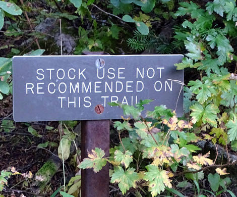
There is a sign at the lower intersection with the Teton Canyon Trail
that warns equestrians not to take pack animals up this trail, and I
haven't seen any previously:
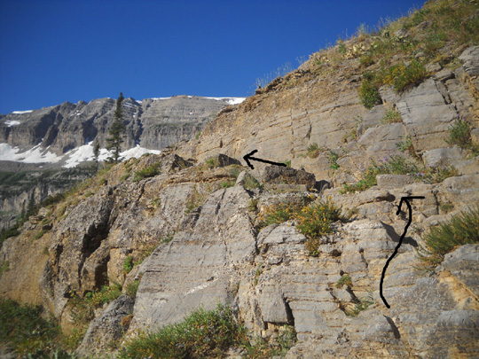
The smooth rock ledges in the staircase section are very narrow and
canted. Some have large steps up or down, like in the photo above with
the arrows.
I have no idea how a horse or other animal with hooves -- besides
bighorn sheep or mountain goats -- could get traction on the
gnarly part of the Staircase. It's hard enough to get traction with
running shoes or hiking boots!
Nevertheless, part way down through the Staircase this afternoon I saw a
40-something couple with two horses. The man was coming up alone first,
scouting out the trail. I informed him it only got worse from where he was,
so he decided -- wisely, since they'd never been up here before --
to turn around and lead the animals back down to the canyon:
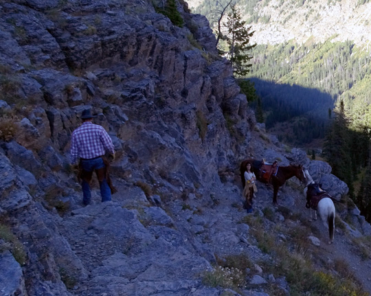
The equestrians were my trail angels, though.
We talked for a little while and I mentioned that
I was cramping because I'd run out of water. They graciously offered me an
extra bottle they were carrying. That saved my butt the last three miles.
I was lucky to run into these folks.
I didn't see very many people all day -- only two backpackers in
the first eight miles; a dozen more backpackers at various places
along the Teton Crest Trail; one runner and his dog in the
basin; and the two equestrians and their horses in the middle of
the Devil's Staircase.
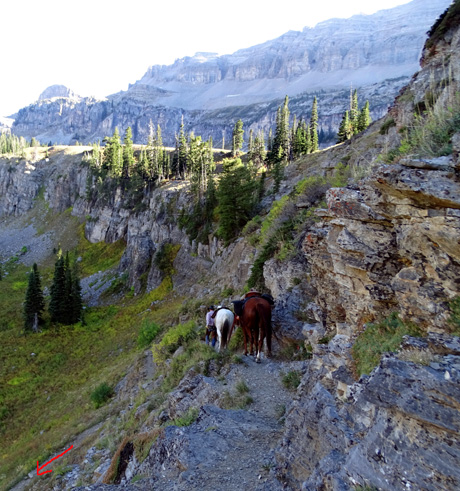
Above and below: The horses follow their
people down the steep trail;
at least it's smoother in the bottom 2/3 mile,
although loose rocks slide around.
On the staircase descent I waited for the horses to go down ahead of me
because I didn't want one of them tumbling down on me from one of the
switchbacks.
Later the CG host, who lives nearby in Driggs, said he knows
locals who routinely take their horses up and down that trail, although
the Forest Service discourages it.
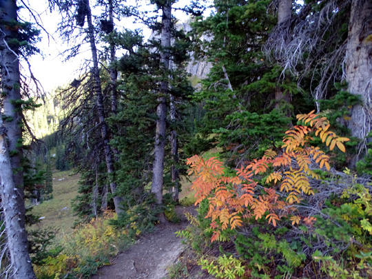
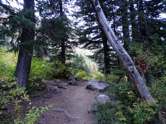
The lower part of the Staircase Trail is partly wooded and much less
rocky but still steep:
SOUTH TETON CANYON TRAIL AGAIN
I completed the hike through Teton Canyon on the same trail I used at
the beginning of the hike. It's a nice gradual, rolling descent for 2.7
miles in that direction.
I had a nice surprise near the end.
I was able to call Jim from my high point below Buck Mountain and talk
to him. We don't have a phone signal at our campground but he was in
town and had a signal.
I let him know that my original estimate of finishing by 6 PM was optimistic
because I might add some extra mileage and I'd probably get down more like 7PM.
He surprised my by driving the minivan back to where I'd parked the truck
and hiked out about half a mile with Casey to meet me. It was good to
see them! I was very tired and thirsty by then but still moving pretty well.
DISAPPOINTING FLOWERS
I've looked at photos of these trails from the prior five years I've
hiked them. Today was the least interesting plant-wise of
any of them.
Previously the sub-alpine and alpine flowers have been stunning on all
of these trails during late August or early September, especially
through the canyon, basin, shelf, and Teton Crest Trail where they get
a lot of sun.
Here are some examples from 2011:
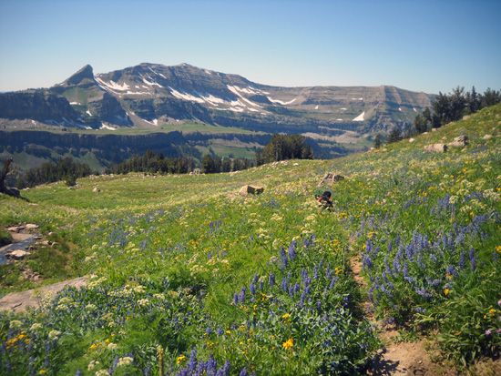
Alaska Basin loop trail on 9-3-11 (The Wedge and
Teton Shelf in background)
Flowers so thick on the Teton Shelf that the trail
was hard to follow! (8-27-11)
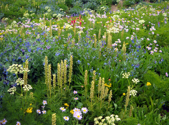
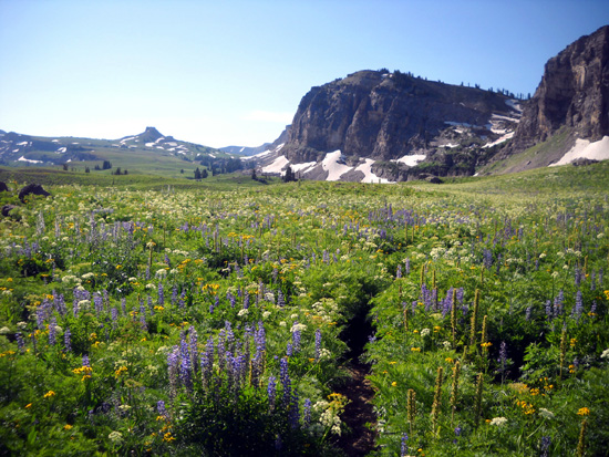
Proliferation of asters, bluebells, yarrow, and other
sub-alpine wildflowers in Alaska Basin on 8-24-11
After seeing those three pictures maybe you can understand why I was so
disappointed in today's lackluster flora.
Very few flowers were still blooming at any elevation and many of
the stems and leaves were brown and brittle instead of orange and red.
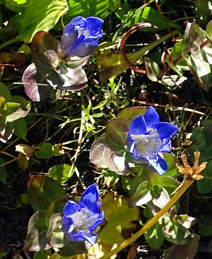
I did see a few cream and red Indian paintbrush,
lavender asters, yellow "daisies," and blue gentians
(below) but all were past prime:
Last winter was milder than normal here and it's been a dry, hot summer.
In addition, we're here a week or two later than usual.
The lesson I've learned is to get here in August instead of September in
a dry, warmer-than-average year. The flowers seem to do better after a
lot of snow.
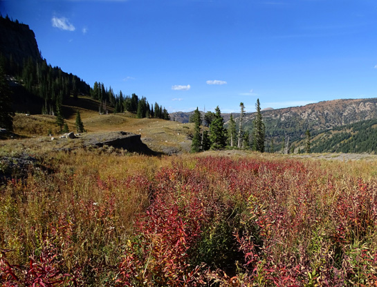
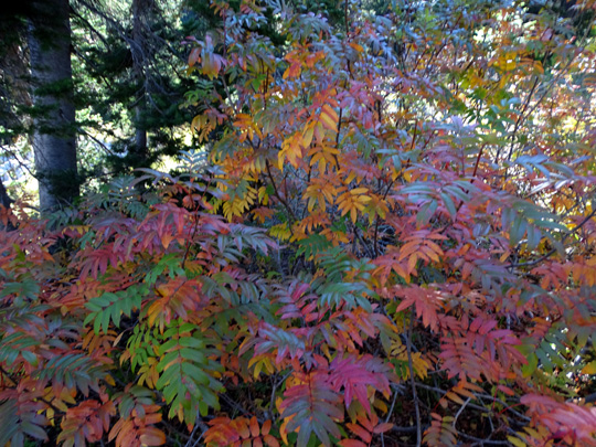
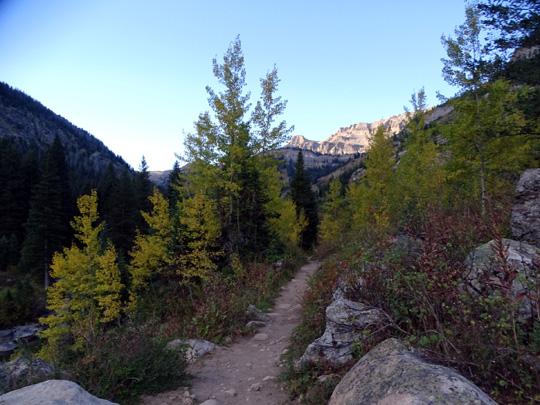
It was still an interesting hike, though. Some of the leaves from
7,500-8,500 feet have turned bright orange and red. Some of the aspen
and/or birch
tree leaves through South Teton Canyon are yellow (I was surprised how
many are still green). I found a few flowers to enjoy. The views from
the high places are still spectacular. And I got to see a bear and a
moose!
So all in all, it was
a very good day.
Jim had a restful day. He took Casey down to Driggs to ride with the
bike but did only 2˝
miles with her because it felt so hot. She wasn't into it. He also picked up two delicious lunches at one of the Thai
restaurants (Bangkok Kitchen) for supper.
My red chicken curry tasted mighty fine at 7:30 PM after hiking all day!
I highly recommend
hiking any of the trails in the Alaska Basin area on the western side of
the Tetons. It's beautiful even when the flowers are gone and there are so many fewer people
than on the national park side of the mountain range.
Next entry: day trip to Grand Teton National Park
to decide if it is practical to camp there next week
Happy trails,
Sue
"Runtrails & Company" - Sue Norwood, Jim O'Neil,
Cody the ultra Lab, and Casey-pup
Previous
Next
© 2015 Sue Norwood and Jim O'Neil
