Continued from the previous page.
TETON CREST TRAIL TO THE NORTH
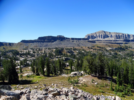
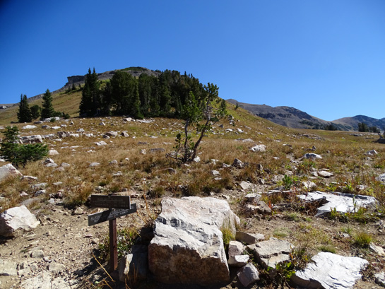
The main trail up to Alaska Basin intersects with the Teton Crest Trail
at 7.8 miles from the trailhead where I started and runs
contiguously with it for a little bit to both the north and south (the
Alaska Basin Trail becomes a loop up in the high basin).
The elevation at this intersection is about 9,300 feet:
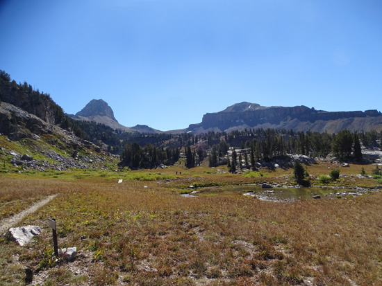
Straight ahead is the lower part of the basin loop and
the Teton Crest Trail going south.
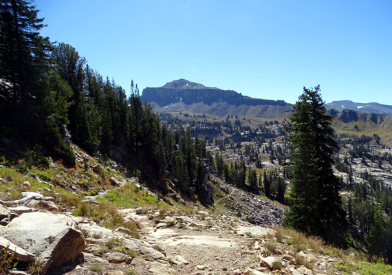
I turned left on the Crest/Basin Trail at the intersection shown above and headed
north -- and up -- for 6/10ths mile to another
intersection above Sunset Lake where the two trails diverge.
Here's the map again:
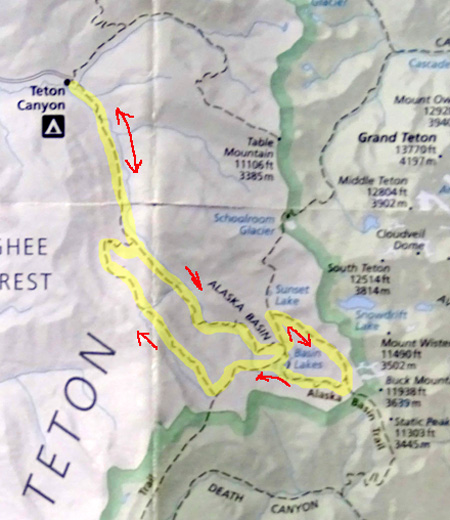
See where it says "ALASKA BASIN" in caps?
I'm at the "N" in Basin. I've always considered the basin to be the
part of the mountain slope within the loop to the right but perhaps it also
extends farther down the slope.
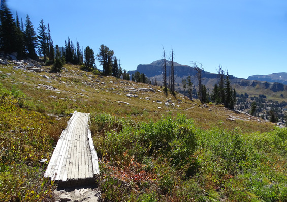
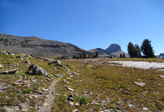
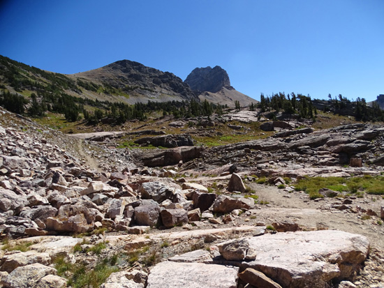
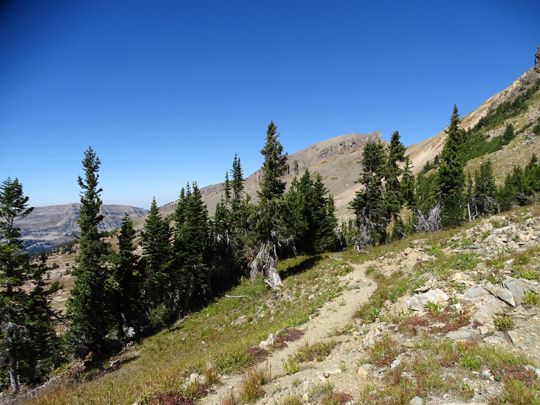
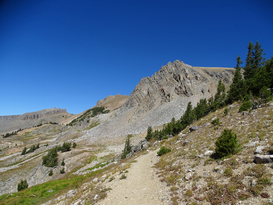
I took these photos on the rocky ascent to the broad alpine meadow
approaching Sunset Lake:
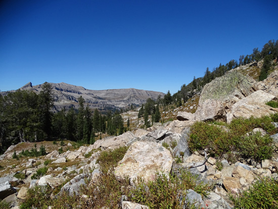
Above and below: views toward The Wedge and
Teton Shelf
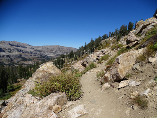
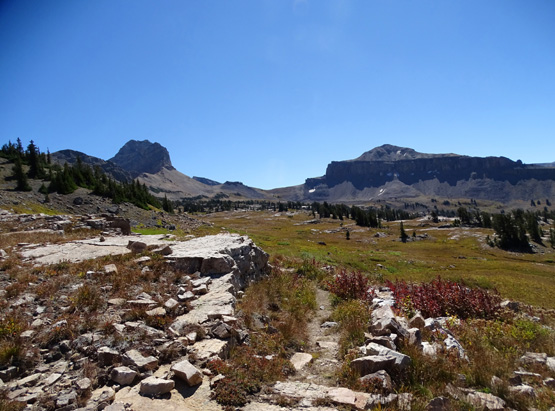
Above and below: Looking back at the trail
and Alaska Basin as I climb higher
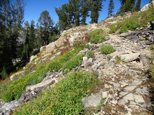
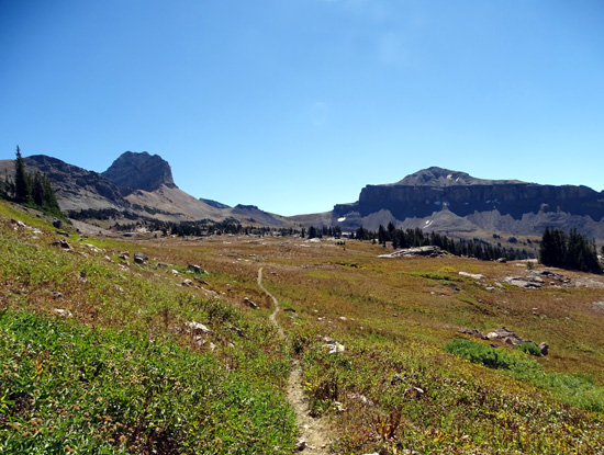
Above and below: Continuing up; too late for
most of the flowers here, too.
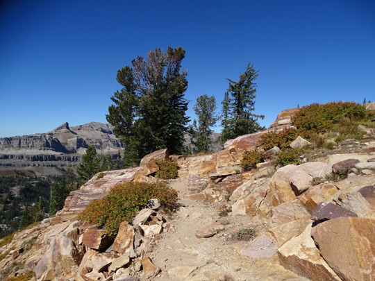
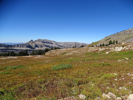
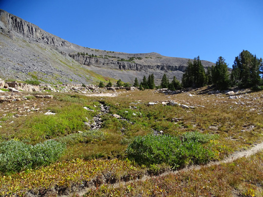
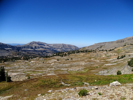
Looking back across high, sometimes wet, meadow before Sunset
Lake
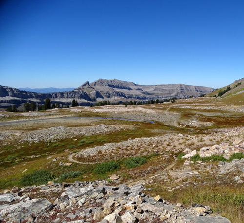
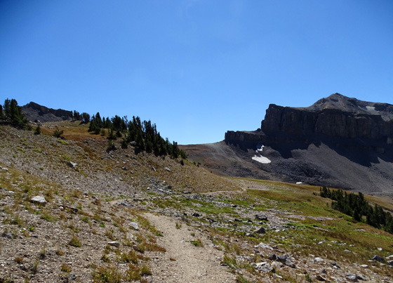
The Teton Crest Trail goes left and downhill at an intersection above
the lake (next photo); the Alaska Basin Trail goes to the right and gradually
ascends through the upper part of the basin toward Buck Mountain:
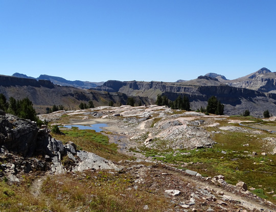
I continued downhill for a few hundred feet on the Teton Crest Trail to
a boulder where I could take another break and get something to eat
while I surveyed the beautiful scene down to and past Sunset Lake:
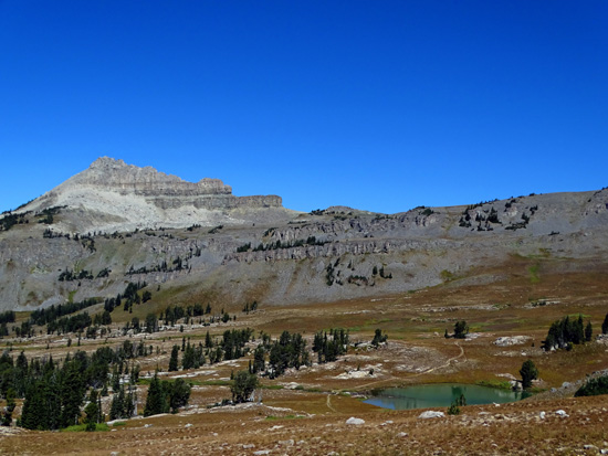
Battleship Mountain is in the background. Sunset Lake is a popular place
for Teton Crest backpackers to camp overnight. The trail continues up
and over Hurricane Pass to the right in the photo above.
I've been on that trail to Hurricane Pass at least three times
previously but didn't go there today. I backtracked to the intersection
with the Alaska Basin Trail and followed it clockwise through the upper
reaches of Alaska Basin.
ALASKA BASIN LOOP: UPPER BASIN
I've hiked both
directions on this trail previously and don't really have a preference.
I love both CW and CCW.
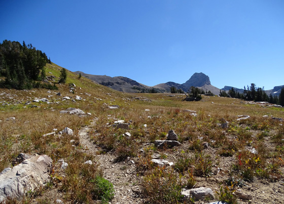
From its intersection with the Teton
Crest Trail above Sunset Lake, the Basin loop trail ascends gradually along
the slope to the north and west of Buck Mountain, which almost looks
like one of the main Teton mountain peaks from this side of
the range:
You can't see Owen, Grand Teton, Middle Teton,
and South Teton peaks from the higher parts of Alaska Basin because
other mountain slopes -- like those on the left in the two
pictures above -- block the view but they are visible from the Teton
Crest and Teton Shelf trails. I'll show photos of them later.
The upper part of the basin is full
of rocks but there are also some green areas (full of flowers earlier in
the season, but not today) and lots of wet areas, streams, and little alpine ponds:
Looking back at a little stream (above) that flows
into an alpine pond (below)
As dry as most of the plants look, I was surprised to see so many wet areas this time
of year.
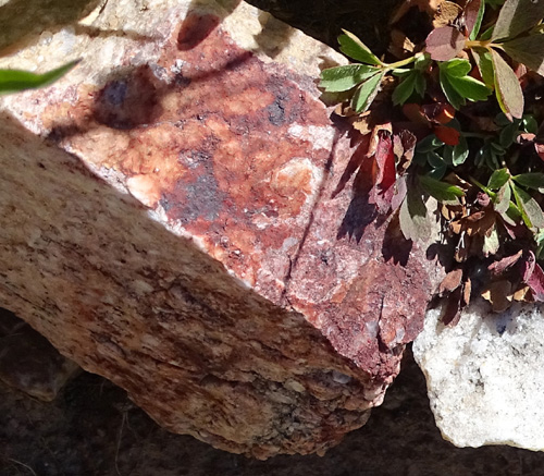
Some of the rocks are quite colorful:
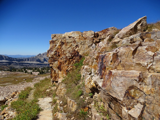
The highest part of the trail is a
little north of Buck Mountain. My GPS recorded 10,419 feet there.
From
the high parts of the loop you can see the entire upper and lower basin, the Teton Shelf,
and Teton Canyon, although all aren't visible in any one of the photos I
took:
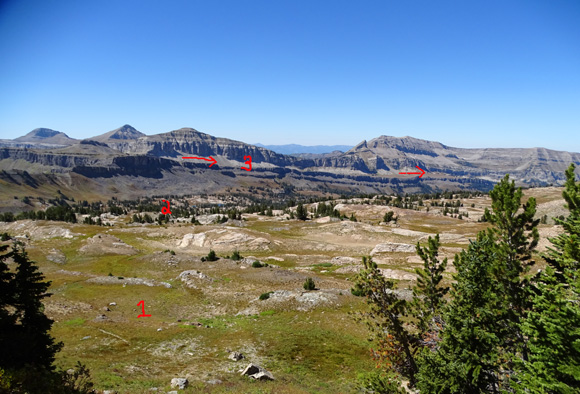
1 = upper basin, 2 = lower basin, 3 = Teton Shelf
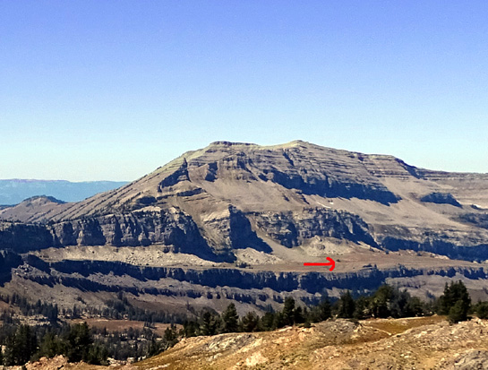
Here's a closer view of part of the "shelf" where
the Teton Shelf Trail runs. It's aptly named.
Even near the high point there are some trees but the upper basin is
mostly open and not a good place to be caught in a thunderstorm.
Fortunately, I've never had to worry about that when I've been up here:
Part of the upper basin -- it's big!
Approaching Buck Mountain Pass
Continued on the next page: descent to the lower part of
the basin within the loop (lots of lakes!) + Teton Crest Trail to the south
Happy trails,
Sue
"Runtrails & Company" - Sue Norwood, Jim O'Neil,
Cody the ultra Lab, and Casey-pup
Previous
Next
© 2015 Sue Norwood and Jim O'Neil
