Continued from the previous page.
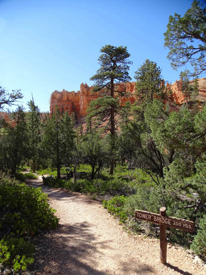
DESCENT TO TOWER BRIDGE
In the next 2+ miles the trail descends gradually via switchbacks to the
intersection with the spur to Tower Bridge. The bridge formation is about
4.5 miles into this hike, going clockwise
from Fairyland Point.
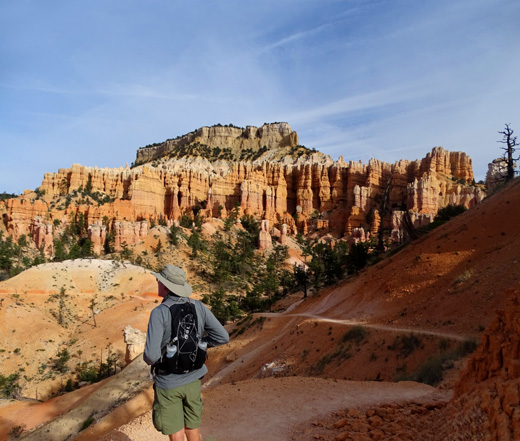
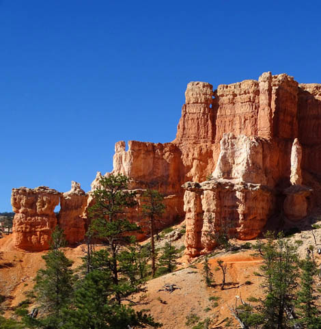
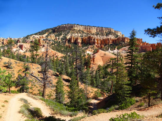
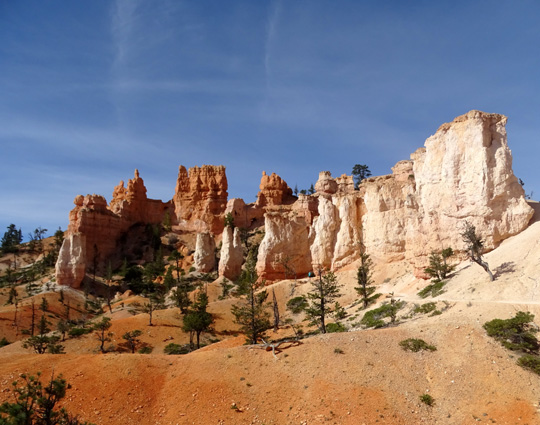
Jim surveys the scene as we descend toward
one of several side canyons below Boat Mesa.
Arrows mark the trail.
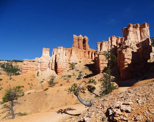
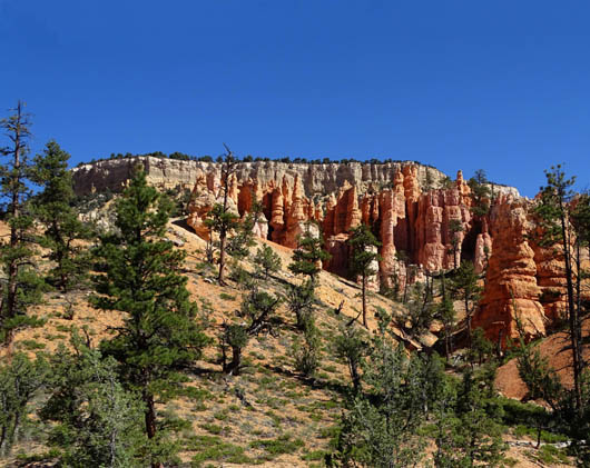
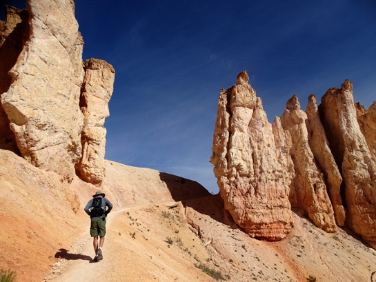
You can see lots of windows and
arches on this trail if you look
up and around frequently. See the two tiny
windows toward the upper right?
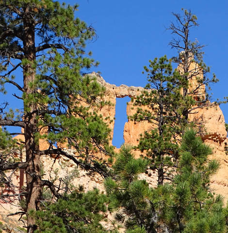
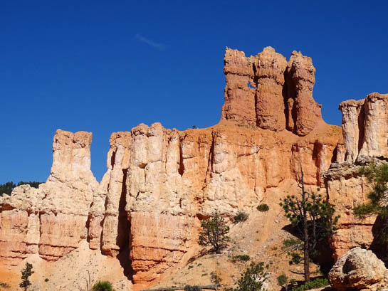
This tall arch is much larger than
the two little windows in the previous photo but
this formation is back in a little canyon
and more easily overlooked from the trail.
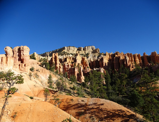
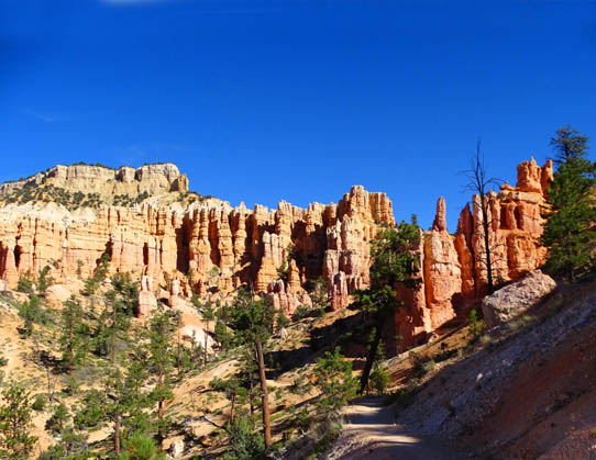
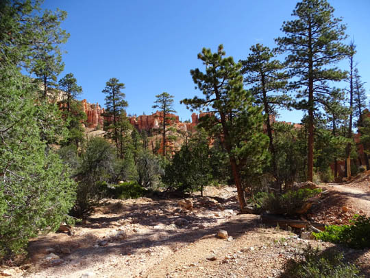
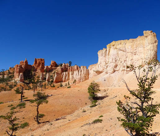
Looking back toward Boat Mesa, which is
surrounded by colorful spires on three sides.
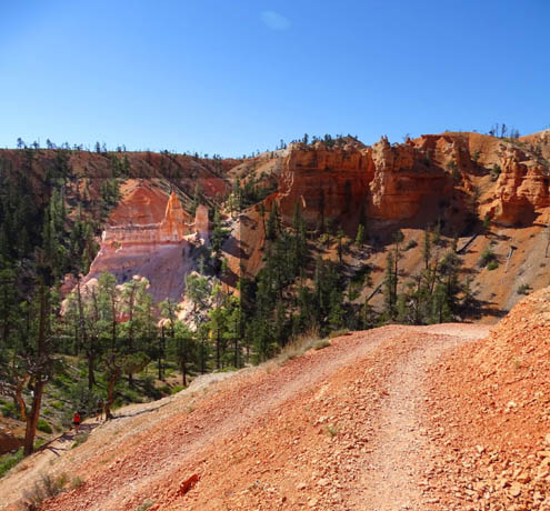
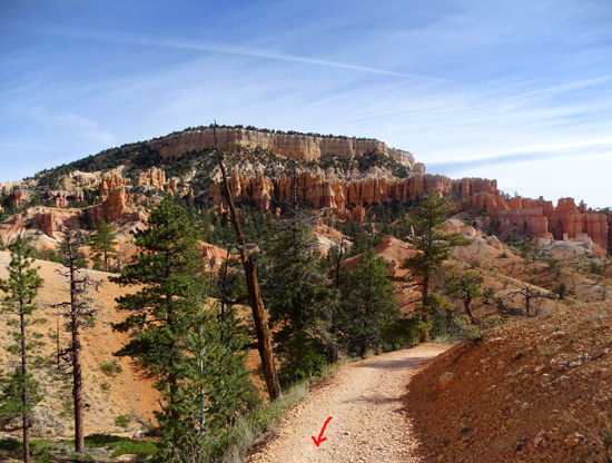
After winding into and out of several coves the Fairyland Trail comes to a little
peninsula that juts into the canyon that holds Tower Bridge. A short renegade trail
goes to the edge and overlooks the "bridge" formation but it's hard to
see unless you know what to look for. There are better views farther down the
trail.
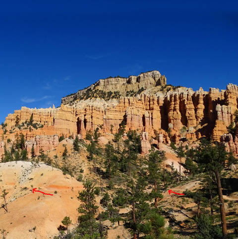
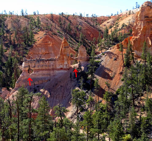
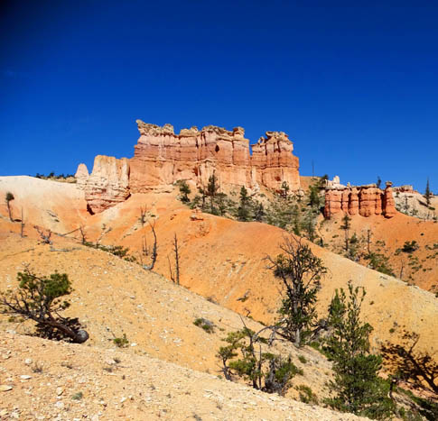
The next picture shows a pretty rock formation where
the real trail and the path across the peninsula intersect:
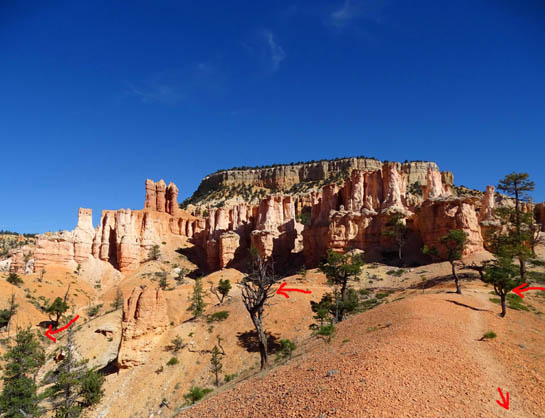
Three arrows in center = Fairyland
Trail; arrow lower right = spur trail
Near the end of our fall visit a year later, rangers put up dozens of little
signs on the edge of the rim and other park trails in places like this where
people made their own paths to see rock formations and other views. The signs asked
hikers not to use the renegade paths for safety and environmental reasons (erosion,
primarily).
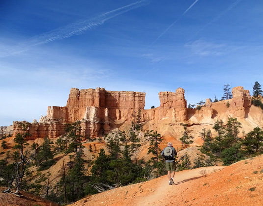
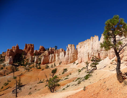
The Fairyland Trail passes this pretty rock formation, then
switchbacks down to the intersection with the spur trail to Tower Bridge:
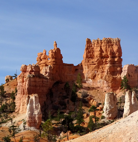
You can see the Tower Bridge formation pretty well
from this vantage point but the "bridge" (arrow right) and "window"
(arrow left) aren't as obvious as they are when you're standing below
the formation and can see the sky through the holes:
I lightened part of this photo
so you can see the tower formation more clearly.
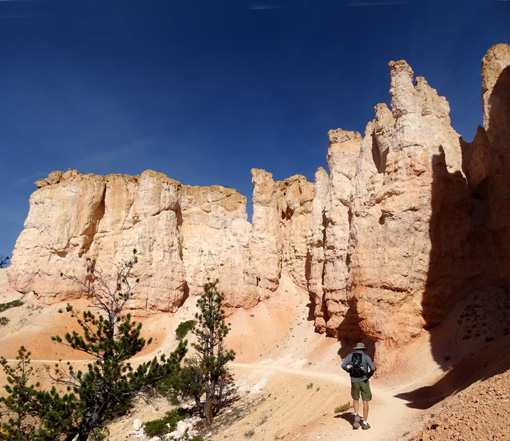
At 4.4 miles going clockwise from Fairyland
Point I came down to this intersection with the short spur trail to
Tower Bridge:
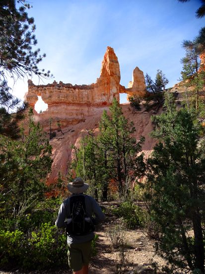
The right part of the formation was named after the
famous bridge in London. Frankly, I think there are more spectacular
bridges and windows in the park than this but lots of people are
thrilled to see this one.
You add just 2/10ths of a mile to your hike if
you're doing the Fairyland Loop and haven't seen the bridge before.
TOWER BRIDGE TO THE RIM TRAIL
This area is one of two low points on the Fairyland Loop, which means
you've got a good little climb out of the canyon in either direction. The
way we're going, the trail now crosses through a couple of usually-dry washes
several times times before it begins its ascent:
Continuing clockwise, there is an elevation gain of 800+ feet in about
1.8 miles from Tower Bridge up to the
Rim Trail.
That's not terrible if you're used to hilly
trails, and halfway through this
section the trail is a little flatter for a bit. In addition, the views
are increasingly better as you get out of the canyon and higher up this
trail. Stopping to look all around you and/or take photos is a good way
to catch your breath.
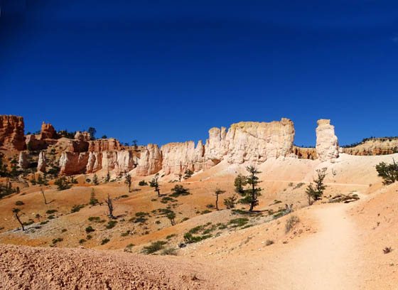
View toward Boat Mesa part
way up the switch-backing slope
View toward Boat Mesa farther up the trail
Despite what is a relatively difficult
elevation gain in this section for many park visitors, it's probably where
you'll see the most people if you're hiking around the whole Fairyland Loop.
It's not as spectacular as the
first three or four miles of the trail on the other side of the loop from
Fairyland Point. I'm showing the best views and formations here, not the
comparatively mundane ones.
However, more folks hike this small section of the
Fairyland Trail than any other part because of its proximity to Sunrise Point
(access by tour and shuttle buses) and the fact that it's shorter going down to
Tower Bridge from Sunrise and back up than going around the whole loop. Many
visitors are short on time and can't spare four or five hours to do the
loop.
It's fun to use your imagination on more
whimsical formations like this.
I see three types of crowns, and there's a
window in the upper left formation.
The flattest part of this segment passes below this long wall of
spires for about a quarter mile, then through a passageway
between the rocks before heading up again:
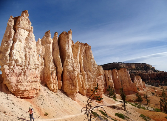
Looking back
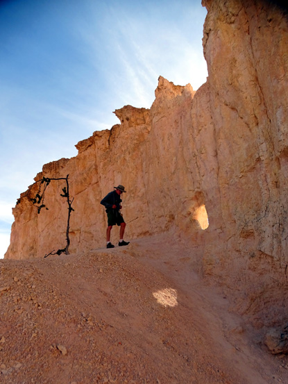
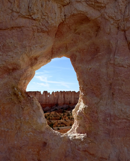
Jim climbs up through the rocks
(above) to a cool "window" (below)
with a view toward the China
Wall formation (2nd picture below).
Continued on the
next page: photos of China
Wall and interesting scenes on the remainder of the loop back to
Fairyland Point
Happy trails,
Sue
"Runtrails & Company" - Sue Norwood, Jim O'Neil,
Cody the ultra Lab, and Casey-pup
Previous
Next
© 2015 Sue Norwood and Jim O'Neil
