I think "Peekaboo" is a goofy name for a trail that is indeed
spectacular, but that's just my opinion. I keep inadvertently calling it
the "Keyhole" Loop.
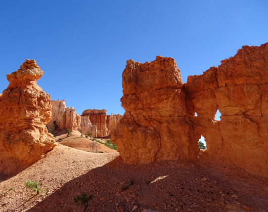
Both monikers refer to the numerous "windows" or holes of varying
sizes that have eroded over time in the rock fins (thin walls) and other
rock formations along this trail. Some of the holes are huge, like the
ones in the Wall of Windows, and some are quite tiny.
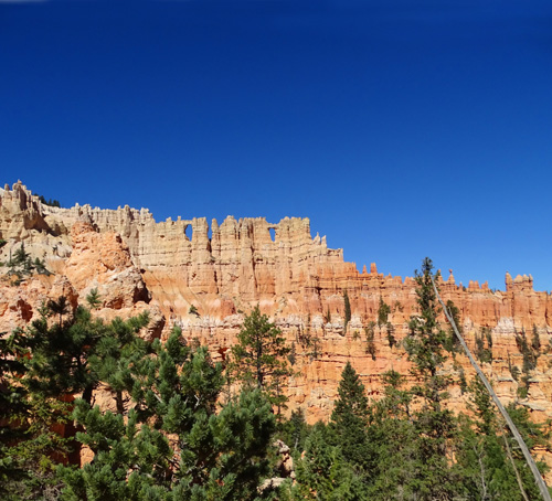
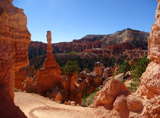
One of the best views of the Wall
of Windows is from the Peekaboo-Bryce Pt. trail intersection.
It's a fair distance away from this vantage point
but you can see the whole wall from here.
It's a fun game for me to try to find as many windows as I can on
each trail here and in Red Canyon. When I hike the same trail in a
different direction, I often find windows I didn't see the first time.
It's easiest to spot windows when you're going slowly, looking up,
and can see blue sky through them. For example, these three holes are
relatively small, a foot high or less, and about 20 feet
off off the trail -- but they're fairly easy to spot with the contrasting
blue color behind them:
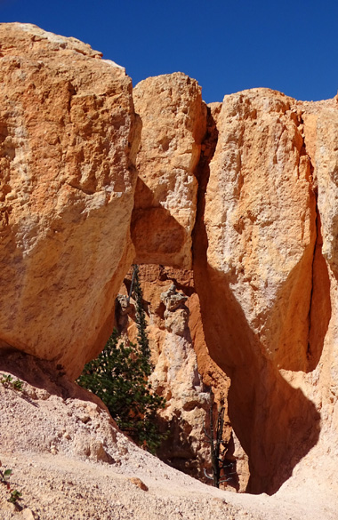
Windows are more difficult to spot when only trees or other rocks are
visible through the holes.
The next window is a good example. Even though
it is right next to the trail and about four feet high, it's easily
overlooked because the hole isn't very obvious with little
to no contrast behind it:
Counting windows would be good, friendly competition if you have more
one or more kids hiking with you -- or even between two
competitive adults. And tough windows to spot should be worth more
points than easy ones . . .
Spotting windows and other cool features is why I advise visitors to
hike these trails slowly and look up and around frequently.
Go too fast and you'll miss many of the more obscure details that
make this park so special.
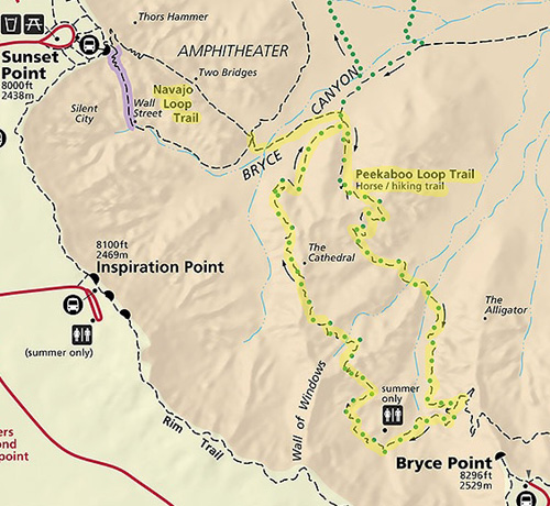
HOW TO ACCESS THE PEEKABOO LOOP
The Peekaboo Loop by itself is about three miles long but, as you can
see on the map section below, you can't do just that in isolation:
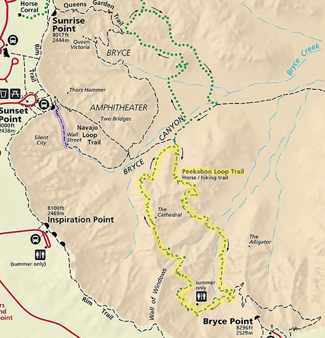
There are several variations to access this loop by combining it with
other trails. The shortest combination is five miles.
Because of the difficulty
of the Peekaboo Loop it is rated "strenuous" in the park newsletter's
description of all the trails. I've hiked it twice, in both directions, and
have heard comments from other folks that the trail was harder and took
them longer to hike than they expected.
I think it's well worth it, though. I love this trail, and so does
Jim. I talked him into hiking it with me one time, and we also did a
guided horseback trip on the loop. (I'll do a separate entry on the ride.)
The scenery is fantastic and not as many people hike this trail so it's
not nearly as crowded as the Navajo Loop or Queen's Garden trails.
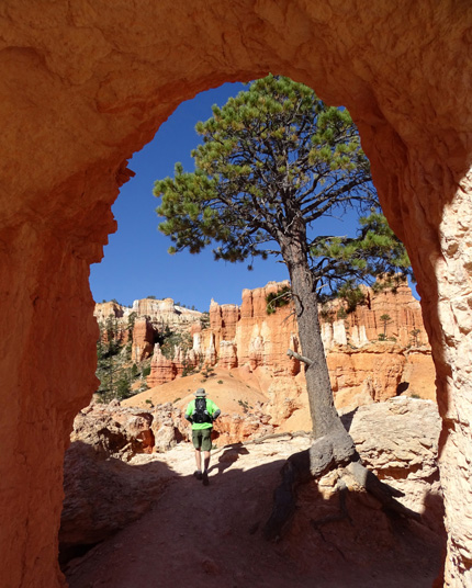
I got a picture of both Jim and a beautiful
sculpted rock wall
through this tunnel, one of several on the Peekaboo
Trail.
Here are the two shortest options.
Option #1 to access the Peekaboo Loop is to park at Sunset
Point and combine Peekaboo and a rather short spur trail with the Navajo Loop. You
can go down either side of Navajo at the beginning of the figure-eight
configuration and back up the same or the other side on the return.
That's about five miles total:
I haven't done that loop in isolation but I did both those loops as
part of a much longer hike one day.
Option #2 combines Peekaboo
with the Bryce Point Trail in more of a lolly-pop figure totaling about
six miles. This is what Jim and I did when we hiked the
loop together.
In this variation we started at Bryce Point, walked
down the Bryce Point Trail 1+ miles, hiked the Peekaboo Loop clockwise
(you can go either direction), and returned to our car back up the Bryce
Point Trail:
Even though the loop incorporating the Bryce Point Trail is a little
longer than the one going up and down the Navajo Loop, the Bryce Point
Trail is not as steep as either side of Navajo and doesn't descend as
many feet into the amphitheater = longer but a little less total
elevation gain and loss.
TRAIL CONDITIONS
I already mentioned that this trail is rated "strenuous" by the Park
Service. It's very hilly, fairly long for some folks, can have rough and
muddy sections after it rains, is at a higher altitude than many people are
used to, and runs through hot, dry canyons.
Note that there is a rather steep slot canyon
on the Peekaboo Loop with switchbacks similar to the Two Bridges side of the
Navajo Loop -- but the slot on Peekaboo is shorter.
The Peekaboo Loop is more "moderate" difficulty if you're
in good physical condition, comfortable hiking five miles or more, used
to hilly terrain, and acclimated to heat, arid conditions, and altitudes
between 7,500 to 8,000 feet or higher.
Old Sol is unrelenting at Bryce
Canyon, even in autumn. Here I'm exploring
a short side trail that goes up to a
"window" I can look through.
No sections of the Peekaboo Loop are as unrelenting as the upper
section of Wall Street on the Navajo Loop. The grades aren't usually as steep
but the ascents and descents are numerous and some are rather long,
especially going up -- from either direction -- after the
intersection with the spur trail. Even if you start and end at Bryce
Point you'll still pass that intersection at the low point on the loop.
My GPS recorded a total elevation gain and loss of about 3,000 feet over six miles
when Jim and I did the Bryce Point-Peekaboo hike (Option #2 above). The
gain and loss is a little more in five miles with Option #1, the
Navajo+Spur Trail+Peekaboo figure-8.
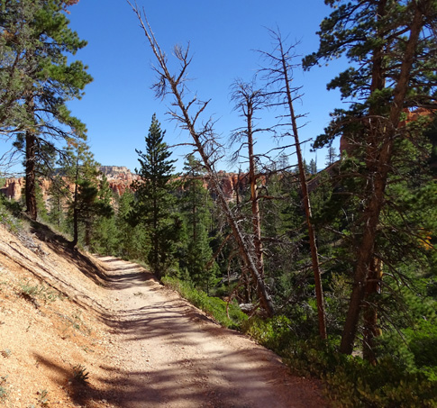
All of the Peekaboo Trail is relatively wide and smooth, with
switchbacks on the steeper sections. There are
only a few places with loose rocks. After storms rocks and mud
may make the trail more challenging until park employees have a chance
to grade them with their cute little 'dozers:
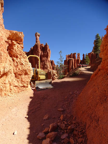
The only picture I could find
of a little bulldozer and rock slide
is this one on the Bryce Point Trail in 2016.
Some of the trail passes through shady trees. More than half of it is
exposed to the sun by mid-morning so a hat, sunscreen, and plenty of fluids are
advisable.
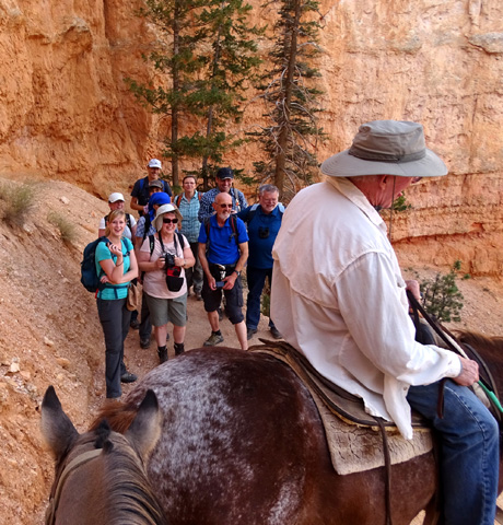
SHARED-USE TRAIL
Some unprepared hikers on the Peekaboo
Trail have been assisted by the guides on horseback-riding tours. They
carry extra water for the riders and in case of any emergency situations they
encounter. They can also radio for help if someone
they pass needs to be rescued.
This is the only hiking trail in
Bryce Canyon that is shared with horses. The park's horse
concessionaire, Canyon Trail Rides, Inc., offers guided horse trips
in the spring, summer, and fall, booked either directly or at the park
lodge. This company has carried close to 20,000 Bryce Canyon National
Park visitors down into the main amphitheater on horseback each year
recently.
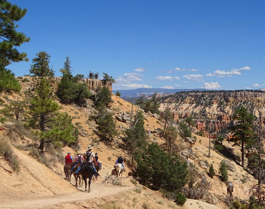
A guided horseback group heads down the Horse Trail
near Sunrise Point.
Private equestrian groups of up to ten can also schedule trips on the
Horse Trail and Peekaboo Loop, with some strict guidelines.
They're aren't as many of them and their schedules are more
varied so they aren't in the same place when the concessionaire guides are
leading their groups. You're much more likely to run into the park's
guided groups than the private equestrian groups while hiking the
Peekaboo Loop.
You can see the green dotted line on the trail map that shows
how the riders travel from the park stables to the Peekaboo Loop on their
own horse-only trail. Although I've seen a couple people hiking on the
clearly-marked Horse Trail, this practice is discouraged by the
Park Service and the horse concessionaire.
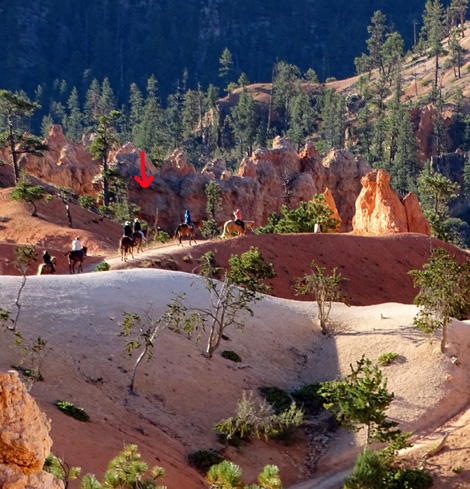
I was on the Queen's Garden Trail
when I saw this group of
guided horseback riders on the
nearby Horse Trail.
Equestrians are required to go clockwise on the Peekaboo Loop, which
is also my preferred direction to hike it, mostly because I like the
views better in that direction. Regardless of the direction you hike,
you'll be walking around some horse poop and urine on this trail.
Just for giggles when you're hiking this trail note how close some of
the hoof prints are to the edge of cliffs! I didn't notice those until
after we took our ride, which was sometimes a little nerve-wracking
along those drop-offs because it's been decades since either of us has
ridden a horse and our level of trust wasn't particularly high.
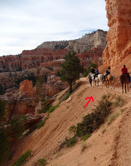
These horses were ahead of Jim and
me on our ride. Note how close
the white horse is to the edge on this part of the
Horse Trail.
If you want to maximize your chances of seeing horses on the trail go
to the booking window at Bryce Lodge where visitors sign up for the
rides and find out when the half-day
morning trips start and end. This fall they started about 8 AM and ended
about noon. Two or three groups of about ten riders each were on the
Peekaboo Loop each day during the middle half of that time,
approximately 9-11 AM.
If you hike CCW you're more likely to meet them somewhere along the
loop than if you are going the same direction they are.
When you see horses coming, get well off the trail so they can pass
-- horses have the right-of-way. These hikers got
over to the side as far as they could on a tight switchback we were
descending on our ride. That's Jim
on the horse; I was riding right behind him:
If, on the other hand, you want to avoid the horses, either get there
earlier in the morning before they reach the Peekaboo Loop (i.e., go clockwise and stay
ahead of them) or wait until afternoon. The two-hour afternoon trips
don't have enough time to do the Peekaboo Loop.
VIRTUAL TOUR OF THE PEEKABOO LOOP
I mentioned that the only two access trails to this loop are from
either Bryce Point or the spur trail at the bottom of the Navajo Loop.
Since I want to do a separate entry on the Bryce Point Trail, I'll
show photos in this entry from the beginning of the spur trail below the
Navajo Loop and go clockwise around the Peekaboo Loop -- the same
direction as the arrows on the map I marked below:
Many visitors to Bryce Canyon aren't able to hike this trail
because their time or ability is limited. I'm including over 80
photos in this three-page entry so more folks can see what it's like. I took
a lot more pictures than that during our visit this fall -- and
even more on our two visits here in 2016.
OK, let's get going!
I'll show you why we like this trail so doggone much.
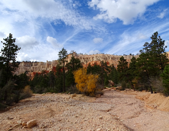
The spur trail is only about a third of a mile long. It crosses a wide
wash just below the intersection with the Navajo and Queen's Garden trails
and stays fairly flat until it intersects with the horse trail:
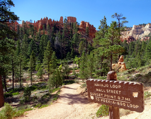
View from large wash toward the rim; note the
pretty yellow aspen leaves.
Hikers turn right at the intersection with the horse trail and can go
up either side of the Peekaboo Loop. Despite the arrows around the loop
on the map it is one-way only for the horses, not hikers. Both
ascents are fairly long but they are gradual.
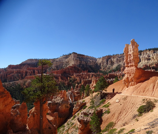
These photos show views
going clockwise, the same direction the horse tours go. They are
from two different hikes and look both forward and backward.
The Bryce Point overlook is in the
background of this and the next two photos.
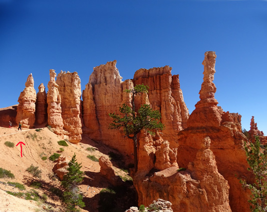
It's possible to take photos on this trail
without any strangers in them but sometimes I like to
have them in a shot, as above the arrow, to
give more perspective to the landscape.
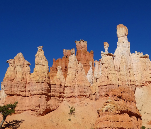
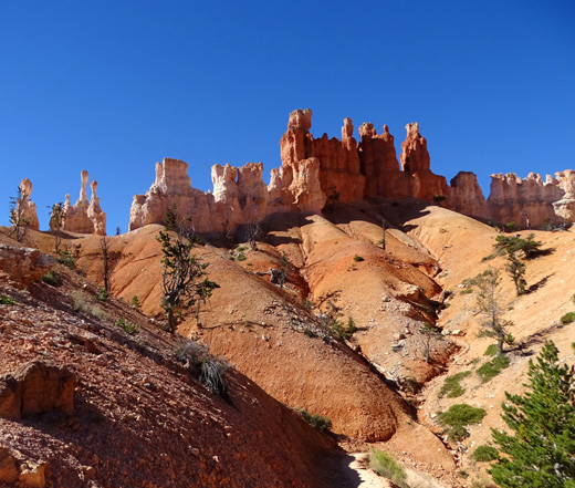
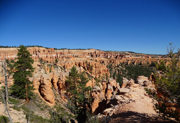
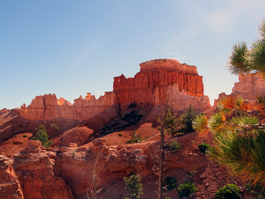
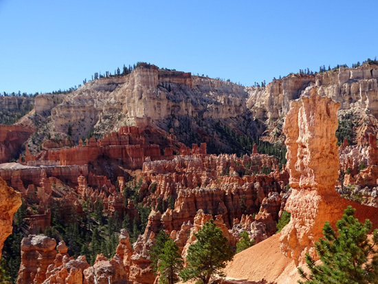
Bryce is renowned for its whimsical rock
spires and pretty sherbet colors.
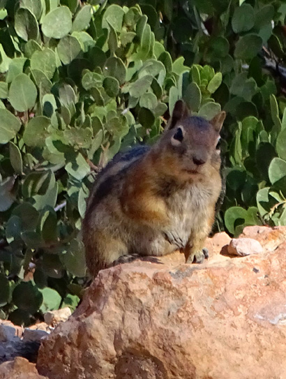
A curious squirrel poses,
hoping for a snack. That's a manzanita shrub
in the background; it will sport tiny pink
bell-shaped flowers in the spring.
Virtual tour continued on the
next page: tunnels, windows,
and lots more
Happy trails,
Sue
"Runtrails & Company" - Sue Norwood, Jim O'Neil,
Cody the ultra Lab, and Casey-pup
Previous
Next
© 2015 Sue Norwood and Jim O'Neil
